체셔 카운티 최고의 워킹 & 하이킹 경로
4.7
(88)
1,181
등산객
82
하이킹
뉴햄프셔주 체셔 카운티에서의 하이킹은 울창한 산, 모나드녹 산과 같은 유명한 산, 그리고 수많은 주립 공원을 특징으로 하는 다양한 풍경을 제공합니다. 이 지역은 도전적인 오르막과 자연 지역 및 수역을 따라 이어지는 완만한 길의 혼합을 특징으로 합니다. 트레일은 종종 삼림 지대, 탁 트인 능선, 연못과 저수지 주변 지역을 포함한 다양한 지형을 통과합니다. 이 카운티의 풍경에는 피스가 주립 공원과 코네티컷 강 계곡과 같은 중요한 자연 지역이 포함됩니다.
체셔 카운티 최고의 하이킹 트레일
- 가장 인기 있는 하이킹 경로는 모나드녹 산 루프 – 화이트 마운틴으로, 8.0마일(12.9km) 길이의 트레일이며 완료하는 데 약 4시간 20분이 소요됩니다. 이 적당한 난이도의 경로는 모나드녹 산 정상에서 광활한 전망을 제공합니다.
- 현지 하이커들 사이에서 또 다른 인기 있는 곳은 완태스티켓 산 자연 지역의 완태스티켓 산 트레일로, 3.9마일(6.2km) 길이의 적당한 난이도의 길입니다. 이 트레일은 완태스티켓 산에서 코네티컷 강 계곡의 경치를 제공합니다.
- 현지 하이커들은 또한 피스가 주립 공원의 피스가 능선 및 저수지 루프 트레일을 좋아하는데, 이 트레일은 8.0마일(12.9km) 길이이며 피스가 주립 공원을 통과하며 완료하는 데 약 3시간 40분이 소요됩니다.
- 체셔 카운티에서의 하이킹은 울창한 산, 자연 지역, 그리고 연못과 저수지 주변의 트레일로 정의됩니다. 이 네트워크는 쉬움, 보통, 어려움의 다양한 난이도의 경로를 제공하여 다양한 능력 수준을 만족시킵니다.
- 체셔 카운티의 경로는 komoot 커뮤니티에서 높은 평가를 받고 있으며, 40개 이상의 리뷰에서 평균 4.7점의 점수를 받았습니다. 800명 이상의 하이커가 komoot를 사용하여 체셔 카운티의 다양한 지형을 탐험했습니다.
마지막 업데이트: 10월 11, 2026
4.5
(2)
43
등산객
2.86km
01:24
510m
0m
The White Dot Trail offers a moderate yet rewarding hike up Mount Monadnock, covering 1.8 miles (2.9 km) with a significant elevation gain of 1684 feet (513 metres). You'll begin through a mixed forest, gradually climbing as the trees thin to reveal rock ledges and spruce-filled gullies. The final push leads to the summit, providing expansive views; expect to complete this ascent in about 1 hour and 24 minutes.
Planning your visit to Mount Monadnock is key due to its popularity. Parking reservations are often required, especially on weekends and during peak season, so secure your spot in advance for a smooth start. Checking the park's official website for current conditions and reservation policies is always a good idea. An early start can help you avoid crowds and enjoy the trail more peacefully.
Mount Monadnock is renowned for its exposed, rocky summit, which offers panoramic vistas across southern New Hampshire. On exceptionally clear days, you might even catch glimpses of the Boston skyline from the top. The mountain's unique geology and distinct ecological zones make it a significant natural landmark, and this trail provides a direct and engaging way to experience its character.
5.0
(1)
15
등산객
6.92km
02:35
450m
450m
Embark on the Mount Monadnock via White Dot and Lost Farm Trail Loop, a moderate hike covering 4.3 miles (6.9 km) with a significant elevation gain of 1466 feet (447 metres). You can expect to complete this route in about 2 hours and 35 minutes. As you ascend, the landscape transforms from lush hardwood forests to dense pine and spruce, eventually revealing expansive vistas. The White Dot Trail challenges you with rock scrambles, while the Lost Farm Trail offers a more gradual climb. Reaching the bare, rocky summit of Mount Monadnock rewards you with exceptional 360-degree panoramic views, where you might even spot the Boston skyline on a clear day.
Before you head out, be aware that parking reservations are frequently required for Monadnock State Park, particularly during busy times, so plan ahead. It is important to note that dogs are generally not permitted within the park boundaries. Always prepare for variable weather conditions at the summit; temperatures and wind can be much more severe than at the base, so pack appropriate layers and gear.
Mount Monadnock stands out as one of the most frequently climbed mountains in the world, renowned for its distinctive bald, rocky peak. This geological feature provides unobstructed views that stretch for miles across the New England landscape. The trail offers a unique opportunity to experience a diverse ecosystem, transitioning from sheltered woodlands to exposed alpine-like conditions as you gain elevation.

15
등산객
10.6km
03:46
580m
580m
Embark on the Monadnock Mountain via Birchtoft to Hinkley Loop, a moderate hike spanning 6.6 miles (10.6 km) with a significant elevation gain of 1912 feet (583 metres). You can expect to complete this journey in about 3 hours and 45 minutes. The trail begins by winding through peaceful wooded areas, where you might catch glimpses of Gilson Pond. As you climb higher, the scenery transforms, guiding you through various natural communities. The ultimate reward is reaching the summit of Mount Monadnock, where you'll be treated to expansive 360-degree panoramic views. On a clear day, these vistas can stretch across all six New England states, making the effort truly worthwhile.
This loop is situated within Monadnock State Park, so planning your visit carefully is key. Parking is generally available at trailheads serving Mount Monadnock, including those near Gilson Pond Campground or the Headquarters Area. Before heading out, always check the current park conditions for any advisories. While specific warnings for snow or road closures are not typically detailed for this particular loop, it is always wise to confirm local conditions to ensure a smooth trip.
Mount Monadnock is renowned for its diverse natural communities, which change noticeably as you ascend its slopes. This ecological variety contributes to the unique experience of the trail. The mountain itself is a prominent landmark in the region, offering a challenging yet accessible climb for many hikers. Its summit views are particularly famous, drawing visitors who wish to experience the vast New England landscape from a single vantage point.
15
등산객
10.9km
03:43
560m
570m
Embark on the Bald Rock and Monadnock Mountain Loop, a moderate hiking route that challenges you with varied terrain and rewarding views. This 6.8-mile (10.9 km) loop involves steep climbs, descents, and numerous rock scrambles, particularly as you approach Mount Monadnock Summit. You will gain 1843 feet (562 metres) in elevation, with an estimated duration of 3 hours and 42 minutes, making it a substantial outing. From Bald Mountain, you can enjoy panoramic views over Jaffrey, while Monadnock's summit offers expansive 360-degree vistas.
Planning your visit requires attention, as reservations are now mandatory for day use at Monadnock State Park, especially on weekends. It is crucial to secure your spot in advance to avoid disappointment. Please note that dogs are not permitted on this trail, so make arrangements for your furry companions before heading out. Be prepared for the challenging nature of the route, which includes significant elevation changes and rocky sections.
This loop is a popular choice for hikers seeking a robust experience in Monadnock State Park. On clear days, the summit of Mount Monadnock is renowned for offering views that can stretch across all six New England states. Spring visitors might also enjoy the added bonus of beautiful wildflowers and opportunities for birdwatching along the trail, enhancing the natural appeal of this iconic New Hampshire mountain.
10
등산객
3.37km
01:03
120m
120m
The Anne Stokes Loop Trail offers a delightful blend of forest scenery and intriguing history within the Madame Sherri Forest. As you hike, you'll traverse diverse terrain, from gentle woodland paths to some steeper, rocky sections, passing a small pond and winding through a hemlock forest. The route provides picturesque views of the surrounding area and Wantastiquet Mountain from higher elevations, making it a great option for those seeking natural beauty without an overly strenuous climb.
Planning your visit is straightforward, as the trail is well-worn and clearly marked with white blazes. While generally considered an easy hike, some rocky areas can be slick, especially in wet weather, so sturdy footwear is a good idea. Dogs are permitted on the trail, provided they are leashed, and you should always pack out their waste. This circular route is particularly popular in autumn for its vibrant fall colors.
What truly sets this trail apart are the historical ruins of Madame Sherri's "castle," a unique landmark from the early 1900s. The impressive stone foundation and grand staircase are all that remain of her French-inspired summer home, offering a fascinating glimpse into the past. Beyond the ruins, you'll also enjoy views of Indian Pond, framed by the open ledges of Mine Ledge, adding to the trail's distinctive charm.
9
등산객
3.58km
01:32
490m
0m
Embark on the Dublin Trail, a moderate hike that quickly transitions from forested paths to a steep, rocky ascent. You'll navigate worn terrain and encounter sections requiring hands-on rock scrambling as you climb towards the summit of Mount Monadnock. This 2.2-mile (3.6 km) route challenges you with a significant 1607 feet (490 metres) of elevation gain, typically taking about 1 hour and 32 minutes to complete. As you gain height, scattered viewpoints emerge, eventually leading to exposed granite ledges offering expansive panoramic views of the surrounding landscape.
Before you set out on the Dublin Trail, make sure to check the information kiosk at the trailhead for maps and current regulations. You will find a port-a-potty available at the start, which is convenient for pre-hike preparations. Remember to bring all the water you need, as there are no drinking water sources along the route. Also, be prepared to pack out everything you pack in, as trash bins are not provided on the trail itself. Please note that dogs are not allowed on this particular trail.
The Dublin Trail offers a direct and rewarding path to the summit of Mount Monadnock, a prominent feature within Monadnock State Park. This route is known for its consistent climb and the dramatic change in scenery as you ascend. It provides a distinct experience for hikers looking to conquer one of the region's most iconic peaks. The trail's character, from dense woods to open granite, makes it a memorable journey.
3.0
(1)
3
등산객
8.25km
02:19
190m
120m
Embark on a moderate hiking adventure up Hubbard Hill and Pitcher Mountain, covering 5.1 miles (8.2 km) with an elevation gain of 621 feet (189 metres). You can expect to spend about 2 hours and 19 minutes traversing a blend of old access roads and distinct paths, featuring moderate inclines. The highlight is reaching the Pitcher Mountain summit, where you will find expansive panoramic views stretching into Vermont, often enhanced by climbing the fire tower. Along the way, you will also pass Hubbard Hill, known for its blueberry fields and northern viewpoints, especially beautiful during berry season.
This trail is well-marked as it combines sections of the Monadnock-Sunapee Greenway. Parking is generally available at the trailheads for both Hubbard Hill and Pitcher Mountain, making access straightforward for your visit. Be aware that some sections of the trail can be rocky or have loose gravel, so appropriate footwear is recommended to ensure a comfortable and safe hike.
This route is a popular option through Andorra Forest in New Hampshire, offering a rewarding outdoor experience with diverse terrain and scenic vistas. The opportunity to pick blueberries on Hubbard Hill during the right season adds a unique charm to your hike. The fire tower on Pitcher Mountain provides an elevated perspective, making it a notable feature for capturing the far-reaching views of the surrounding landscape.
5
등산객
1.04km
00:19
40m
40m
Step into the dramatic rock canyon of Chesterfield Gorge, where towering walls, some reaching 70 feet high, have been carved by Wilde Brook. This easy hiking route offers a quick escape, covering just 0.6 miles (1.0 km) with an elevation gain of 137 feet (42 metres), taking about 19 minutes to complete. As you follow the path, you'll discover a series of cascades and waterfalls, with the brook tumbling through the narrow ravine. The dense hemlock canopy provides ample shade, creating a quiet and picturesque atmosphere, perfect for a short, refreshing walk.
The main trail is well-maintained, featuring sturdy railings in steeper sections, making it accessible for families and casual hikers. When planning your visit, be aware that the enclosed nature of the gorge means temperatures inside can be cooler than outside, so dress in layers. While generally easy, some parts of the path can be rugged with exposed tree roots. Additionally, areas close to the water may be slippery, so wear appropriate footwear to ensure a safe and enjoyable experience.
Chesterfield Gorge is a natural wonder, showcasing unique geological features like potholes and ripple marks in the rock, sculpted over millennia by natural forces. The dense hemlock tree canopy not only offers shade but also contributes to the quiet, serene atmosphere of the area. This trail provides a fascinating glimpse into the power of water to shape the landscape, making it a notable stop for anyone exploring the region's natural beauty.
3
등산객
9.19km
03:18
540m
540m
Embark on the Mount Monadnock Loop, a moderate 5.7-mile (9.2 km) hike that takes you through diverse landscapes. You will ascend 1763 feet (537 metres) over an estimated 3 hours and 17 minutes, experiencing a journey from dense woodlands to rugged, exposed ledges. As you climb, the terrain shifts dramatically, leading you to the bare, rocky summit of Mount Monadnock. From this vantage point, you can enjoy impressive 360-degree views that stretch all the way to Boston and the White Mountains on clear days. This route combines some of the mountain's more demanding trails with its most scenic ridge walk, offering a varied and engaging experience.
Before you set out, be aware that this is a strenuous hike, best suited for experienced hikers due to its technical sections that may require hand-over-foot climbing. Good footwear with strong grip is essential, as many rocks are worn smooth and can become hazardous when wet. Parking is conveniently available at the Monadnock Visitor Center, which also serves as the Mount Monadnock State Park Headquarters. Plan your visit accordingly to ensure a safe and enjoyable adventure.
This particular loop combines several distinct paths, including the White Dot, Cascade, Spellman, Pumpelly, and Parker Trails. Along the Pumpelly Trail, you might encounter unique geological features like "The Sarcophagus" rock formation. The route offers a dynamic transition from shaded forest paths to open, exposed rock, providing a comprehensive exploration of Monadnock State Park's varied ecosystems. It's a chance to experience one of New Hampshire's most iconic peaks through a challenging and rewarding circuit.
5.0
(2)
4
등산객
7.63km
02:09
160m
160m
Embark on a moderate hike to Stoddard Rocks via Pioneer Lake, a 4.7-mile (7.6 km) route that takes about 2 hours and 9 minutes to complete. You'll gain 535 feet (163 metres) as you traverse varied terrain, from winding forest paths to sections with uneven, rocky ground. The trail guides you past the tranquil Pioneer Lake, known for its undeveloped shoreline, before ascending to Stoddard Rocks, a striking collection of massive glacial erratics scattered across a hilltop.
Access this trail from the Pickerel Cove trailhead, where you'll find parking available. While the path is generally blazed, limited signage means downloading a map is essential for confident navigation. This area welcomes dogs, so feel free to bring your leashed companion along for the adventure. Always check local conditions before you head out to ensure a smooth visit.
Stoddard Rocks stands out with its impressive glacial erratics, some reaching 30-40 feet in height, offering a unique geological feature to explore. Pioneer Lake adds to the natural appeal, serving as a nesting habitat for loons and providing picturesque views. This route offers a rewarding experience for those seeking a blend of forest hiking and distinctive natural landmarks.
더 다양한 경로와 다른 탐험가들의 추천을 살펴보세요.
이미 komoot 계정이 있나요?
투어 추천은 다른 사람들이 komoot에서 완료한 수천 개의 활동을 바탕으로 구성되어 있습니다.







커뮤니티 팁


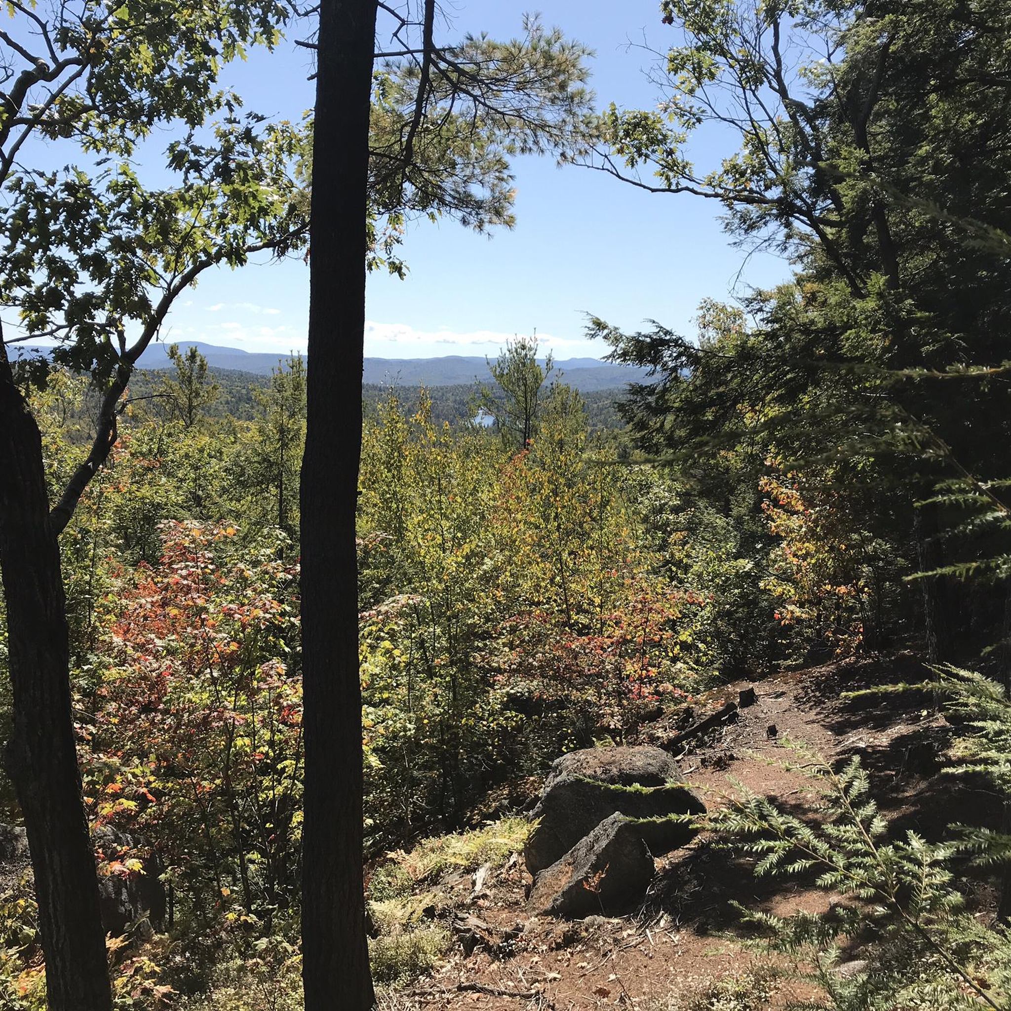
This mountain never disappoints. Always a fun quick hike.
0
0

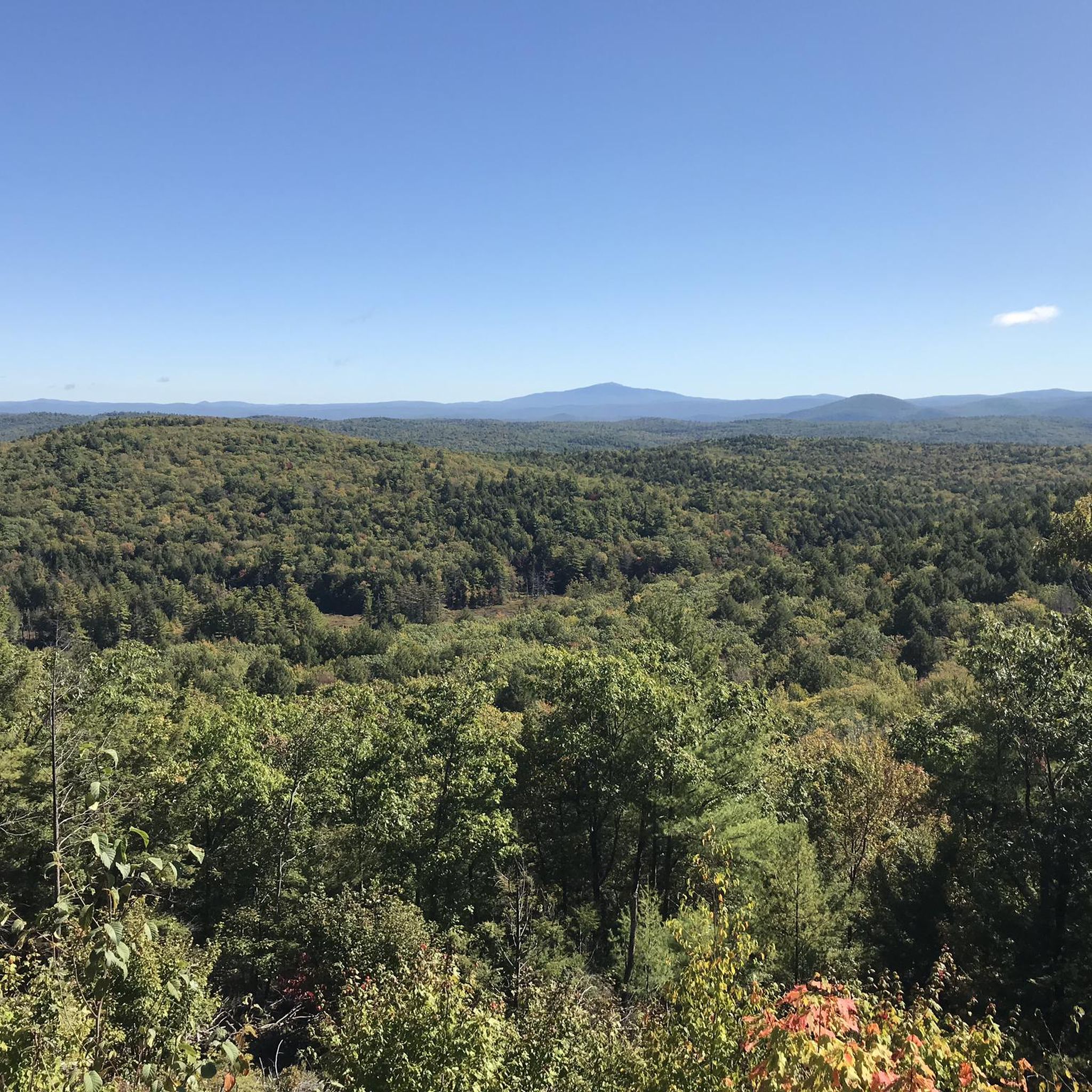
From the cleared hilltop of Hubbard Hill, you are afforded wonderful views that span across the green landscape of Andorra Forest.
1
0
Pitcher Mountain showcases incredible 360 degree panoramic views that reach across the many surrounding hillsides and pastures including the Green Mountains, Mount Monadnock, and on a very clear day, the White Mountains of Mount Washington and Mount Lafayette. Atop Pitcher Mountain there are blueberry pastures where you can PYO blueberries. This area has been named one of the best places for blueberry picking hikes in America! Don't forget to pop a donation in the box available.
1
0

Nice, quiet spot by Gilson Pond. Good area for a break in a shady spot. There are beautiful views of the woodlands across the water.
1
0
Great view point of the White Mountains. It is named Thoreau's Seat because Henry David Thoreau was speaking at a local college when he was told about this beautiful viewpoint. He was able to go to visit it and ended up including it in some of his writing.
0
0
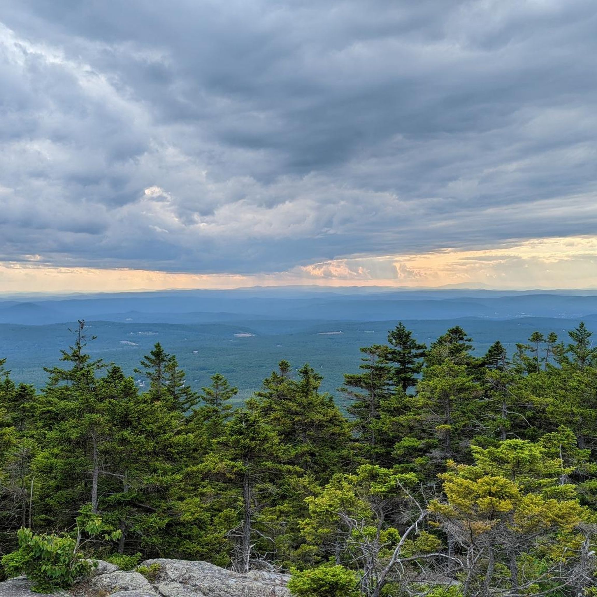
Mount Monadnock is the highest point in Cheshire County and the most popular peak in New Hampshire. It gives great views of the surrounding mountains. There are many paths that get you to the summit, so there should be a route that suits everyone's ability.
1
0
체셔 카운티에서 가장 인기 있는 명소


찾고 계신 것을 찾지 못하셨나요?
체셔 카운티에서 더 많은 하이킹를 확인하고 목적지에서 완벽한 경로를 찾아보세요.
