블라스코산초 최고의 라이딩 경로
81
자전거 타는 사람
9
라이딩
블라스코산초의 로드 사이클링 경로를 찾으시나요? 그렇다면 블라스코산초 로드 라이딩 컬렉션 중에서 가장 멋진 라이딩 장소를 아래에서 살펴보세요.
마지막 업데이트: 10월 19, 2026
6
자전거 타는 사람
64.8km
02:50
620m
620m
보통 도로 자전거 타기. 좋은 체력 필요. 지면 대부분이 잘 포장되어 있고 라이딩하기 쉬움.
16
자전거 타는 사람
50.2km
02:11
460m
460m
보통 도로 자전거 타기. 좋은 체력 필요. 지면 대부분이 잘 포장되어 있고 라이딩하기 쉬움.

25
자전거 타는 사람
78.6km
03:14
520m
520m
보통 도로 자전거 타기. 좋은 체력 필요. 지면 대부분이 잘 포장되어 있고 라이딩하기 쉬움.
11
자전거 타는 사람
68.0km
03:00
610m
600m
보통 도로 자전거 타기. 좋은 체력 필요. 지면 대부분이 잘 포장되어 있고 라이딩하기 쉬움.
8
자전거 타는 사람
60.9km
02:38
390m
390m
보통 도로 자전거 타기. 좋은 체력 필요. 지면 대부분이 잘 포장되어 있고 라이딩하기 쉬움.
더 다양한 경로와 다른 탐험가들의 추천을 살펴보세요.
이미 komoot 계정이 있나요?
투어 추천은 다른 사람들이 komoot에서 완료한 수천 개의 활동을 바탕으로 구성되어 있습니다.
오늘 무료 계정으로 시작하세요
다음 모험이 기다리고 있어요.
블라스코산초 주변 인기 장소


커뮤니티 팁


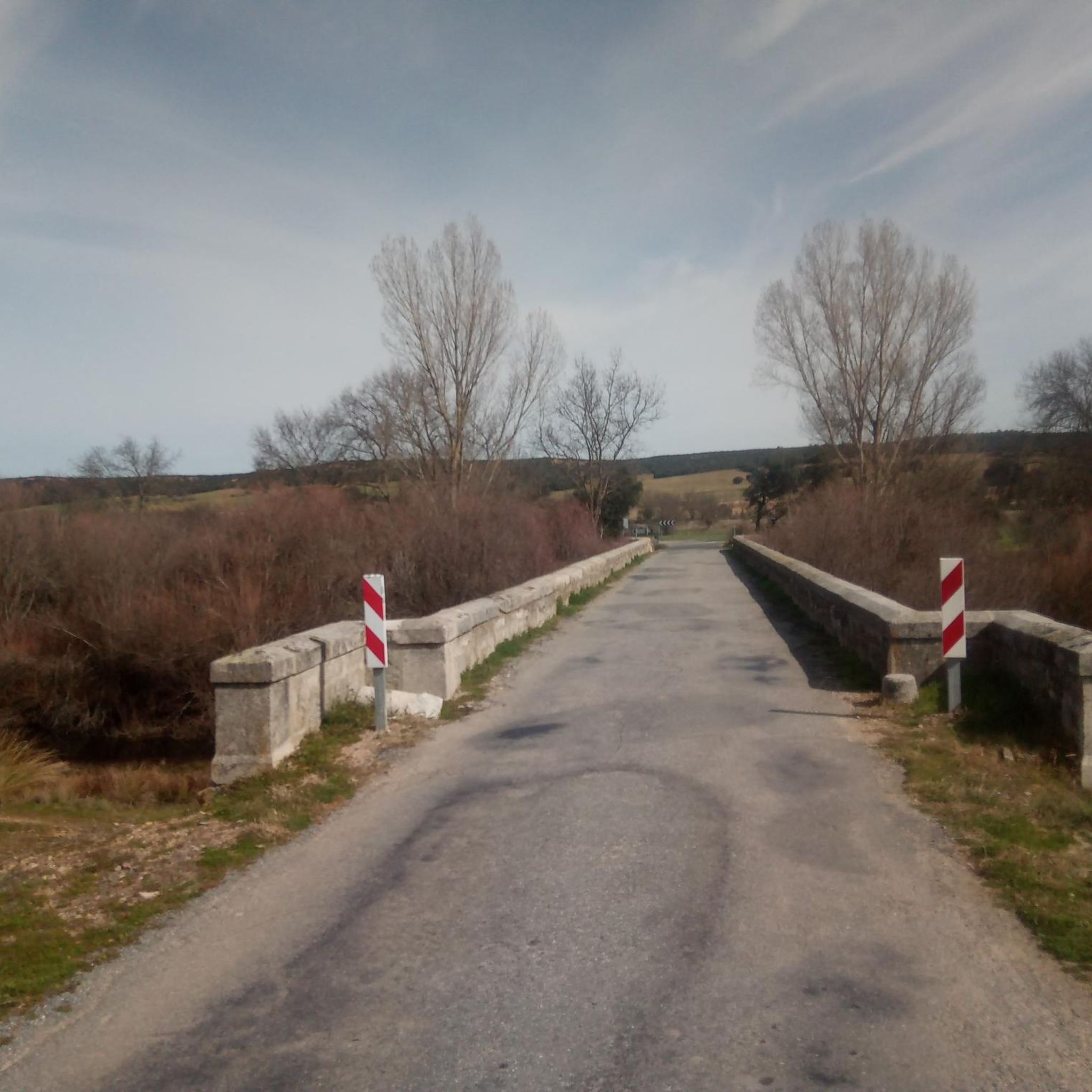
The bridge located in Moñibas (Segovia) is a small stone bridge, very characteristic of traditional Castilian rural architecture.
4
0
Hontanares de Eresma is a charming municipality and town in the province of Segovia, within the autonomous community of Castilla y León. Hontanares de Eresma is mentioned for the first time in 1247 as “Fontanares” and until the 19th century it was simply called “Hontanares”.
2
0

Population center that is divided into two scattered areas, one called Hontanares de Eresma and the other the Estación. This second one was well known since it is where the train station of the center was located and that currently passing through the greenway can still be seen.
1
0
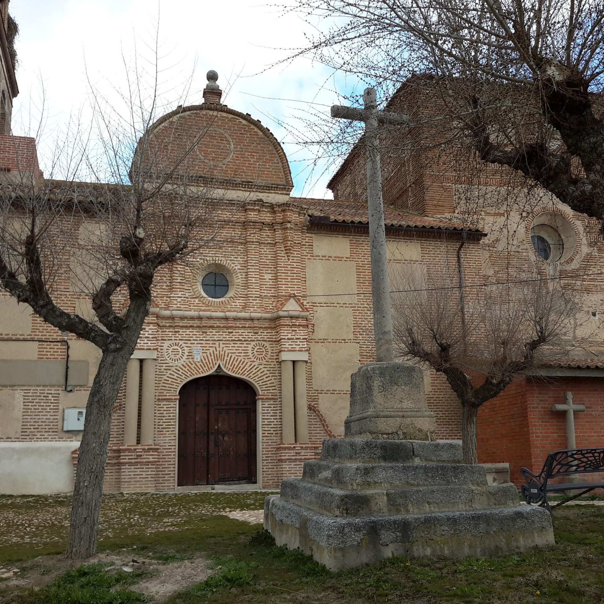
On its arrival in the town, it is enclosed in large ridges that fall in rounded shapes where the nucleus is located in its lower part. The church, beautiful, there is usually a nest of storks that give it a special touch.
1
0
Small town located north of the city of Ávila and that offers views of the plains of Avila in the area. At the beginning of the town is the Iglesia de Nuestra Señora de la Asunció, a little away from the center.
0
0
Huge straights that are there before reaching Muñopedro and that are surrounded by agricultural fields. Watch if the wind blows!
0
1
Small bridge that is close to the town of Moñibas and that crosses the Río Voltoya, on the border between Segovia and Álava.
0
0
블라스코산초 주변에서 가장 인기 있는 명소


더 살펴보기
다른 지역의 최고의 로드 사이클링 경로를 살펴보세요.
