계획 최고의 사이클링 경로
4.5
(49)
970
자전거 타는 사람
64
라이딩
계획 최고의 사이클링 경로를 따라 지역을 둘러볼까요? 계획에서 가장 멋진 자전거 라이딩 장소 중에서 가장 마음에 드는 라이딩을 선택해보세요.
마지막 업데이트: 8월 31, 2026
20
자전거 타는 사람
44.6km
04:06
1,480m
1,480m
어려운 자전거 타기. 우수한 체력 필요. 대부분 포장된 지면. 실력과 관계없이 누구나 갈 수 있음.
2
자전거 타는 사람
26.4km
02:32
940m
940m
This difficult 16.4-mile touring cycling route in the Chistau Valley offers stunning Pyrenean views and passes through charming villages.

무료 회원 가입
5.0
(4)
31
자전거 타는 사람
32.6km
02:19
600m
600m
어려운 자전거 타기. 우수한 체력 필요. 대부분 포장된 지면. 실력과 관계없이 누구나 갈 수 있음.
31
자전거 타는 사람
20.3km
02:21
830m
830m
어려운 자전거 타기. 우수한 체력 필요. 대부분 포장된 지면. 실력과 관계없이 누구나 갈 수 있음.
21
자전거 타는 사람
35.4km
03:35
1,130m
1,130m
어려운 자전거 타기. 우수한 체력 필요. 투어 중 자전거를 끌고 가야 하는 구간이 있을 수 있음.
더 다양한 경로와 다른 탐험가들의 추천을 살펴보세요.
무료 회원 가입
이미 komoot 계정이 있나요?
투어 추천은 다른 사람들이 komoot에서 완료한 수천 개의 활동을 바탕으로 구성되어 있습니다.
오늘 무료 계정으로 시작하세요
다음 모험이 기다리고 있어요.
로그인 또는 가입하기



커뮤니티 팁


A fountain ⛲ and a shade to refresh yourself along the way.
0
0


From the campsite, first follow the Cinqa river to Labuerda to avoid the A138.
0
0

Leaving the town towards the swimming pools in a square where there are cars parked there is a fountain.
0
0

Eresué is a town that has the charm of tiny mountain villages, with only 25 neighbors, and that enjoys a privileged location on the right bank of the Ésera. The access route is through the Camino del Solano, which is a small paved road, with surprising and wonderful views over the Benasque Valley and its mountains. The height at which this town is located (1,350 meters) gives it a feeling of closeness to the nature that surrounds it, its forests and fantastic pine forests and spectacular views.
0
0
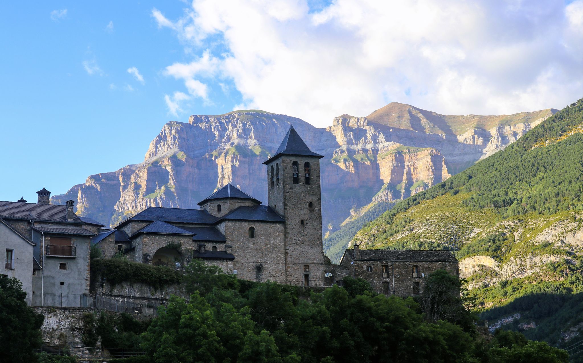
In the upper part of the town is the parish church, of Romanesque origin, from the 12th century, reformed between the 16th and 18th centuries. The head, oriented to the east, is rectangular, probably from the 18th century when it had to replace the primitive semicircular apse, of which three arcuations are preserved inside the bell tower. There are five chapels, four of them covered with a barrel vault, except one of them, with a lunette vault cover. In one of them there is a baptismal font. Between two of these spaces you can see the old access to the bell tower, whose current access is only external. The tower, much reformed, maintains the tile roof and a last section with a semicircular window on each side and a skylight and small bell. A reform has cleaned the walls, leaving the stone exposed. The cemetery extends to the east and north, and is accessible by a door to the south-east of the church and also by stairs to the north-west.
0
0

The point where the path crosses the ravine is disconcerting because you hear more water than you see. If you leave the path briefly, looking down the ravine, you will be able to see a small waterfall covered in exuberant vegetation.
0
0


더 살펴보기
다른 지역의 최고의 자전거 경로를 살펴보세요.
