발 데 갈리네라 최고의 라이딩 경로
4.6
(105)
4,402
자전거 타는 사람
38
라이딩
발 데 갈리네라의 로드 사이클링 경로를 찾으시나요? 그렇다면 발 데 갈리네라 로드 라이딩 컬렉션 중에서 가장 멋진 라이딩 장소를 아래에서 살펴보세요.
마지막 업데이트: 8월 22, 2026
4.8
(4)
60
자전거 타는 사람
59.8km
03:48
1,300m
1,300m
어려운 도로 자전거 타기. 우수한 체력 필요. 지면 대부분이 잘 포장되어 있고 라이딩하기 쉬움.
4.6
(14)
284
자전거 타는 사람
46.3km
02:02
380m
380m
보통 도로 자전거 타기. 좋은 체력 필요. 투어 중 라이딩하기 어려운 비포장 구간이 있을 수 있음.

무료 회원 가입
4.8
(4)
232
자전거 타는 사람
78.8km
04:10
1,320m
1,320m
어려운 도로 자전거 타기. 우수한 체력 필요. 투어 중 라이딩하기 어려운 비포장 구간이 있을 수 있음.
64
자전거 타는 사람
34.0km
01:52
710m
710m
보통 도로 자전거 타기. 좋은 체력 필요. 지면 대부분이 잘 포장되어 있고 라이딩하기 쉬움.
4.0
(1)
75
자전거 타는 사람
30.7km
01:39
590m
590m
보통 도로 자전거 타기. 좋은 체력 필요. 투어 중 라이딩하기 어려운 비포장 구간이 있을 수 있음.
더 다양한 경로와 다른 탐험가들의 추천을 살펴보세요.
무료 회원 가입
이미 komoot 계정이 있나요?
투어 추천은 다른 사람들이 komoot에서 완료한 수천 개의 활동을 바탕으로 구성되어 있습니다.
오늘 무료 계정으로 시작하세요
다음 모험이 기다리고 있어요.
로그인 또는 가입하기

커뮤니티 팁

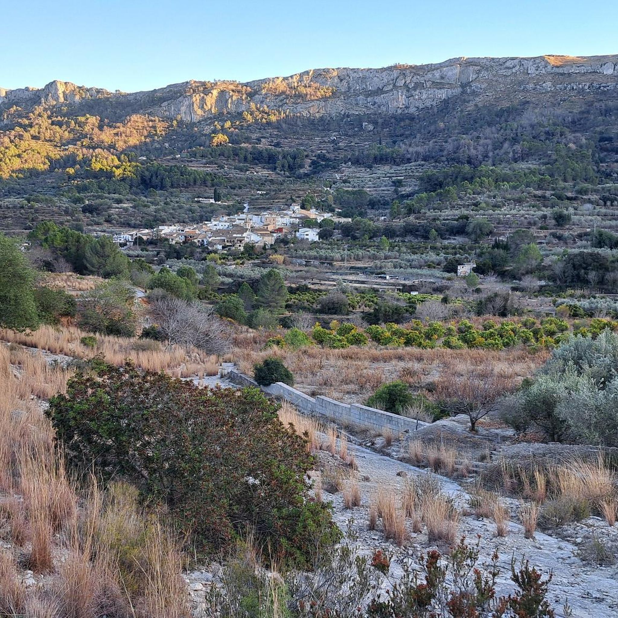
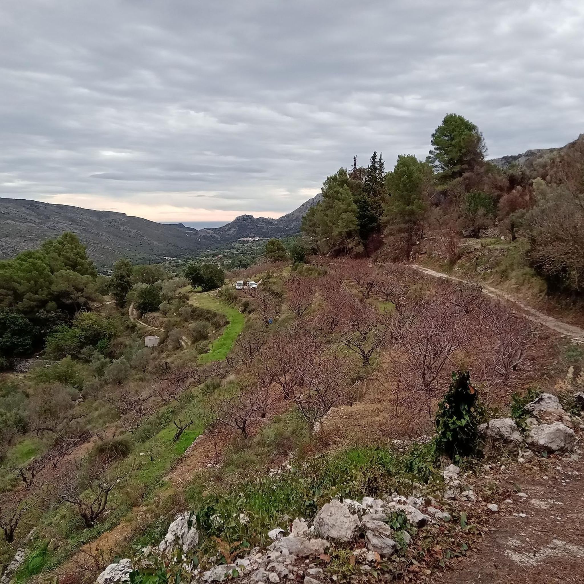
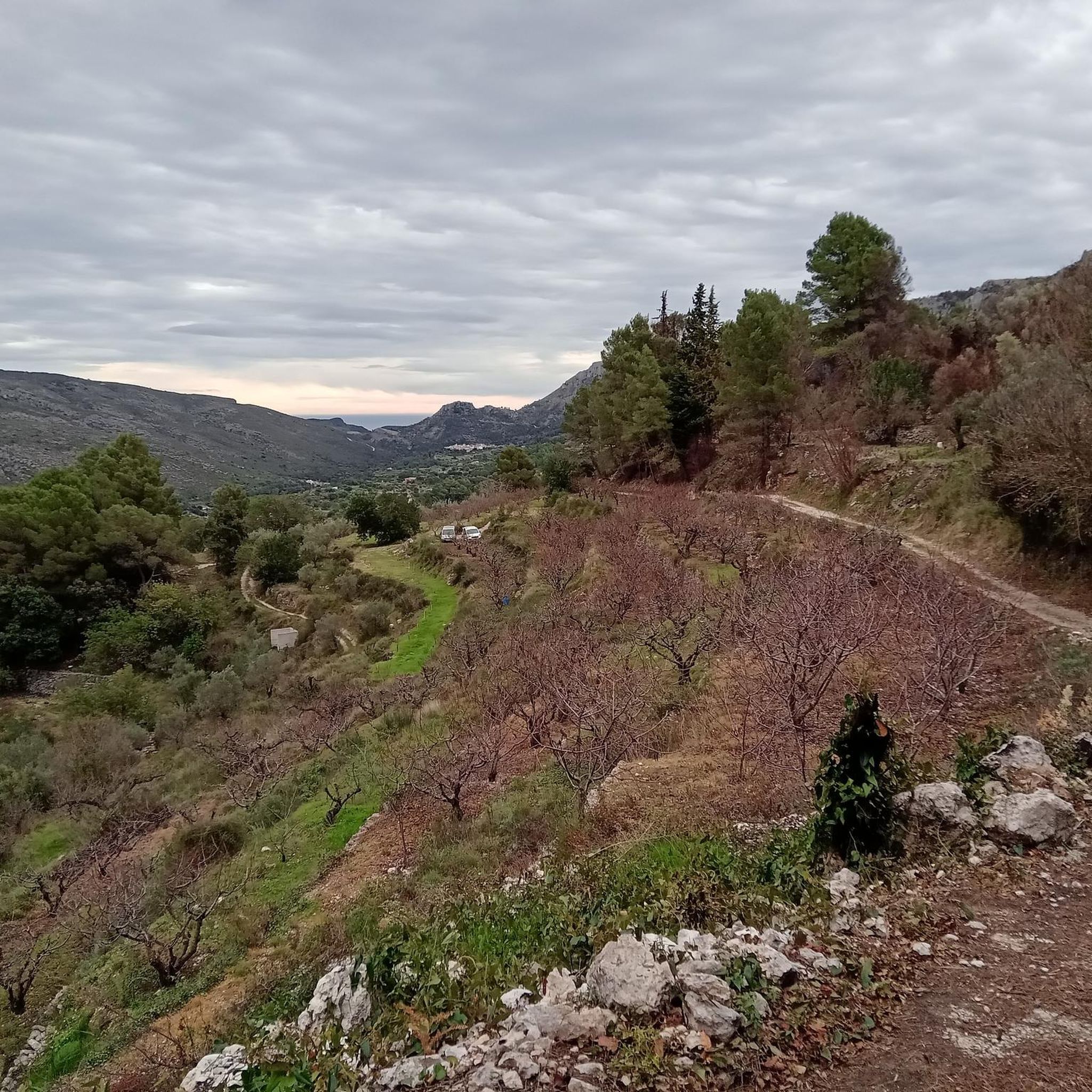
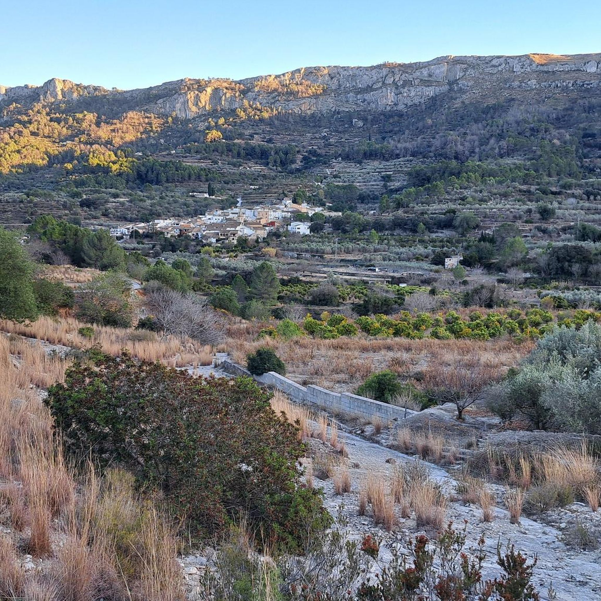
L’Atzúbia의 아래쪽에는 콘크리트로 포장된 Barranc de Mostalla인 Carrer Nou가 있습니다. 실제로 폭우가 내리면 다시 계곡이 됩니다. 표지판은 없지만 위로 올라가는 길은 하나뿐입니다. 안테나로 가는 길은 "공사중"으로 막혀 있습니다. 현재 공사는 보이지 않으며 "문" 옆으로 지나갈 수 있습니다. 정상까지 가는 길은 완벽한 상태입니다. 경사면 : ADSUBIA 고도: 753 고도차: 663 길이: 6,26 평균 %: 10,60 최대 %: 22
0
0

해발 320m는 완벽한 높이입니다. 시원한 공기, 멋진 전망, 그리고 지치지 않을 정도의 보람 있는 하이킹을 위한 적당한 오르막이 있습니다. <a href="https://pips-game.com">pips</a> 정말 좋은 곳입니다!
0
0

Look out for the small fountain at the entrance of the village – a refreshing stop to fill your water bottle on hot days.
2
1
Benissivá is one of the eight small villages of the Vall de Gallinera, a quiet valley in the mountains of the Costa Blanca known for its cherry orchards, almond trees and Moorish heritage. The village is set on a gentle slope with narrow streets and traditional whitewashed houses, offering cyclists and hikers a peaceful stop along their route. From Benissivá you can enjoy beautiful views of the valley and the surrounding peaks, with easy access to both road and gravel routes that link the neighbouring villages. In spring, the cherry blossom transforms the landscape into a colourful spectacle, while the rest of the year the calm atmosphere and local charm make it a perfect place to pause, refuel and take in the scenery. A coffee on the terrace of the village bar is the ideal reward before continuing your ride or hike deeper into the Vall de Gallinera.
2
1
Stop in Beniali at a local bar or restaurant to try a dish with 🍒 from the valley – a true seasonal highlight.
2
1
Beniali is the central village of the Vall de Gallinera, a hidden valley in the Costa Blanca surrounded by almond and cherry orchards. This picturesque spot is rich in Moorish history and traditional Mediterranean charm, with narrow streets and whitewashed houses that reflect the authentic character of inland Spain. The Vall de Gallinera is a true paradise for cyclists and hikers, offering winding roads, quiet gravel tracks and breathtaking views of the surrounding mountains, including the Serra de la Foradà. In spring the valley transforms into a sea of blossoms as the cherry trees bloom, making it one of the most spectacular natural sights in the region. Starting from Beniali, you can easily explore the other small villages of the valley, enjoy panoramic climbs and descents, and discover peaceful landscapes far from the coast. With its tranquil atmosphere, local cafés and traditional restaurants, Beniali is both a perfect base and a memorable stop on any cycling or hiking adventure through the Costa Blanca.
2
1

Long port from Ebo, little shade, every curve is worth it
1
0
The Puerto de Sorell is a quiet and under-the-radar ridge climb in the northern Costa Blanca, linking Pego and Ràfol d’Almúnia via the CV‑728. It’s not long, not high — but it’s a perfect connector on a peaceful inland loop. From Ràfol d’Almúnia, the climb is 2.7 km long at an average gradient of 3.1%. It’s a smooth, steady ascent through olive groves and farmland, ideal for keeping a light rhythm and soaking up the rural scenery. The road surface is good and traffic is almost nonexistent. From the Pego side, the climb is roughly the same length but considerably steeper, with sections reaching 6 to 8%. It’s a short but honest effort, and a nice little test when coming up from the coastal plain. The views are wide and open — toward the Segària range, the valley below, and even the sea in the distance. At the summit, you'll spot the blue "Puerto de Sorell – 170 m" sign, a modest but official col marker that makes the climb feel just a bit more special. From here, you can descend either way or continue inland toward Vall de Gallinera, Vall d’Ebo, or Coll de Rates. Puerto de Sorell is a local favourite: short, scenic, quiet — and perfect for linking bigger climbs on a longer ride.
2
1
발 데 갈리네라 주변에서 가장 인기 있는 명소


더 살펴보기
다른 지역의 최고의 로드 사이클링 경로를 살펴보세요.
