20의 비에일레빈가지 명소 & 주요 장소
비에일레빈에는 둘러볼 만한 장소가 많답니다. 하이킹 또는 사이클링을 좋아한다면 비에일레빈에 숨겨진 20
가지 보석을 만날 수 있을 거예요. 이 지역의 주요 명소를 살펴보면서 다음 모험을 계획해보세요.
마지막 업데이트: 8월 25, 2026
로이자드 공장과 인도교
하이라이트 • 전망대
번역자 Google •
팁에 의해

로슈세르비에르의 오래된 다리
하이라이트 • 다리
번역자 Google •
팁에 의해

이런 장소를 발견하려면 지금 가입하세요
최고의 싱글 트랙, 봉우리 및 다양한 흥미로운 야외 장소에 대한 추천을 받아보세요.
무료 회원 가입

Vieille-Écluse 제방과 물레방아
하이라이트 • 기념물
번역자 Google •
팁에 의해

무료로 가입하여 비에일레빈 주변의 더 많은 명소를 발견하세요.
무료 회원 가입
이미 komoot 계정이 있나요?
오늘 무료 계정으로 시작하세요
다음 모험이 기다리고 있어요.
로그인 또는 가입하기

커뮤니티 팁

. Originally, there was an ovoid-shaped enclosure flanked by about ten towers and a gatehouse, located to the northeast. The fortified town was located to the north of the fortress and extended a little to the east. A dry moat separated the fortified town from the fortress. A barbican protected the gatehouse. A Romanesque keep of the Niort type, with its courtyard and small enclosure, was located in the castle courtyard, roughly in the middle in the north-south direction and located to the west. The fortified city extended from the rue de Gaulle, a gate was located at the level of the Carré de l'Europe (the porte de Nantes), then the ramparts continued along the rue de la Place du Champ de Foire, then went back down the Esplanade des Olivettes, where a gate was located towards the roundabout of the rue des Jardins (porte de Tiffauges) then the ramparts ran along the Asson to go up the rue du Pont Jarlet and around the barbican not far from the Presbytery The dry moats surrounding the city were 16 meters deep in the 15th century, today they are flowered and are the subject of different colored squares decorating this part of the ramparts.
0
0
. Originally, there was an ovoid-shaped enclosure flanked by about ten towers and a gatehouse, located to the northeast. The fortified town was located to the north of the fortress and extended a little to the east. A dry moat separated the fortified town from the fortress. A barbican protected the gatehouse. A Romanesque keep of the Niort type, with its courtyard and small enclosure, was located in the castle courtyard, roughly in the middle in the north-south direction and located to the west. The fortified city extended from Rue de Gaulle, with a gate located at the Carré de l'Europe (the Porte de Nantes). The ramparts then continued to Rue de la Place du Champ de Foire, then descended to the Esplanade des Olivettes, where a gate was located near the roundabout on Rue des Jardins (Porte de Tiffauges). The ramparts then ran along the Asson River, up Rue du Pont Jarlet and around the barbican not far from the Presbytery. The dry moats surrounding the city were 16 meters deep in the 15th century.
0
0
In the 9th century, a castrum, a wooden castle built on a mound of earth, was built to counter the Viking raids that had previously sacked the city of Durivum (Saint-Georges-de-Montaigu). For strategic reasons, this fortress was built on a rocky spur at the junction between the Maine and Asson rivers. Maurice I of Montaigu, the first known lord, witnessed the consecration of the church of Saint-Nicolas de la Chaize-le-Vicomte in 1099. His successor until 1174 was Brient I of Commequiers, married to his daughter, Agathe de Montaigu. Later, his grandchildren, Brient II, Maurice II "the Younger," and Marguerite, succeeded him. It was perhaps this Brient II who had the Romanesque keep built in 1218, a large square tower with flat corner towers. He also removed the wooden palisade, replacing it with a wide moat extending to the Saint-Georges Gate. The Montagues (also known as Belleville by marriage around 1180) pledged allegiance to the Plantagenets, Henry II, Richard the Lionheart, and John Lackland. Margaret of Belleville-Montaigu, daughter of Brient de Montaigu and Agnes de Belleville, granddaughter of Maurice I de Montaigu, sister of Maurice II de Belleville-Montaigu, married Hugh of Thouars in 1203. In 1227, the couple submitted to Philip Augustus through the ceremony of homage. Hugh of Thouars died in 1229, and Margaret remarried in 1235 to the Duke of Brittany, Mauclerc, whose real name was Pierre de Dreux. Marguerite de Montaigu died in 1241, childless. The lordship of Montaigu fell to her nephew, Maurice III de Belleville-Montaigu (d. c. 1297; son of Maurice II). He became lord of Montaigu upon the death of Mauclerc in 1250[2], and his son Maurice IV (d. c. 1292) ensured the succession through his children Jeanne (d. 1284 Geoffroy II David de La Flocellière) and Maurice V de Belleville-Montaigu (he married 1° Sibylle, daughter of Geoffroy VI de Châteaubriant, then 2° Isabelle/Létice de Parthenay, daughter of Guillaume V Larchevêque de Parthenay). Jeanne de Belleville (c. 1300-c. 1359), daughter of Maurice V of Montaigu and Létice of Parthenay, married Olivier IV of Clisson for the second time in 1328. Olivier IV was executed by beheading after being suspected of "felony" against the English, during the Hundred Years' War. Jeanne became a privateer with her children Olivier V and Jeanne de Clisson, in revenge, and was banished from the kingdom of France. While she attacked French ships, the fortress of Montaigu was held by the English, according to the Treaty of Brétigny-Calais, a garrison of which engaged in pillaging the surrounding area. Jeanne lost her ship and withdrew with her children to England. Olivier V, having grown up, rallied to the king of France, recovered his property in 1362 and fought the English with Bertrand du Guesclin. In 1373, Olivier and Bertrand succeeded in driving the English out of Montaigu, and Olivier ceded the lordship to his sister Jeanne, who had married an English captain, Jean Harpedenne. The latter sided with the King of France in 1373 and became Jean de Belleville. His grandson, Jean III, married Charles VII's half-sister, Marguerite de Valois, in 1433. Louis I de Belleville succeeded Jean III. King Louis XI advised him to fortify the town between 1464 and 1468 to protect it from the Bretons.
0
0

An absolutely beautiful site, but difficult to access by bike. You can cross, but the footbridge is too narrow (for my bike anyway) and you have to push the bike vertically. Obviously impossible with panniers.
1
0

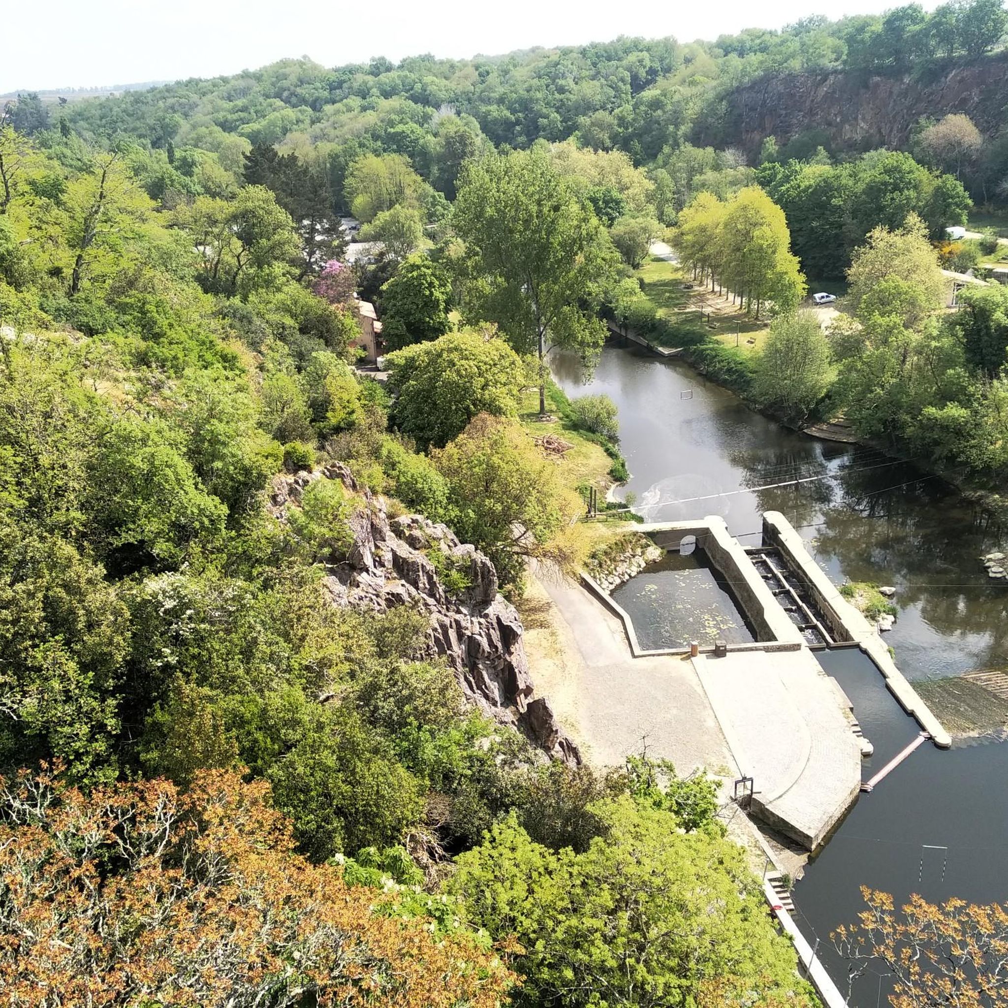
In the past, the Maine was crossed using beams fixed to the rock. The 17th century Reuzard mill with its metal footbridge attests to the intense milling activity that reigned on the river at the time. The current footbridge, which dates from 1911, was renovated in 1977 and allows hikers to access from one bank to the other.
1
0
The great interest of the route along the Maine lies in the many water mills typical of the valley. Each one is accompanied by a causeway - dam - which once formed the water reservoir necessary to operate the wheel. The Reuzard mill (17th century) with its metal footbridge and that of the Vieille-Écluse (15th-16th century) attest to the intense milling activity that reigned on the river at the time. As for the Épinettes mill (mid-19th century), it produced the town's public electricity from 1912. Although they were initially used to grind cereals, these mills were also used to work hides and paper. The name of the village of La Trélitière also evokes the weaving of lattice.
1
0

Nice bridge, kayak base underneath.
0
0
Very beautiful bridge, of uncertain age. Beautifully renovated in 2024.
1
0
비에일레빈 주변에서 가장 인기 있는 명소


더 살펴보기
찾고 있는 하이라이트를 아직 못 찾으셨나요? 다른 지역의 주요 명소 가이드를 확인해보세요:
