ルートプランナー機能アップデート
App
ログインまたはサインアップ
アプリを入手
ログインまたはサインアップ
ルート
Places to see
Mountain passes
フランス
オーヴェルニュローヌアルペス
アヌシー

タロワール-モンマン

タロワール-モンマンの峠・トップ20

風景を楽しんだり、上りや下りを満喫したり、峠には楽しみ方がたくさんあります。タロワール-モンマンの素晴らしい峠の一覧を参照して、思い出に残るアドベンチャーに出かけましょう。コミュニティのメンバーがコミュニティのために投稿した峠のハイライトは、他のユーザーが実際におすすめする情報なので、どれも信頼できるものです。気に入った峠にさっそく向かってみましょう。

最終更新日: 10月 27, 2026

コル・ドゥ・ラ・フォルクラ

ハイライト • 山道

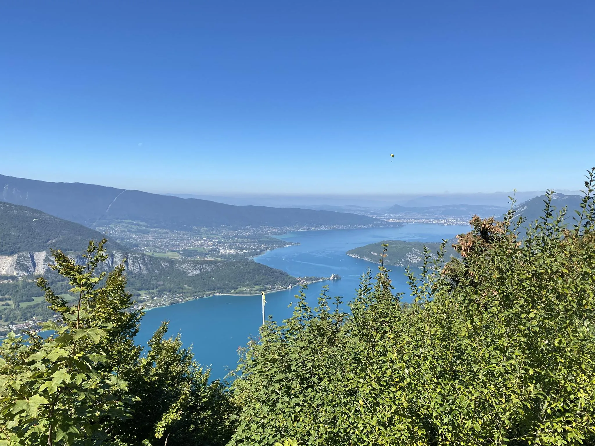
Located at an altitude of 1150 meters, the Col de la Forclaz offers a superb plunging view of Lake Annecy and the peaks that surround it. An incredible spot!

翻訳者 Google •

役立つ情報 は

によるものです

ここでのライドを見るスマートフォンに送信
保存

レショー峠

ハイライト • 山道

It is an alpine pass at an altitude of 900 meters. Several roads provide access. A bar / restaurant can be found at the pass.

翻訳者 Google •

役立つ情報 は

によるものです

保存

今すぐサインアップして、こんな場所を発見しよう

最高のシングルトラック、ピーク、その他のエキサイティングなアウトドアスポットのおすすめを受け取ろう。

無料新規登録

セムノー峠の頂上

ハイライト • 山頂

Alas sign absent during my visit. Very nice shaded climb from Annecy as you cross state forests. Only the last two kilometers are in full sun.

翻訳者 Google •

役立つ情報 は

によるものです

保存
The climb is 7.5 km long. The first half is moderate, and you'd never think you were in the Alps. The second half has an average gradient of 10%, which …

翻訳者 Google •

役立つ情報 は

によるものです

保存

コル・ド・ラ・フラース

ハイライト • 山道

It is a pretty mountain pass, in the middle of the pastures. From there, there is a superb view of the peaks that surround Lake Annecy, in particular the Tournette …

翻訳者 Google •

役立つ情報 は

によるものです

保存

無料でサインアップして、さらに多くの山道を発見しましょう タロワール-モンマンでの。

無料新規登録

すでにアカウントをお持ちですか?

無料アカウントで今日から始めよう

次の冒険が待っています。

ログインまたは登録

タロワール-モンマン周辺で人気

マキシレース - アヌシー湖一周の全貌

Tour de la Resistance - アンシー湖の上のグラベルバイクバックパッキングループ

サモアンからアントルモン=ル=ヴィーユ까지のフランスアルプスを堪能 - GR 96

石灰石の頂を探検する — アンシー湖 GRPツアー

タロワール-モンマンでのハイキング

タロワール-モンマンのランニングコース

タロワール-モンマンでのサイクリング

タロワール-モンマンのMTBトレイル

タロワール-モンマンのロードバイクルート

タロワール-モンマンでの登山&山歩き

タロワール-モンマンでのの他の冒険

マキシレース - アヌシー湖一周の全貌

ランニングのコレクション によって

Julien Harté

コミュニティからのヒント

Tahiry R.
9月 2, 2026, Col de la Frasse

湖側、Entrevernes経由では、最後の数キロは自転車では困難、あるいは通行不能(わだちや段差)です。最後の森の端までロードバイクで往復することは可能です。 Mont-DerriereからのBauges側は、わだちやいくつかの木製構造物があり、依然として非常に急な坂です。 夏でも冬でもハイキングにおすすめです🥾、主にハイキング用のマーキングがその証拠です。

Google翻訳による翻訳•

0

0

小さな峠、D10経由で静かな登り。 峠には井戸があります。

Google翻訳による翻訳•

2

0

Located at an altitude of 1,150 meters, the Col de la Forclaz offers a superb view overlooking Lake Annecy and the surrounding peaks. An incredible spot!

Google翻訳による翻訳•

1

0

The Frasse mountain pasture offers beautiful views of the Roc des Boeufs and sometimes you can even glimpse the lake. It is easily accessible on foot.

Google翻訳による翻訳•

0

0

The Col du Semnoz, climbed by bike, offers a sporty and panoramic experience in the heart of the Alps. Starting from Annecy, the climb takes you through dense forests, green meadows and breathtaking alpine landscapes. As you climb, breathtaking views of Lake Annecy, Mont Blanc and the surrounding massifs are revealed.

Google翻訳による翻訳•

2

1

JP
11月 4, 2023, Col de la Frasse

Even in the snow, this pass is worth the detour!

Google翻訳による翻訳•

0

0

Col de Leschaux is a climb in the Annecy region. It has a length of 11.8 kilometers and a climb of 442 vertical meters with a slope of 3.7% on average, which implies a difficulty level of 191. The top of the climb is located at 900 meters above sea level. Great climb for beginners, a long and linear route with small tight curves, ideal for maintaining speed on the descent. Some traffic, but the road is wide enough and people are generally careful when approaching. You can take this climb as a warm-up for Semnoz, which connects perfectly to the top of this climb. Disadvantage: no views from the top.

Google翻訳による翻訳•

4

1

Semnoz is a mountain in Haute-Savoie, France. It is found in the Bauges range. It has an altitude of 1,699 m above sea level. The mountain is crossed by the D41/D110 road near the Crêt de Chatillon at an altitude of 1,660 m.

Google翻訳による翻訳•

1

0

タロワール-モンマンでのの人気ルート

タロワール-モンマンでのハイキング

タロワール-モンマンでのの人気観光スポット

Lakes

Store rating

komootモバイルアプリでインスピレーションを得よう

無料のkomootアカウントがあれば、無限のアウトドアコースを簡単に見つけてカスタマイズし、ナビで案内できます。

または

今すぐkomootに参加しよう
Store rating

さらに探索

これらのガイドでさらに壮大な山道を見てみましょうタロワール-モンマンでの:

マニグードルブッシェモンシャルヴァンドゥサールトーヌレクレセラヴァルファヴェルジュ-セイテンスシェヴァリーンラチュイルデュアンラ・クリュササンジョリオセヴリエモントンサンベルナールサントゥスタッシュアントルヴェルヌサンフェレオルLa Balme-De-Thuyギエズラ・シャペル・サン・モーリス(La Chapelle-Saint-Maurice)ル・グラン・ボルナンヴェリエデュラックヴァル・ド・シェーズレショーアレックスブリュフィーLesVillards-Sur-Thônesサンジャンドシクストダンジーサンクレアトランス=グリエールセーノッドアレヴキンタルキュシーヴィラズエヴィルアヴィエルノアヌシー・ル・ヴューViuz-La-Chiésazエリー=シュル=アルビーサンフェリックスマリニーサンマルセルナーヴ=パルメラングロワジーレ・ゾリエールChainaz-Les-Frassesクランジェヴリエモエアルビー=シュル=シェラン不機嫌そうなシャヴァノッドマルセラ・アルバネうるさいサンシルベストルシャペリームレシュリュミリーマッサンジーヴァル=ド=フィエロルネブロワメテアルゴネプランジーエパニー-メッツ-テシーシャルヴォネックスクランピニーボネゲテベルソネヴァリエール

近くのアドベンチャーガイド

ブリュフィーでやるべきこと

background

新しいピークを征服する準備をしよう

無料でサインアップ
探検する
ルートルートプランナー機能バウチャーを利用ハイキングMTBトレイルロードバイクルートバイクパッキングサイトマップ
アプリをダウンロード
SNSでフォローする

© komoot GmbH

プライバシーポリシー