ルート

プランナー

機能

アップデート

App

ログインまたはサインアップ

アプリを入手

ログインまたはサインアップ

ルート
登山・山歩き
ドイツ
バーデン・ヴュルテンベルク
レラハ

カンダーン

カンダーンのおすすめ登山&山歩きルート

4.0

(3)

12

ハイカー

2

ハイキング

レラハの山々をもっと探索しませんか?このガイドでご紹介するのは、komootがカンダーンでの登山&山歩きのコレクション全体を評価して選び抜いた、このエリアの人気ルートです。あなたに合ったルートを見つけるには、他のユーザーがアップロードした役立つ情報や写真を閲覧し、クリック操作で簡単に表示できる詳細なデータを参考にしましょう。カンダーンでの次の冒険にぴったりの登山&山歩きルートが見つかるはずです。

最終更新日: 7月 5, 2026

5.0

(2)

6

ハイカー

#1.

Badenweilerから出発する ブラウエン山頂 – ホッホブラウエンからの眺め ループコース

12.3km

04:14

680m

680m

中程度の登山ルート. ある程度のフィットネスレベルが必要です。 進みやすいルートです。あらゆるスキルレベルに適しています。

デバイスでナビ

スマートフォンに送信

保存

中程度

中程度の登山ルート. ある程度のフィットネスレベルが必要です。 進みやすいルートです。あらゆるスキルレベルに適しています。

中程度
guide_signup
私たちがkomootモバイルアプリで道を示します
無料の komoot アカウントがあれば、無限のアウトドアコースを簡単に見つけてカスタマイズし、ナビで案内できます。

無料新規登録

中程度の登山ルート. ある程度のフィットネスレベルが必要です。 進みやすいルートです。あらゆるスキルレベルに適しています。

中程度

おすすめのツアーは他のkomootユーザーが実際に経験した何千ものアクティビティに基づいています。
無料アカウントで今日から始めよう

次の冒険が待っています。

ログインまたは登録

カンダーン周辺で人気

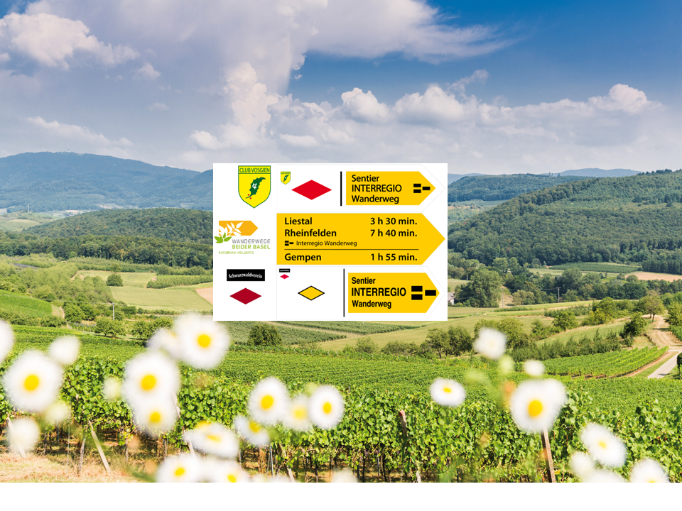
インターレギオハイキングルートをドライレンダーレックまで

Westwegトレイル ブラックフォレストのハイキング – ドイツ 最初の長距離トレイル

カンダーンでのハイキング

カンダーンでのサイクリング

カンダーンのロードバイクルート

カンダーンのランニングコース

カンダーンのMTBトレイル

カンダーンでののグラベルライド

カンダーンでのの他の冒険

インターレギオハイキングルートをドライレンダーレックまで

ハイキングのコレクション によって

Schwarzwaldverein e.V.

コミュニティからのヒント

Andi
9月 30, 2025, Nonnenmattweiher Lake

At around 325 meters long and 200 meters wide, the Nonnenmattweiher pond isn't particularly large, but it's truly beautiful to look at. So, if you're looking for a wonderfully located swimming lake in the Black Forest, you're in the right place by jumping into this medieval lake near Badenweiler. Here, you can swim in peace and enjoy the Black Forest in all its splendor. After the lake had probably silted up in the Middle Ages, it was subsequently dammed. According to legend, a nunnery is said to have sunk into the lake. However, the lake's name doesn't stem from this legend, but rather from the fact that fattening cows, called nuns, used to grazed the pastures surrounding the lake. Source: https://www.schwarzwald-tourismus.info/attraktionen/nonnenmattweiher-der-herrliche-badesee-im-schwarzwald-42507ff4b5

Google翻訳による翻訳

1

0

krihama
12月 31, 2024, Langenebene Hut

In the Langenebenenhütte there is a wood-fired oven where you can cook and bake pizza...😻 Invites you to linger! 👍🏼

Google翻訳による翻訳

0

0

Very nice cabin, in the middle of the forest on the Westweg. A very large bench and weather station are right next to it. Not far away is the Sausenburg ruins.

Google翻訳による翻訳

2

0

Spacious barbecue or picnic area in the middle of the forest. Not far from Sitzenkirch and the Sausenburg ruins. A gigantic bench and a great weather station in the shape of a stone.

Google翻訳による翻訳

1

0

Fantastic views all the way to the Alps...

Google翻訳による翻訳

0

0

Very lovingly restored hut with comfortable furnishings. Spacious surroundings with seating, barbecue area, etc. You can endure it here!

Google翻訳による翻訳

1

0

On the edge of the southern Black Forest, in Baden-Württemberg, is the approximately 1165 m high mountain, which lies in the middle of the districts of Lörrach and Breisgau. A neighboring and well-known place is, for example, Badenweiler. Geographically, the town is located centrally in the triangle of Germany, Switzerland and France. The Hohe Blauen is particularly popular as a viewing point. The area around the Blauen is designated as a landscape conservation area and includes approximately 4119 hectares of mixed forest that extends to just below the summit. The mountain was already named in documents in the 14th century and was known as Blauwen or Blawen. In the 17th century, the mountain was first referred to as "Hoche Blawen". The mountain originally got its name from the dark green, blue-shimmering fir forests. These bathe the mountain in a bluish light and give it an unmistakable face. https://www.schwarzwaldportal.com/ausflugsziel- outlooksturm-hochblauen.html

Google翻訳による翻訳

5

0

Brand new shelter very well insulated and clean with 2 tables, a brand new stove on a small square where there are tables and you can make a fire.

Google翻訳による翻訳

1

0

カンダーンでのの人気ルート

カンダーンでのハイキング

カンダーンでのの人気観光スポット

Places to see

Store rating

komootモバイルアプリでインスピレーションを得よう

無料のkomootアカウントがあれば、無限のアウトドアコースを簡単に見つけてカスタマイズし、ナビで案内できます。

または

今すぐkomootに参加しよう

Store rating

さらに探索

他の地域の最高の登山ハイキング & ルートを見てみましょう。

FeldbergフレーントSchönauimSchwarzwaldトートナウベルクウィーンベーレンアイターンシェーネンベルククライネス・ヴィーゼンタルトゥナウトートナウヴェンバッハウッツェンフェルトヘーク・エールスベルクツェル・イム・ヴィーゼンタルマルスブルク=マルツェルシュリーンゲンショップハイム

近くのアドベンチャーガイド

ヴィットリンゲンでやるべきこと

background

新しいピークを征服する準備をしよう

無料でサインアップ

探検する
ルートルートプランナー機能ハイキングMTBトレイルロードバイクルートバイクパッキングサイトマップ
アプリをダウンロード
SNSでフォローする

© komoot GmbH

プライバシーポリシー