ルート

プランナー

機能

アップデート

App

ログインまたはサインアップ

アプリを入手

ログインまたはサインアップ

ログインまたはサインアップ

ルート
Places to see
Mountain passes
イギリス
ウェールズ
北ウェールズ
コンウィ

ドルウイゼランコミュニティ

ドルウイゼランコミュニティの峠・トップ16

風景を楽しんだり、上りや下りを満喫したり、峠には楽しみ方がたくさんあります。ドルウイゼランコミュニティの素晴らしい峠の一覧を参照して、思い出に残るアドベンチャーに出かけましょう。コミュニティのメンバーがコミュニティのために投稿した峠のハイライトは、他のユーザーが実際におすすめする情報なので、どれも信頼できるものです。気に入った峠にさっそく向かってみましょう。

最終更新日: 5月 13, 2026

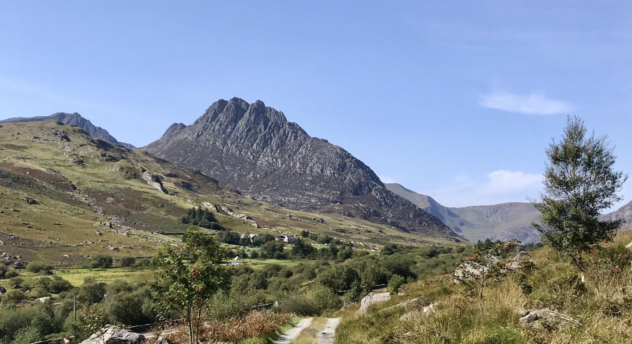
クニヒト山頂

ハイライト • 自然記念物

Nicknamed the Welsh Matterhorn, albeit 12,431 feet (3,789 m) lower than its Swiss counterpart, what Cnicht lacks in height it makes up in shapely attractiveness. It is a fantastically pointy, …

役立つ情報

によるものです

ここでのハイキングを見る

スマートフォンに送信

保存

ペン・イー・パス

ハイライト • 駐車場

Right in the heart of northern Eryri (Snowdonia), Pen-y-Pass is superbly located for adventures on the Yr Wyddfa (Snowdon) massif and the Glyderau. It is a popular starting point for …

役立つ情報

によるものです

保存

今すぐサインアップして、こんな場所を発見しよう

最高のシングルトラック、ピーク、その他のエキサイティングなアウトドアスポットのおすすめを受け取ろう。

無料新規登録

ブールク・グラス峠

ハイライト • 自然記念物

The finger stone at Bwlch Glas marks the point at which the Pyg and Miners' Tracks reach the summit ridge and join the Crib Goch, Ranger and Llanberis Paths. Particularly helpful in poor visibility.

役立つ情報

によるものです

保存

Bwlch Main(ブールク・マイン)稜線

ハイライト • トレイル

The narrow ridge of the Bwlch Main (Narrow Pass) is the highlight of the route. Although the ridge is not difficult, it is still exposed with steep slopes on either …

翻訳者 Google •

役立つ情報

によるものです

保存

テレグラフ・バレー(マエスグム)

ハイライト (セグメント) • トレイル

Maesgwm is also known as Telegraph Valley. The trail is gravel and well-made, brilliant to ride and much quieter than the main Llanberis path. It makes a great loop from …

役立つ情報

によるものです

保存

無料でサインアップして、さらに多くの山道を発見しましょう ドルウイゼランコミュニティでの。

無料新規登録

すでにアカウントをお持ちですか?

無料アカウントで今日から始めよう

次の冒険が待っています。

ログインまたは登録

ドルウイゼランコミュニティ周辺で人気

エリリの山奥の心臓を通るドラマ的なハイキング - スノウドニアウェイ

ドルウイゼランコミュニティのMTBトレイル

ドルウイゼランコミュニティでのハイキング

ドルウイゼランコミュニティのロードバイクルート

ドルウイゼランコミュニティでののグラベルライド

ドルウイゼランコミュニティのランニングコース

ドルウイゼランコミュニティでのサイクリング

ドルウイゼランコミュニティでの登山&山歩き

ドルウイゼランコミュニティでのの他の冒険

エリリの山奥の心臓を通るドラマ的なハイキング - スノウドニアウェイ

ハイキングのコレクション によって

Alex Foxfield

コミュニティからのヒント

Clive G
10月 10, 2025, Bwlch Main Ridge

The Bwlch Main (south west ridge) is a great way to descend from the summit of Snowdon, particularly on a winter's day. Great views all the way to the Irish Sea

0

0

🥾Bwlch Main (Welsh: “narrow pass”) is the exposed ridge that connects the upper slopes of the Rhyd Ddu Path to the Snowdon summit. A narrow crest with steep drops on either side, making it both dramatic and challenging. The ridge is roughly 500–600m long and feels like a true alpine section compared with the grassy and stony lower parts of the trail. 👥 Quiet & scenic: Unlike the “motorway” feel of the Llanberis Path, Bwlch Main gives a real mountain experience with the thrill of exposure. For experienced hikers seeking an exhilarating experience, it significantly quieter (albeit much easier) than Crib Goch. 👁️‍🗨️ On a clear day you can see the Nantlle Ridge, Moel Hebog, and across to the sea. Looking north, Llyn Cwellyn and the ridges rolling out towards Anglesey. ⚠️ Dramatic ridgeline section: The path to the top of Snowdon from this ridge includes the Llechog ridge, which provide exposure (drops, narrower path sections) the narrow section gets to only a couple of feet wide. You will need a good head for heights! And some boots with good grips for some looser rock or scree sections. Check the mountain forecast before heading out 🌬️ In high winds, the ridge can feel intimidating and unsafe. 🌧️❄️In ice, snow, or heavy rain, the narrow path and sloping rock become treacherous. 😶‍🌫️ Cloud / fog can reduce visibility and make it psychologically harder. To sum up: The Bwlch Main ridge is one of Snowdon’s most thrilling features. It adds a real sense of adventure to the Rhyd Ddu Path. On a good day, it’s a highlight: airy, beautiful, and memorable without being a true scramble. But in poor weather, it can turn from exhilarating to dangerous very quickly. For experienced walkers in fair conditions, it’s one of the most rewarding routes to the summit. For those with vertigo or less mountain experience, it may be better admired from afar.

0

0

Clive G
8月 14, 2025, Cnicht Summit

Rainbows on mountains tend to be a mixed blessing as they are a pretty sure sign that you are about to get wet! However from the photographers point of view they can also signal some great light, with sun mixed in with dark moody clouds. This was the view from near the summit of Cnicht - otherwise sometimes called the Welsh Matterhorn due to its pointy appearance from the village of Croesor. To the right of the picture is Moel Hebog which rises steeply above the pictuesque village of Beddgelert.

0

0

Clive G
8月 14, 2025, Cnicht Summit

A fine rocky and in places narrow ridge, and you will often have it all to yourself!

0

0

Beautiful hike, too bad it was cloudy at the top. 12.3 km isn't the actual distance you'll be hiking: it's definitely 10 km more because you can't walk a straight line on this path. It's very busy on this trail; there's a queue to reach the top.

Google翻訳による翻訳

0

0

Crazy hiking all the way up and then seeing a train pass you on the final section!

0

0

Juliane
6月 24, 2025, Pen-y-Pass

If you want to park here, you have to reserve a parking space in advance for 20 GBP. We didn't manage to do it, as everything was fully booked. You can then park in Llanberies and take the Sherpa Bus S1 or S2 to Pen y Pass. The bus runs every half hour. From Pen y Pass, you can then choose the Miner's Track or Pyg Track. Have fun!

Google翻訳による翻訳

2

0

Bumble-Bee
6月 23, 2025, Pen-y-Pass

Currently parking is pre-booking only! All others are directed to the P+R in the village and need to get up by bus or walk.

3

0

ドルウイゼランコミュニティでのの人気ルート

ドルウイゼランコミュニティのMTBトレイル

ドルウイゼランコミュニティでのの人気観光スポット

Places to see

Store rating

komootモバイルアプリでインスピレーションを得よう

無料のkomootアカウントがあれば、無限のアウトドアコースを簡単に見つけてカスタマイズし、ナビで案内できます。

または

今すぐkomootに参加しよう

Store rating

さらに探索

これらのガイドでさらに壮大な山道を見てみましょうドルウイゼランコミュニティでの:

カペルキュリグコミュニティドルガルログコミュニティカイルヒンコミュニティトレリウコミュニティブローマハノコミュニティLlanddoged And MaenanEglwysbachBetws-Y-CoedLlangwm

近くのアドベンチャーガイド

リナウ・ミンビールでやるべきこと

background

新しいピークを征服する準備をしよう

無料でサインアップ

探検する
ルートルートプランナー機能ハイキングMTBトレイルロードバイクルートバイクパッキングサイトマップ
アプリをダウンロード
SNSでフォローする

© komoot GmbH

プライバシーポリシー