ルート

プランナー

機能

アップデート

App

ログインまたはサインアップ

アプリを入手

ログインまたはサインアップ

ログインまたはサインアップ

ルート
ランニングコース
オーストリア
ニーダーエスターライヒ州
ノインキルヒェン地区

メーニッヒキルヒェン

メーニッヒキルヒェンのおすすめランニングルート

4.3

(20)

494

ランナー

46

ランニング

メーニッヒキルヒェンでランニングを楽しめば、このエリアをより深く知ることができます。ランニングに適した美しいルートが見つかるように、komootがメーニッヒキルヒェンでのルートのコレクション全体を評価して選び抜いた、人気ランニングトレイルをご紹介します。ルートをクリックして詳細を表示し、他のユーザーがアップロードした役立つ情報や写真を閲覧しましょう。

最終更新日: 5月 20, 2026

22

ランナー

#1.

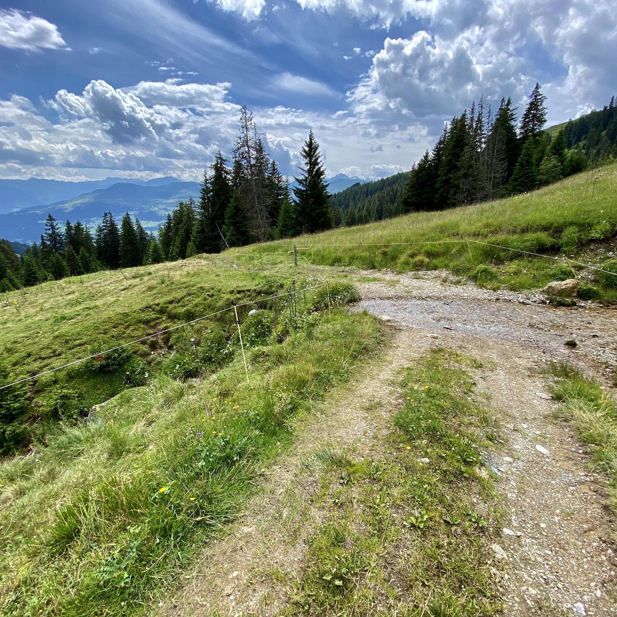
ハラーハウス・マウンテンロッジループコース(Mönichkirchenから出発)

6.83km

00:59

370m

370m

難しいジョギング. 標準以上のフィットネスレベルが必要です。 全般的に舗装された状態です。あらゆるスキルレベルに適しています。

デバイスでナビ

スマートフォンに送信

保存

難しい

難しいジョギング. 標準以上のフィットネスレベルが必要です。 全般的に進みやすいルートです。一部で、安定して歩行できる技術が必要です。

難しい
guide_signup
私たちがkomootモバイルアプリで道を示します
無料の komoot アカウントがあれば、無限のアウトドアコースを簡単に見つけてカスタマイズし、ナビで案内できます。

無料新規登録

難しいジョギング. 標準以上のフィットネスレベルが必要です。 全般的に進みやすいルートです。一部で、安定して歩行できる技術が必要です。

難しい

難しいジョギング. 標準以上のフィットネスレベルが必要です。 全般的に舗装された状態です。あらゆるスキルレベルに適しています。

難しい

難しいジョギング. 標準以上のフィットネスレベルが必要です。 安定して歩行できる技術、丈夫な靴、高標高地での登山経験が必要です。

難しい
無料新規登録すると、メーニッヒキルヒェンでのでのランニングをさらに42件ご覧いただけます。

さらに多くのルートや他のユーザーのおすすめ情報を確認できます。

無料新規登録

すでにアカウントをお持ちですか?

おすすめのツアーは他のkomootユーザーが実際に経験した何千ものアクティビティに基づいています。

無料アカウントで今日から始めよう

次の冒険が待っています。

ログインまたは登録

メーニッヒキルヒェン周辺で人気

オーストリア下部の最も美しい峰 - ウィーンアルプス弧をハイキング

国境を越えて-オーストリアからハンガリーまでのアルパノニアハイキング

ウィーンの地方山での家族アドベンチャー

Ride & Relax – Mit dem Rad in den Wiener Alpen

メーニッヒキルヒェンでのハイキング

メーニッヒキルヒェンでのサイクリング

メーニッヒキルヒェンでののグラベルライド

メーニッヒキルヒェンのロードバイクルート

メーニッヒキルヒェンのMTBトレイル

メーニッヒキルヒェンでの登山&山歩き

メーニッヒキルヒェンでのの他の冒険

オーストリア下部の最も美しい峰 - ウィーンアルプス弧をハイキング

ハイキングのコレクション によって

Tamara (unterwegs)

コミュニティからのヒント

Johann K
8月 17, 2025, Hallerhaus

Beautiful location, good place to stop for a break, right next to the mountain bike trails and the start of the "Haller Trail".

Google翻訳による翻訳

0

0

Michi :)
7月 5, 2025, Stoa Alm

Very interesting hut, made entirely of wood and whole tree trunks.

Google翻訳による翻訳

0

0

A knife was stuck in front of the memorial stone. We used it for our own purposes and then returned it to the memorial stone for future visitors to this murder scene.

Google翻訳による翻訳

0

0

Cool trail, also suitable for non-professionals. It starts at the Mönichkirchner Schwaig. 😊

Google翻訳による翻訳

1

0

The mountain ridge of the Wechsel stretches for over 15 km - the eastern Austrian low mountain range on the border between Lower Austria and Styria 🌲 Its three most lofty peaks each rise over 1,700 m ⛰️ Thanks to its mountain landscapes, which range from lovely to challenging, the Wechsel is considered a hiking destination for families on the one hand - and a local recreation area for experienced hikers and climbers on the other 🥾 The Hochwechsel, as the highest peak, offers particularly worthwhile views: the panoramic view stretches from Semmering and Rax to the Schneeberg 🌄 In good weather, even Burgenland, Styria, Hungary and Slovenia can be seen 😎 From mid-May to mid-November, a wonderful rest in the Wetterkoglerhaus is also tempting 🧃 www.wieneralpen.at/ausflugsziel-in-den-wiener-alpen-entdecken/a-hochwechsel-im-wechselgebirge

Google翻訳による翻訳

10

0

The Hochwechsel summit not only offers an impressive panoramic view of the surrounding landscape of Styria and Lower Austria, but is also known for its picturesque chapel, which invites visitors to reflect and relax 🌄 Inside, the chapel surprises with colorful paintings, coats of arms and inscriptions that are painted directly onto the wood of the dome and reach all the way to the top ⛪ Source www.steiermark.com/de/Oststeiermark/Urlaub-planen/Ausflugsziele/Hochwechsel-Gipfel_isd_42403458

Google翻訳による翻訳

9

0

Altitude 📕 1743 m Rooms/beds 📗 9 Mattresses 📘 26 Winter room 📙 The winter room is not locked (3 places, heated). 3 places, electric fan heater with coin slot, no cooking facilities. Emergency room 📓 The emergency room is unlocked. Is the same as the winter room. www.alpenverein.at/wetterkoglerhaus

Google翻訳による翻訳

8

0

The mountain ridge of the Wechsel stretches for over 15 km - the eastern Austrian low mountain range on the border between Lower Austria and Styria 🌲 Its three most lofty peaks each rise over 1,700 m ⛰️ Thanks to its mountain landscapes, which range from lovely to challenging, the Wechsel is considered a hiking destination for families on the one hand - and a local recreation area for experienced hikers and climbers on the other 🥾 The Hochwechsel, as the highest peak, offers particularly worthwhile views: the panoramic view stretches from Semmering and Rax to the Schneeberg 🌄 In good weather, even Burgenland, Styria, Hungary and Slovenia can be seen 😎 From mid-May to mid-November, a wonderful rest in the Wetterkoglerhaus is also tempting 🧃 www.wieneralpen.at/ausflugsziel-in-den-wiener-alpen-entdecken/a-hochwechsel-im-wechselgebirge

Google翻訳による翻訳

9

0

メーニッヒキルヒェンでのの人気ルート

メーニッヒキルヒェンでのハイキング

メーニッヒキルヒェンでのの人気観光スポット

Places to see

Store rating

komootモバイルアプリでインスピレーションを得よう

無料のkomootアカウントがあれば、無限のアウトドアコースを簡単に見つけてカスタマイズし、ナビで案内できます。

または

今すぐkomootに参加しよう

Store rating

さらに探索

他の地域の最高のランニングトレイル & ルートを見てみましょう。

Reichenau an der Raxゼーベンシュタイン自然公園テルニッツヴィンパッシングイムシュワルザターレBürg-Vöstenhofゼーベンシュタインプリクグリッツモルラマーの森Prein an der RaxRaach am HochgebirgeGrafenbach-Sankt ValentinピッテングログニッツProbstwaldエンツェンライトキルヒベルクアムウェッセルパイエルバッハザンクトコロナアムウェッヒセルツェーバーントラッテンバッハエトリッツショットヴィーントーマスベルクHöfleinanderHohenWandシュラッテンバッハプフベルクプフベルク・アム・シュニーベルクオッタータールアスパングマルクトファイストリッツ・アム・ウェッヒセルシャイブリングキルヒェン-テルンベルクグリンメンシュタインSchwarzau im GebirgeZinswaldウィレンドルフグリューンバッハ・アム・シュニーベルクゼンメリングブライテンシュタインSierningtal FlatzerWand自然公園Aspangberg-St.PeterザンクトエーギュデンアムスタインフェルドLahnwaldシュヴァルツァウアムスタインフェルドヴュルフラッヒヴァルトマンシュテッテンロイパースバッハ

近くのアドベンチャーガイド

Aspangberg-St.Peterでやるべきこと

background

新しいピークを征服する準備をしよう

無料でサインアップ

探検する
ルートルートプランナー機能ハイキングMTBトレイルロードバイクルートバイクパッキングサイトマップ
アプリをダウンロード
SNSでフォローする

© komoot GmbH

プライバシーポリシー