ルートプランナー機能アップデート
App
ログインまたはサインアップ
アプリを入手
ログインまたはサインアップ
ルート
Places to see
Lakes
イタリア
トレント

ジアーノ・ディ・フィエンメ

ルート
Places to see
Lakes
イタリア
トレント

ジアーノ・ディ・フィエンメ

ジアーノ・ディ・フィエンメの湖・トップ20

次の冒険でジアーノ・ディ・フィエンメの素晴らしい湖を訪れてみませんか?湖畔の穏やかな雰囲気や、天気が良い日のひと泳ぎは格別です。komootコミュニティがおすすめするジアーノ・ディ・フィエンメの素晴らしい湖の一覧を参考にして、次の冒険では湖をもっと満喫しましょう。

最終更新日: 11月 6, 2026

カレッツァ湖(カレルゼー)

ハイライト • 湖

It is most beautiful when there is light sunshine and no wind. Then the Latemar massif is beautifully reflected in the emerald green, clear water of the lake.

翻訳者 Google •

役立つ情報 は

によるものです

ここでのハイキングを見るスマートフォンに送信
保存

ラヴァゼ峠

ハイライト • 山道

The Lavazè pass, located at an altitude of 1,808 metres, connects the Val di Fiemme, Trentino, with the Val d'Ega, Alto Adige. The Lavazè pass area is known for Nordic …

翻訳者 Google •

役立つ情報 は

によるものです

保存

今すぐサインアップして、こんな場所を発見しよう

最高のシングルトラック、ピーク、その他のエキサイティングなアウトドアスポットのおすすめを受け取ろう。

無料新規登録
“Where is a lake here?” - That's what many people will think if they only find a wet meadow here. Due to the strong karstification of the subsoil, the lake …

翻訳者 Google •

役立つ情報 は

によるものです

保存

ラヴァツェ湖

ハイライト • 湖

THE LAVAZÈ LAKE

Hydrogeological information

The lake is located in a depression formed during the last ice age, following the retreat of the moraine that descended from the slopes of …

翻訳者 Google •

役立つ情報 は

によるものです

保存

ボンバゼル湖群

ハイライト • 湖

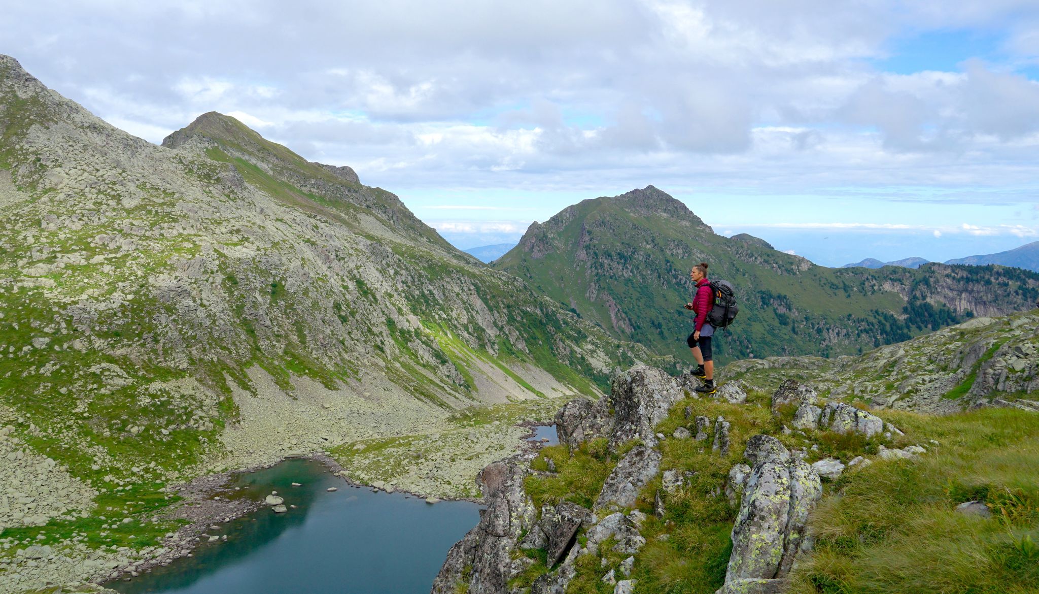
The three lakes of Bombasel are small but suggestive alpine basins set in wild nature.
They are located in the Lagorai valley and offer a spectacular view of the Dolomites.
This is a perfect spot to enjoy a well-deserved break.

翻訳者 Google •

役立つ情報 は

によるものです

保存

無料でサインアップして、さらに多くの湖を発見しましょう ジアーノ・ディ・フィエンメでの。

無料新規登録

すでにアカウントをお持ちですか?

無料アカウントで今日から始めよう

次の冒険が待っています。
ログインまたは登録

ジアーノ・ディ・フィエンメ周辺で人気

トランスラゴライ – トレンティーノの野生の心を夢のトレッキング

Explore the heart of the Dolomites – discover Val di Fiemme by MTB

ジアーノ・ディ・フィエンメのロードバイクルート

ジアーノ・ディ・フィエンメでのハイキング

ジアーノ・ディ・フィエンメのMTBトレイル

ジアーノ・ディ・フィエンメでのサイクリング

ジアーノ・ディ・フィエンメのランニングコース

ジアーノ・ディ・フィエンメでの登山&山歩き

ジアーノ・ディ・フィエンメでののグラベルライド

ジアーノ・ディ・フィエンメでのの他の冒険

トランスラゴライ – トレンティーノの野生の心を夢のトレッキング

ハイキングのコレクション によって

Visit Trentino

コミュニティからのヒント

RyAn
9月 20, 2024, Lago di Lavazè

THE LAVAZÈ LAKE Hydrogeological information The lake is located in a depression formed during the last ice age, following the retreat of the moraine that descended from the slopes of the Pala de Santa (2488 m above sea level) and formed a large part of the Lavazè plateau, whose terrain is characterized by rugged moraines, sandy-silty alluvial deposits, porphyries and groundwater debris. The hill that contains the lake on the south-west side is also composed of morainic debris to a depth of about 10 meters, as are the sides to the north and east. On the south side, however, the porphyries of volcanic origin stand out, which form the substrate of the lake and, under the morainic debris, form its actual impermeable bed. (Text from the exhibitor) The basin of Lake Lavazè is located at an altitude of 1804.2 m above sea level, contains a volume of about 26,000 m3 of water and occupies an area of about 26,000 m².

Google翻訳による翻訳•

1

0

Wonderful place, as is the path to get there from Lagorai lake

Google翻訳による翻訳•

1

0

The 1808m high Passo di Lavazè offers the opportunity for easy hikes. There is a short circular route around the lake, right at the pass, from where you can enjoy a beautiful view of the nearby and mighty Latemaar mountain rocks.

Google翻訳による翻訳•

1

0

The three lakes of Bombasel are small but suggestive alpine basins set in wild nature. They are located in the Lagorai valley and offer a spectacular view of the Dolomites. This is a perfect spot to enjoy a well-deserved break.

Google翻訳による翻訳•

1

0

A fantastic place that invites you to linger!

Google翻訳による翻訳•

2

0

The Lavazè pass, at an altitude of 1,807 metres, connects the Fiemme valley in Trentino with the Ega valley in Alto Adige. This area is renowned for Nordic skiing, with around 80 meters of trails dedicated to cross-country skiing. The lake is calm and the views are fantastic. For running, the pass offers easy, well-maintained trails. Even if it gets crowded, there are many routes available and as you get further away, you will find fewer people. You have several options of routes, both flat and uphill.

Google翻訳による翻訳•

2

0

The route begins on the fork on the left, and continues up to the summit.

Google翻訳による翻訳•

0

0

The lake can dry up completely in summer and is then a large meadow.

Google翻訳による翻訳•

2

0

ジアーノ・ディ・フィエンメでのの人気ルート

ジアーノ・ディ・フィエンメのロードバイクルート

ジアーノ・ディ・フィエンメでのの人気観光スポット

Natural Monuments

Store rating

komootモバイルアプリでインスピレーションを得よう

無料のkomootアカウントがあれば、無限のアウトドアコースを簡単に見つけてカスタマイズし、ナビで案内できます。

または

今すぐkomootに参加しよう
Store rating

さらに探索

まだ完璧な湖が見つかりませんかジアーノ・ディ・フィエンメでの?これらの地域のガイドをチェックして、さらに美しい場所を見てみましょう。

ステーニコロンツォ・キエニスリーヴァデルガルダレードロナーゴ・トルボレアルコ天皇森トレ・ヴィッレコマーノテルメトレントピンゾロカリゾーロジュスティーノモルヴェーノドロブレントーニコフィアヴェフォンドヴェルミーリオペッリッツァーノヴィッレ・ダナウニアコンメッツァドゥーラオッサーナアヴィオサルノーニコマロスコルッフレメンドラカヴァレーノプレダイアメッツァーナサンロレンツォドルシーノアディジェロンゾンアンブラールドンサントルソラテルメチヴェッツァーノペルジーネ・ヴァルスガナParco naturale provinciale dell'Adamello Brentaバゼルガ・ディ・ピネディマロ・フォルガリダスフルツヴァッレラーギフラッシロンゴヴィニョーラファレシーナマドルッツォドレーナペイイオ男ロンチェーニョテルメフォルガリーアイゼーラカステルフォンドアンダロノヴァレードテナカルチェラーニカアルラーゴベゼネッロヴィララガリーナラヴァローネルゼルナレーヴィコ・テルメラビロメノアルトピアーノデラヴィゴラナカルドナッツォカンピテッロディファッサフィエロッツォブレッジョ・スペリオーレブレズクロズスピアッツォピエーヴェ・ディ・ボノ-プレッツォルモFornaceカヴェーディネAltavalleスポルマッジョーレアラカデルツォーネテルメガルニーガテルメマッシメーノアルビアーノプレダッツォクレスダンベルロヴェレートカナツェイStoroベドッロシモーネカナールサンボボティオネ・ディ・トレントブレージモラビスカステッロテシーノモエナファイデッラパガネッラポッツァディファッサカステッロ・モリーナ・ディ・フィエンメセゴンツァーノボルゴ・バルスガナジョーヴォソヴェールTelveストレンボカッリアーノヴァルフロリアーナパルーデルフェルシーナセラ・ジュディカリーボルゴ・キエーゼヴァルダオーネマッツィーンロナ・ラゼスファエードチェンブラリジニャゴカヴェダーゴザンバーナソラーガトルチェーニョボルゴラレスヴィーゴ・ディ・ファッサボンドーネプリミエーロサンマルティーノディカストロッツァイメルテゼロポマローロメッツァーノカバレゼカラーノパンキアダイアーノシンテテシーノスポルミノーレスクレッレカプリアーナナーヴェサンロッコヴァレナピエーヴェ・テシーノトンカンポデンノパルコナチュラーレパネヴェッジョ-パレディサンマルティーノロヴェレ・デッラルナRevòテルヴェ・ディ・ソプラグリーニョサンミケーレオールアディジェモンテブリオーネメッゾロンバルドサンゼーノカルデスノガレードでんの続きストリーニョカステルビエノメッツォコローナレドロ湖カステルコンディーノヴァラルササグロンミスモルヴェーノ湖クロヴィアーナサモーネアルデーノリボテルツォラーストランビレーノテラニョーロロマッロカルツァーノポルテディレンデナカヴィッツァーナRete Di Riserve Alpi Ledrensiロンキ・ヴァルスガナカーニョシスペルーゴトブリーノ湖カルドナッツォ湖カヴェーディネ湖レヴィコ湖ボチェナーゴCastelnuovo能美ヴォラーノテンノ湖フェダイア湖

近くのアドベンチャーガイド

パンキアでやるべきこと

background

新しいピークを征服する準備をしよう

無料でサインアップ
探検する
ルートルートプランナー機能バウチャーを利用ハイキングMTBトレイルロードバイクルートバイクパッキングサイトマップ
アプリをダウンロード
SNSでフォローする

© komoot GmbH

プライバシーポリシー