アルメントのおすすめツーリングルート
21
ライダー
8
ライド
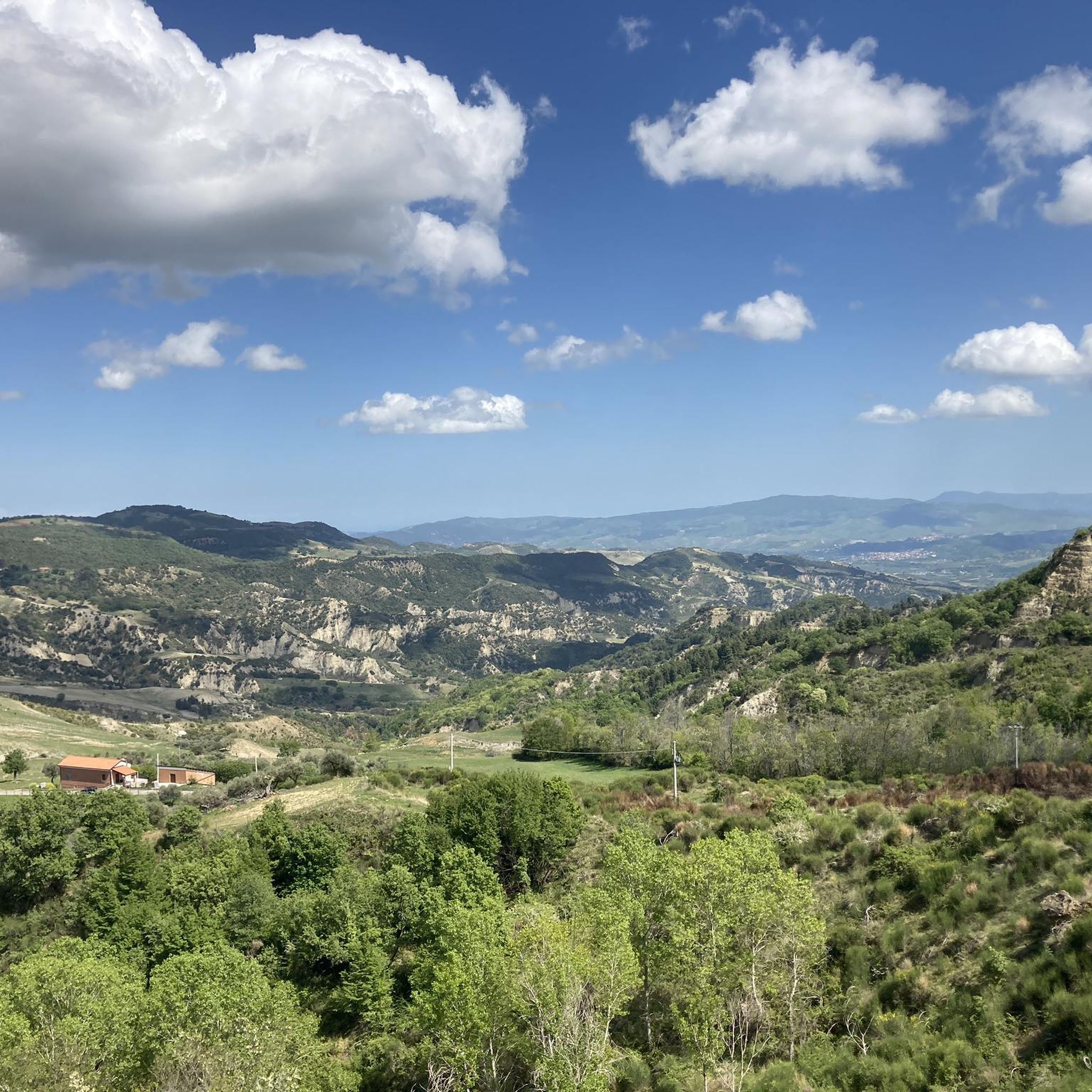
アルメート(イタリア)周辺のサイクリングは、バジリカータ州の多様な景観を巡るルートを提供します。ヴァル・ダグリに位置するこの地域は、標高325メートルから1080メートルまで変化し、サイクリストに様々な地形を提供します。この地域は、なだらかな丘陵地帯、ルカニア・アペニン山脈の山岳地帯、そして絵のように美しい谷が特徴です。サイクリストは、カラーンキのバッドランドのユニークな地質学的特徴を含む、これらの自然の景観を横断するルートを期待できます。
アルメート周辺のベストサイクリングルート
- 最も人気のあるサイクリングルートは、アリアーノとカラーンキのループで、距離16.3マイル(26.3 km)、所要時間1時間57分です。この難易度の高いルートは、特徴的なカラーンキのバッドランドの景観を探検します。
- 地元のサイクリストに人気のもう一つのルートは、ペルトゥジッロ湖とグルメンツムのループで、距離26.3マイル(42.4 km)の難易度の高いコースです。このルートはペルトゥジッロ湖の景色を楽しみ、古代の考古学的遺跡グルメンツムを通過します。
- 地元のサイクリストに愛されているもう一つのルートは、コルレト・ペルティカラからのルカニア・ドロミテスのループで、距離40.3マイル(64.9 km)、所要時間約5時間11分で、ドラマチックなルカニア・ドロミテスを抜けるルートです。
- アルメート周辺のサイクリングは、なだらかな丘陵地帯、ルカニア・アペニン山脈の山岳地帯、そして絵のように美しい谷によって特徴づけられます。このネットワークは、主に経験豊富なサイクリスト向けのオプションを提供しており、いくつかの適度な難易度のルートも利用可能です。
- このガイドには、この地域の景観の最高を披露する高評価のルートが含まれています。20人以上のサイクリストがkomootを利用して、アルメートの多様な地形を探検しました。
最終更新日: 8月 28, 2026
1
ライダー
42.4km
02:54
710m
710m
Embark on the Lake Pertusillo and Grumentum Loop, a challenging touring cycling adventure that spans 26.3 miles (42.4 km). You will climb a significant 2315 feet (705 metres) in elevation,…
2
ライダー
64.9km
05:12
1,830m
1,830m
Prepare for a difficult touring cycling adventure on the Lucanian Dolomites Loop from Corleto Perticara, covering 40.3 miles (64.9 km) with a significant 6020 feet (1835 metres) of elevation gain.…

無料新規登録
5
ライダー
76.3km
05:00
1,070m
1,070m
難しい自転車ライド. 標準以上のフィットネスレベルが必要です。 全般的に舗装された状態です。あらゆるスキルレベルに適しています。
5
ライダー
35.1km
03:18
1,080m
1,080m
難しい自転車ライド. 標準以上のフィットネスレベルが必要です。 全般的に舗装された状態です。あらゆるスキルレベルに適しています。
3
ライダー
40.3km
03:24
1,160m
1,160m
難しい自転車ライド. 標準以上のフィットネスレベルが必要です。 全般的に舗装された状態です。あらゆるスキルレベルに適しています。
さらに多くのルートや他のユーザーのおすすめ情報を確認できます。
無料新規登録
すでにアカウントをお持ちですか?
おすすめのツアーは他のkomootユーザーが実際に経験した何千ものアクティビティに基づいています。
無料アカウントで今日から始めよう
次の冒険が待っています。
ログインまたは登録
アルメント周辺で人気

コミュニティからのヒント

descent that leads to the shore of the lake
0
0

After the narrow alleys and steps through the old town, the climb to the rocks is worthwhile. Even in rainy weather, the rocks are easily accessible via iron stairs. In heavy rain, every small alley becomes a rushing stream.
3
0

The Grumentum Archaeological Park preserves, within an exceptionally suggestive landscape, the remains of one of the major Roman cities of Regio III: Lucania et Bruttii. Initially a small Lucanian center allied with Rome, settled since the beginning of the 3rd century BC, it was crossed by Hannibal during the Second Punic War, when he took the side of the Carthaginians, and was the scene of a battle narrated by Livy. Following a slow process of Romanization, which provided for land assignments to the Romans through the centuriation system, the center was monumentalized starting from the middle of the 1st century BC, when it was refounded as a Roman colony. From this period onwards, it was equipped with all the typical monuments of Roman cities, in imitation of the Urbe. Today the site, a unique example in Basilicata of a Roman urban plan that is clearly legible as a whole, allows a visit through the public and private spaces of the Roman city, still delineated by the regularity of the ancient road axes. From the theater you can reach the Italic temple, the domus with mosaics and, along the paving of the main plateia, the area of the Forum with public, civil and religious buildings (Capitolium, Augusteo, Porticus, Curia, Basilica, Forensic Baths). The route then continues to the Terme Maggiori, an extraordinarily preserved thermal complex, rich in luxurious decorative apparatus (mosaics, imported marbles...), to the Basilica of Santa Maria Assunta, which represents the first cathedral when the center became the seat of a bishop. The route ends near the monumental amphitheater, one of the oldest masonry amphitheaters known to us. Strategically positioned on the eastern edge of the hill, it is located overlooking the Pietra del Pertusillo Lake, in the heart of the Appennino Lucano National Park. A visit to Grumentum allows you to fully appreciate the close relationship between archaeology and nature, between landscape and culture. Source Ministry of Culture Discover all our routes on www.viaggiatorelento.com
0
0

Steep stairs, narrow streets, some chapels and churches are waiting to be explored. There are beautiful views from the Piazza Emilio Caizzo of the village and the surrounding countryside.
2
0

Archaeological area of the ancient Roman Grumentum.
0
0
Ancient remains of an amphitheater of Roman origin.
0
0
the archaeological park deserves a greater enhancement, difficult to visit as it is almost always closed.
0
0

Small and picturesque village that rises almost lying on the Lake of Pietra del Pertusillo and at the foot of Mount Raparo, in the heart of the Appennino Lucano Val D’Agri Lagonegrese National Park. In the historic center stands a terrace from which it is possible to enjoy an exceptional view over the entire Val d'Agri.
1
0
よくある質問
アルメンド周辺のサイクリングツアーでは、どのような地形が予想されますか?
Val d'Agriに位置するアルメンド周辺のサイクリングツアーでは、多様でしばしば険しい景観が楽しめます。起伏のある丘、ルカニア・アペニン山脈の山岳地帯、絵のように美しい谷々に出会うでしょう。標高は325メートルから1080メートルまで大きく変化し、やりがいのある登りと景色の良い下りが期待できます。この地域には、カラ ンキのバッドランドのようなユニークな地質学的特徴もあります。
アルメンドのサイクリングツアーコースはどのくらい難しいですか?
アルメンド周辺のサイクリングツアーコースは、主に経験豊富なサイクリストに適しています。利用可能な9つのコースのうち、8つが難易度が高いと分類されており、中程度のコースは1つだけです。これは、この地域の山岳地帯と大きな標高差を反映しています。
アルメンド近郊のサイクリングツアーコースでは、どのような自然の特徴やランドマークを見ることができますか?
多くのコースで素晴らしい自然の景色が楽しめます。例えば、ペルトゥジッロ湖とグルメンツムのループでは、ペルトゥジッロ湖の景色を眺めることができます。アリアーノとカラ ンキのループでは、特徴的なカラ ンキのバッドランドを探検します。また、ベルサリエレ渓谷を見下ろす展望台のような展望ポイントや、コルレト・ペルティカラからのルカニア・ドロミテのループのようなコースで見られるドラマチックなルカニア・ドロミテも見られます。
アルメンド周辺をサイクリングする際に、訪れることができる史跡はありますか?
はい、アルメンドとその周辺は歴史が豊かです。この町自体、アルメンドのライダーやクリトニオスの王冠を含む重要な考古学的発見で知られています。ペルトゥジッロ湖とグルメンツムのループは、古代の考古学遺跡グルメンツムのそばを通ります。さらに、「キリストはエボリで止まった」で紹介されたアリアーノ村は、アリアーノとカラ ンキのループからアクセスできます。
アルメンド地域で、長距離のサイクリングツアーコースにはどのようなものがありますか?
長距離ライドには、距離40.3マイル(64.9 km)で通常約5時間11分かかるコルレト・ペルティカラからのルカニア・ドロミテのループを検討してください。もう一つの長距離オプションは、76.3 kmをカバーするスピノソからのペルトゥジッロ湖~カヴール水道のループです。
アルメンドには、家族向けのサイクリングツアーコースはありますか?
アルメンド周辺のサイクリングツアーコースは、ほとんどが難易度が高く、中程度のコースは1つしかありません。これは、ほとんどのコースが子供連れの家族や非常に平坦で簡単なライドを求める家族には難しすぎる可能性があることを示唆しています。経験豊富なサイクリングを楽しむ家族は、中程度のコースが適しているかもしれませんが、大きな標高差と険しい地形のため、注意が必要です。
他のサイクリストは、アルメンドでのサイクリングツアーのどのような点を最も楽しんでいますか?
この地域はkomootコミュニティから高く評価されており、平均スコアは5.0つ星です。レビューでは、多様で挑戦的な地形、ルカニア・アペニン山脈とカラ ンキのバッドランドの息をのむような自然の美しさ、そして史跡や静かな田園イタリアを探検する機会がしばしば称賛されています。
アルメンド近郊には、周回型のサイクリングツアーコースはありますか?
はい、この地域のサイクリングツアーコースの多くは周回型です。例としては、人気のアリアーノとカラ ンキのループ、ペルトゥジッロ湖とグルメンツムのループ、そしてコルレト・ペルティカラからのルカニア・ドロミテのループがあります。これらのループコースは、同じ場所から出発して同じ場所に戻ることができます。
アルメンドでのサイクリングツアーに最適な時期はいつですか?
この地域の山岳地帯や丘陵地帯を考慮すると、春と秋は一般的にサイクリングツアーに最も快適な時期です。気温は穏やかで、景色は鮮やかです。夏は、特に谷間ではかなり暑くなる可能性があり、冬は気温が低くなり、標高の高い場所では道路状況が厳しくなる可能性があります。
ルカニア・アペニン山脈の景色を楽しめるサイクリングツアーコースはありますか?
もちろんです。この地域はルカニア・アペニン山脈に特徴づけられており、多くのコースでパノラマビューが楽しめます。コルレト・ペルティカラからのルカニア・ドロミテのループは、特にこのドラマチックな山脈を通り抜けます。もう一つのコース、コルレト・ペルティカラからのルカニア・アペニン山脈~森林トレイルのループも、アペニン山脈の景観の素晴らしい眺めを提供しています。
アルメントでのの人気観光スポット

komootモバイルアプリでインスピレーションを得よう


さらに探索
他の地域の最高のサイクリングルートを見てみましょう。
