スラスクロス貯水池周辺のアトラクション&必見スポット - トップ4
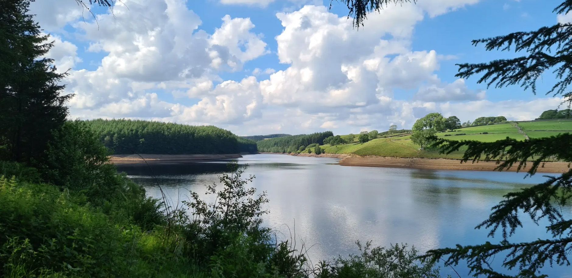
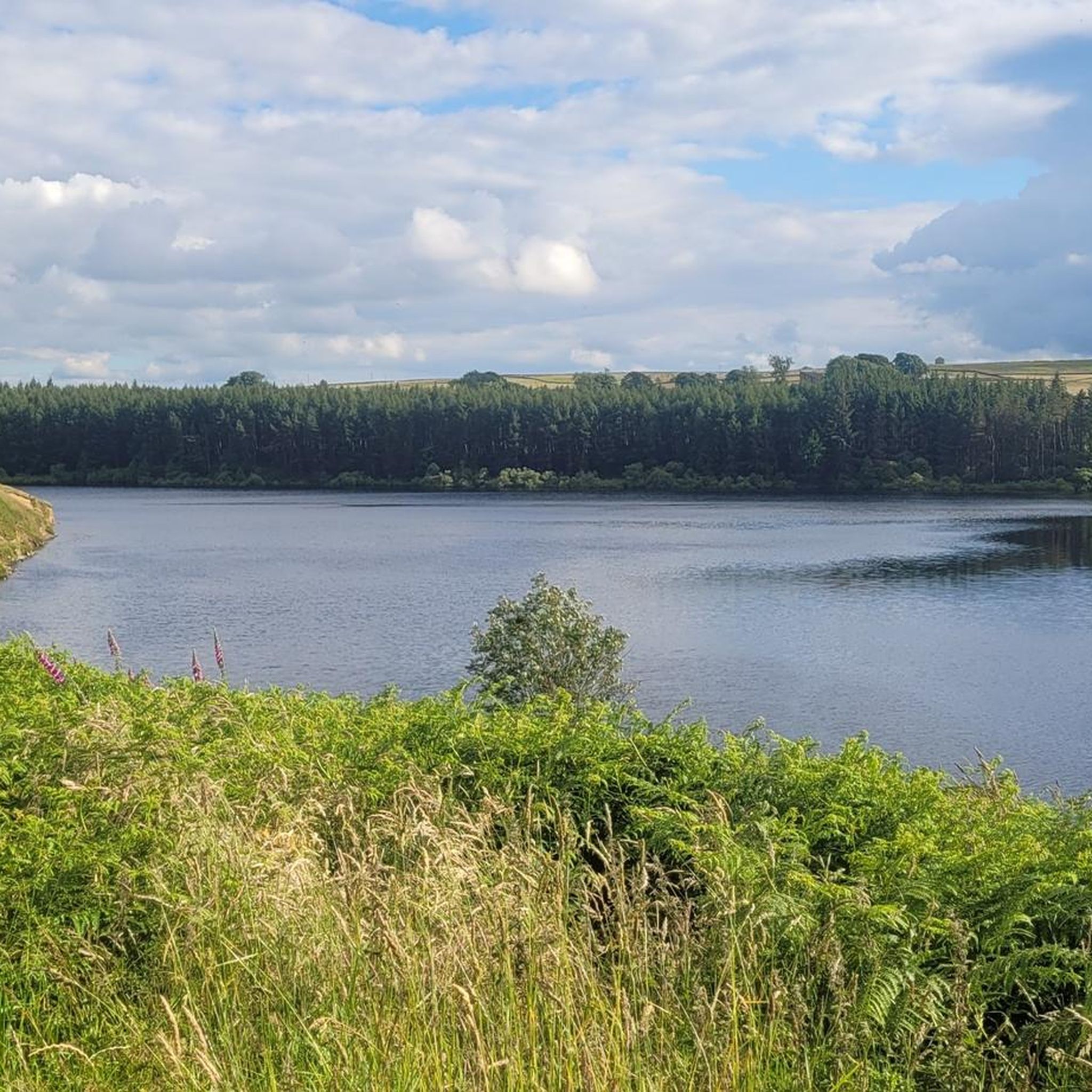
スラスクロス貯水池周辺の最高の観光スポットや見どころには、ウォッシュバーン渓谷の重要な自然景観である貯水池自体が含まれます。ここは4つの貯水池の中で最も北に位置し、最も標高が高く、人里離れた風光明媚な景観を提供しています。この地域は、周囲の荒野、森林、そして水没したウェストエンド村の史跡で知られています。訪問者は多様な景観と歴史的な痕跡を探検できます。
スラスクロス貯水池周辺の最高の観光スポットと見どころ
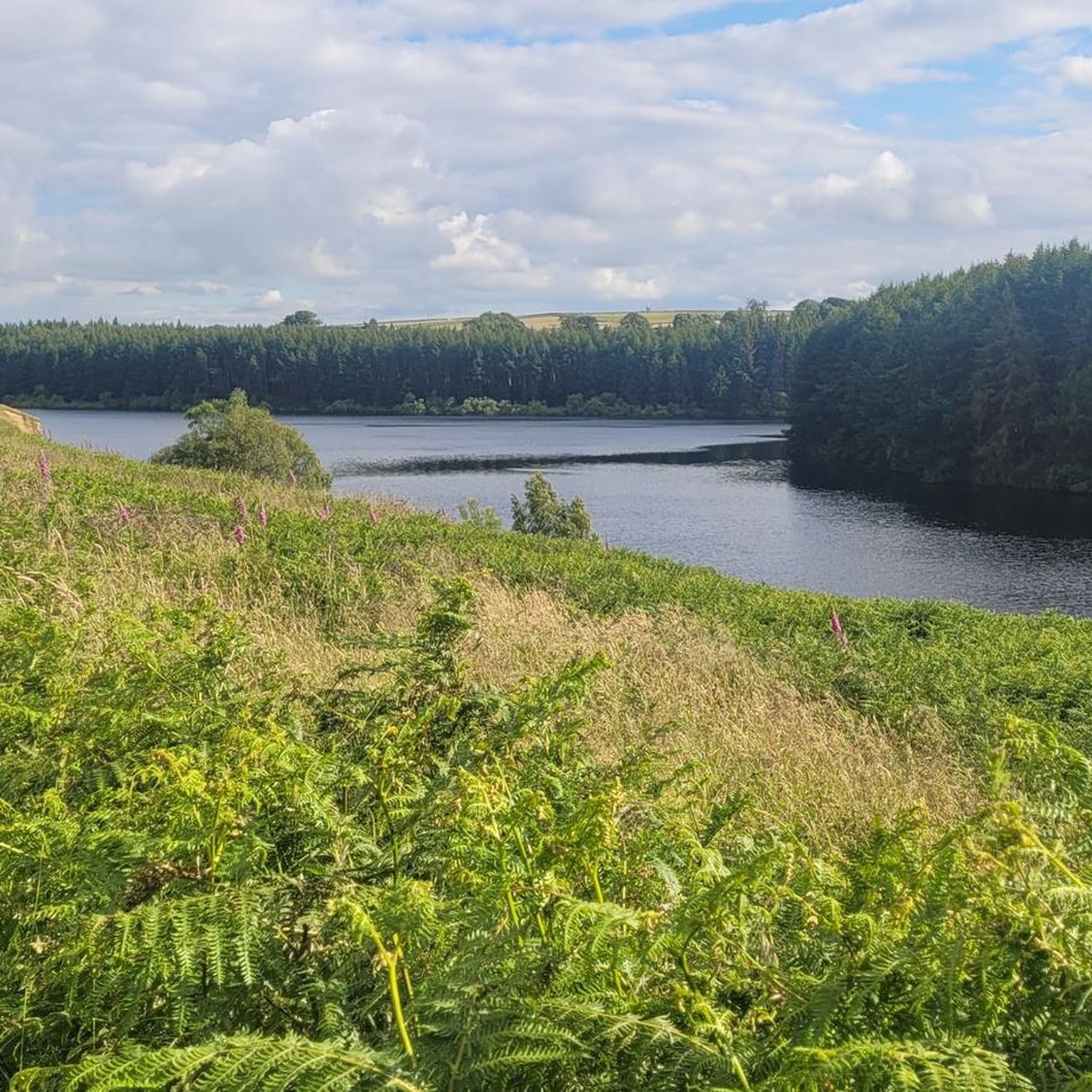
- 最も人気のあるアトラクションは、ウォッシュバーン貯水池の中で最も静かなビューポイントであるスラスクロス貯水池です。人里離れた場所にあり、特に貯水池道路からの眺めは素晴らしい、散策に最適な風光明媚な場所です。
- もう一つの必見スポットは、史跡であるスラスクロス貯水池のウェストエンド村の遺跡です。1960年代に貯水池が建設された際に水没した村の痕跡が残る不気味な光景で、パトリックの製粉所や教会などの建物が水の下に消えています。
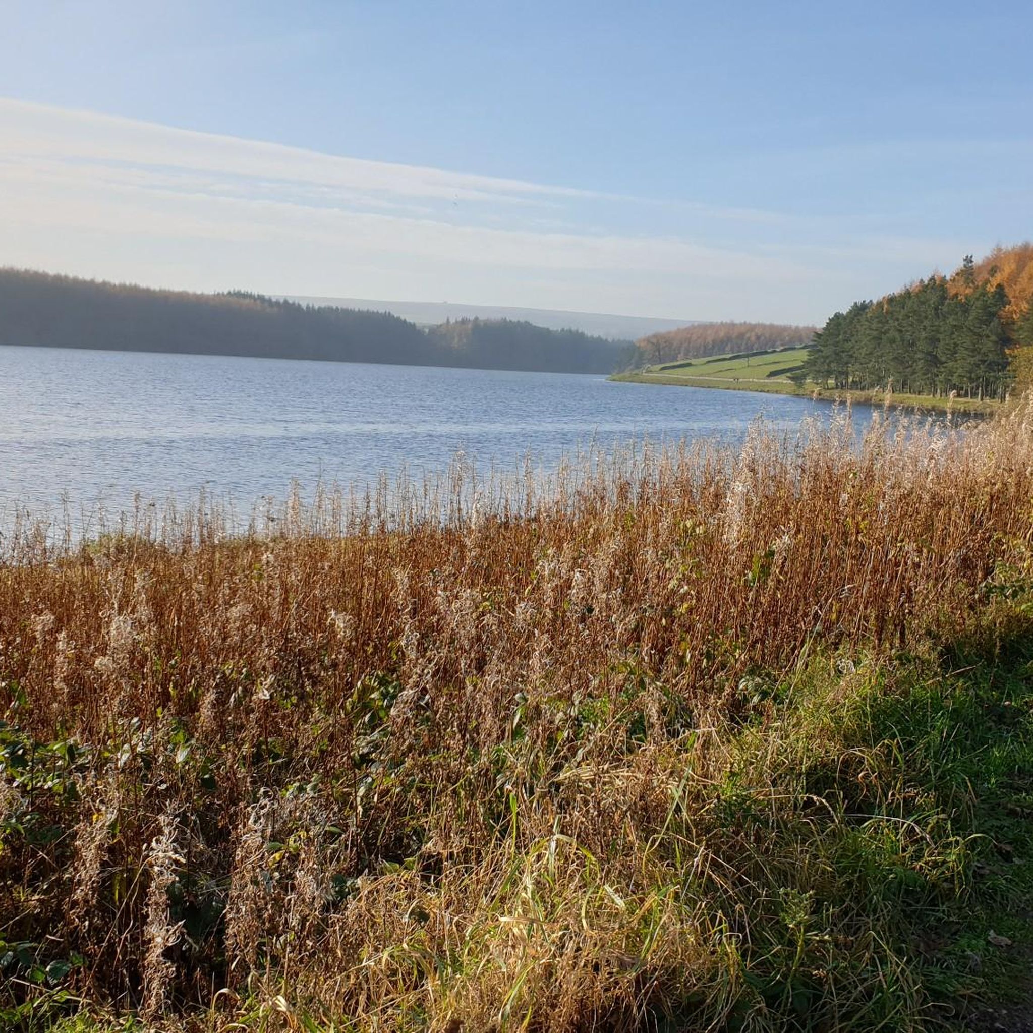
- 訪問者は、貯水池の心地よい景色を提供するトレイルであるスコットレーン湖畔パスも気に入っています。このパスは北岸に沿って走り、西側とは異なる体験を提供し、ダムまでの景色が広がります。
- スラスクロス貯水池は、自然景観、史跡、ウォーキングルートで知られています。この地域は、風光明媚な展望台から考古学的な興味まで、さまざまなアトラクションを提供しています。
- スラスクロス貯水池周辺のアトラクションは、komootコミュニティによって高く評価されており、訪問者から29件の「いいね」と13枚の写真が共有されています。
最終更新日: 8月 18, 2026
スラスクロス貯水池
ハイライト • 展望台
役立つ情報 は

スラスクロス貯水池にあるウェストエンド村の廃墟
ハイライト • 集落
役立つ情報 は

今すぐサインアップして、こんな場所を発見しよう
最高のシングルトラック、ピーク、その他のエキサイティングなアウトドアスポットのおすすめを受け取ろう。
無料新規登録
スコット・レーン湖畔の小道
ハイライト • トレイル
役立つ情報 は
スラスクロス貯水池駐車場
ハイライト • 駐車場
役立つ情報 は

ホルム・フィールド・ヘッド遺跡
ハイライト • 展望台
役立つ情報 は
無料アカウントで今日から始めよう
次の冒険が待っています。
ログインまたは登録

コミュニティからのヒント

Imposing and deserted building overlooking the northern end of Thruscross Reservoir. Recorded by the Yorkshire Vernacular Buildings Group in 1976: "The 1841 census return shows it to have been occupied by a young unmarried woman called Ann Young farming over 200 acres; a family with the same surname contemporaneously occupied Whit Moor Farm with a similar acreage."
1
0
Undoubtedly the most scenic of the Washburn reservoirs with the moorland backdrop to the north. The circular route around the reservoir from the car park is about 5 miles, the track on the southwestern side runs along the edge of plantations and offers some shade from the sun and shelter from the elements. The track on the northeastern side is more exposed, and if you do the whole circuit you will cross over Far Comb Hill and the plantation along the edge of the reservoir at Whit Moor - a great route.
0
0
Fair sized and well-maintained car park with space for at least 30-40+ vehicles. Few picnic tables at the south-eastern end of the car park. There is also space for a few cars if you park off-road next to Thruscross Reservoir Lodge, on Reservoir Road on the eastern side of the dam, but these spots tend to fill up quickly.
1
0
Different experience on each side of the reservoir. The track on the west / southwestern side is shaded and slightly elevated, running along the edge of plantations, and Scot Lane on the eastern side is a bit more exposed. A full circular route of the reservoir is around 5 miles or so.
1
0
The walk from the large car park at Thruscross Reservoir dam up the west side of the reservoir to Cloggers Lane is magical and gives far better views than the tracks along Scot Lane on the eastern side. The track meanders along the edge of coniferous plantations, giving dappled shade on a sunny day and unobstructed views across the reservoir.
1
0

Scot Lane runs on the northern bank of the reservoir. A pleasant, relatively newly planted hedge runs along this bank, and the views of the reservoir are lovely; you will be able to make out the dam from here on the opposite side of it.
0
0
It is very odd to think that an entire village once existed here, but that's what you're looking at here. The entire village of West End. Cloggers Lane dropped here towards Patrick's Mill, the Butcher's Arm and a church, all of which vanished under the Thruscross Reservoir in the mid 1960s. A curious, eerie sight.
0
0
There are four reservoirs in the Washburn Valley, and this one is the northernmost. What distinguishes this one from the other three is also the fact that this one was built in 1966 while the other ones in the 19th century. The reservoir belongs to Yorkshire Water, the water company. From Reservoir Road in particular, the views of the reservoir are stunning - particularly given that you are high above. Sunsets here are just something else!
0
0
よくある質問
スクラストロ・リザーバー周辺で探索できる史跡は何ですか?
最も重要な史跡は、スクラストロ・リザーバーにあるウェスト・エンド・ビレッジ遺跡です。この村は1966年に貯水池が建設された際に水没しましたが、その遺構、古い基礎やかつての亜麻工場などが、水位が低い時期に姿を現します。また、貯水池の北端を見下ろす威厳のある廃墟であるホルム・フィールド・ヘッド遺跡や、より広いワッシュバーン渓谷の先史時代の集落の痕跡も見られます。
スクラストロ・リザーバー周辺にハイキングコースはありますか?
はい、スクラストロ・リザーバーはウォーキングに非常に人気があります。貯水池の周りを巡る起伏のある約7.2km(4.5マイル)の円形ルートは、森林、荒野、牧草地を抜ける変化に富んだ地形を提供します。より穏やかなオプションとして、水辺へと続く森林地帯を抜ける約2.4km(1.5マイル)のアクセス可能な円形小道があります。スコット・レーン・レイクサイド・パスは貯水池の北岸にあり、美しい眺めを楽しめます。
スクラストロ・リザーバーとその周辺の最高の眺めはどこで見られますか?
貯水池自体が素晴らしい眺めを提供しており、特に高台にある貯水池道路からは絶景が楽しめます。スコット・レーン・レイクサイド・パスからは、貯水池越しにダムの素晴らしい眺めが楽しめます。より広いエリアのパノラマビューを楽しむには、より挑戦的なサイモンズ・シートとロッキング・ホールのループを検討してみてください。
スクラストロ・リザーバーは、この地域の他の貯水池と比べて何がユニークですか?
スクラストロはワッシュバーン渓谷にある4つの貯水池の中で最も北に位置し、最も標高が高いため、より人里離れた静かな雰囲気を持っています。その最もユニークな特徴は、水面が低い時に水没したウェスト・エンドの村の遺跡が現れることで、過去への物悲しい一瞥を提供します。この地域はダーク・スカイ・ディスカバリー・サイトとしても指定されており、星空観察に最適です。
スクラストロ・リザーバーにはアクセス可能な小道や施設はありますか?
はい、森林地帯を抜けて水辺へと続く約2.4km(1.5マイル)のアクセス可能な円形小道があり、より穏やかな散策を求める方に適しています。主要なスクラストロ・リザーバー駐車場は、適度な広さで手入れが行き届いており、車椅子でのアクセスも可能で、ピクニックテーブルも利用できます。
スクラストロ・リザーバーの近くにはどのようなアウトドアアクティビティやルートがありますか?
貯水池の円形ウォーキングコース以外にも、この地域では様々なアウトドアアクティビティが楽しめます。簡単な「スクラストロ・リザーバーとクロッガーズ・レーン・ループ」や、より挑戦的な「サイモンズ・シートとロッキング・ホール・ループ」など、数多くのハイキングコースがあります。マウンテンバイク愛好家には、「デントン・ムーア – レッド・ゲート・トレイル・ループ」のようなルートがいくつかあります。詳細については、スクラストロ・リザーバー周辺のハイキングおよびスクラストロ・リザーバー周辺のマウンテンバイクコースのガイドページをご覧ください。
スラスクロス貯水池を訪れるのに最適な時期はいつですか?
スラスクロス貯水池は一年中その美しさを提供します。春と夏は、緑豊かな森林と荒野を楽しむのに理想的です。秋は風景に鮮やかな色彩をもたらします。水没したウェストエンド村の遺構を見るチャンスを得るには、干ばつや水位が低下する時期が最適ですが、これは一年中のさまざまな時期に発生する可能性があります。この地域は、光害が最小限であるため、晴れた夜の星空観察にも優れています。
スラスクロス貯水池は家族連れや犬の散歩に適していますか?
はい、この地域は一般的に家族連れや犬の散歩に適しています。1.5マイル(約2.4km)のアクセス可能な円形パスは、より穏やかな家族の散歩に最適です。スコットレーン湖畔パスも心地よい選択肢です。多くのトレイルは犬に優しいですが、特に家畜や野生動物の近くでは、常に犬を管理下に置いてください。
スラスクロス貯水池の近くで星空観察はできますか?
もちろんです。スラスクロス貯水池周辺の地域、特に駐車場は、ダークスカイディスカバリーサイトとして指定されています。これは光害が最小限であることを意味し、晴れた夜の星空観察や天体の観測に最適な場所となっています。
スラスクロス貯水池の周辺でどのような野生生物に会えますか?
スラスクロス貯水池は野生生物、特に鳥類の楽園です。ウズラシギ、ミヤコドリ、時折現れるトビなどが見られるバードウォッチングの良い場所です。周囲の森林や荒野は、さまざまな他の地元の動物相も支えています。
経験豊富なハイカー向けの、より挑戦的なハイキングコースはありますか?
はい、経験豊富なハイカーで挑戦を求めている方には、「サイモンズシートとロッキングホールループ」がおすすめです。これは13.3マイル(21.4km)のハイキングで、かなりの標高差があり、サイモンズシートからはパノラマビューが楽しめます。このルートは、より広い荒野の景観をよりハードに探検できます。

komootモバイルアプリでインスピレーションを得よう


さらに探索
まだ探しているハイライトが見つかりませんか?他の地域のトップアトラクションのガイドを見てみましょう:
