センター郡周辺のおすすめ犬連れハイキング&ウォーキング
4.9
(22)
278
ハイカー
5
ハイキング
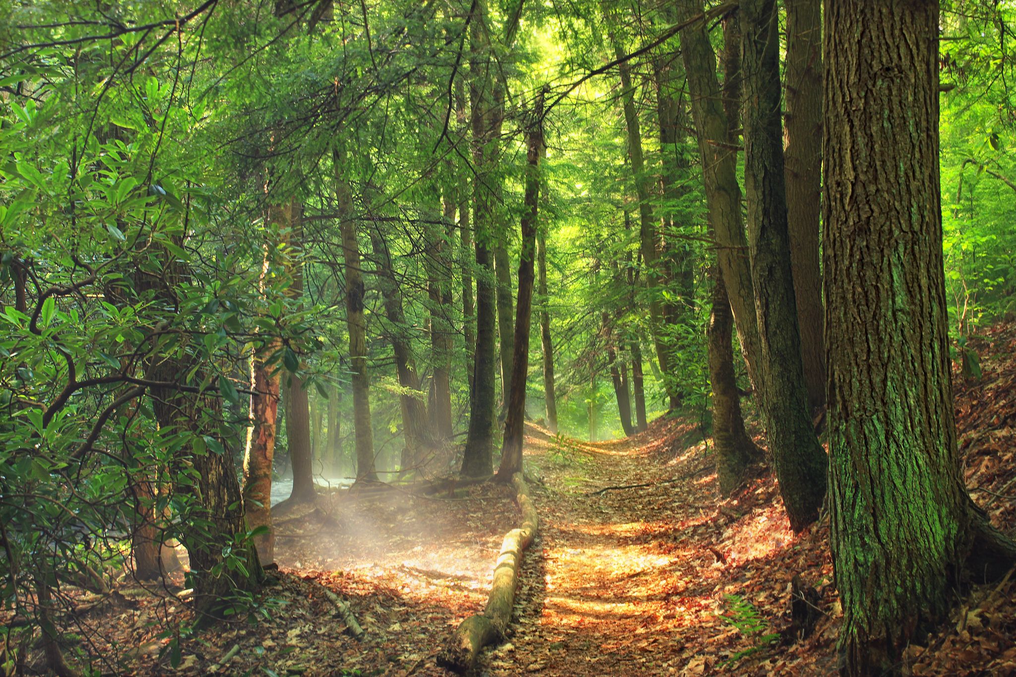
Centre Countyの犬同伴可能なハイキングトレイルは、山岳の尾根、広大な州立森林、ユニークな湿地生態系を特徴とする景観を横断します。この地域には、ニッタニー山やタッシー山のような著名な高台があり、ロスロック州立森林やイーグル州立森林のような広大なエリアもあります。ハイカーは、森の小道から独特のフェン湿地、川沿いの小道まで、多様な地形を期待できます。
Centre Countyの犬同伴可能な最高のハイキングトレイル
- 最も人気のある犬同伴可能なハイキングルートは、State Game Lands Short Loop via Sleepy Hollow Driveで、2.2マイル(3.5 km)のトレイルで、所要時間は約1時間です。この簡単なルートは、木立の中を緩やかに登ります。
- 地元のハイカーに人気のもう一つのトップコースは、Allegheny Front Trail: Beaver Mills to Ralph's Majestic Vistaで、3.3マイル(5.4 km)の簡単なコースです。このトレイルは、周囲の谷の広大な景色を提供する、注目すべき景色の良い展望台へと続いています。
- 地元のハイカーはまた、Ralph's Pretty Good View – Ralph's Majestic Vista loop from Defunct microwave facilityも気に入っています。これは、森に覆われた地形を通り抜ける6.6マイル(10.7 km)のトレイルで、所要時間は約3時間15分です。
- Centre Countyでのハイキングは、山岳の尾根、広大な州立森林、ユニークな沼沢生態系によって特徴づけられます。このネットワークは、簡単なループからより挑戦的な長距離ルートまで、さまざまなレベルの能力に対応するオプションを提供します。
- Centre Countyのルートは、komootコミュニティから高く評価されており、20件以上のレビューで平均4.7つ星を獲得しています。約300人のハイカーがkomootを使用して、Centre Countyの多様な地形を探索しました。
最終更新日: 10月 11, 2026
5.0
(2)
1
ハイカー
3.48km
00:58
60m
60m
初級者向けハイキング. あらゆるフィットネスレベルに適しています。 進みやすいルートです。あらゆるスキルレベルに適しています。
5.37km
01:34
160m
120m
初級者向けハイキング. あらゆるフィットネスレベルに適しています。 進みやすいルートです。あらゆるスキルレベルに適しています。

87.6km
25:29
2,260m
2,200m
難しいハイキング. 標準以上のフィットネスレベルが必要です。 進みやすいルートです。あらゆるスキルレベルに適しています。
5.0
(4)
2
ハイカー
6.02km
01:38
90m
90m
初級者向けハイキング. あらゆるフィットネスレベルに適しています。 進みやすいルートです。あらゆるスキルレベルに適しています。
1
ハイカー
中程度のハイキング. ある程度のフィットネスレベルが必要です。 進みやすいルートです。あらゆるスキルレベルに適しています。
おすすめのツアーは他のkomootユーザーが実際に経験した何千ものアクティビティに基づいています。
無料アカウントで今日から始めよう
次の冒険が待っています。



コミュニティからのヒント

This junction connects the AFT to the 3.67-mile Shingle Mill Trail, which follows the beautiful Black Moshannon Creek into the heart of Black Moshannon State Park's recreation area. The trail ends at Black Moshannon Lake Dam, one of the park's highlights. The lake is known for world-class trout fishing, a fantastic beach, and a swimming area, making it an excellent detour, especially on a warm summer day.
0
0
Black Moshannon Creek spans 22.9 miles from the Allegheny Plateau into Black Moshannon Lake and through the expansive Black Moshannon Bog. This slow-moving and peaceful branch, also known as Little Moshannon Creek, is fed by clear springs and small streams and is a reliable water source for hikers.
0
0
Moshannon Creek, a tributary of the West Branch of the Susquehanna River, runs for 57.4 miles and is known for its reddish-orange water and rocks colored by iron compounds from nearby mining activities.“Often called “Red Moshannon” or “Red Mo,” this creek is known for its striking appearance—but its water is heavily polluted and not safe for drinking. Don’t confuse it with nearby Black Moshannon Creek, which does have safe, drinkable water.
0
0
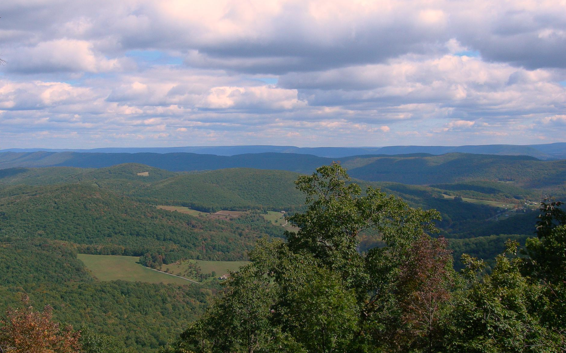
The name of this viewpoint is arguably quite an understatement. The vantage point gives a different view of the valley below than the nearby Ralph's Majestic Viewpoint as it stretches northwest. The area is filled with lush pastures and forests, and the Bald Eagle Ridge extends for miles. You’ll find yourself thinking, “That really is pretty good.”
0
0
This trailhead, also known as the PA-504 trailhead, is the official eastern access point for the Allegheny Front Trail (AFT). Parking is available, and there is a posted sign with up-to-date trail information. Access to the trailhead is free to the public. There is no restroom here, and potable water is only available near the beach at Black Moshannon State Park. However, the trail itself is often close to streams, making water sources relatively easy to find, so bring a filter or pack plenty of water. From this trailhead, several trails branch off and connect back to the main trail, making it a popular spot for day hikers to explore the Moshannon State Forest and Black Moshannon State Park for a few hours.
0
0
Ralph’s Majestic Vista offers breathtaking views to the southwest over the valley below, beyond Bald Eagle Ridge, with Mount Nittany and Tussey Mountain. On a clear day, you can catch a glimpse of the community of Julian in the distance. Beautifully framed by the surrounding trees, it’s worthy of taking a few memorable photos. There is a nice log bench here, perfect for a break to enjoy the incredible scenery.
0
0

Black Moshannon State Park provides access for a few outdoor activities across this 3,394-acre landscape. Black Moshannon Lake is one of the park's highlights, where trout can be caught and swimmers can enjoy themselves.
0
0
よくある質問
Centre Countyには、犬と一緒に歩けるハイキングコースがいくつありますか?
このガイドでは、Centre Countyで犬と一緒に楽しめるハイキングコースを5つ紹介しています。難易度は簡単なものから難しいものまで幅広く、様々な体力レベルや好みに合わせた選択肢があります。
初心者や犬連れの家族に適した、簡単な犬同伴ハイキングコースはありますか?
はい、Centre Countyには初心者やご家族連れに最適な、簡単な犬同伴ハイキングコースがいくつかあります。気軽に散策するなら、3km強の「State Game Lands Short Loop via Sleepy Hollow Drive」を検討してみてください。もう一つのアクセスしやすい選択肢は、「Allegheny Front Trail: Beaver Mills to Ralph's Majestic Vista」で、5.3kmの簡単なコースで風光明媚な景色を楽しめます。
Centre Countyの犬同伴ハイキングコースでは、どのような自然の特徴やランドマークが期待できますか?
Centre Countyの犬同伴ハイキングコースは、山岳の尾根、広大な州立森林、ユニークな湿原生態系など、多様な景観を巡ることがよくあります。ラルフズ・マジェスティック・ビスタのような風光明媚な展望台からは、広大な眺望が楽しめます。多くのコースは、Colyer Lakeのような主要な自然の名所や、Rothrock State Forestのような地域内にあり、愛犬と一緒に森林や水辺の景観を楽しむ機会を提供しています。
経験豊富なハイカー向けの、挑戦的な犬同伴ハイキングコースはありますか?
愛犬と一緒に挑戦的なハイキングを求める経験豊富なハイカーには、完全な「Allegheny Front Trail」がおすすめです。この87kmに及ぶ長大なルートは、かなりの高低差があり、Moshannon State Forestを抜ける真の持久力の試練となります。
Centre Countyには、犬同伴可能なループトレイルはありますか?
はい、犬同伴可能なループトレイルがあります。「Ralph's Pretty Good View – Ralph's Majestic Vista loop from Defunct microwave facility」は、中程度の難易度で10.6kmのループコースで、素晴らしいパノラマビューと、あなたと愛犬にとって満足のいく体験を提供します。
Centre Countyの犬同伴ハイキングコースについて、他のハイカーはどのような点を最も楽しんでいますか?
komootコミュニティはCentre Countyでのハイキング体験を高く評価しており、平均スコアは4.7つ星です。レビューでは、静かな森から印象的な展望まで、多様な景観と、愛犬との楽しい外出を可能にする手入れの行き届いた小道がよく称賛されています。
Centre Countyで愛犬とハイキングするのに最適な時期はいつですか?
Centre Countyで愛犬とハイキングするのに理想的なのは、一般的に春と秋です。穏やかな気温は、あなたとペットの両方にとってより快適であり、秋の紅葉は壮観な景色を提供します。夏も快適ですが、特に長いコースでは暑さや湿度に注意が必要です。冬のハイキングも可能ですが、コースは氷や雪で覆われている場合があるため、適切な装備と注意が必要です。
Centre Countyで特に犬に優しい州立公園はありますか?
Centre Countyのいくつかの州立公園では、トレイルでの犬の同伴が許可されています。「Black Moshannon State Park」は、ユニークな湖と周囲の湿地で知られ、穏やかなトレイルを提供しています。「Bald Eagle State Park」も山岳トレイルを提供しています。訪問前に、必ず各公園のリード着用義務や立ち入り禁止区域に関する規則を確認してください。
私と愛犬のために、風光明媚な景色を楽しめるトレイルはどこで見つけられますか?
Centre Countyには風光明媚な展望スポットが豊富にあります。Allegheny Front Trailの一部を含む多くのトレイルは、Ralph's Majestic VistaやRalph's Pretty Good Viewのような展望台へと続いています。この地域で言及されているその他の注目すべき場所には、Tussey MountainのJo Hayes VistaやMount NittanyのMike Lynch Overlookがあり、周囲の景観の象徴的な眺めを提供しています。
湖や川のような水辺の近くにある犬同伴可能なトレイルはありますか?
はい、水辺の近くにある犬同伴可能なトレイルを見つけることができます。Spring Creek Canyon Trailは魅力的な川沿いの景色を提供し、Colyer Lake周辺のトレイルは快適な散策を提供します。Black Moshannon Lake(Black Moshannon State Park内)も、水辺の散策に最適な場所です。
挑戦と景色の良いバランスが取れた、中程度の難易度の犬同伴ハイキングコースはありますか?
挑戦と美しい景色を組み合わせた、中程度の難易度の犬同伴ハイキングコースとしては、「Ralph's Pretty Good View – Ralph's Majestic Vista loop from Defunct microwave facility」が素晴らしい選択肢です。この10.6kmのループコースは、かなりの高低差があり、ハイカーに素晴らしい展望で報いてくれます。
湿原や沼地のようなユニークな自然地域を通過するトレイルはありますか?
はい、Centre Countyにはユニークな湿原生態系があります。Bear Meadows Natural Areaは、歩道のある独特のフェン(低層湿原)を特徴とし、Millbrook Marsh Nature Centerは、豊かな湿地帯の生態系を通る遊歩道を提供しています。このガイドの特定のルートが直接これらを横断するわけではありませんが、この地域ではこれらの特別な環境を探検する機会があります。
このガイドで紹介されている最も長い犬同伴可能なトレイルは何ですか?
このガイドで最も長い犬同伴可能なトレイルは、全長約87.5kmの「Allegheny Front Trail」です。この挑戦的なルートは、十分に準備された犬との数日間のバックパッキング旅行に適しています。
センター郡の人気観光スポット

komootモバイルアプリでインスピレーションを得よう


探していたものは見つかりませんでしたか?
センター郡の下にある他のハイキングをチェックして、目的地で完璧なルートを見つけましょう。
さらに探索
他の地域の最高のハイキングを見てみましょう。
