フェアフィールド郡周辺のおすすめバス停からハイキング&ウォーキング
4.8
(137)
1,871
ハイカー
4
ハイキング
ハイキングは、西部コネチカット計画地域で、なだらかな丘陵、鬱蒼とした森林、数多くの川や湖を特徴とする多様な景観を提供します。この地域の地形は、森林に覆われた丘陵と河谷を含み、一部の地域では標高が1,000フィートを超えます。氷河の活動が地形を形成し、岩石の構造物や漂礫岩を残し、変化に富んだハイキングコンディションに寄与しています。
西部コネチカット計画地域のバス停からの最高のハイキングコース
- 最も人気のあるバス停からのハイキングコースは、ジュッジズ・ケイブ – ウィンターグリーン湖ループ(イェールボウル発)で、距離6.9マイル(11.2 km)、所要時間3時間7分の中級コースです。このコースは、顕著な標高変化を伴う多様な地形が特徴です。
- 地元ハイカーに人気のもう一つのコースは、バタミルク・ヒル USGSベンチマークループ(プレザントビル村発)で、距離5.0マイル(8.0 km)の中級コースです。このトレイルは、バタミルク・ヒルからの眺めを提供し、森林地帯を抜けていきます。
- 地元ハイカーに愛されているのは、スティル・リバー・グリーンウェイ・ループ(ブルックフィールド発)で、距離2.3マイル(3.7 km)のトレイルは、緑豊かな景観の中を通り抜け、所要時間は約58分です。
- 西部コネチカット計画地域のハイキングは、森林に覆われた丘陵、河谷、氷河の岩石構造物によって特徴づけられます。このネットワークは、簡単なグリーンウェイの散策から、より挑戦的な中級の登りまで、さまざまなレベルのハイカーに対応するオプションを提供しています。
- 西部コネチカット計画地域のコースは、komootコミュニティから高く評価されており、40件以上のレビューで平均4.8つ星を獲得しています。800人以上のハイカーがkomootを利用して、西部コネチカット計画地域の多様な地形を探索しています。
最終更新日: 9月 14, 2026
2.72km
00:42
10m
10m
初級者向けハイキング. あらゆるフィットネスレベルに適しています。 進みやすいルートです。あらゆるスキルレベルに適しています。
4.8
(5)
5
ハイカー
11.2km
03:06
200m
200m
中程度のハイキング. ある程度のフィットネスレベルが必要です。 進みやすいルートです。あらゆるスキルレベルに適しています。

6
ハイカー
18.2km
05:04
340m
340m
難しいハイキング. 標準以上のフィットネスレベルが必要です。 進みやすいルートです。あらゆるスキルレベルに適しています。
7
ハイカー
3.74km
00:58
20m
20m
初級者向けハイキング. あらゆるフィットネスレベルに適しています。 進みやすいルートです。あらゆるスキルレベルに適しています。
5
ハイカー
10.4km
02:53
180m
180m
中程度のハイキング. ある程度のフィットネスレベルが必要です。 進みやすいルートです。あらゆるスキルレベルに適しています。
おすすめのツアーは他のkomootユーザーが実際に経験した何千ものアクティビティに基づいています。
無料アカウントで今日から始めよう
次の冒険が待っています。



コミュニティからのヒント

Very deserted. But a bit noisy because of the motorway down in the valley.
0
0

Lake Wintergreen is a beautiful freshwater lake that is part of West Rock Ridge State Park. There is a beach, a nature trail that loops around the entire lake, and additional trails that connect to the Regicides Trail. You can canoe, kayak, and fish and there is a composting toilet at the main Lake Wintergreen parking area.
0
0

This is a really nice spot to sit, relax and take in the wildlife.
1
0
Hiking along Brother's Path reveals an abundance of natural beauty. Wildflowers bloom along the trail in spring and summer. Painted turtles can be spotted sunbathing on fallen logs near the water's edge. Lily pads and water lilies flourish across the wetland surfaces. Graceful herons stand watch in search of fish. And in winter, migratory waterfowl find respite and rest on the peaceful waters. The biodiversity along Brother's path provides ample wildlife sightings for nature lovers throughout the seasons.
1
0
This plaque from 1833 commemorates the 200th anniversary of the Buttermilk Hill triangulation station established by the US Geological Survey. This station is recognized as the oldest triangulation point in America. The actual survey marker is located about half a mile west of where this commemorative plaque stands.
0
0

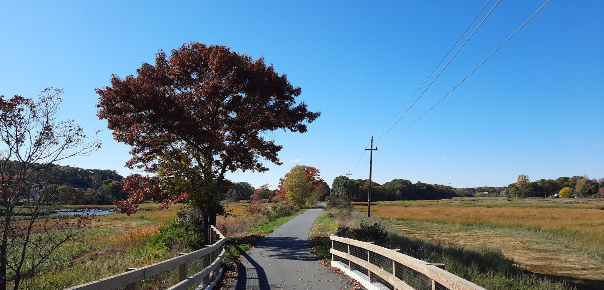
The Still River Greenway is a multiuse trail that runs from the Brookfield Municipal Center to Federal Road. It is mostly paved through a wooded area; there is also an unpaved part that creates a loop section towards the southern end of the trail. The trail is mostly flat, so it is a great path for children.
0
0
Lake Wintergreen is a beautiful freshwater lake that is part of West Rock Ridge State Park. There is a beach, a nature trail that loops around the entire lake, and additional trails that connect to the Regicides Trail. You can canoe, kayak, and fish and there is a composting toilet at the main Lake Wintergreen parking area.
0
0
よくある質問
西コネチカット計画地域には、バスでアクセス可能なハイキングコースがいくつありますか?
現在、このガイドでは西コネチカット計画地域向けのバスでアクセス可能なハイキングコースが3つ紹介されています。これらは、地域の多様な景観を探検するのに最適な、簡単なコースと中程度のコースが組み合わされています。
この地域のバスでアクセス可能なトレイルについて、他のハイカーはどのように言っていますか?
西コネチカット計画地域のバスでアクセス可能なトレイルは、komootコミュニティから高く評価されており、46件のレビューで平均5つ星中4.8つ星を獲得しています。ハイカーは、静かな自然環境と公共交通機関へのアクセスの便利さをしばしば賞賛しています。
初心者や家族向けの簡単なバスアクセス可能なハイキングはありますか?
はい、この地域には初心者や家族に最適な簡単なバスアクセス可能なハイキングコースが2つあります。スティル・リバー・グリーンウェイは、風光明媚な景色の中を穏やかな道を進む素晴らしい選択肢です。もう一つの簡単な選択肢は、快適でアクセスしやすい散策を提供するブルックフィールドからのスティル・リバー・グリーンウェイのループです。
周回型のバスアクセス可能なルートはありますか?
はい、ループトレイルを好む方のために、ブルックフィールドからのスティル・リバー・グリーンウェイのループは便利なバスアクセス可能なオプションです。このルートでは、ハイキングの開始地点と終了地点が同じになるため、公共交通機関の利用者にとって理想的です。
西コネチカットのバスアクセス可能なハイキングでは、どのような景色が期待できますか?
西コネチカット計画地域は、なだらかな丘、鬱蒼とした森林、そして多くの川や湖が特徴です。森林地帯、川沿いの谷、そして一部地域では氷河地形のある岩場などの景色が期待できます。この地域の4つの distinct な季節は、鮮やかな春の緑から豊かな秋の色合いまで、年間を通して美しい背景を提供します。
これらのバスアクセス可能なトレイルの近くに、興味深い自然のランドマークやアトラクションはありますか?
はい、この地域は豊かな自然美に恵まれています。ハイキング中には、急峻な森林の斜面の景色が澄んだ青い水面に映ることで知られるスクアンツ・ポンド州立公園のような著名な場所の近くを通るかもしれません。その他の自然のハイライトには、絵のように美しい湖畔の環境を提供するマクドゥガル湖やパットナム湖があります。
これらのバスアクセス可能なトレイルに犬を連れて行けますか?
西コネチカット計画地域の多くのトレイルは犬同伴可能ですが、行く前に必ず特定の公園やトレイルの規則を確認することをお勧めします。一般的に、ほとんどの州立公園や森林ではリードをつけた犬は歓迎されます。例えば、スティル・リバー・グリーンウェイは犬の散歩に人気の選択肢です。
これらのバスアクセス可能なトレイルをハイキングするのに最適な季節は何ですか?
西コネチカット計画地域は、年間を通して美しいハイキング体験を提供します。春には緑豊かな植物と野花が咲き、夏は暖かい気候で探索を楽しめます。秋は鮮やかな紅葉で特に素晴らしいです。冬でも、寒い時期に備えている方には、静かな雪景色が楽しめます。あなたの選択は、好みの景色と天候によって異なります。
もう少し挑戦的な、中程度のバスアクセス可能なハイキングはありますか?
はい、より挑戦的なバスアクセス可能なハイキングをお探しなら、イェールボウルからのジャッジズ・ケーブ – ウィンターグリーン湖ループを検討してみてください。このルートは、より長い距離と標高差があり、中程度の冒険を求める方に満足のいく体験を提供します。
これらのトレイルで野生動物を見ることができますか?
西コネチカット計画地域の多様な森林地帯と自然地域は、さまざまな野生動物の生息地となっています。ハイカーは、鹿、様々な鳥類、そして小型哺乳類を目撃したという報告をしばしばしています。野生動物の観察には、通常、早朝または夕方が最も良い時間帯です。
この地域のバスアクセス可能なトレイルをハイキングするには、どのような服装をすればよいですか?
多様な地形と4つの distinct な季節を考慮すると、重ね着が鍵となります。快適で吸湿発散性のある衣類を着用してください。特に岩の多い区間があるトレイルでは、足首のサポートが良い丈夫なハイキングシューズをお勧めします。ハイキングに出かける前に必ず天気予報を確認し、季節に関わらず必要であれば雨具を持参してください。
フェアフィールド郡の人気ルート
フェアフィールド郡の人気観光スポット

komootモバイルアプリでインスピレーションを得よう


