グレザック周辺のおすすめ交通量の少ないサイクリングルート
4.8
(12)
81
ライダー
12
ライド
グラベルサイクリングは、シャラント=マリティーム県に位置するグレザック周辺で、オフロードサイクリングに多様な地形を提供します。この地域は、広大な農地と開けた眺望、そしてシュザックの森(Forêt de Suzac)のような木立や森が点在する未舗装の道が特徴です。サイクリストは、塩性湿地と牡蠣養殖の村々が特徴的なセードル川河口のユニークな景観を探検したり、特徴的な「白い砂利道」が続く起伏のある田園地帯に出会うこともできます。この組み合わせは、グラベルサイクリストに変化に富んだルートを提供します。
グレザック周辺の交通量の少ない最高のグラベルバイクコース
- 最も人気のある交通量の少ないグラベルバイクコースは、ラ・ロッシュの断崖の眺め – サン=ジョルジュ=デ=ディドンヌからのブールバール・デュ・マレのループで、距離26.3マイル(42.4 km)、所要時間2時間43分で、海岸線の景色を楽しめます。
- 地元のグラベルバイカーに人気のもう一つのコースは、ラ・ロッシュの断崖の眺め – エグリーズ・レフォルメからのブールバール・デュ・マレのループで、海岸線と内陸の景観を探検する難易度の高い60.2マイル(96.8 km)のコースです。
- 地元のグラベルバイカーに愛されているのは、ピレロンジュ塔 – レ・フルノーからのリベルー港のループで、距離24.7マイル(39.8 km)、田園地帯を抜け、歴史的建造物を巡るルートで、所要時間は約2時間22分です。
- グレザック周辺のグラベルサイクリングは、農耕地、森林の小道、河口の眺めが特徴で、様々なレベルのサイクリストに対応するオプションがあります。
- グレザックのルートは、komootコミュニティから高く評価されており、8件のレビューで平均4.3つ星を獲得しています。40人以上のグラベルバイカーがkomootを利用して、グレザックの多様な地形を探検しました。
最終更新日: 8月 27, 2026
5.0
(2)
12
ライダー
14.4km
00:50
50m
50m
初級者向けグラベルライド. あらゆるフィットネスレベルに適しています。 全般的に舗装された状態です。あらゆるスキルレベルに適しています。
4
ライダー
99.5km
06:37
840m
840m
難しいグラベルライド. 標準以上のフィットネスレベルが必要です。 全般的に舗装された状態です。あらゆるスキルレベルに適しています。

無料新規登録
3.0
(1)
5
ライダー
30.6km
01:51
100m
100m
初級者向けグラベルライド. あらゆるフィットネスレベルに適しています。 全般的に舗装された状態です。あらゆるスキルレベルに適しています。
4.0
(1)
6
ライダー
74.6km
04:30
390m
390m
中程度のグラベルライド. ある程度のフィットネスレベルが必要です。 全般的に舗装された状態です。あらゆるスキルレベルに適しています。
9
ライダー
27.2km
01:36
40m
40m
初級者向けグラベルライド. あらゆるフィットネスレベルに適しています。 全般的に舗装された状態です。あらゆるスキルレベルに適しています。
さらに多くのルートや他のユーザーのおすすめ情報を確認できます。
無料新規登録
すでにアカウントをお持ちですか?
おすすめのツアーは他のkomootユーザーが実際に経験した何千ものアクティビティに基づいています。
無料アカウントで今日から始めよう
次の冒険が待っています。
ログインまたは登録
グレザック周辺で人気
コミュニティからのヒント

🏛️ 建設:紀元後18~19年 このアーチは、皇帝ティベリウスの治世下、紀元後18~19年頃に建設されました。リヨンとサントを結ぶアグリッパ街道の出口、シャラント川を渡るローマ橋の入り口に位置していました。 そのため、厳密には「凱旋門」ではありませんでした。それは道路の記念碑であり、ローマ領アキテーヌの首都であったメディオラヌム・サントヌムへの入り口を示す記念碑的な門でもありました。 👤 誰が建設を命じたのか? このアーチは、ローマ化されたサントン地方の有力者、ガイウス・ユリウス・ルプスによって資金提供されました。彼はそれをティベリウスと甥のゲルマニクスに捧げました。現在でも、楣(まぐさ)に刻まれた碑文によって、誰に捧げられた人物を知ることができます。 「ゲルマニクス門」という名前は、ゲルマニクスが個人的にアーチを建設したり、通過したりしたという事実からではなく、この献納に由来しています。 🏗️ かなり例外的な記念碑 アーチには2つの開口部があり、交通の流れを区別できるようにしていたと考えられています。高さは約15メートル、幅は約16メートルです。コリント式とコンポジット式の柱頭は、特に精巧なローマ建築を物語っています。 それは、サントの権力とローマ化の真の証でした。 ⚠️ アーチが消滅しかけた瞬間 これはおそらく、その歴史の中で最も興味深いエピソードです。 何世紀にもわたり、アーチは常にシャラント川右岸のローマ橋、そして中世の橋のレベルにありました。 19世紀には、古い橋は老朽化していました。1843年頃に橋の解体が決定されたとき、アーチもまた破壊の危機に瀕していました。 そこで、歴史的建造物総監であったプロスペル・メリメが登場しました。彼はその保存を主張し、アーチの解体、移設、そして新しい岸辺への再建を手配しました。 この保存には、もう一人の人物も関わっています。それは、1843年9月にサントに滞在し、メリメに対して記念碑の保存を擁護したヴィクトル・ユーゴーです。 📍 なぜアーチは正確に古代の場所になくなったのか? 今日、バソンピエール広場で見られるアーチは、そのため、元の場所にはもうありません。 河岸の改修と古い橋の消滅の際に、数十メートル移動されました。保存のために、石一つ一つに分解され、再組み立てされました。 現在、古代のローマ橋の渡り場のすぐ近くに設置されています。 🏛️ 保護 ゲルマニクス門は、最終的に1905年7月に歴史的建造物として指定されました。 興味深い補足 サント近郊にあるクラザンヌの石切り場は、この地域の古代の建造物に広く使用されていた石灰岩を供給していました。クラザンヌ産の石は、特にゲルマニクス門のような記念碑に使用されました。 要約: 18~19年 → ローマ橋の入り口にアーチが建設される ↓ 古代 → 中世 → アーチはシャラント川の渡り場に関連し続ける ↓ 1843年 → 古い橋の解体とアーチへの脅威 ↓ 1843~1844年 → メリメの介入とアーチの移設 ↓ 1905年 → 歴史的建造物に指定
0
0

その自然とその教会のために
0
0
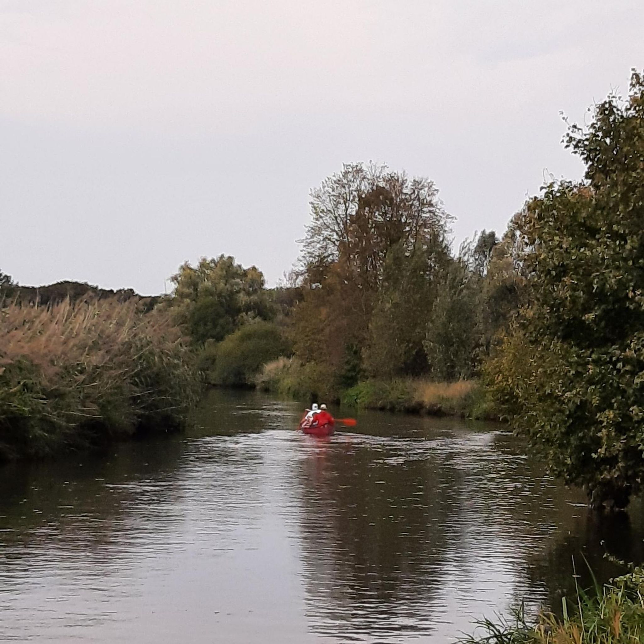
The port of Ribérou is a major heritage site in Saujon, bearing witness to a prosperous maritime past linked to the salt and wine trade. Transformed in the 19th century by ambitious works, it has now been reinvented as a place for living, relaxation, and preserving local history. 🛶 Origins and the Middle Ages The port of Ribérou takes its name from the Latin word ripa ("riverbank") or the Occitan word ribèira ("river"). It is located at the head of the Seudre estuary. It existed as early as the 11th century and became an important river and sea port thanks to its strategic position at the head of the estuary, used particularly for the salt trade—then called "white gold"—a highly sought-after product for preserving food. 🚢 Medieval Period and International Trade With the opening of British markets during the reigns of Eleanor of Aquitaine and Henry II Plantagenet, ships laden with wool, salt, wine, and other goods flocked to Ribérou. In the 16th century, the port exported local wines (such as cognac and pineau) throughout Europe. In 1577, during the Wars of Religion, the port was a strategic site: troops were stationed there, and battles took place. 🏗️ Decline, Reconstruction, and the 19th Century The estuary gradually silted up, making navigation difficult. By 1691, only smaller vessels could dock there. During the French Revolution, the sale of the tidal mill, which helped remove sediment, worsened the silting, leading to the port's decline. A modernization project began in 1822, but it wasn't until 1839 that an ambitious program was launched under the impetus of Jules Dufaure—a native of Saujon and Minister of Public Works—with the construction of sturdy quays, slipways, a lock bridge (marking the boundary between fresh and salt water), and reception facilities. In 1842, the work was completed, and the main quay was named Quai Dufaure in honor of this political support. 📉 Gradual Decline and Modernization The arrival of the railway in 1876 and the persistent problems of silting led to a decline in the port's traditional commercial activity, already facing competition from other transport networks. In the 20th century, the port gradually lost its economic importance but remained active for traditional fishing and became a place for pleasure boating, leisure, and local culture. Urban and tourism development projects (particularly in 2011–2012) modernized the port while preserving its historical charm. 🌊 Today The port of Ribérou is now a small fishing and pleasure port, much appreciated for its walks along the Seudre River, water sports (canoeing, kayaking, paddleboarding, etc.), and seasonal events.
0
0

The flushing lock is located at the head of the port, between the north bank's embankment and the south bank's quay. A retention basin, occupying the non-navigable Seudre riverbed as far as Saujon, follows the flushing lock. Within the retention basin, rubble stone embankments extend the lock's return walls for a few meters. The lock itself forms a bridge carrying a road. The lock bridge consists of two piers, forming three arches, each housing two gates. On the upstream side of the lock, the piers have semicircular cutwaters. The three bands are stacked and terminate in clamps. The lock ends with a cornice resting on modillions. The cornice follows the shape of the cutwaters. A metal balustrade, also semicircular in shape, is fixed to the top of the lock. This balustrade is framed by two stone moldings. The sluice gate and its upstream and downstream return walls are constructed of dressed stone. The masonry is of medium and regular quality, except for the coping of the return walls, which features large and regular masonry. The upstream north return wall is lower than the one on the south bank. A small parapet of recently constructed white rubble masonry surmounts it. The sluice gate is equipped with metal gates, the modern racks of which are visible. The first sluice gate was built around 1825 on the site of a former tidal mill. During the works carried out between 1839 and 1842, the sluice gate's embankment was modified to allow the passage of vehicles. Between 1847 and 1853, the lock was enlarged to allow for larger flushes, and the reservoir was excavated. Return walls were also built to connect the flushing lock to the riprap. It was then restored in 1865 and completely rebuilt between 1868 and 1869. The lock is 10.50 m wide, and its gates are each 1.50 m wide. The reservoir is 700 m long and has an average width of 30 m.
0
0

よくある質問
Grézac周辺には、交通量の少ないグラベルバイク用トレイルがいくつありますか?
このガイドでは、Grézac周辺の交通量の少ない素晴らしいグラベルバイク用トレイルを5つ紹介しており、様々な距離と難易度があります。komootでは、シャラント=マリティーム地域全体にさらに多くのルートがあり、多様な景観を探検するのに最適です。
Grézac近郊のグラベルバイク用トレイルでは、どのような地形が期待できますか?
Grézac周辺のグラベルバイク用トレイルは、地形のバラエティに富んでいます。未舗装の道で広大な農耕地を走り抜け、Forêt de Suzacのような木陰の木立や森を抜け、塩沼や牡蠣養殖の村があるSeudre河口のユニークな景観を探検することになるでしょう。この地域は、グラベルサイクリングに最適な路面を提供する「白い砂利道」(chemins blancs)で知られており、しばしば緩やかな起伏があります。
この地域には、初心者向けの簡単で交通量の少ないグラベルルートはありますか?
はい、より簡単なライドをお探しの方には、Saujon発、L'Éguille-sur-Seudre – Riberou Port ループがおすすめです。この簡単なルートは約21.9kmで、標高差は最小限なので、初心者やリラックスしたサイクリングに最適です。
交通量の少ないグラベルトレイル沿いには、どのような興味深い景観やランドマークがありますか?
多くのトレイルでは、この地域の自然の美しさや歴史的な魅力に触れることができます。Saint-Georges-de-Didonne Beachを通り過ぎたり、Suzac Forestを探検したり、Meschers-sur-GirondeのユニークなMarsh Cycle Pathを発見したりできるかもしれません。この地域には、Moulin d'AmbreuilやMoulin des Alluchonsのような歴史的な風車や、Grézac自体のロマネスク様式のSaint-Symphorien教会も点在しています。
Grézac周辺には、円形のグラベルバイクルートはありますか?
はい、このガイドで紹介されているルートはすべて円形なので、同じ場所からスタートして同じ場所に戻ることができます。例えば、サン=ジョルジュ=デ=ディドンヌ発の適度な難易度のLa Roche断崖の眺め – Boulevard du Marais ループや、Église Réformée発の挑戦的なLa Roche断崖の眺め – Boulevard du Marais ループを楽しむことができ、どちらも円形のルートで多様な景観を提供しています。
Grézacでのグラベルサイクリングに最適な時期はいつですか?
Grézacを含むシャラント=マリティーム地域は、春から秋にかけてグラベルサイクリングに快適な時期です。春は緑豊かで花が咲き乱れ、秋は快適な気温と美しい紅葉が楽しめます。夏は暑くなることがありますが、多くの森の道は心地よい木陰を提供してくれます。冬でも、特に水はけの良い「白い砂利道」では適していますが、大雨の後には一部の道がぬかるむ可能性があります。
経験豊富なライダー向けの、長くてより挑戦的な交通量の少ないグラベルルートはありますか?
もちろんです。長くてより挑戦的な冒険を求める経験豊富なライダーには、Église Réformée発のLa Roche断崖の眺め – Boulevard du Marais ループがおすすめです。この難易度の高いルートは約97kmで、かなりの標高差があり、変化に富んだ景観を巡るやりがいのある体験を提供します。
Grézac周辺のトレイルについて、他のグラベルバイカーが最も楽しんでいる点は何ですか?
komootコミュニティはGrézac周辺のグラベルサイクリング体験を高く評価しており、平均スコアは4.3つ星です。レビューでは、交通量の少ないルートの静けさ、絵のように美しい農耕地、魅力的な河口の眺め、そして優れたグラベルライディング路面を提供する手入れの行き届いた「chemins blancs」がしばしば称賛されています。
Grézac近郊の海岸や河口地域を探検するルートは見つけられますか?
はい、この地域はSeudre川やジロンド川の河口に近いので、多くのルートがこれらのユニークな環境を取り入れています。例えば、Les Fourneaux発のPirelonge Tower – Riberou Port ループは、Seudre川とその特徴的な塩沼や牡蠣養殖場を眺めながら進むルートで、独特の海岸グラベル体験を提供します。
大きな登りや下りがあるルートはありますか?
この地域は緩やかな起伏の多い田園地帯が特徴ですが、一部のルートではよりダイナミックな標高変化があります。例えば、Arces発の畑を横断 – 壁 20% !! ループには顕著な登りがあり、グラベルライドで少し多めの垂直方向の努力を楽しむ人々にとって、良い挑戦とやりがいのある眺めを提供します。
グラベルサイクリングと地元の村や観光スポットの探検を組み合わせることは可能ですか?
もちろんです!交通量の少ないグラベルルートは、魅力的な村や史跡を通り抜けたり、近くを通ったりすることがよくあります。GrézacのSaint-Symphorien教会のような場所への立ち寄りを計画したり、近くの海岸沿いの町を探検したりできます。この地域の豊かな遺産と絵のように美しい建築は、ライド中の楽しい休憩になります。
グレザックでのの人気観光スポット

komootモバイルアプリでインスピレーションを得よう


さらに探索
他の地域の最高のグラベルライドを見てみましょう。
