ビジャマルティン周辺のおすすめ交通量の少ないサイクリングルート
4.6
(68)
862
ライダー
49
ライド
サイクリングツアーでヴィジャマルティン周辺を巡ると、川沿いの谷、なだらかな丘、海岸への近さなど、多様な景観を楽しめます。この地域は、ヤシの木や松の木が点在する地中海の風景が特徴で、サイクリストに変化に富んだ地形を提供します。ボルノス貯水池のような自然地域や、トレベリア近くのユニークな塩湖は、際立った自然の美しさを提供します。地形は、難易度の低いライドから、高低差のあるより挑戦的なツアーまで、さまざまなルートに対応しています。
ヴィジャマルティン周辺の交通量の少ないサイクリングツアーのおすすめルート
- 最も人気のある交通量の少ないサイクリングツアーは、ヴィジャマルティン発、イプトゥシのローマ塩田~ボルノス貯水池展望台ループです。このルートは35.5マイル(57.1 km)で、所要時間は4時間32分です。このルートからはボルノス貯水池の景色が楽しめます。
- 地元のサイクリングツアー愛好家にもう一つ人気のルートは、ヴィジャマルティン発、イプトゥシのローマ塩田~マハセテ渓谷展望ループです。これは難易度の高い45.8マイル(73.7 km)のルートです。このルートからはマハセテ渓谷の広大な景色が楽しめます。
- ヴィジャマルティン周辺のサイクリングツアー愛好家は、プラド・デル・レイ発、マハセテ渓谷展望ループも気に入っています。このルートは24.7マイル(39.7 km)で、変化に富んだ地形を通り抜け、所要時間は約3時間50分です。
- ヴィジャマルティン周辺のサイクリングツアーは、川沿いの谷、なだらかな丘、地中海の風景が特徴です。このネットワークは、中程度のグリーンウェイルートから、より長く、より挑戦的なツアーまで、さまざまなスキルレベルに対応するオプションを提供しています。
- ヴィジャマルティンのルートは、komootコミュニティから高く評価されており、40件以上のレビューで平均4.5つ星を獲得しています。800人以上のサイクリングツアー愛好家がkomootを利用して、ヴィジャマルティンの多様な地形を探索しています。
最終更新日: 10月 5, 2026
13
ライダー
57.1km
04:33
530m
520m
難しい自転車ライド. 標準以上のフィットネスレベルが必要です。 全般的に舗装された状態です。あらゆるスキルレベルに適しています。
11
ライダー
54.8km
04:36
830m
820m
難しい自転車ライド. 標準以上のフィットネスレベルが必要です。 全般的に舗装された状態です。あらゆるスキルレベルに適しています。

6
ライダー
中程度の自転車ライド. ある程度のフィットネスレベルが必要です。 全般的に舗装された状態です。あらゆるスキルレベルに適しています。
5.0
(1)
8
ライダー
52.5km
03:39
890m
890m
難しい自転車ライド. 標準以上のフィットネスレベルが必要です。 全般的に舗装された状態です。あらゆるスキルレベルに適しています。
4
ライダー
31.1km
02:06
360m
350m
中程度の自転車ライド. ある程度のフィットネスレベルが必要です。 全般的に舗装された状態です。あらゆるスキルレベルに適しています。
さらに多くのルートや他のユーザーのおすすめ情報を確認できます。
すでにアカウントをお持ちですか?
おすすめのツアーは他のkomootユーザーが実際に経験した何千ものアクティビティに基づいています。
無料アカウントで今日から始めよう
次の冒険が待っています。
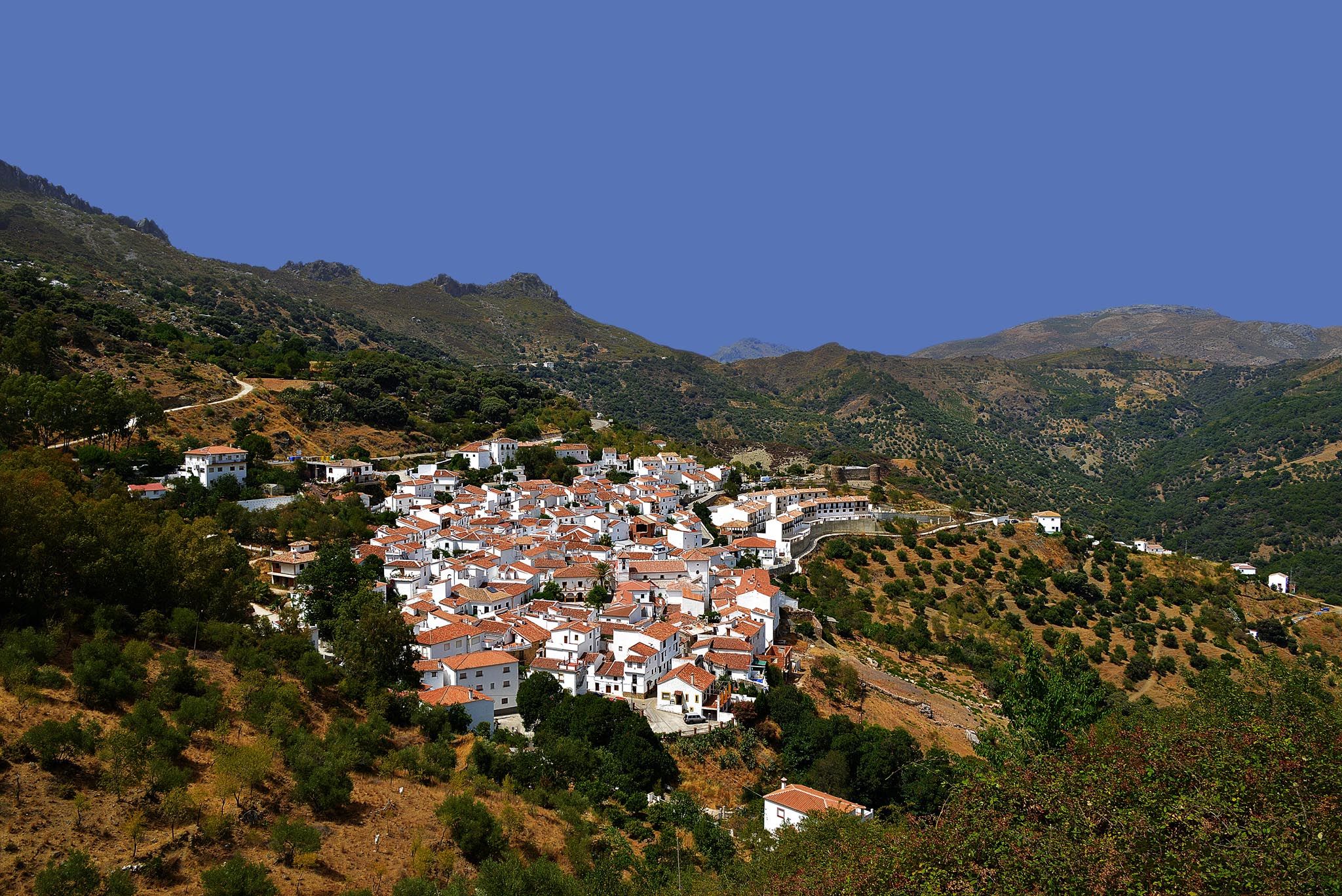
ビジャマルティンでのの他の冒険

コミュニティからのヒント


Railroad tunnel No. 25 of the Sierra Greenway Nature Trail. Located 1,670 meters from the previous tunnel, it is 500 meters long and equipped with artificial lighting, although it is advisable to have a flashlight. This tunnel is dug into the limestone slope of the Cerro de los Borregales or Castellar de Jalifa. The castellares are hills with a limestone plateau at the top, raised on a base of softer materials, in this case Triassic clay and sandstone, which give them the appearance of a fortress. At the top of this hill are the remains of an old watchtower from the Spanish-Islamic period.
8
0
Viaduct of 65 meters long, built by means of truncated-pyramidal pilasters with a rectangular plan with mortared bluestones. Formed by the repetition of 3 equal spans. Built to save the bed of the Azar stream. Less than 100 meters away there is a small rest area from where you have a good view of the Guadalete river at the exit of the Villalón meander, at the foot of the Cerro del Castellar.
7
0
Railroad Tunnel No. 27 of the Sierra Greenway Nature Trail. Located 385 meters from the previous tunnel, it is 68 meters long and not equipped with artificial light, so it is advisable to have a flashlight. This tunnel is dug in clays of different colors known as Triassic iridescent clays, or as variegated clays, because of the random combination of colors they present in the field.
8
0
Railroad tunnel No. 28 of the Sierra Greenway Nature Trail. Located 1,031 meters from the previous tunnel, it is 87 meters long and not equipped with artificial light, so it is advisable to have a flashlight. This tunnel was dug from clay and sandstone. The tunnels of this section of the railway were built by means of shoring (fastening of the excavation) based on props and wooden beams to later form the concrete of the slab that supports the tunnel. The mouth of the tunnel is finished with sculpted limestone from a quarry for Zaframagón.
9
0
The terminus of the Vía Verde de la Sierra between Olvera (Cádiz) and Puerto Serrano, built on the old railway infrastructure between Jerez de la Frontera and Almargen, built at the beginning of the twentieth century but never used due to a collective suicide of more than 20 inhabitants, which was created by a Masonic sect. The station is currently dedicated to rural tourism.
9
0
The Via Verde de la Sierra is a beautiful green route in Andalusia that starts in Puerto Serrano and ends in Olvera. This 36-kilometre route follows an old railway line that was built in the early 20th century between Jerez de la Frontera and Almargen. The route offers a unique combination of beautiful nature and historical sights, including the impressive Sierra de Cádiz and a large colony of Griffon Vultures. The route is ideal for both walking and cycling and passes through several tunnels and viaducts, making it a unique experience. Along the way you will pass through smaller villages and peaceful landscapes, making it perfect for a relaxing adventure in nature.
10
0
The Los Azares Viaduct is an impressive historical structure located in the Sierra de Cádiz, on the Via Verde de la Sierra. This viaduct spans the Los Azares River and is 65 metres long. It is located between Junta de los Ríos and Puerto Serrano. It is one of the four main viaducts on the green route and offers beautiful views of the area.
8
0
よくある質問
ヴィジャマルティン周辺には、交通規制のないサイクリングルートがいくつありますか?
ヴィジャマルティン周辺には、40以上の交通規制のないサイクリングルートがあり、様々なスキルレベルに対応する幅広い選択肢を提供しています。これらのルートを利用して、コスタ・ブランカ地方の多様な景観を探検できます。
ヴィジャマルティンでの交通規制のないサイクリングに最適な時期はいつですか?
ヴィジャマルティンは地中海性気候で、年間約300日の晴天に恵まれており、一年中サイクリングに適しています。しかし、特に春(3月~5月)と秋(9月~11月)は、夏の厳しい暑さを避けながらサイクリングを楽しむのに理想的な、快適な気温となります。
初心者や家族連れに適した、簡単な交通規制のないサイクリングルートはありますか?
はい、ヴィジャマルティンには初心者や家族連れに最適な、簡単な交通規制のないルートがいくつかあります。これらのルートは、より緩やかな地形と短い距離が特徴です。ここでは具体的な簡単なルートは詳述されていませんが、komootのガイドには3つの簡単なルートが掲載されており、この地域のVía Verde de la Sierraトレイルはアクセスしやすく景観も良いことで知られています。
これらの交通規制のないサイクリングルートでは、どのような景観が期待できますか?
ヴィジャマルティン周辺の交通規制のないルートは、多様な景観を巡ります。ヤシの木や松の木が生い茂る絵のように美しい地中海の風景、川の谷、緩やかな丘、ユニークな塩湖などに出会えます。また、ボルノス貯水池のような貯水池の景色を楽しめるルートもあり、変化に富んだ景観のサイクリング体験を提供します。
交通規制のないサイクリングルートで、周回コースはありますか?
はい、ヴィジャマルティン周辺の交通規制のないサイクリングルートの多くはループコースとして設計されており、同じ地点からスタートして同じ地点に戻ることができます。例として、ヴィジャマルティン発、ローマ塩田とボルノス貯水池の眺めを巡るループがあり、広大な景色とやりがいのある周回コースを提供します。
交通規制のないサイクリングルート沿いには、どのような興味深い場所やランドマークがありますか?
ルートはしばしば重要な自然および歴史的な見どころを通過します。マハサイテ川トレイル、マハサイテ川水車小屋跡のようなエリアを探検したり、Vía Verde de la Sierraの一部をサイクリングしたりできます。このトレイルには、古い鉄道線路、トンネル、そしてロス・アサレス高架橋のような viaduct があります。
ヴィジャマルティンでの交通規制のないサイクリングルートの長さはどのくらいですか?
ルートの長さは大きく異なります。例えば、約24kmのプラド・デル・レイ発、プラド・デル・レイからローマ塩田へのループのような短いルートから、73kmを超える長距離でより挑戦的なヴィジャマルティン発、ローマ塩田とマハサイテ渓谷の眺めを巡るループのようなルートまであります。
経験豊富なライダー向けの、上級または挑戦的な交通規制のないサイクリングルートはありますか?
もちろんです。ヴィジャマルティンには、経験豊富なライダー向けの難易度が高い交通規制のないサイクリングルートが21本あります。これらのルートは、しばしば大きな標高差と長い距離を特徴としており、例えば68kmを超える距離とかなりの登りがあるヴィジャマルティン発、ロス・アサレス高架橋からバスティアン・トンネルへのループなどがあります。
他のサイクリストは、ヴィジャマルティンでの交通規制のないルートのどのような点を最も楽しんでいますか?
komootコミュニティは、ヴィジャマルティンでのサイクリング体験を高く評価しており、平均スコアは4.5つ星です。レビューでは、この地域の多様で絵のように美しい地中海の景観、静かな道路、そしてボルノス貯水池のような自然の景観や史跡といった文化的な探検とサイクリングを組み合わせられる機会がしばしば称賛されています。
これらの交通規制のないサイクリングルートの出発点に公共交通機関で行くことはできますか?
ヴィジャマルティン自体は有名な目的地ですが、すべての交通規制のないサイクリングルートの特定の出発点への公共交通機関のオプションは限られている場合があります。主要なトレイルヘッドに車で行くか、中心部からの送迎やガイド付きツアーを提供する地元の自転車レンタルサービスを検討することをお勧めします。
交通規制のないサイクリングルート沿いには、カフェや休憩できる場所はありますか?
多くのルートは、地元のカフェ、レストラン、またはショップで休憩できる小さな町や村を通過するか、その近くを通ります。具体的なアメニティはルートによって異なりますが、この地域は一般的にサイクリストに対応できるよう整備されており、特に人口の多いエリアやVía Verde de la Sierraのような人気のトレイル沿いではそうです。
ビジャマルティンでのの人気観光スポット

komootモバイルアプリでインスピレーションを得よう


さらに探索
他の地域の最高のサイクリングルートを見てみましょう。
