ルート

プランナー

機能

アップデート

App

ログインまたはサインアップ

アプリを入手

ログインまたはサインアップ

ルート
Places to see
Natural Monuments
イギリス
イングランド
イングランド南西部

聖アグネス

聖アグネスの天然記念物・トップ19


聖アグネスが誇る美しい風景を見てみたいなら、聖アグネスの素晴らしい天然記念物・トップ19
に行ってみましょう。あなたにぴったりの場所が見つかるよう、素晴らしい天然記念物を探索するために必要なすべての情報を集めました。次のアウトドアの冒険に出かける計画の参考にしましょう。

最終更新日: 8月 10, 2026

Basset's Cove

ハイライト • 自然記念物

The 7.3 km long circular route takes you back to a time when Cornwall was covered by sea and then became a Europe-wide mountain range. The sedimentary rocks of this …

翻訳者 Google •

役立つ情報

によるものです

ここでのハイキングを見る

スマートフォンに送信

保存

Basset's Cove

ハイライト (セグメント) • 展望台

GB: Basset's Cove provides a good overview of the high cliff with its narrow beach area. The sides of the cove are weathered to varying degrees, so that some parts …

翻訳者 Google •

役立つ情報

によるものです

保存

今すぐサインアップして、こんな場所を発見しよう

最高のシングルトラック、ピーク、その他のエキサイティングなアウトドアスポットのおすすめを受け取ろう。

無料新規登録

While hiking along along Cligga Head you will find some cracking coastal views, but also some interesting evidence of the mining history. You are walking in the shoes of the miners who would walk along this path to work.

役立つ情報

によるものです

保存

Cadjack Cove

ハイライト (セグメント) • ビーチ

GB: In Cadjack Cove, in addition to large faults, many folds can be seen. These folds are formed in different scales ranging from a few inches to several hundred feet. …

翻訳者 Google •

役立つ情報

によるものです

保存

ホーリーウェル洞窟

ハイライト • ビーチ

At low tide, you can find Holywell Cave under the southern cliffs of Kelsey Head. Whilst the cave entrance from the beach does not seem very large, if you follow …

役立つ情報

によるものです

保存

無料でサインアップして、さらに多くの自然記念物を発見しましょう 聖アグネスでの。

無料新規登録

すでにアカウントをお持ちですか?

無料アカウントで今日から始めよう

次の冒険が待っています。

ログインまたは登録

聖アグネス周辺で人気

壮大なる歴史を通じ、野生の美しさのセルト人の道 - Celtic Way

聖アグネスでのハイキング

聖アグネスのランニングコース

聖アグネスでのサイクリング

聖アグネスのロードバイクルート

聖アグネスでののグラベルライド

聖アグネスのMTBトレイル

聖アグネスでのの他の冒険

壮大なる歴史を通じ、野生の美しさのセルト人の道 - Celtic Way

ハイキングのコレクション によって

Dan Hobson

コミュニティからのヒント

Babs
8月 27, 2025, Basset's Cove

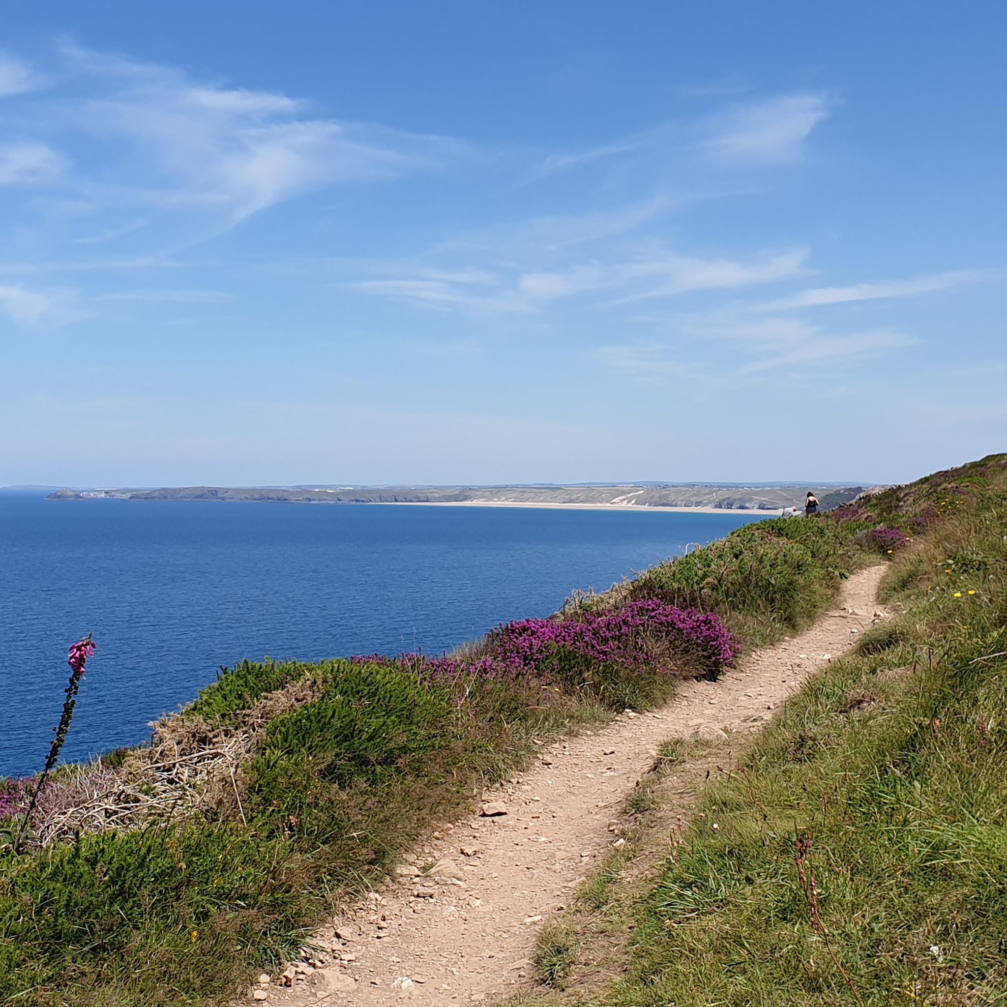
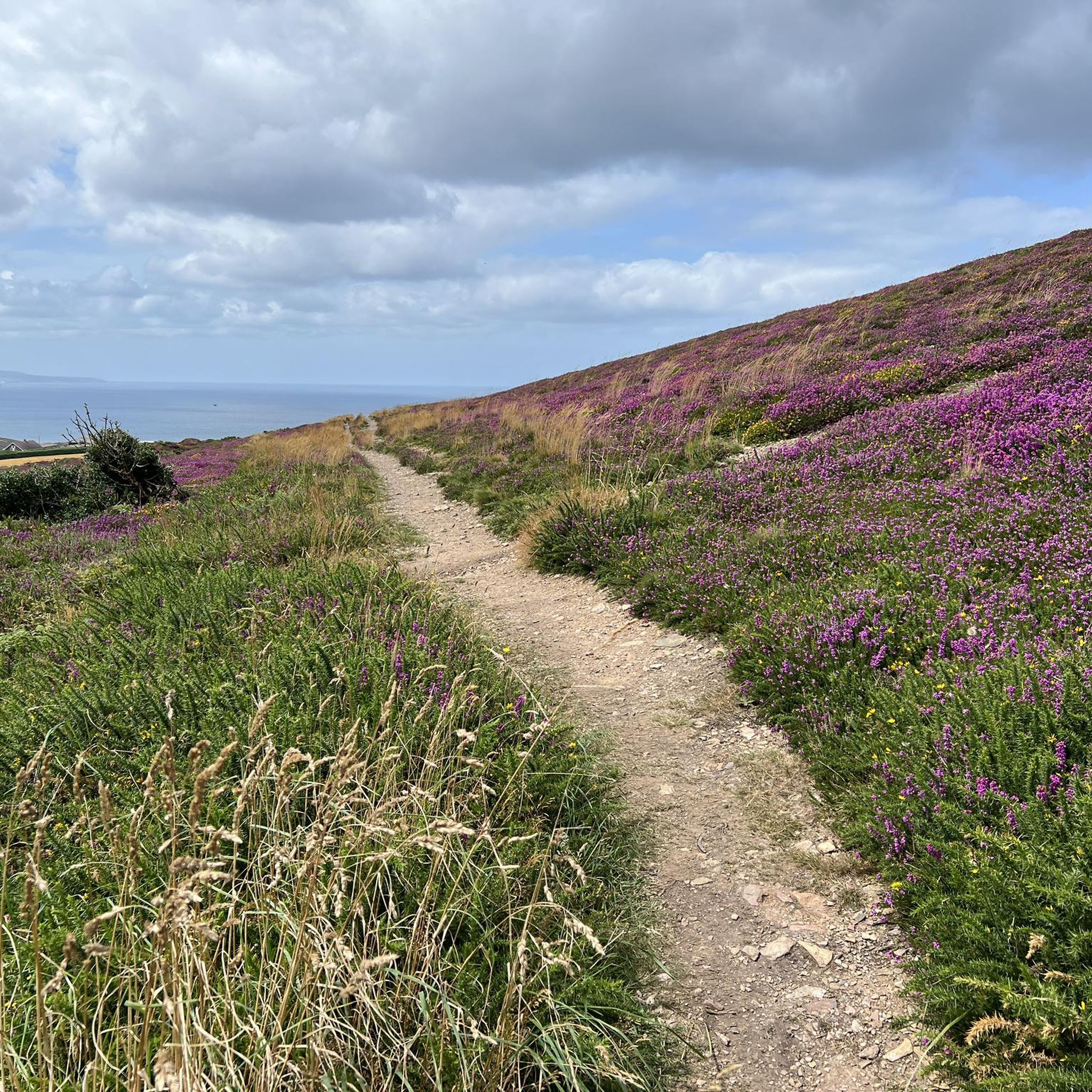
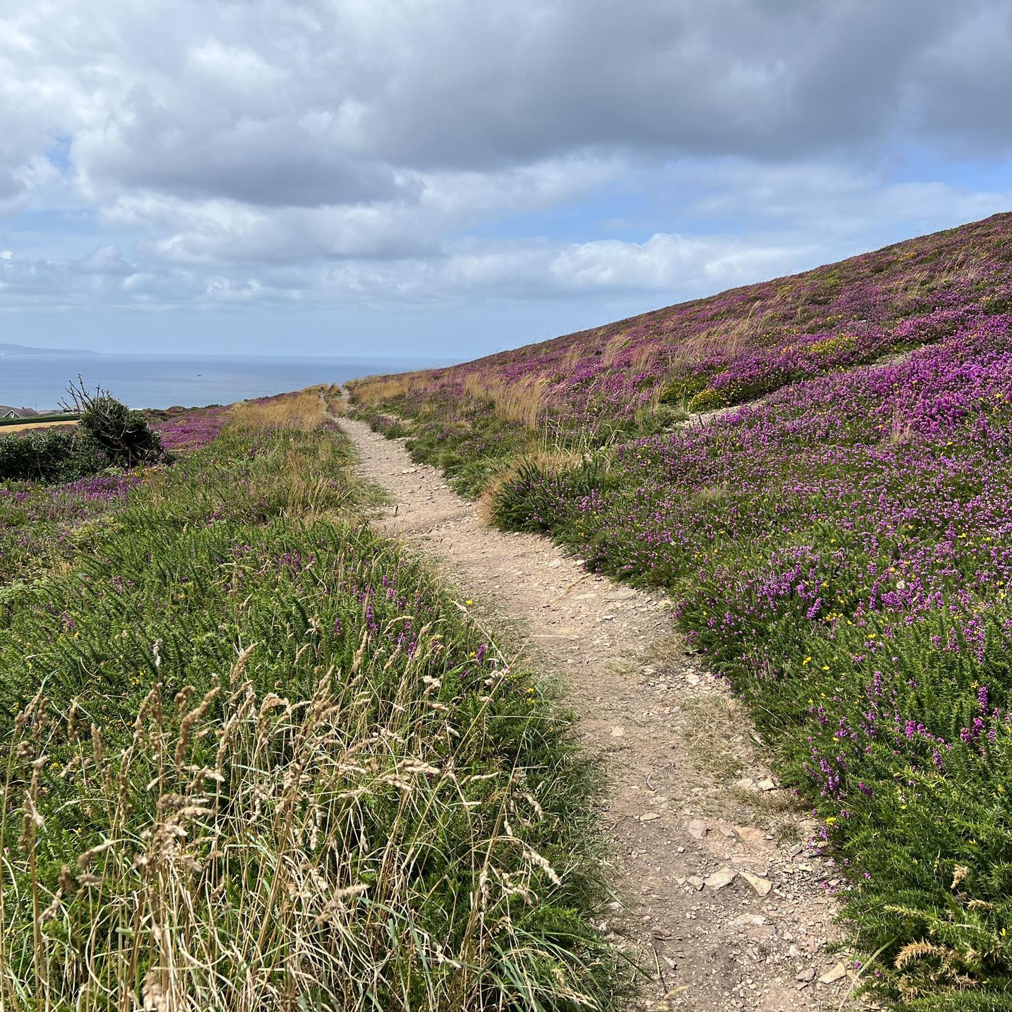
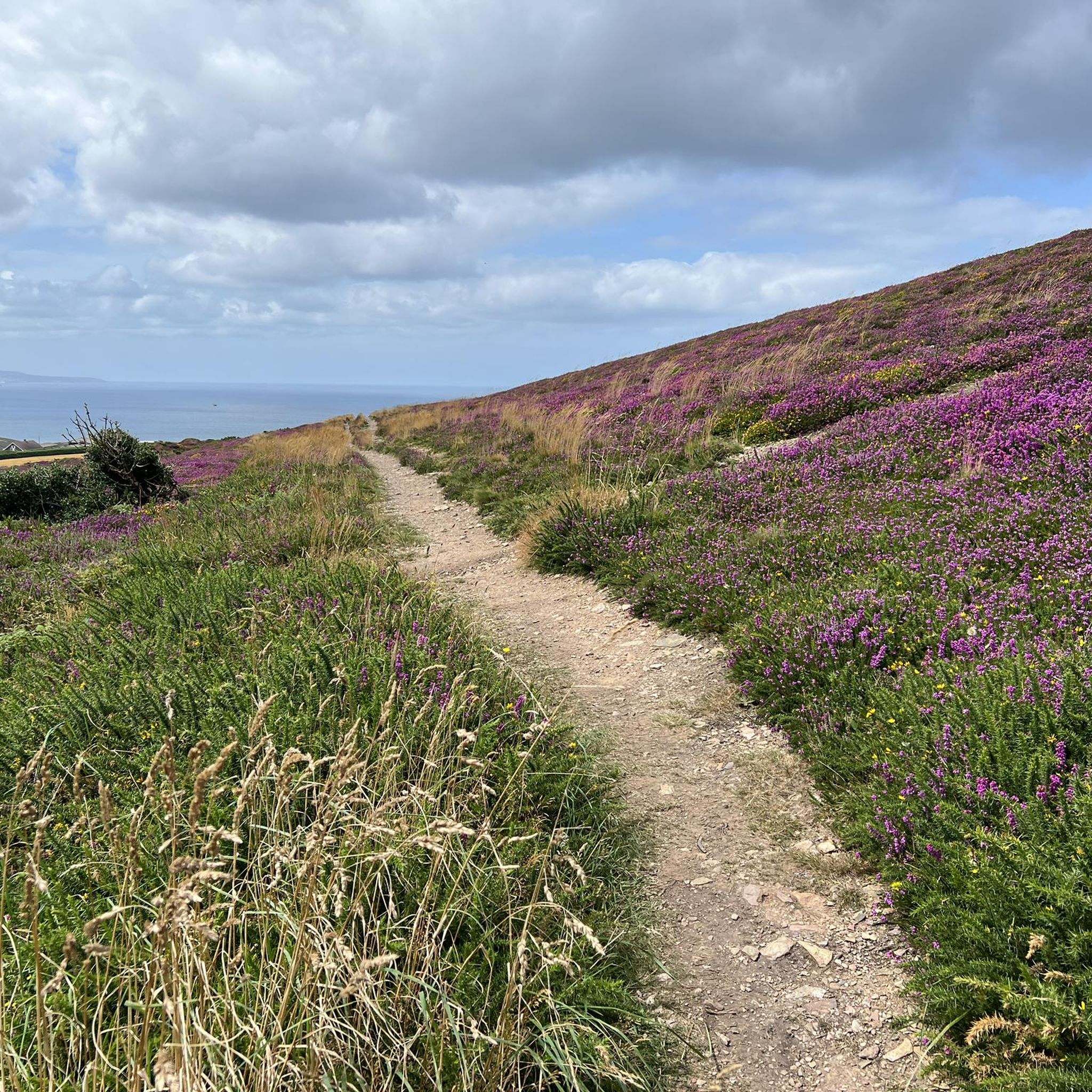
Breathtaking views. Especially when combined with the blooming heather!

Google翻訳による翻訳

0

0

A beautiful section of the SWC Path between Perranporth and St. Agnes. The walk to St. Agnes is about 8km long, with no major climbs but fantastic views.

Google翻訳による翻訳

0

0

Nej
9月 21, 2024, Basset's Cove

Naturist beach with views.

0

0

Site of Alfred Nobel's Munitions Factory. Active during WWI & WWII, mostly filling grenades and other explosives. I would recommend looking up the talking history clip on BBC Sounds. Also the site of Tungsten mining during the same time.

0

0

While running along along Cligga Head you will find some cracking coastal views, but also some interesting evidence of the mining history. You are running in the shoes of the miners who would take this path to work.

0

0

While hiking along along Cligga Head you will find some cracking coastal views, but also some interesting evidence of the mining history. You are walking in the shoes of the miners who would walk along this path to work.

1

0

GB: In Cadjack Cove, tectonic features can be seen, such as faults (described in ⑦) and folds, which were formed during the Variscan orogeny as a result of pressure from the south. These folds are formed on different scales and range from a few inches to several hundred feet. In addition, the folds show different openings and curves. Very narrow folds with pointed angles are called kink bands. However, the folds seen in this bay are not the main folds of orogeny but represent folds that are folded in themselves. Another special feature in this bay is the pink to dark red coloring of the rocks. This is caused by iron-rich water that runs down the cliffs. EN: Tectonic phenomena can be seen in Cadjack Cove, such as faults (described in ⑦) and folds, which were formed by pressure from the south during the Variscan Orogeny. These folds are formed at different scales and range from a few centimeters to several meters. The folds also show different openings and curves. Very tight folds with acute angles are called kink bands. However, the folds seen in this bay are not the main folds of the orogeny, but rather represent folds that fold into themselves. Another special feature in this bay is the pink to dark red color of the rocks. This is caused by iron-rich water running down the cliffs.

Google翻訳による翻訳

0

0

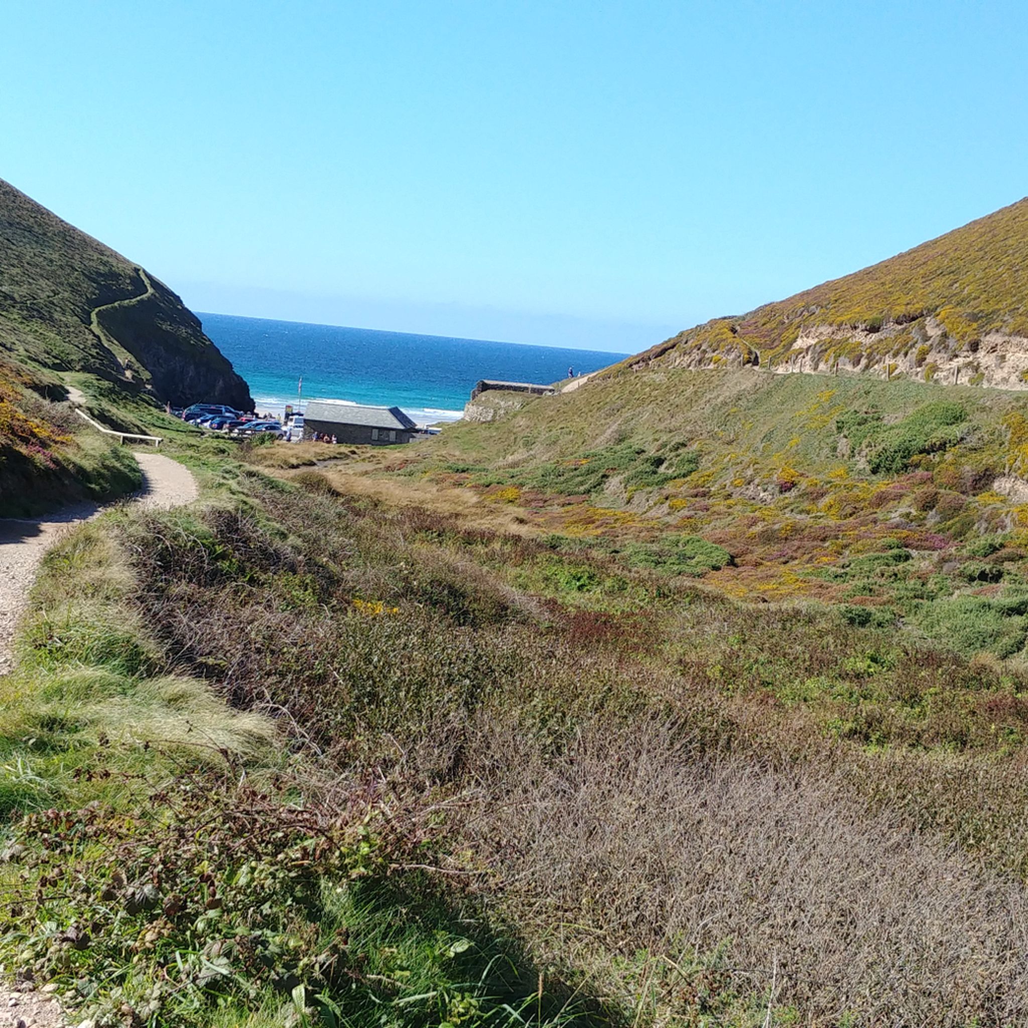
GB: Basset's Cove provides a good overview of the high cliff with its narrow beach area. The sides of the cove are weathered to varying degrees, so that some parts are mainly made up of debris. The weathering resistance of the cliffs depends on the rock from which they are formed. Sedimentary rocks usually weather more easily than igneous rocks (formed from melted rocks). In the bay below, it is mainly the siltstones and the clay shales that weather particularly easily. In addition, the lower part of the coastal cliffs is exposed to particularly strong weathering caused by the tides. Due to their resistance to weathering, the different rocks form cliffs and steep coasts of different heights. If the coastline consists mainly of sedimentary rocks, as is the case here, the cliffs reach a maximum height of 164 feet(50 m). In the Lands End area, the coasts are formed by granitic rocks and reach heights of more than 459 feet (140 m). Besides the differences in the rocks, the shape of the coast is also influenced by tectonic processes. EN: Basset's Cove provides a good overview of the high cliffs with their narrow beach area. The walls of the bay are weathered to varying degrees, so that some areas consist mainly of rubble. The weathering resistance of the cliffs depends on the rock from which they are made. Sedimentary rocks generally weather more easily than igneous rocks (formed from molten rock). In the bay below us, it is primarily the siltstones and slate that weather particularly easily. In addition, the lower area of the cliffs is particularly exposed to weathering due to the tides. Due to their resistance to weathering, the different rocks form cliffs and cliffs of different heights. If the coastline consists mainly of sedimentary rocks, as here, the cliffs reach a maximum height of 50 meters. In the Lands End area, the coasts are formed by granitic rocks and reach heights of more than 140 meters. In addition to the differences in rocks, the shape of the coast is also influenced by tectonic processes.

Google翻訳による翻訳

0

0

聖アグネスでのの人気ルート

聖アグネスでのハイキング

聖アグネスでのの人気観光スポット

Places to see

Store rating

komootモバイルアプリでインスピレーションを得よう

無料のkomootアカウントがあれば、無限のアウトドアコースを簡単に見つけてカスタマイズし、ナビで案内できます。

または

今すぐkomootに参加しよう

Store rating

さらに探索

これらのガイドで、最高の洞窟を探す範囲を広げましょう聖アグネスでの:

デボンドーセットサマセットコーンウォールWinscombe&Sandfordチャーチルバリントンライントンブラッグドンバンウェルコングレスベリーコンプトンマーティンアブリーロクストンウェストハープトゥリーイーストハープトゥリーウィンフォードバットクームネンプネット・スラブウェルチューストークグロスターシャーサンクリードセントエンデリオンパクストンセントバーヤンポールセントジャストセントブレオックセントアイジーセントアーバンパドストウセントメリリンセントティースマドロンウィルトシャーセントキューデイビッドストウ出現キャメルフォードフォーラベリーアンドミンスターレズノースセントジュリオットティンタジェルセントミンバー低地トレバルガセネンオターハムセントミンバーハイランドMawgan-In-Meneageカリーグレードルアンセントケバーンマリオンペンザンスセントレバンセントアイブスヒントン・ブレウェットストーウィサットンエグロシャイルウェイドブリッジバックウェルセントジェニーズラッジバンチューマグナ聖エヴァルコンプトンダンドイーストケネットエイヴベリーウェストオーバートンウィンターボーンモンクトンプレシュートフィーフィールドMawgan-In-Pydarクローワンオグボーンセントアンドリュースタントンセントバーナードすべての缶詰アルトンチャーヒルSavernakeマールボロタウェッドナックヘイルウォーブストウセントブルーワードマイケルストウバーウィックバセットビショップス・キャニングスウィルコットHuishピュージーミルトン・リルボーンゼナーウィンターボーンバセットアルドボーンモーバーセントマーティンインメネージホイットチャーチエッチルハンプトンチゼルドンケインシャムバロウ・ガーニーウッドボロートレネグロスカルネ・ウィズアウトコンプトンバセットセントコロンブメジャーグウィイアー・グウィシアンラウンドウェイヘディントンヒルマートンダンドリーラスホールアップアボンブロードヒントンロートンミルデンホールハナム・アボッツマニングフォードウートンリバーズクリフ・ピパードブロードタウンコルストンハナムマークスベリーレッドルースビショップストーンセント・エスケルストンパトニーポーツレスオグボーンセントジョージワンバラチャールトンカーンブレアイローガンヤットンソルトフォードガンウォローブロックリーバスアンド北東サマセットニュートンセントローマラジオンビットンファームバラリディントンビーチングストークパブロウロングアッシュトンハイワースサウスマーストンエンフォードスタートノートン・マルルーワードウェンドロンブレッジキャメリーストーククリムズランドセントネオットカムボーンノースニューントンノースヒルセントクリアーハイリトルトンファーリントン・ガーニーオールドランドチャーフィールドウィックアンドアブソンノースストークピルニングアンドセバーンビーチランズベリーコールドアッシュトンドイントンプリストンイーストンベイドンストークギフォードWinterbourneイングリッシュクームブリスランドオルターナン聖ブレイズカーライオンカルネアボッツ・リーセントオーステルベイジェイコブストウUrchfontレッドリンチセントユーオースト聖ヒラリーシストンセントメワンチャールクームダイラム・アンド・ヒントンソールズベリーマーデンレワニックリディアード・トレゴズフィルトンオールドベリー=オン=セバーンDevizesウィルズフォードアリントンレサントメンヘニオットタイウォードレスアンドパーモーウェンストウサウスニュートンマーシュフィールドLaverstockセントアイブサウスヒルチャスウォーターアーモンズベリースタントン・ドリューペンテワンバレーダウンエンド&ブロムリーヒースチャートンカリントントレヴァービンセントオーステルセントデイラナー聖ミカエルの山ネザーエイヴォンフィトルトンラクソール・アンド・フェランドダーンフォードウッドフォードエイムズベリーWinterbourneアイドミストンワーレガンリンキンホーンマーケットラビントンケシオックブロマム

近くのアドベンチャーガイド

チャスウォーターでやるべきこと

background

新しいピークを征服する準備をしよう

無料でサインアップ

探検する
ルートルートプランナー機能バウチャーを利用ハイキングMTBトレイルロードバイクルートバイクパッキングサイトマップ
アプリをダウンロード
SNSでフォローする

© komoot GmbH

プライバシーポリシー