ルート

プランナー

機能

アップデート

App

ログインまたはサインアップ

アプリを入手

ログインまたはサインアップ

ルート
ハイキング
イギリス
イングランド
北西イングランド

ランカシャー

ランカシャーのおすすめウォーキング&ハイキングルート

4.5

(8274)

70,101

ハイカー

3,377

ハイキング

ランカシャーでのハイキングに出かけて、北西イングランドのこのエリアを探索してみませんか?このガイドでご紹介するのは、komootがランカシャーでのハイキング・ウォーキングルートのコレクション全体を評価して選び抜いた、このエリアの人気ハイキングルートです。あなたに合った でのハイキングを見つけるには、他のユーザーがアップロードした役立つ情報や写真を閲覧し、各ルートに関するみんなの意見やコメントを参考にしましょう。

最終更新日: 7月 7, 2026

4.8

(285)

1,719

ハイカー

#1.

ハーストグリーンループからトルキントレイル - ボーランドの森

10.7km

02:52

130m

130m

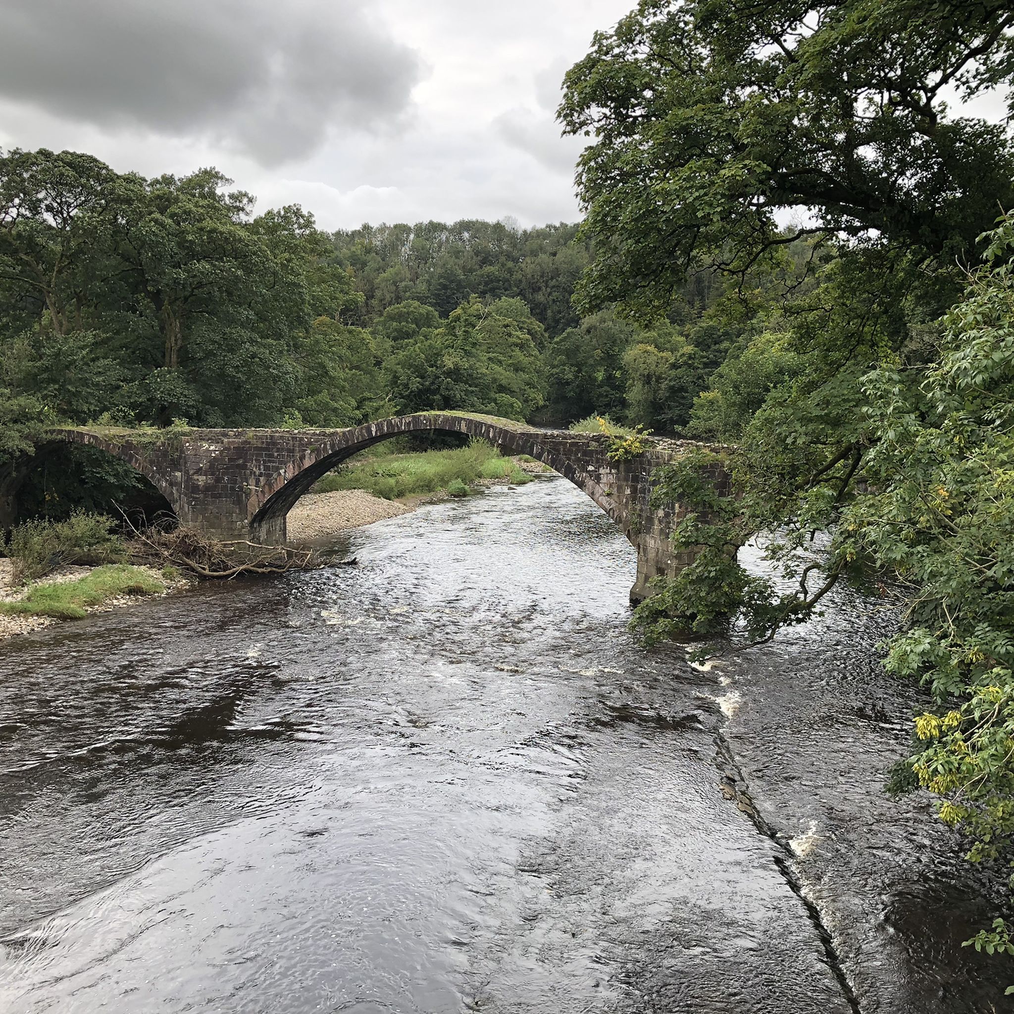
Embark on a moderate hike through the picturesque Forest of Bowland on the Tolkien Trail from Hurst Green. This 6.6 miles (10.7 km) loop takes you along undulating farmland, through lush woodlands, and beside the Rivers Ribble, Hodder, and Calder. You will gain 422 feet (129 metres) in elevation over approximately 2 hours and 51 minutes, passing historical landmarks like Cromwell's Bridge and the grand Stonyhurst College, with views of Pendle Hill.

While the main loop is considered moderate, the area offers various routes to suit different abilities, including shorter woodland walks. Be aware that some sections can be muddy after rain, though new paths have improved conditions in parts. The Shireburn Arms pub in Hurst Green is a popular starting point for this journey, offering a convenient place to begin and end your adventure.

This trail is famously associated with J.R.R. Tolkien, who spent time at Stonyhurst College during the Second World War while working on "The Lord of the Rings." The local landscape is widely believed to have inspired elements of his fictional Middle-earth, particularly "The Shire." As you walk, you might recognize features like Shire Lane in Hurst Green and the River Hodder's steep, tree-filled embankment, which could have sparked ideas for his legendary stories.

デバイスでナビ

スマートフォンに送信

保存

中程度

Embark on the Stonyhurst College & the Ribble Way loop from Hurst Green, a moderate hike that winds through the picturesque Ribble Valley. This 7.1-mile (11.4 km) route, with an elevation gain of 440 feet (134 metres), typically takes around 3 hours and 2 minutes to complete. You will experience a diverse landscape of rolling hills, ancient woodlands, and open farmland, with paths leading you along the scenic River Ribble. Keep an eye out for the impressive architecture of Stonyhurst College as you pass by, a striking landmark on your journey. The terrain varies from gentle valley paths to moderate climbs through forested areas, offering a rewarding outdoor experience.

Your hike begins in Hurst Green, a charming village that serves as a popular starting point for many local trails. You can find amenities here, including the Shireburn Arms pub, perfect for a pre-hike coffee or a post-hike meal. The trail is generally accessible, but be aware that some riverside sections can become muddy, especially after rain, so wear appropriate footwear. While the route is considered moderate and suitable for most skill levels, a good level of fitness will help you enjoy the varied terrain. Consider starting your walk earlier in the day to fully appreciate the views and avoid busier times, particularly during peak seasons.

This trail is particularly notable for its strong connection to J.R.R. Tolkien; the surrounding landscape is believed to have inspired parts of "The Lord of the Rings." You will also cross Cromwell's Bridge over the River Hodder, a historic site where Oliver Cromwell's army once passed. The route offers views of significant river confluences, where the Ribble meets the Calder and later the Hodder, adding to the natural beauty. This blend of literary heritage, historical significance, and stunning river landscapes makes the loop a unique adventure in the Ribble Valley.

中程度
guide_signup
私たちがkomootモバイルアプリで道を示します
無料の komoot アカウントがあれば、無限のアウトドアコースを簡単に見つけてカスタマイズし、ナビで案内できます。

無料新規登録

The Nicky Nook & Grizedale Reservoir loop from Scorton offers a diverse hiking experience in the Forest of Bowland. You'll encounter a mix of roads, tracks, and fields, with a steep initial ascent towards Nicky Nook. From the summit, enjoy panoramic views of the Lancashire coastal plain, Morecambe Bay, and even the distant Lake District fells on a clear day. The trail then descends to the tranquil Grizedale Reservoir, where you can walk along its calm waters and through peaceful woodlands. This moderate 4.4-mile (7.1 km) loop involves 596 feet (182 metres) of elevation gain and typically takes around 2 hours and 4 minutes to complete.

Starting from Scorton, the trail is easily accessible, and the village offers amenities for before or after your hike. You can find refreshments at places like the Applestore Cafe near Wyresdale Park. The route is considered an all-season walk, remaining enjoyable even after wet weather without becoming excessively boggy. However, be prepared for potentially muddy sections, especially after rain, due to the varied terrain. This loop is well-regarded as suitable for families and is often dog-friendly, making it a pleasant outdoor activity for many visitors.

Despite Nicky Nook's modest height, it offers exceptionally far-reaching views, making it a popular choice for those seeking panoramic scenery without an overly strenuous climb. The route also features the historic Grizedale Reservoir, built between 1861 and 1863, which once supplied water to Blackpool. Along the way, keep an eye out for various bird species like meadow pipits and skylarks, and in spring and summer, wildflowers add splashes of color to the route.

中程度

Embark on the Pendle Hill Circular Walk, a moderate hiking route that takes you across 5.3 miles (8.6 km) of varied terrain. You will experience a challenging ascent, gaining 1113 feet (339 metres) in elevation, and be rewarded with expansive views of the Lancashire countryside from the summit trig point. The trail offers a mix of charming village lanes and open moorland, passing by the picturesque Lower Ogden Reservoir, and typically takes around 2 hours and 41 minutes to complete.

To begin your hike, head to Barley village, which serves as the usual starting point for this route. Here, you will find convenient amenities such as parking, public toilets, and places to eat and drink. Be prepared for rugged sections and potentially boggy ground, especially as you approach the open moorland near the top, so make sure you wear sturdy footwear.

This area holds a significant place in history, famously linked to the Pendle Witch trials of 1612. As you traverse the landscape, you can reflect on the unique historical context that adds another layer to your outdoor adventure. The views from the top can extend to the Ribble Valley, the Trough of Bowland, and even the Yorkshire Dales on a clear day, making it a truly memorable experience.

中程度

4.4

(89)

332

ハイカー

This moderate 7.3-mile (11.8 km) hike, taking around 3 hours and 33 minutes, offers a diverse journey through the West Pennine Moors. You'll gain about 1278 feet (390 metres) as you explore cultivated gardens, woodlands, and rugged moorland. The route often winds through the historic Rivington Terraced Gardens, with their hidden paths and follies, before ascending to open moorland slopes. From the summit of Rivington Pike, you'll find sweeping panoramic views that can stretch to the Lake District and even Wales on a clear day. Be prepared for some steeper, rockier ascents and potentially muddy sections.

The Rivington Pike & Moor loop is a popular destination, accessible year-round. While the full loop is considered moderate, be prepared for some steep, rocky ascents and potentially muddy sections, especially after rain. The trail is not suitable for wheelchairs or pushchairs due to many steps and uneven paths. Many hikers begin their journey from Rivington Hall Barn. Consider visiting on a clear day to fully appreciate the extensive views from the Pike, or join the long-standing tradition of walking the Pike on Good Friday.

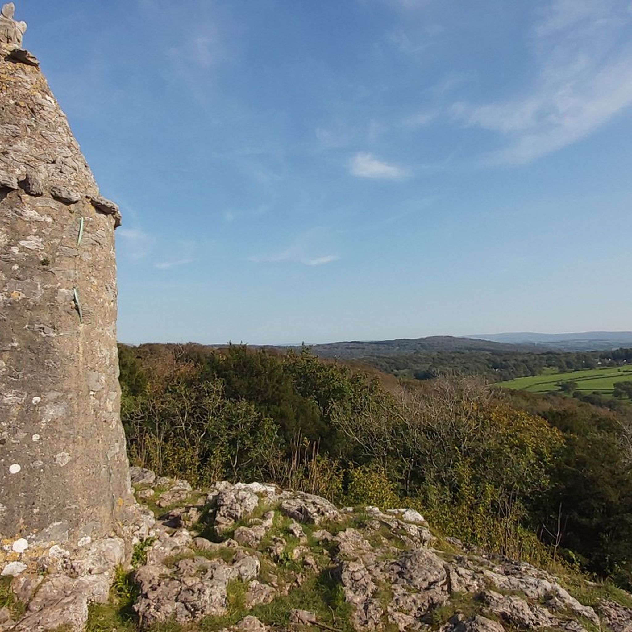
Beyond the physical challenge, this trail is rich in history and unique features. The Rivington Pike Tower, a Grade II listed building from 1733, once served as a hunting lodge and a beacon site, even warning of the Spanish Armada. The Rivington Terraced Gardens, sometimes called "Little Switzerland," showcase the ambition of Lord Leverhulme. This blend of historical significance, varied landscapes, and far-reaching views makes it a true local gem in the North West of England.

中程度

Embark on a moderate hike through the Silverdale to Arnside loop, a journey spanning 11.0 miles (17.6 km) with an elevation gain of 942 feet (287 metres). You can expect to complete this route in about 4 hours and 50 minutes, immersing yourself in a landscape where coastal paths meet ancient woodlands. As you hike, you will discover the unique atmosphere of Morecambe Bay, with views stretching out from places like the White Pebble Beach.

When you plan your visit, be aware that some limestone paths can become quite slippery, especially after rain. Certain coastal sections might also be less clear, so pay attention to your footing. If you choose to walk directly on the beach, remember that Morecambe Bay experiences very fast-incoming tides and has areas of quicksand, so exercise extreme caution. The trail is conveniently accessible by train, offering a straightforward public transport option for your trip.

This loop offers a captivating blend of scenery within the Arnside & Silverdale National Landscape, moving from open fields to dense woods. From elevated spots like Arnside Knott, you can enjoy expansive vistas across Morecambe Bay, and on a clear day, even glimpse the distant Lakeland mountains. The route also takes you past historical landmarks such as the Arnside Tower Ruins, adding a rich cultural layer to your outdoor adventure.

中程度

Embark on the Stocks Reservoir loop, a moderate hike spanning 8.9 miles (14.3 km) with an elevation gain of 624 feet (190 metres), typically taking around 3 hours and 51 minutes to complete. You will ramble through ancient woodlands and picturesque moorlands, enjoying continuous views of the glistening reservoir waters. The terrain is varied, featuring well-surfaced stone and grassy paths, though be mindful of a couple of short, steep sections, like the descent past New House Farm, which can be slippery in wet conditions.

To begin your hike, head to the Stocks Reservoir Car Park on School Lane, where parking is available for a fee. The route is well waymarked with blue finger posts, making it easy to follow the circular path around the reservoir. Be aware that you might encounter cattle and sheep as you traverse local farmland, and the footbridge crossing the River Hodder can also be slick when wet.

This area is a haven for birdwatchers, renowned as one of the UK's best spots, with wildlife hides available on the eastern shoreline to observe various wildfowl species. Historically, the reservoir's creation in 1932 led to the relocation of St. James' Church, stone by stone, to a nearby upland pasture, where it stands today. The trail also offers panoramic views across the Forest of Bowland, and on clear days, you might even spot the distant Yorkshire Three Peaks.

中程度

4.5

(46)

263

ハイカー

Embark on the easy Anglezarke Reservoir loop, a picturesque hike covering 4.3 miles (6.9 km) with a gentle 218 feet (67 metres) of elevation gain. You can typically complete this route in about 1 hour and 50 minutes, enjoying diverse scenery along the way. The trail circles the lovely Anglezarke Reservoir, providing views of woodlands, open fields, and expansive moorland reaching towards the West Pennine Moors. While the paths are generally well-maintained, expect varied surfaces like grass tracks and stone setts; some sections might be muddy after rain. In spring and summer, you might spot wildflowers such as wood anemones and bluebells lining the banks.

This easy loop is suitable for all fitness levels and families, making it a great choice for a leisurely outing. The paths are generally accessible, though some woodland sections may have exposed roots. Given its popularity, consider visiting during quieter times to fully appreciate the tranquil beauty of the area. Remember that some parts of the trail can become muddy after rainfall, so appropriate footwear is advisable.

Anglezarke Reservoir is nestled within the West Pennine Moors, part of an area often called the "Little Lake District" due to its series of beautifully naturalized 19th-century reservoirs. These reservoirs were originally built to supply water to Liverpool, adding a layer of historical significance to the natural landscape. The trail offers a blend of serene waterscapes, open moorland, and enchanting woodlands, ensuring a varied and engaging hiking experience.

初級

Embark on the Fair Snape Fell loop, a moderate hike through the Forest of Bowland, offering diverse terrain and wide-ranging views. This 5.6-mile (9.0 km) route involves an initial steep climb, often up Parlick Fell, before leading you onto a wide moorland ridge. You can expect sections of smooth, grassy paths, but also be prepared for boggy areas and peat hags, especially after rain. The trail takes about 2 hours and 49 minutes to complete, covering an elevation gain of 1077 feet (328 metres). From elevated points like Paddy's Pole, you will see sweeping vistas of the Lancashire countryside, including Pendle Hill and the Bleasdale Fells.

The Fair Snape Fell loop is generally rated as moderate to strenuous, with its initial steep ascent contributing significantly to the challenge. While some sections are flatter and allow for quicker hiking, the varied terrain means you should wear appropriate hiking boots. Boggy conditions and peat hags are common, particularly after rainfall, so good footwear is essential for a comfortable experience. The route is often undertaken in conjunction with Parlick Fell, forming a popular circular route. Consider checking local weather conditions before you go, as clear days will enhance the panoramic views.

This trail is notable for offering some of the best 360-degree panoramas in the Trough of Bowland, especially from the summits of Fair Snape Fell and Parlick Fell. The stretch of ridge walking between these two fells is often called 'the loveliest mile in Lancashire' due to its smooth path and continuous views. Combining two significant fells, the route maximizes scenic rewards for your effort. On favorable days, you might even spot hang gliders and paragliders soaring above, adding to the unique character of this Area of Outstanding Natural Beauty.

中程度

Embark on The River Brock & Beacon Fell loop, a moderate hiking route that guides you through varied landscapes. You will cover 5.9 miles (9.4 km) with an elevation gain of 556 feet (170 metres), typically taking about 2 hours and 36 minutes to complete. Expect a journey that transitions from peaceful riverside paths to more open, elevated terrain, offering a diverse experience for your outdoor adventure.

When planning your visit, be aware that the trail can become quite muddy, especially after rain, so appropriate footwear is essential. You will also encounter several stiles and gates as the path crosses agricultural fields, adding to the rural charm of the hike. Parking is generally available at the trailhead, making it convenient to start your exploration of this scenic area.

This loop offers more than just a walk; it takes you past the historic ruins of an old cotton mill located at the Brock Bottom picnic area, a spot rich in local heritage. As you ascend Beacon Fell, the views expand dramatically across the surrounding plains and towards the impressive Bowland Fells. On a clear day from the summit, you might even catch a glimpse of the distant Great Orme in North Wales, providing a memorable reward for your efforts.

中程度
無料新規登録すると、ランカシャーでのでのハイキングをさらに3,368件ご覧いただけます。

さらに多くのルートや他のユーザーのおすすめ情報を確認できます。

無料新規登録

すでにアカウントをお持ちですか?

おすすめのツアーは他のkomootユーザーが実際に経験した何千ものアクティビティに基づいています。

無料アカウントで今日から始めよう

次の冒険が待っています。
ログインまたは登録

ランカシャー周辺で人気

Forest Of Bowland Aonbでのハイキング

リブルバレーでのハイキング

ランカスターでのハイキング

チョーリーでのハイキング

ペンドルでのハイキング

セフトンでのハイキング

ウェストランカシャーでのハイキング

ワイアでのハイキング

フィルドでのハイキング

バーンリーでのハイキング

ランカシャーでのの他の冒険

デールズの心臓部にとどまる印象的な川沿いの散歩 — リブルウェイ

ハイキングのコレクション によって

Alex Foxfield

コミュニティからのヒント

Michael
4月 21, 2026, Paddy's Pole Summit, Fair Snape Fell

このトラックは良さそうですが、この丘の反対側には行けません。

Google翻訳による翻訳

0

0

Much of the path around the base is presently closed owing to maintenance works, so please be aware!

0

0

Circular walk starting from Wolfenden Hall public footpath then up the back of Fairsnape and down to the beginning of the walk.

0

0

Delicious food and friendly staff. More about the café at https://www.rivingtonhallbarn.co.uk/sundays-2/

Google翻訳による翻訳

0

0

any age can do this walk, was a really nice most flat, very enjoyable and had lunch in pub at end great day in all

0

0

Stunning views — in clear air you can see the seaside as far as Lytham and even Blackpool Tower. On some days, ultralight planes pass overhead, adding a unique attraction. They glide close like giant birds — always a pleasure to watch.

0

0

Path is straightforward and accessible in dry weather. My 10-year-old granddaughter managed it easily — a good relaxed hike.

0

0

Great at Halloween

0

0

ランカシャーでのの人気ルート

ランカシャーのファミリーハイキング

ランカシャーでのの人気観光スポット

Places to see

Store rating

komootモバイルアプリでインスピレーションを得よう

無料のkomootアカウントがあれば、無限のアウトドアコースを簡単に見つけてカスタマイズし、ナビで案内できます。

または

今すぐkomootに参加しよう

Store rating

探していたものは見つかりませんでしたか?

ランカシャーの下にある他のハイキングをチェックして、目的地で完璧なルートを見つけましょう。

バーンリーリブルバレーチョーリーウェストランカシャーワイアランカスターフィルドサウスリブルForest Of Bowland Aonbセフトンペンドルロッセンデールプレストンハインドバーン

さらに探索

他の地域の最高のハイキングを見てみましょう。

カンブリアマンチェスターチェシャーイーストチェシャーウェストアンドチェスターミリントンウォリントンオールダムリトルボリントンアグデントラフォードリムマックルズフィールドフォレストとワイルドボークローロッチデールストックポートダーウェンとブラックバーンサットンマンチェスターウィルムズローウィラルサルフォード埋め込むMacclesfieldテームサイドリバプールハルトンレイナウエガートンボルトンウィンクルアップルトンセントヘレンズウィガンブラックプールオーバーアルダリーほんのネザーアルダリーCholmondeleyナッツフォードボリントンリドリーBulkeleyコングルトンPoynton-With-Worthライムハンドリービッカートンケトルシュルムペックフォートンニューボールド・アストベリーウィアーズウォールタットンムーアアストンバイバドワースロスザーンリトルワーフォードモートンカムアルカムロウディズリーTabley SuperiorローワーウィジントンノースロードモバリーマートホールサマーフォードデアズベリーBosleyプレストンブルックチェルフォードグラッペンホールアンドテルウォールストレットンアストン・ジャックスタ・モンドラムに従うストークアルダリーエッジベッチトンハーレストンバーランドヘンハルオラートンファディリーモットラムセントアンドリューポットシュリグリーサンドバックハルム・ウォルフィールドチョーモンデストンハッサルプールアークリッドブリンドリースウェッテナムウォルトンサマーフォードブースハザートンアシュリークラネージの教区オッドロードブラッドウォールピックメアヘイルバディントンプレストベリーヘイルバンクマートンTwemlowモストンウィラストンブルームホールヘンベリーシディントンTabley InferiorPeover Inferiorバディリーオースターソンストックトンヒースチャーチミンスハルニューホールカアードリースネルソンエドレストンペンケスナントウィッチバザートンウォーミンガムドッドコットカムウィルクスリーハイレグマーベリー・カム・コイズリーブレトン教区グレートサンキーカルチェスアンドグレイズベリースモールウッドハンスターソントフトペオーバースーペリアイートンハンケロウステープリーチャーチロートンホームズチャペルの教区ブリッジメアリクストンウィズグレイズブルックアドリントンバーチウッドポールトンウィズファーンヘッドクールピレートウェッテンホールゴースワースブレーケンホールレイトンミンスハルヴァーノングーストリープラムリーノーズリーチェックリーカムラインヒルバサムリーハットンアルサガーハフバートンウェストンミドルウィッククルーロープグレートワーフォードウールストンサンディムアアルプラハムウィンウィックウィバンベリーハスリントンバートンウッドとウェストブルックウールスタンウッドワードルShavington Cum Grestyハイアーハーズフィールドワールストンバスフォードベクストン小作地ウィスタストンドッディントンクルーグリーンウォルガートンノーベリーホートンチョールトンリーオードレムレンベリー兼フリスCalveleyスパーストウバンバリー

探索できるほかのスポット

ランカシャーの自然保護区

近くのアドベンチャーガイド

Whittinghamでやるべきこと

background

新しいピークを征服する準備をしよう

無料でサインアップ

探検する
ルートルートプランナー機能ハイキングMTBトレイルロードバイクルートバイクパッキングサイトマップ
アプリをダウンロード
SNSでフォローする

© komoot GmbH

プライバシーポリシー