プエブラデアルコサーの湖・トップ8
プエブラ・デ・アルコセル周辺の最高の湖は、スペイン、エストレマドゥーラ州のラ・シベリア地域にあります。この地域は、その規模とレクリエーションの提供から、しばしば湖と呼ばれる重要な貯水池で知られています。主にグアディアナ川とスハール川沿いに位置するこれらの人造水域は、スペイン最大の陸地の海岸線を形成しています。この地域は、生物圏保護区内に位置し、自然と水辺のアクティビティ観光の目的地となっています。
プエブラ・デ・アルコセル周辺の最高の湖
- 最も人気のある湖はガルシア・デ・ソラ貯水池で、美しい自然環境に位置する印象的な工学技術の成果です。岩石層と地中海性植生が特徴で、様々な鳥類の重要な生息地となっています。
- もう一つの必見スポットは、オレジャナ貯水池にある内陸のビーチ、プラヤ・デ・ロス・カリカントスです。このビーチは、サービスを備えた静かな自然環境を提供しており、夏を楽しむのに理想的な場所です。
- 訪問者は、スペイン最大の貯水池の一つであるマサトリゴ山とラ・セレーナ貯水池も気に入っています。道路が貯水池の縁を走り、マサトリゴと呼ばれる山をかすめ、貯水池の景色を眺めることができます。
- プエブラ・デ・アルコセルは、その広大な貯水池と内陸のビーチで知られています。これらの水域は、探検のための広大な淡水環境を提供しています。
- プエブラ・デ・アルコセル周辺の湖は、komootコミュニティに高く評価されており、6件の「いいね」と9枚の写真が共有されています。
最終更新日: 8月 28, 2026
ガルシア・デ・ソラ貯水池
ハイライト • 湖
翻訳者 Google •
役立つ情報 は

カナル・デ・ラス・デヘサス — グアディアナ自然歩道
ハイライト • トレイル
翻訳者 Google •
役立つ情報 は
今すぐサインアップして、こんな場所を発見しよう
最高のシングルトラック、ピーク、その他のエキサイティングなアウトドアスポットのおすすめを受け取ろう。
無料新規登録
Playa de los Calicantos
ハイライト • ビーチ
翻訳者 Google •
役立つ情報 は
マサトリゴ山とラ・セレナ貯水池
ハイライト • 湖
翻訳者 Google •
役立つ情報 は

ガルシア・デ・ソラ貯水池のそばの美しいストレッチ
ハイライト • サイクリングロード
翻訳者 Google •
役立つ情報 は
無料でサインアップして、さらに多くの湖を発見しましょう プエブラデアルコサーでの。
無料新規登録
すでにアカウントをお持ちですか?
無料アカウントで今日から始めよう
次の冒険が待っています。
ログインまたは登録

コミュニティからのヒント

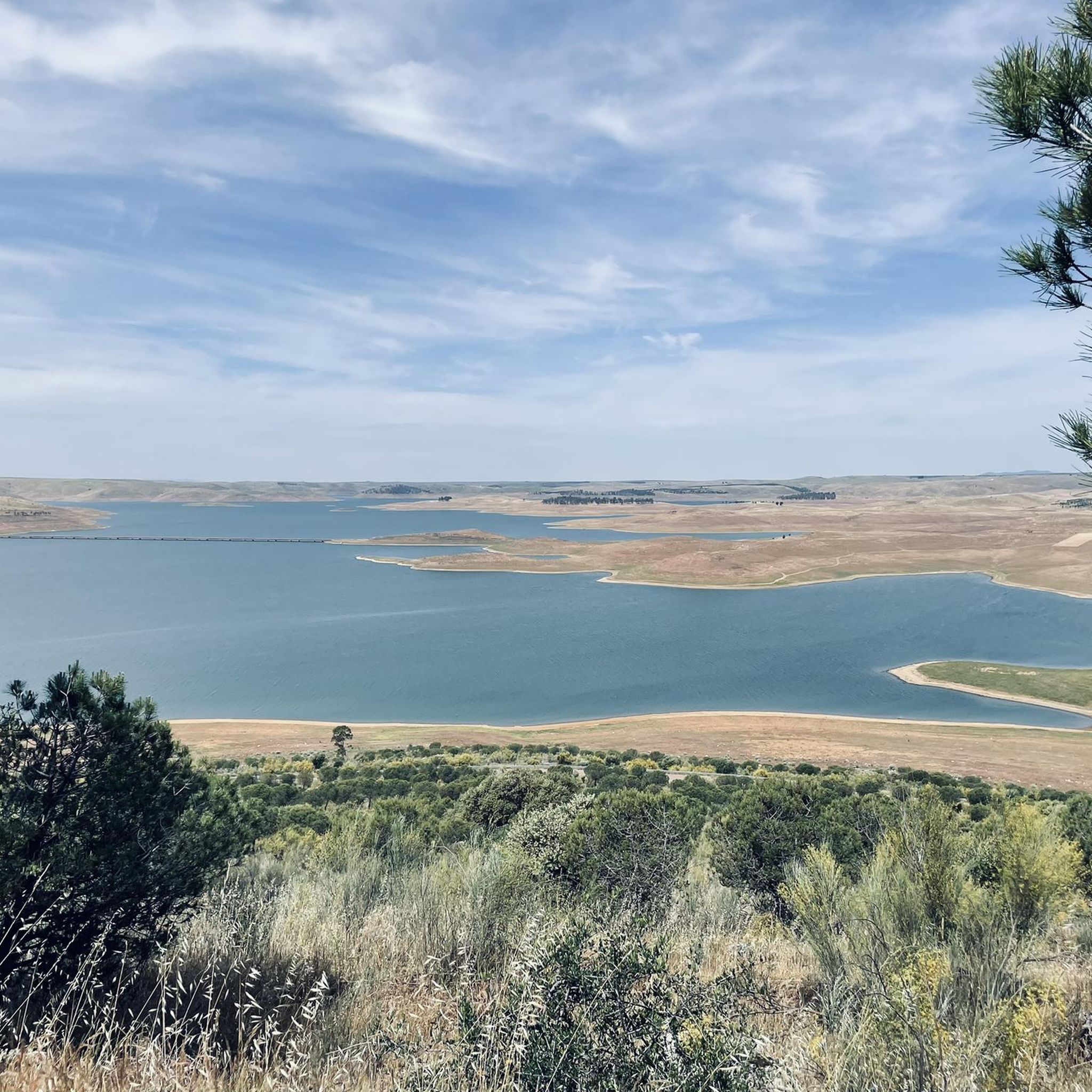
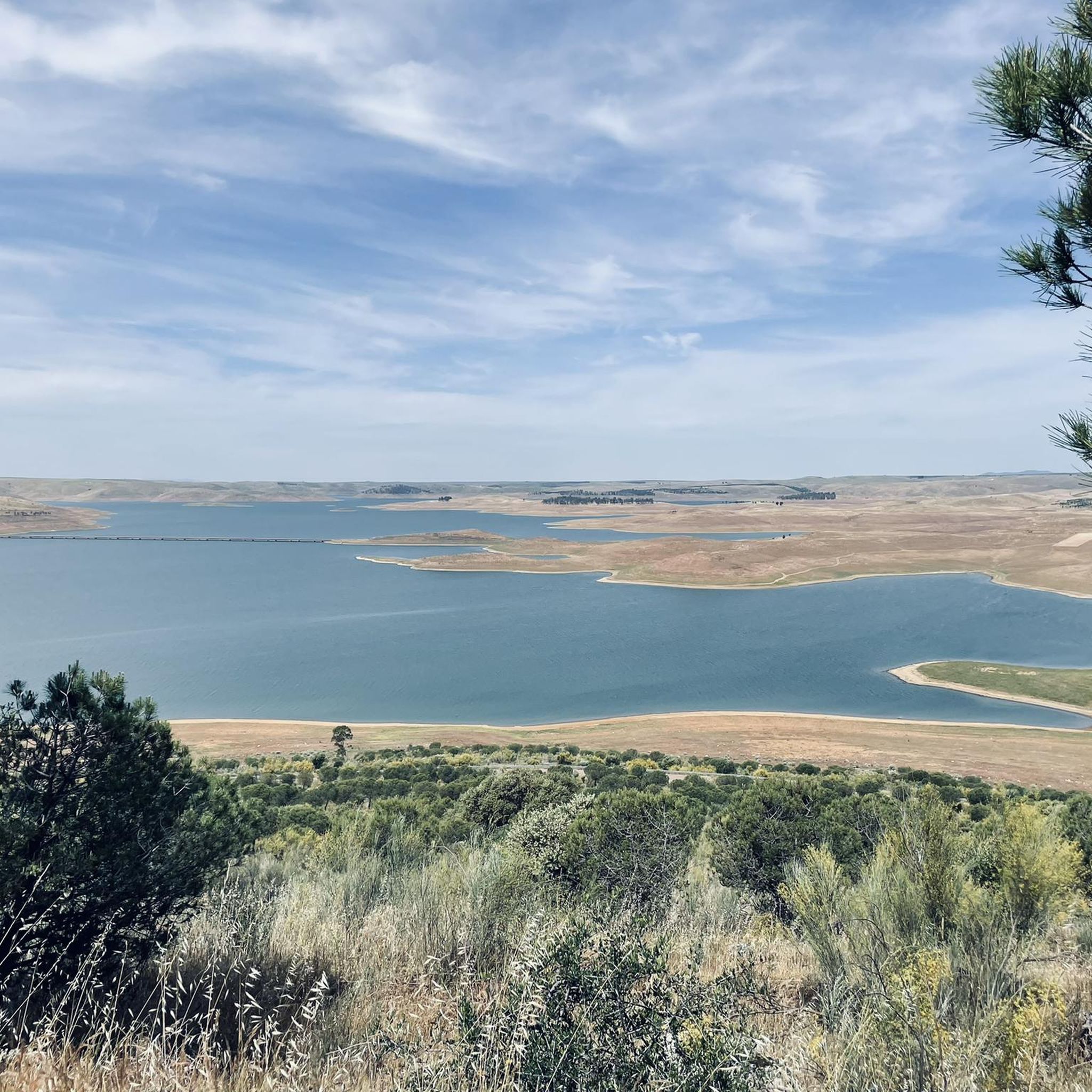
The García de Sola Reservoir, also known as Puerto Peña, is located on the Guadiana River, in the La Siberia Extremeña region (Badajoz). It was built in 1962 as part of the Badajoz Plan and has a capacity of 554 hm³. It is an emblematic site for its natural, scenic, and recreational value.
5
0
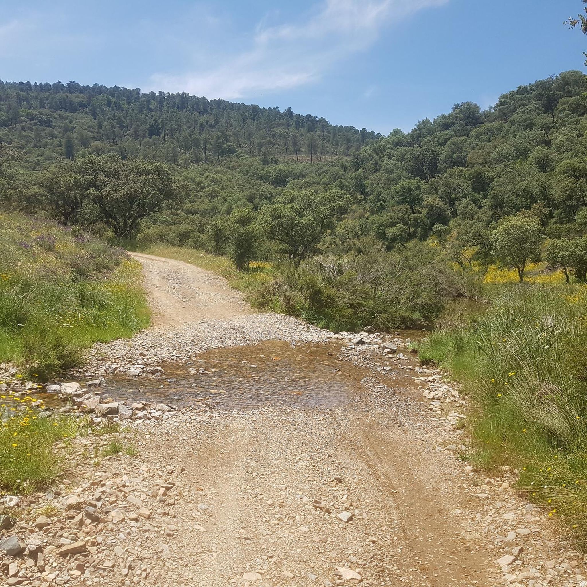
The Canal de las Dehesas is part of the Guadiana Nature Trail (GR-114), a route that runs along the Guadiana River basin from Albacete to Huelva. It's very popular for cycling and hiking.
5
0
Playa de los Calicantos, located in Casas de Don Pedro (Badajoz), is an inland beach at the tail end of the Orellana Reservoir, within the La Siberia Extremeña region. It's an ideal place to enjoy the summer surrounded by nature, with excellent services and a peaceful setting.
10
0

This spectacular reservoir was built during the 1960s. The reflection of the sunsets in the water and the surrounding landscape make it a must-see if you're exploring the Guadiana Nature Trail.
0
1

Stage 2. Herrera del Duque/Orellana la Vieja 88 kilometers. 1,020 meters of elevation gain. Compared to the previous stage, the second day of the trip is a pleasant walk through the vast rural and livestock plains of the Guadiana River, passing through the pastures of the García de Sola and Orellana reservoirs. The first contact with the inland sea of García de Sola is the serene river environment of the beaches and piers of Peloche; when the reservoir level is high, the water reaches the town streets. The route continues along a fairly quiet and scenic road to the Puerto Peña dam, tracing the curves and inlets of the reservoir's shore. Puerto Peña is a narrowing in the course of the Guadiana River that was used to build the García de Sola dam. There is also an active tourism center and hiking trails. The surroundings of the river gorge and the canyon's cliffs are an important wildlife reserve. There is a large colony of griffon vultures, white and black storks, cranes, falcons, eagle owls, buzzards, and kites, and it is possible to see flocks of the rare long-tailed wagtail. The mountain range is a lush forest populated by strawberry trees, holm oaks, cork oaks, pines, eucalyptus, pyrénergos, and the rest of the scrubland typical of Mediterranean forests. The route crosses the Puerto Peña gorge and continues along the Canal de las Dehesas track, one of the large canals built along the middle course of the Guadiana River during the Badajoz Plan hydraulic project. The path is completely flat and the surface is excellent. In some places, panels display environmental values and interesting landscape features. In spring, the rockrose flowers fill the green hills of the dehesas with white dots. The kilometers fly by on a bike, contemplating the meanders of the Orellana Reservoir. At the Casas de Don Pedro junction, the Guadiana Nature Trail turns toward Talarrubias and, before reaching it, enters a Cordel de Merinas (Merinas Cordillera) toward the Roman site of Lacimurga. The ruins are on the banks of the reservoir; it was a strategic crossing for the Guadiana River for centuries, even before the Romans built walls and expanded a primitive oppidum from the 5th century BC, founding a powerful Roman city of the Flavian dynasty on the plains of the Guadiana and Zújar rivers. The road surface is excellent for gravel bikes; it climbs along the foothills of the Maribáñez mountain range, passes through Orellana de la Sierra, and ends the stage in Orellana la Vieja.
0
1
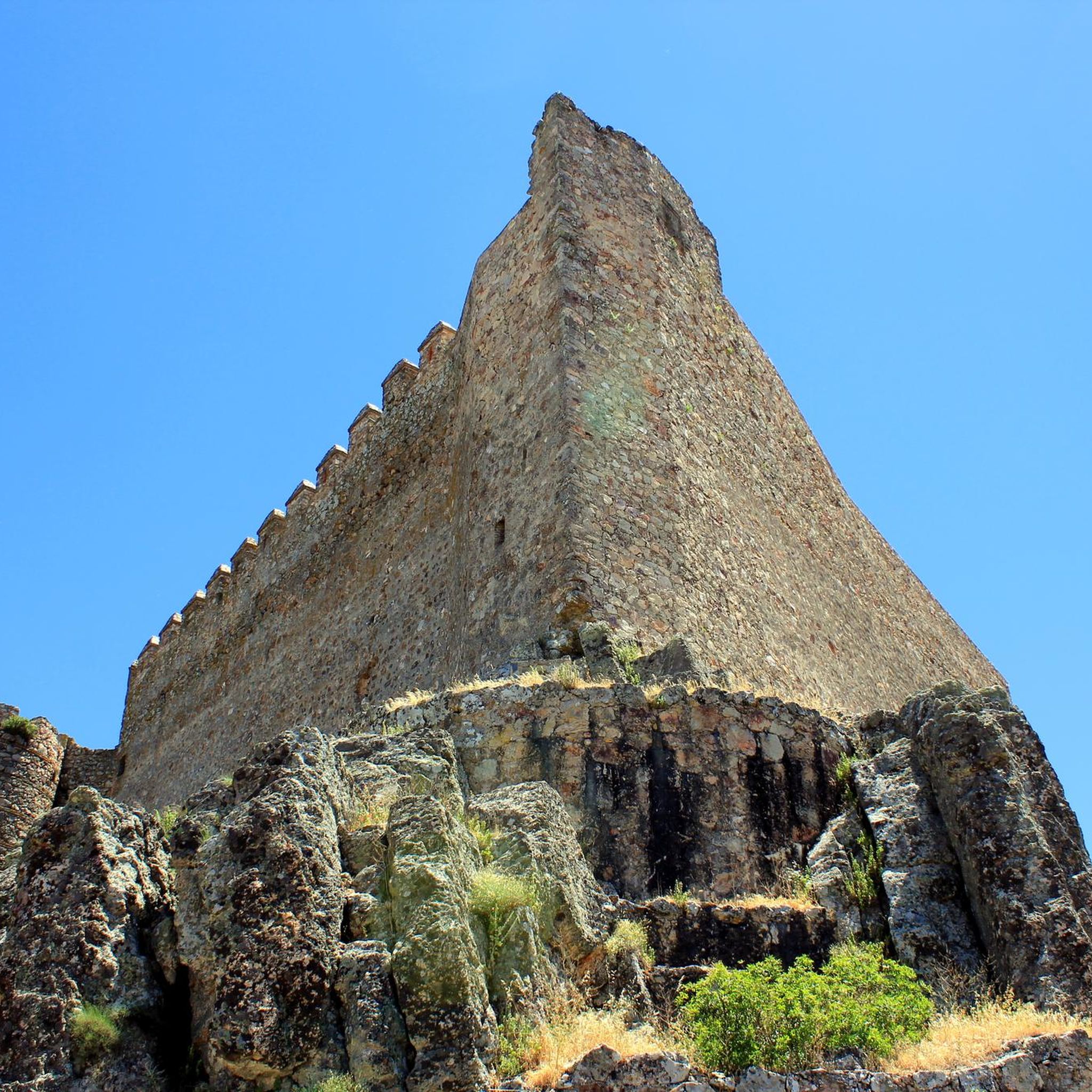
The García de Sola Reservoir is an impressive work of engineering located in the Extremadura region, near Talarrubias, in the province of Badajoz. The reservoir is located in an environment of great beauty, surrounded by imposing rock formations and dense vegetation composed of Mediterranean forests, pine forests and eucalyptus trees. It is a place of great value for birdlife, with species such as the griffon vulture, black vulture, black stork, golden eagle and peregrine falcon.
5
0

Road that runs along the banks of the Garcia de Sola reservoir toward the town of Peloche. The road winds along, offering incredible views of the reservoir and its surroundings.
1
0
Reservoir that collects water from several rivers, but mainly from the water that comes from the Cíjara Reservoir, which is located in the north, at the foot of the Montes de Toledo.
1
0
よくある質問
プエブラ・デ・アルコセル周辺の湖は何がユニークなのですか?
プエブラ・デ・アルコセル周辺の「湖」は、実際には広大な人工貯水池であり、スペイン最大の内陸海岸線の一部を形成しています。これらは生物圏保護区内に位置し、豊かな自然の美しさと多様な生態系を提供しています。ラ・セレーナ、オレジャーナ、ガルシア・デ・ソラなどの貯水池は、灌漑と水力発電に不可欠であると同時に、広範なレクリエーションの機会も提供しています。
プエブラ・デ・アルコセル近郊の主な貯水池は何ですか?
近郊で最も著名な貯水池は、ヨーロッパ最大級として知られるラ・セレーナ貯水池、ブルーフラッグビーチで有名なオレジャーナ貯水池、そしてドラマチックな岩層と豊かな鳥類で特徴づけられるガルシア・デ・ソラ貯水池です。
プエブラ・デ・アルコセル周辺の湖を訪れるのに最適な時期はいつですか?
訪問に最適な時期は、計画しているアクティビティによって異なります。春(3月~5月)と秋(9月~11月)は、ハイキング、サイクリング、バードウォッチングに快適な気温です。夏(6月~8月)は内陸のビーチでのウォータースポーツや水泳に理想的ですが、気温は高くなることがあります。冬は一般的に穏やかで、静かな訪問やバードウォッチングに適しています。
プエブラ・デ・アルコセル近郊の湖の周りにはハイキングコースがありますか?
はい、ハイキングの機会は数多くあります。例えば、グアディアナ自然遊歩道は、貯水池沿いの景色の良いルートを提供しています。セロ・マサトリゴ植物園トレイルなど、簡単なものからより挑戦的なものまで、さまざまなトレイルを見つけることができます。より詳細なルートについては、プエブラ・デ・アルコセル周辺のランニングトレイルガイドをご覧ください。
湖の近くでサイクリングはできますか?
もちろんです。この地域はサイクリングに適しており、グアディアナ自然遊歩道のようなルートは、グラベルバイクやツーリング自転車に最適な路面を提供しています。オレジャーナ貯水池を周回するルートや、ラ・セレーナ貯水池に接続するルートを見つけることができます。特定のルートや難易度については、プエブラ・デ・アルコセル周辺のサイクリングガイドをご覧ください。
これらの湖ではどのようなウォータースポーツやアクティビティが利用できますか?
貯水池は水上アクティビティの中心地です。オレジャーナ貯水池は、セーリング、カヌー、ウィンドサーフィン、ペダルボート、釣りで特に人気があります。ラ・セレーナ貯水池は、特にパイク、ブラックバス、バルベルなどの釣りに高く評価されています。多くのエリアでは、水泳や一般的なウォーターレクリエーションの機会も提供しています。
この地域はバードウォッチングに適していますか?
はい、この地域はバードウォッチャーの楽園です。ラ・セレーナ貯水池は鳥類の特別保護区(SPA)であり、コウノトリ、クロコウノトリ、ツルなどの種を引き付けています。ガルシア・デ・ソラ貯水池は、特にプエルト・ペーニャ複合施設の周辺で、グリフォンハゲワシ、クロハゲワシ、イヌワシが生息しています。
プエブラ・デ・アルコセル周辺の湖は家族連れに適していますか?
多くのエリアは家族連れに非常に適しています。オレジャーナ貯水池には、スペイン初の内陸ブルーフラッグビーチであるプラヤ・デ・ロス・カリカントスがあり、設備が整っており安全に泳ぐことができます。ラ・セレーナ貯水池には、「プラヤ・デ・ロス・ジャノス」という内陸の自然ビーチもあり、夏の間はピクニックエリア、バーベキュー、子供用公園が利用できます。ガルシア・デ・ソラのプエルト・ペーニャ複合施設にもビーチとキャンプ場があります。
湖で泳げるビーチはどこにありますか?
内陸のビーチにはいくつかの選択肢があります。オレジャーナ貯水池には、優れた設備を備えたブルーフラッグ認定ビーチであるプラヤ・デ・ロス・カリカントスがあります。ラ・セレーナ貯水池の「プラヤ・デ・ロス・ジャノス」は、水泳やレクリエーションのための自然な環境を提供しています。ガルシア・デ・ソラ貯水池のプエルト・ペーニャ複合施設にもビーチエリアがあります。
貯水池の周りに注目すべき展望スポットはありますか?
はい、いくつかの場所から印象的な景色を眺めることができます。ラ・セレーナ貯水池を横切り、マサトリゴ山をかすめる道路からは美しい眺めが楽しめます。ガルシア・デ・ソラ貯水池のプエルト・ペーニャ複合施設は、その印象的な岩層とパノラマビューで知られています。ペローチェ方面へ向かうガルシア・デ・ソラ貯水池沿いの道路も、信じられないほどの景色を提供しています。
湖の近くに食事や宿泊できる場所はありますか?
はい、主要な貯水池の近くにはアメニティがあります。「イスラ・デル・スハール」複合施設は、ラ・セレーナ貯水池内にあり、田舎の宿泊施設やアクティビティを提供しています。オレジャーナ貯水池エリア、特にブルーフラッグビーチ周辺には、マリーナを含むインフラがあります。ガルシア・デ・ソラ貯水池のプエルト・ペーニャ複合施設には、ビーチバーとキャンプ場があります。近くの町にも様々な食事や宿泊施設があります。
プエブラデアルコサーでのの人気観光スポット

komootモバイルアプリでインスピレーションを得よう


さらに探索
まだ完璧な湖が見つかりませんかプエブラデアルコサーでの?これらの地域のガイドをチェックして、さらに美しい場所を見てみましょう。
