カサスデドンペドロの湖・トップ9
カサス・デ・ドン・ペドロ周辺の最高の湖は、スペイン、エストレマドゥーラ州バダホス県に位置しています。この地域は、工学的にもレクリエーション的にも重要な貯水池が特徴です。この地域では、釣りや湖畔でのリラクゼーションなど、さまざまなアウトドアアクティビティの機会が提供されています。その自然景観は、岩層と多様な植生を特徴としています。
カサス・デ・ドン・ペドロ周辺の最高の湖
- 最も人気のある湖はカンチョ・デル・フレスノ貯水池で、コイやブラックバス釣りのようなレクリエーション活動で知られる湖です。そのビーチは2023年にブルーフラッグ賞を受賞しました。
- もう一つの必見スポットは、ラ・シエラ・エクストレメーニャ地域内のグアディアナ川にある湖、ガルシア・デ・ソラ貯水池です。岩層と地中海性森林に囲まれ、その自然、景観、レクリエーションの価値で知られています。
- 訪問者は、オレジャーナ貯水池の奥にあるプラヤ・デ・ロス・カリカントスも気に入っています。水辺でのレジャーや楽しみのための場所を提供しています。
- カサス・デ・ドン・ペドロは、貯水池と内陸のビーチで知られています。これらは、釣り、水泳、自然景観の探索の機会を提供します。
- カサス・デ・ドン・ペドロ周辺の湖は、10件の「いいね!」と5枚の写真が共有されており、komootコミュニティに高く評価されています。
最終更新日: 8月 28, 2026
カンチョ・デル・フレスノ貯水池
ハイライト • 湖
In addition, …
翻訳者 Google •
役立つ情報 は

ガルシア・デ・ソラ貯水池
ハイライト • 湖
翻訳者 Google •
役立つ情報 は
今すぐサインアップして、こんな場所を発見しよう
最高のシングルトラック、ピーク、その他のエキサイティングなアウトドアスポットのおすすめを受け取ろう。
無料新規登録
カナル・デ・ラス・デヘサス — グアディアナ自然歩道
ハイライト • トレイル
翻訳者 Google •
役立つ情報 は
Playa de los Calicantos
ハイライト • ビーチ
翻訳者 Google •
役立つ情報 は
マサトリゴ山とラ・セレナ貯水池
ハイライト • 湖
翻訳者 Google •
役立つ情報 は

無料でサインアップして、さらに多くの湖を発見しましょう カサスデドンペドロでの。
無料新規登録
すでにアカウントをお持ちですか?
無料アカウントで今日から始めよう
次の冒険が待っています。
ログインまたは登録
コミュニティからのヒント

The García de Sola Reservoir, also known as Puerto Peña, is located on the Guadiana River, in the La Siberia Extremeña region (Badajoz). It was built in 1962 as part of the Badajoz Plan and has a capacity of 554 hm³. It is an emblematic site for its natural, scenic, and recreational value.
5
0
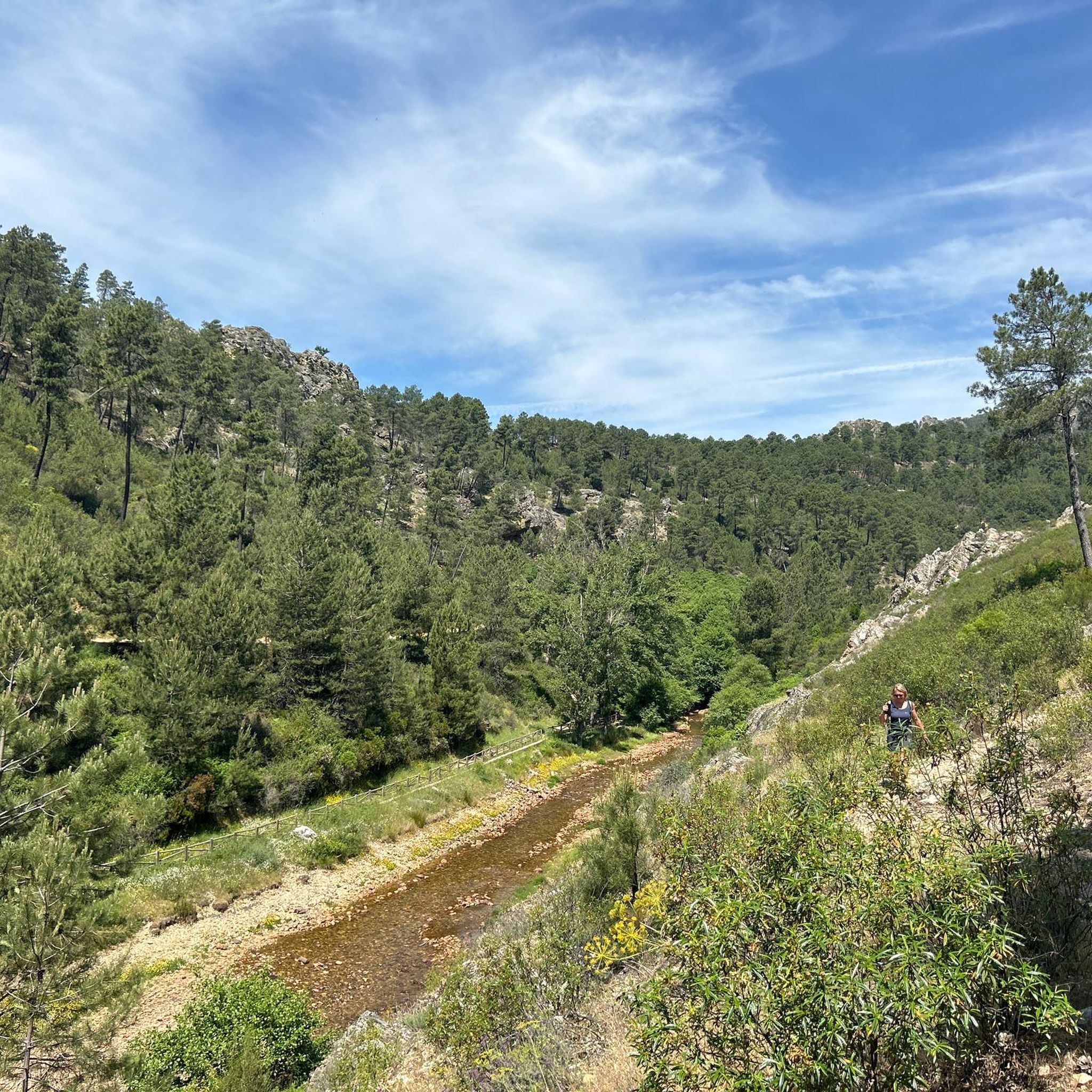
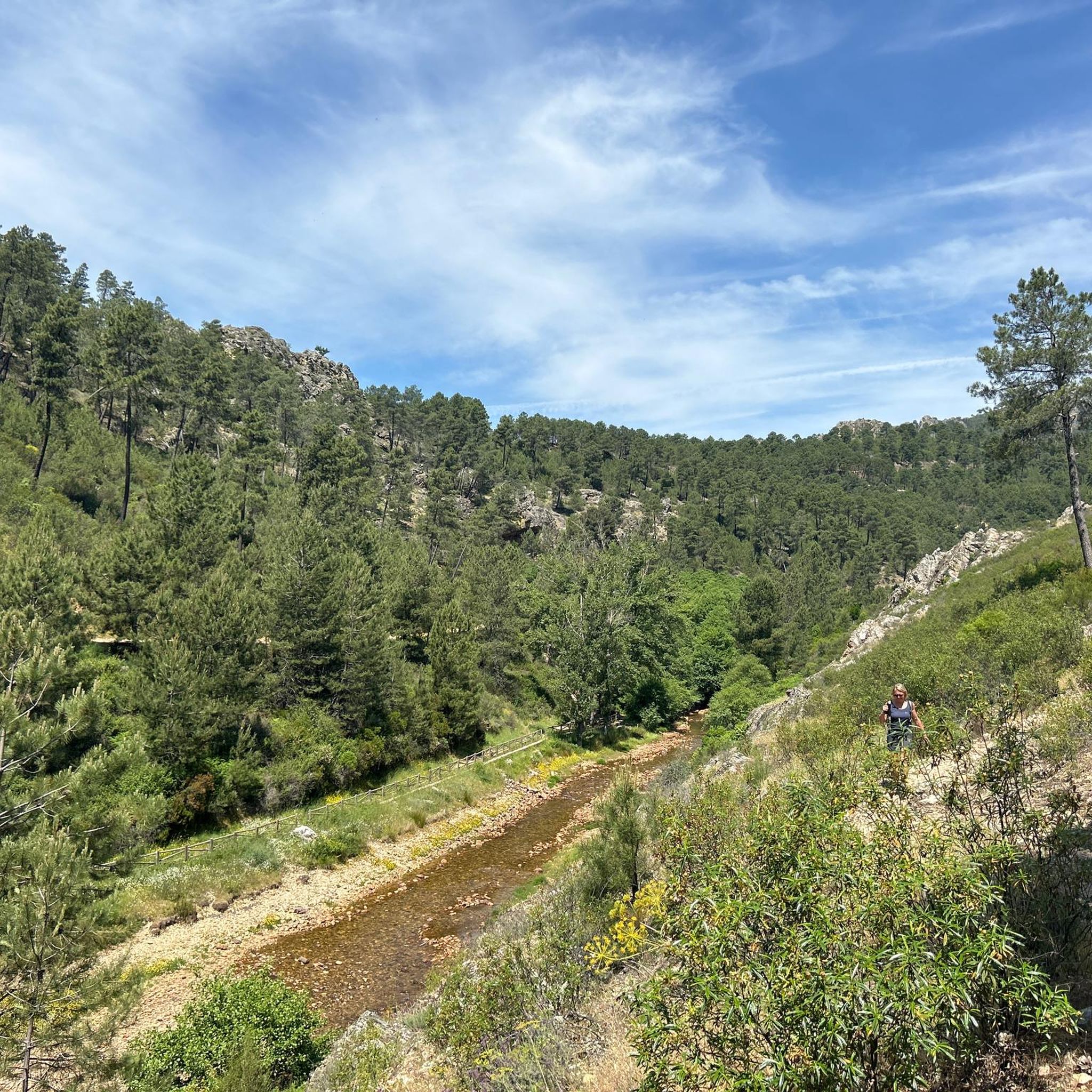
The Canal de las Dehesas is part of the Guadiana Nature Trail (GR-114), a route that runs along the Guadiana River basin from Albacete to Huelva. It's very popular for cycling and hiking.
5
0
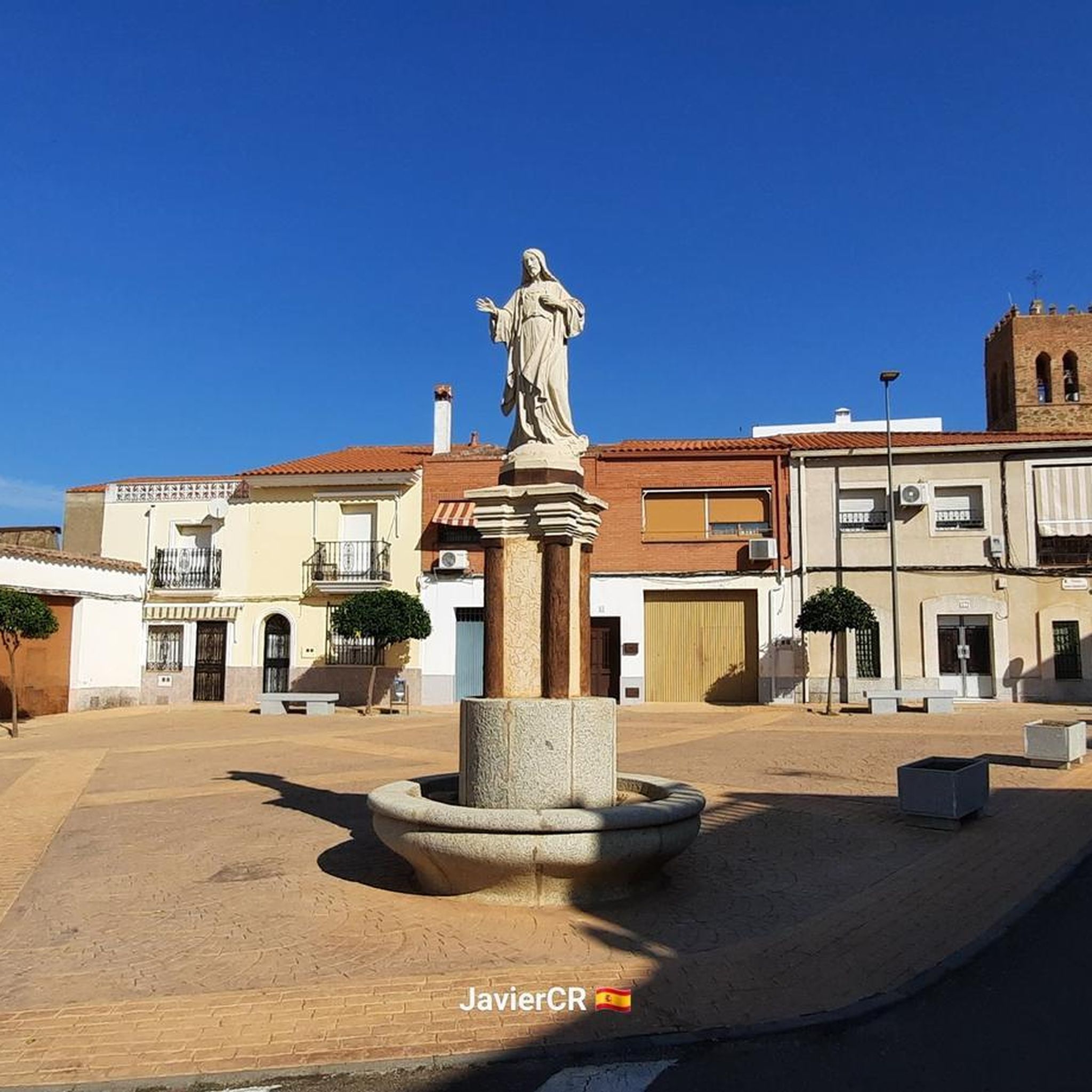
Playa de los Calicantos, located in Casas de Don Pedro (Badajoz), is an inland beach at the tail end of the Orellana Reservoir, within the La Siberia Extremeña region. It's an ideal place to enjoy the summer surrounded by nature, with excellent services and a peaceful setting.
10
0

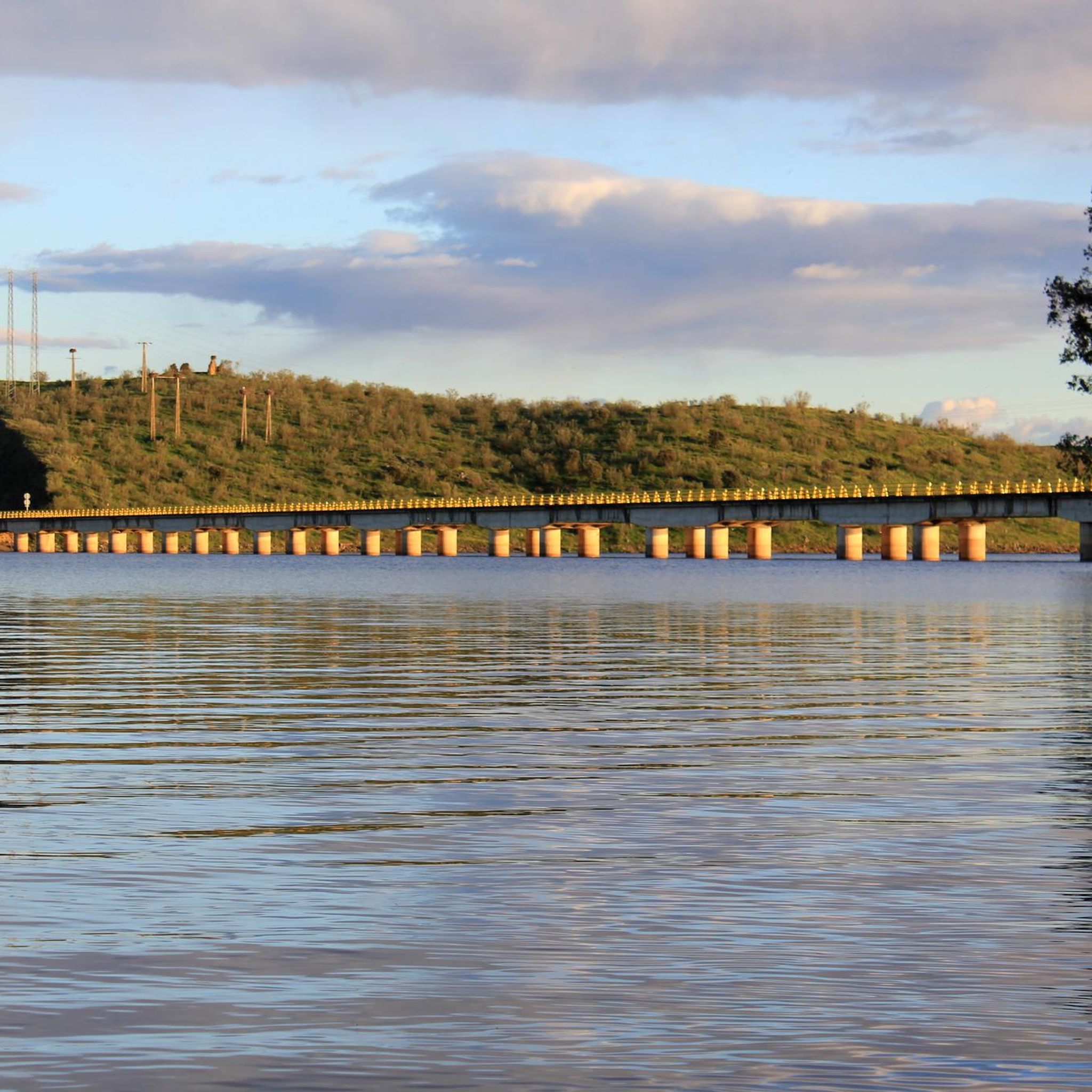
This spectacular reservoir was built during the 1960s. The reflection of the sunsets in the water and the surrounding landscape make it a must-see if you're exploring the Guadiana Nature Trail.
0
1

Stage 2. Herrera del Duque/Orellana la Vieja 88 kilometers. 1,020 meters of elevation gain. Compared to the previous stage, the second day of the trip is a pleasant walk through the vast rural and livestock plains of the Guadiana River, passing through the pastures of the García de Sola and Orellana reservoirs. The first contact with the inland sea of García de Sola is the serene river environment of the beaches and piers of Peloche; when the reservoir level is high, the water reaches the town streets. The route continues along a fairly quiet and scenic road to the Puerto Peña dam, tracing the curves and inlets of the reservoir's shore. Puerto Peña is a narrowing in the course of the Guadiana River that was used to build the García de Sola dam. There is also an active tourism center and hiking trails. The surroundings of the river gorge and the canyon's cliffs are an important wildlife reserve. There is a large colony of griffon vultures, white and black storks, cranes, falcons, eagle owls, buzzards, and kites, and it is possible to see flocks of the rare long-tailed wagtail. The mountain range is a lush forest populated by strawberry trees, holm oaks, cork oaks, pines, eucalyptus, pyrénergos, and the rest of the scrubland typical of Mediterranean forests. The route crosses the Puerto Peña gorge and continues along the Canal de las Dehesas track, one of the large canals built along the middle course of the Guadiana River during the Badajoz Plan hydraulic project. The path is completely flat and the surface is excellent. In some places, panels display environmental values and interesting landscape features. In spring, the rockrose flowers fill the green hills of the dehesas with white dots. The kilometers fly by on a bike, contemplating the meanders of the Orellana Reservoir. At the Casas de Don Pedro junction, the Guadiana Nature Trail turns toward Talarrubias and, before reaching it, enters a Cordel de Merinas (Merinas Cordillera) toward the Roman site of Lacimurga. The ruins are on the banks of the reservoir; it was a strategic crossing for the Guadiana River for centuries, even before the Romans built walls and expanded a primitive oppidum from the 5th century BC, founding a powerful Roman city of the Flavian dynasty on the plains of the Guadiana and Zújar rivers. The road surface is excellent for gravel bikes; it climbs along the foothills of the Maribáñez mountain range, passes through Orellana de la Sierra, and ends the stage in Orellana la Vieja.
0
1
Built in 1985, this reservoir has a capacity of 15 cubic hectometres and is known for its recreational activities such as carp, royal carp and black bass fishing. In addition, the reservoir has a beach that has been awarded the Blue Flag in 2023, making it an attractive destination for visitors.
7
0
The García de Sola Reservoir is an impressive work of engineering located in the Extremadura region, near Talarrubias, in the province of Badajoz. The reservoir is located in an environment of great beauty, surrounded by imposing rock formations and dense vegetation composed of Mediterranean forests, pine forests and eucalyptus trees. It is a place of great value for birdlife, with species such as the griffon vulture, black vulture, black stork, golden eagle and peregrine falcon.
5
0

Within a set of mountain ranges such as the Sierra de Belén or Sancho where the Río Ruecas appears and at this point the Cancho del Fresno Reservoir appears.
1
0
よくある質問
カサス・デ・ドン・ペドロ近郊でレクリエーションに人気の湖はありますか?
カサス・デ・ドン・ペドロ周辺地域は、地元の人々が湖と呼ぶこともある印象的な貯水池で知られています。最も人気のあるものの中には、釣りができ、ブルーフラッグ認証ビーチがあるカンチョ・デル・フレスノ貯水池、そしてその景観の美しさ、岩層、多様な野鳥で知られるガルシア・デ・ソラ貯水池があります。もう一つのお気に入りは、オレジャーナ貯水池にある内陸のビーチ、プラヤ・デ・ロス・カリカントスで、夏のレジャーに最適です。
カサス・デ・ドン・ペドロ周辺の湖を訪れるのに最適な時期はいつですか?
湖は一年中楽しめますが、水泳やウォータースポーツなどのアクティビティには、夏の月(6月から8月)が理想的です。春(3月から5月)と秋(9月から11月)は、ハイキング、サイクリング、バードウォッチングに快適な気温で、春は緑豊かな風景、秋は鮮やかな色彩を楽しめます。
カサス・デ・ドン・ペドロ周辺に家族向けの湖はありますか?
はい、いくつかの湖は家族連れに適しています。カンチョ・デル・フレスノ貯水池とプラヤ・デ・ロス・カリカントス(オレジャーナ貯水池の一部)の両方にはブルーフラッグ認証ビーチがあり、水質が高く設備も整っているため、お子様連れの家族に最適です。また、ガルシア・デ・ソラ貯水池には指定された遊泳エリアとキャンプ場があります。
これらの湖でどのような自然の特徴を見ることができますか?
この地域は、多様な自然景観に囲まれた広大な内陸の水域が特徴です。印象的な岩層、松やユーカリの森を含む地中海性の密な植生、そして広大なデエサ(牧草地)が見られます。例えば、ガルシア・デ・ソラ貯水池は、見事な岩層の中にあり、グリフォンハゲワシやクロコウなどの鳥類の楽園です。マサトリゴ山とラ・セレーナ貯水池では、道路が貯水池を横切り、山に沿って走るユニークな景色が楽しめます。
カサス・デ・ドン・ペドロ近郊の湖で泳ぐことはできますか?
もちろんです。この地域は「スウィート・コースト」と呼ばれる内陸のビーチで知られています。オレジャーナ貯水池はプラヤ・デ・ロス・カリカントスで有名で、カンチョ・デル・フレスノ貯水池にもブルーフラッグ認証ビーチがあります。ガルシア・デ・ソラ貯水池には指定された遊泳エリアがあります。これらの場所は、きれいな水と設備を備えており、爽やかな水泳を楽しめます。
この地域にブルーフラッグ認証ビーチのある湖はありますか?
はい、この地域には誇りを持ってブルーフラッグ認証ビーチがあります。オレジャーナ貯水池は、そのプラヤ・デ・オレジャーナでスペイン初のブルーフラッグ認証を受けた内陸地域でした。さらに、カンチョ・デル・フレスノ貯水池のビーチは2023年にブルーフラッグ認証を受け、オレジャーナ貯水池の奥にあるプラヤ・デ・ロス・カリカントスもその品質が認められています。
湖での釣りにはどのような機会がありますか?
貯水池は釣り愛好家にとっての楽園です。オレジャーナ貯水池は、パイク、ブラックバス、コイ釣りに最適です。ガルシア・デ・ソラ貯水池は、特にブラックバス、パイク、ズーダーのスポーツフィッシングの主要な目的地であり、様々な大会が開催されています。シハラ貯水池は、バルベル、ブラックバス、パイクで高く評価されており、カンチョ・デル・フレスノ貯水池はコイ、ロイヤルカープ、ブラックバスで知られています。
湖の周辺では、水泳以外にどのようなアウトドアアクティビティができますか?
水泳以外にも、湖では幅広いアクティビティが楽しめます。オレジャーナ貯水池ではカヤック、セーリング、ウィンドサーフィンを楽しめます。ガルシア・デ・ソラ貯水池はカヌーやモーターセーリングで人気があります。シハラ貯水池は、ボートスポーツ、ハイキング、マウンテンバイク、乗馬ルート、狩猟、バードウォッチングに最適です。多くのエリアにはピクニックスポットや展望台もあります。
カサス・デ・ドン・ペドロ周辺の湖の近くにハイキングコースはありますか?
はい、この地域には数多くのハイキングの機会があります。「コスタ・ドゥルセ」ブルー・トレイルやグアディアナ自然遊歩道では、オレジャーナ貯水池周辺のデエサや川岸を探索できます。シハラ貯水池にも素晴らしいハイキングコースがあります。特定のコースについては、「セロ・マサトリゴ植物トレイル」や「カニャメロからのカンチョ・デル・フレスノ貯水池ループ」のようなコースを探索できます。これらはカサス・デ・ドン・ペドロ周辺のランニングトレイルガイドに掲載されています。
湖の周りをサイクリングできますか?
サイクリングは湖の周辺を探索する素晴らしい方法です。カナール・デ・ラス・デエサスのような区間を含むグアディアナ自然遊歩道は、サイクリングに非常に人気があります。ロードサイクリングとマウンテンバイクの両方に対応したコースが見つかります。詳細なコースについては、ガルシア・デ・ソラ貯水池周辺のループを含む、カサス・デ・ドン・ペドロ周辺のロードサイクリングルートおよびカサス・デ・ドン・ペドロ周辺のマウンテンバイクコースガイドをご覧ください。
湖の近くでどのような野生生物を観察できますか?
貯水池は、特に野鳥に関して、生物多様性が豊かです。オレジャーナ貯水池は鳥類の特別保護区(SPA)およびラムサール条約登録地です。ガルシア・デ・ソラ貯水池は、グリフォンハゲワシ、クロハゲワシ、クロコウ、イヌワシ、ハヤブサなどの種で知られています。シハラ貯水池周辺地域もバードウォッチングに最適で、地中海の森林や低木地帯に様々な種が生息しています。
湖の近くに歴史的または文化的な史跡はありますか?
自然の美しさに焦点が当てられていますが、この地域には歴史的な重要性もあります。シハラ貯水池では、水位が低いときに、カニャーダ・レアル・デ・セゴビアからの14世紀の橋が現れます。グアディアナ自然遊歩道は、グアディアナ川沿いの戦略的に重要な古代都市であったローマ時代の遺跡ラシムーガの近くも通っており、この地域の過去を垣間見ることができます。
カサスデドンペドロでのの人気観光スポット

komootモバイルアプリでインスピレーションを得よう


さらに探索
まだ完璧な湖が見つかりませんかカサスデドンペドロでの?これらの地域のガイドをチェックして、さらに美しい場所を見てみましょう。
