韓国の絶景の山頂・トップ20
絶景を目指して登るのであれ、達成感のために登るのであれ、山頂を訪れることで、韓国の美しい自然をもっと満喫することができます。20
もの選択肢の中から、制覇する山頂を決めるのは簡単ではありません。スムーズに次の冒険で目指す山頂を選べるように、韓国の素晴らしい山頂をこのガイドにまとめました。
最終更新日: 8月 19, 2026
白雲台、北漢山国立公園
ハイライト • 山頂
A hike to Mount …
翻訳者 Google •
役立つ情報 は

雪岳山国立公園
ハイライト • 自然記念物
For those …
翻訳者 Google •
役立つ情報 は
今すぐサインアップして、こんな場所を発見しよう
最高のシングルトラック、ピーク、その他のエキサイティングなアウトドアスポットのおすすめを受け取ろう。
無料新規登録
ウルサンバウィ峰、雪岳山国立公園
ハイライト • 山頂
翻訳者 Google •
役立つ情報 は

白鹿潭(ベンノクダム) — 漢拏山山頂
ハイライト • 山頂
役立つ情報 は

北漢山国立公園
ハイライト • 自然記念物
翻訳者 Google •
役立つ情報 は

元暁峰
ハイライト • 山頂
役立つ情報 は
제비봉
ハイライト (セグメント) • 山頂
翻訳者 Google •
役立つ情報 は

チャンサン山頂
ハイライト • 山頂
役立つ情報 は

仁王山登山道
ハイライト (セグメント) • トレイル
Definitely take the passport - the Baegak Mounatain Trail is partially military restricted area. You can make your way, but you have to register beforehand (without any problems but you need the passport)
翻訳者 Google •
役立つ情報 は
チョンワンボン峰(智異山国立公園)
ハイライト • 山頂
翻訳者 Google •
役立つ情報 は

無料でサインアップして、さらに多くの山を発見しましょう 韓国での。
無料新規登録
すでにアカウントをお持ちですか?
無料アカウントで今日から始めよう
次の冒険が待っています。
ログインまたは登録

コミュニティからのヒント

A stunning view from the summit of the highest mountain on the Korean Peninsula. Despite the cold November weather, the summit was quite busy.
0
0
The highest mountain on the Korean Peninsula, offering correspondingly good views. The climb shouldn't be underestimated, and the temperature is quite cold and windy due to the high altitude. Snow can also linger at the summit for a long time.
0
0

Wonhyobong Peak (687m) is the highest peak in the east of Geumjeongsan Mountain. Like blooming apricot bathed in the light of the rising sun in the East Sea, it has a glamorous appearance as if embroidered with multiple hues. It is therefore called Wonhyobong Peak, meaning "the first of dawn". Located above the fourth lookout tower of Geumjeongsanseong Fortress, it also serves as a lookout with panoramic views of the boundless East Sea. A story handed down from Wonhyobong Peak tells of General Kim Yushin training the Hwarang (Silla's elite young military). The soldiers urinated on the rocks after standing at attention for a long time, then a Hwarang member planted a small pine tree on that spot. This pine tree boasted its freshness, overcoming rainstorms for many years, so people called the rock on which General Kim Yushin was standing "Kim Yushin Pine Rock". However, its exact location cannot be known.
1
0

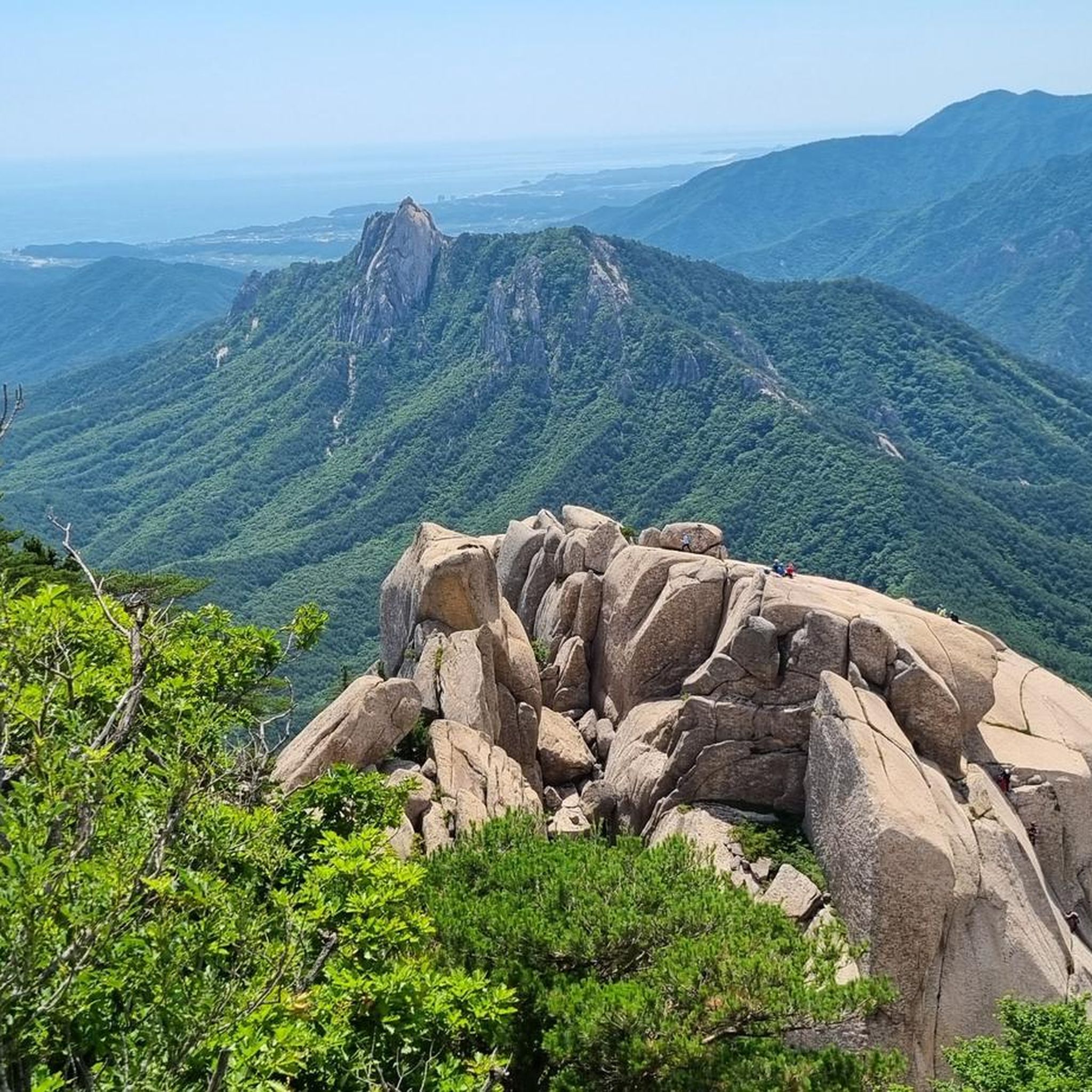
Beautiful views up there. Easy to reach, just take bus 7 or 7-1 from Sokcho and disembark on the very last stop. The route does not require any special equipment as it's mostly gravel and stairs (with handrail). Leave your poles at home, even sturdy mountain shoes are not particularly necessary. The last part is quite steep, so bring decent fitness. I did this trail in summer which can be very warm. We came early (the first bus from Sokcho runs at ~6.30) and the ascent was in the shadow mostly. Would not recommend to come later in the day as the sun will roast you. As everywhere in Korea, there's an abundance of toilets, the last one before the ascent is clearly marked as such.
0
0

The Baekmudong to Cheonwangbong section has many stone steps, so shoes with good grip are essential.
0
0

There are restrooms along the way. As is typical in Korea: clean, tidy, and free to use.
0
0
Just before the summit, there's a guardhouse. Pass it and take the stairs 200 meters further toward the summit. From the summit, the skyscrapers of Busan don't look so tall anymore. :-)
0
0

You can only see it when the weather is good. If it's windy and rainy, you can't see anything because of the clouds and fog.
0
0

komootモバイルアプリでインスピレーションを得よう


探していたものは見つかりませんでしたか?
韓国の最高の山や頂上を地域ごとに発見しましょう:
さらに探索
これらのガイドでさらに素晴らしい頂上を見てみましょう韓国での:
