ルート

プランナー

機能

アップデート

App

ログインまたはサインアップ

アプリを入手

ログインまたはサインアップ

ログインまたはサインアップ

ルート
Places to see
Waterfalls
ドイツ
バーデン・ヴュルテンベルク

ヴァルデンブルク

ヴァルデンブルクの滝・トップ2

Waldenburg周辺の最高の滝は、歴史的ランドマークと自然景観で知られるシュヴェービッシュ=フランケン森林自然公園内にあります。Waldenburg自体は中世の趣で知られていますが、その周辺地域にはいくつかの水辺の景観があります。これらには、渓谷、自然の滝、川の急流が含まれ、訪問者に多様な自然の魅力を提供しています。この地域の変化に富んだ地形は、さまざまなアウトドア体験に貢献しています。

Waldenburg周辺の最高の滝

  • 最も人気のある滝は、小さなテラスのある小川沿いの道がある渓谷、エセルスリンゲン渓谷です。この深く自然な谷は、特に雨や雪の後には険しくなることがあります。
  • もう一つの必見スポットは、自然の滝であるシェーンターラー・バッハの滝です。訪問者はハイキングコース沿いの小さな滝を期待できます。これは十分な水量があれば壮観になり、他にも小さな滝があります。
  • 訪問者はまた、小さな急流であるゲルビンゲンのコーハー急流も気に入っています。これらの川の景観は、水鳥を引きつけ、景色の良い展望を提供することで知られています。
  • Waldenburgは、渓谷、自然の滝、川の急流で知られています。これらはハイカーや自然愛好家に多様な体験を提供します。
  • Waldenburg周辺の滝はkomootコミュニティに高く評価されており、68件の「いいね!」と109件の写真が共有されています。

最終更新日: 5月 13, 2026

エゼルスクリンゲ渓谷

ハイライト (セグメント) • 峡谷

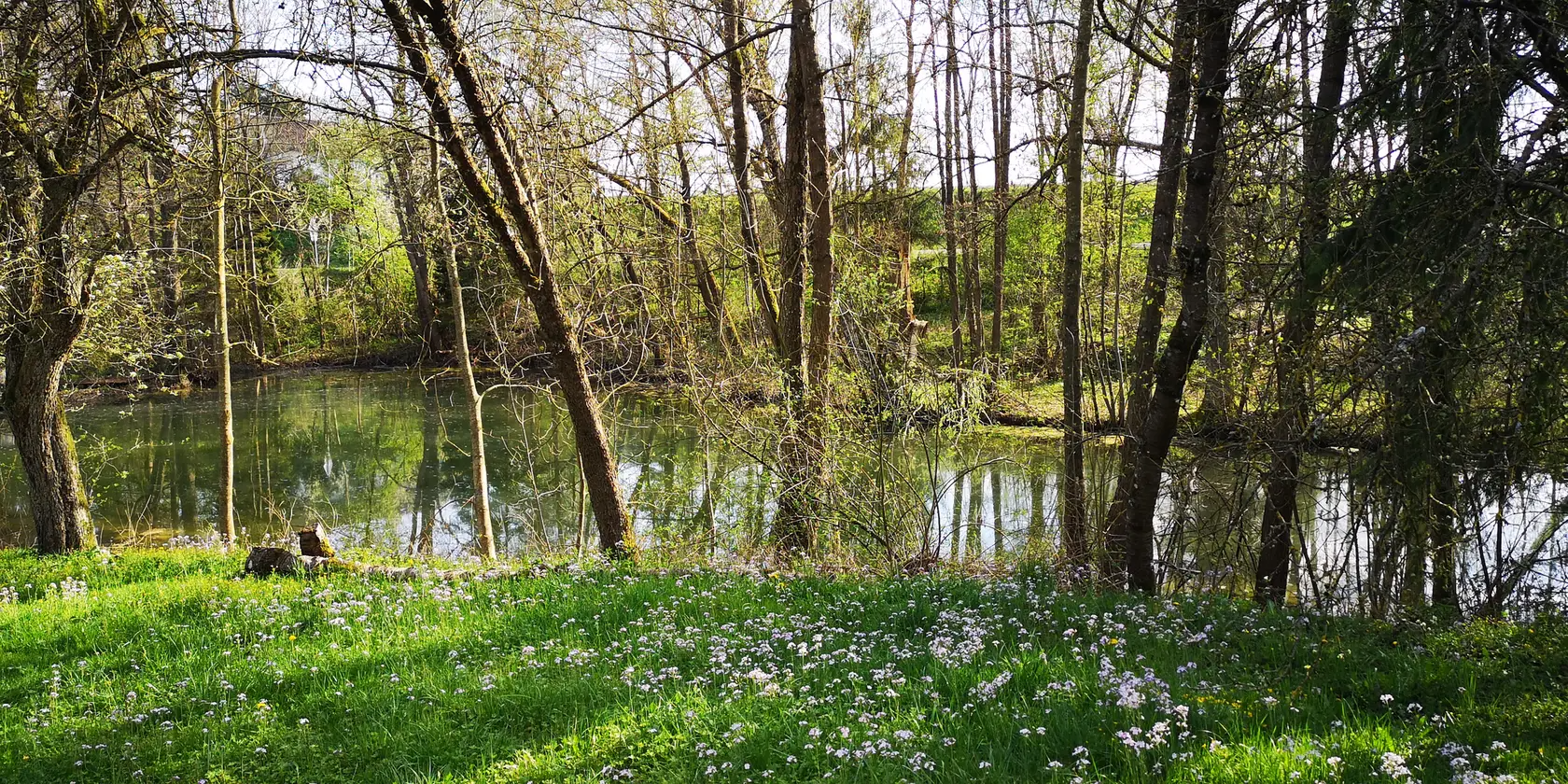
Very nice path that leads along the stream, sometimes very demanding!
After rain or snow, sturdy shoes and sticks are recommended!

翻訳者 Google •

役立つ情報

によるものです

ここでのハイキングを見る

スマートフォンに送信

保存

Small waterfall on the Schöntaler Bach directly on the hiking trail towards Rottal.

翻訳者 Google •

役立つ情報

によるものです

保存

今すぐサインアップして、こんな場所を発見しよう

最高のシングルトラック、ピーク、その他のエキサイティングなアウトドアスポットのおすすめを受け取ろう。

無料新規登録

Bach collects lime from the Gipskeuper west of Gailenkirchen. This falls out at barriers and lime sinter is formed. This forms the small waterfalls. (Hohenlohian "Pamukkale") :)

翻訳者 Google •

役立つ情報

によるものです

保存

無料アカウントで今日から始めよう

次の冒険が待っています。

ログインまたは登録

ヴァルデンブルク周辺で人気

Family hiking with the adventure factor in the 'Süden ganz oben'

Aktiv in die längeren Tage – Frühlingsradeln im Norden Baden-Württembergs

ヴァルデンブルクでのハイキング

ヴァルデンブルクでのサイクリング

ヴァルデンブルクのロードバイクルート

ヴァルデンブルクのランニングコース

ヴァルデンブルクのMTBトレイル

ヴァルデンブルクでののグラベルライド

ヴァルデンブルクでのの他の冒険

Family hiking with the adventure factor in the 'Süden ganz oben'

ハイキングのコレクション によって

Im Süden ganz oben

コミュニティからのヒント

Kristian
4月 12, 2025, Waterfalls on the Schöntaler Bach

Small waterfall on the Schöntaler Bach directly on the hiking trail towards Rottal.

Google翻訳による翻訳

6

0

The Eselsklinge is an approximately one kilometre long, east-facing forest valley in the Hohenlohe district of Baden-Württemberg on the edge of the Waldenburg region.

Google翻訳による翻訳

1

0

Very nice idyllic creek tour and so close to town. 🤩

Google翻訳による翻訳

3

0

Fantastic! 😍

Google翻訳による翻訳

1

0

Bach collects lime from the Gipskeuper west of Gailenkirchen. This falls out at barriers and lime sinter is formed. This forms the small waterfalls. (Hohenlohian "Pamukkale") :)

Google翻訳による翻訳

1

0

Very nice route, unfortunately not mobile, through many fallen trees, some of which are difficult to overcome. The path is also very narrow and slippery in places.

Google翻訳による翻訳

0

0

A beautiful hiking trail. Climb over tree trunks and now and then through a ford. Beautifully natural.

Google翻訳による翻訳

1

0

There's a magnificent waterfall at this spot! With enough water, it's truly a small spectacle, something you'd never expect here. In addition to the relatively large waterfall, there are a few other smaller waterfalls to admire along the Schöntaler Bach. -------- The Schöntaler Bach is a stream in the Mainhardt Forest in northern Baden-Württemberg, approximately 3 km long from its source furthest from its mouth. It flows into the middle reaches of the Fichtenberger Rot from the right and southwest, just downstream of the former Hankertsmühle (mill) in Mainhardt, on the municipal and district border between Großerlach in the Rems-Murr district and Mainhardt in the Schwäbisch Hall district, and flows into the middle reaches of the Fichtenberger Rot from the right and southwest. Sources: The Schöntaler Bach originates on the spring-rich northeast slope and foot of the almost entirely forested Hohe Brach, with its summit at 586.9 m above sea level, the highest elevation in the entire Swabian-Franconian Forest. Two springs at the origin of the main stream rise close together at only about 510 m above sea level; the outflow of a nearby third soon strengthens the young stream. The highest spring, with a noticeably longer branch, rises at about 570 m above sea level, just about 400 meters northwest of the high point of the flat mountain cap on the edge of the K 1903 county road from Großerlach to Grab. Its half-kilometer-long and thus noticeably longer branch runs northeast down the slope and joins the main stream branch at the west-southwest tip of an elongated clearing around the Großerlacher Schöntalhöfle, also called Schertelshöfle. Course: The stream then flows for approximately 750 meters along the southern edge of the clearing to the Buch forest area on the lower slope of the Brach, passing through a quarter-hectare pond with a small island near the Schöntalhöfle. A second long slope branch, the Fuchsklingenbach, joins it from the right, emerging from the mountain forest, this time even more than a kilometer long. It rises near the eastern subsidiary peak of the Brach and the hamlet of Hohenbrach, also next to the county road. Shortly thereafter, the stream passes under the access road from Grab to the Schöntalhöfle at approximately 460 meters above sea level. Here it turns northeast, flowing between the Schöntalhöfle on the left slope of the hill and the Schöntalsägmühle on the right bank, and immediately enters the Schöntal Forest permanently. At a small clearing, the district and municipal border with Mainhardt reaches the stream from the north and then follows it to its mouth. At a multiple fork in a forest path that now follows the stream to the left, the Limes route, accompanied by the Limes hiking trail, crosses the small valley from Grab in the south-southeast to Mainhardt in the north-northwest. On the section from Grab, the Säugraben, a striking notch in the terrain, several times as deep and wide as a typical sunken road and sometimes drained by a small trickle, lies here on the dead-straight old border line. Shortly afterward, the last significant tributary, the Güldenklinge, flows in, also from the right, towards Schönbronn in the southeast. After crossing under a small farm track along the edge of the Rottal valley, the Schöntaler Bach flows from the right into the middle course of the Fichtenberger Rot, which flows eastward here in a narrow, open forest valley floor, between the now deserted sites of the Mainhardt Hankertsmühle (main mill) and the Schönbronn Sägmühle (saw mill) downstream. Source: https://de.wikipedia.org/wiki/Sch%C3%B6ntaler_Bach

Google翻訳による翻訳

2

2

よくある質問

ヴァルデンブルク周辺で最も注目すべき滝は何ですか?

ヴァルデンブルク自体は歴史的建造物や景観で知られていますが、そのすぐ近くには魅力的な自然の水辺がいくつかあります。エセルスリンゲ渓谷は、小さな段差のある小川沿いに続く非常に険しい道で、深い自然の谷となっています。もう一つのハイライトは、ショーンターラー・バッハの滝です。水量が十分にあれば、ハイキングコース沿いのいくつかの滝が小さなスペクタクルとなります。

ヴァルデンブルクのより広い地域に、家族向けの滝や水辺はありますか?

はい、より家族向けの体験としては、ゲルビンゲンのコーハー急流がおすすめです。これは水鳥の観察に適した小さな急流です。もう一つの選択肢は、ガイレンキルヒェン近郊のトラバーチン滝です。石灰の堆積物が小さな滝を作り出すユニークな自然記念物で、「ホーエンローエのパムッカレ」と呼ばれることもあります。

エセルスリンゲ渓谷を訪れる際、どのような地形が予想されますか?

エセルスリンゲ渓谷は、小川沿いに続く非常に険しい道が特徴です。雨や雪の後には、状況が厳しくなる可能性があるため、丈夫な靴とトレッキングポールを強くお勧めします。美しい渓流の段差がある、深く自然な谷です。

ショーンターラー・バッハの滝は何が特別なのですか?

ショーンターラー・バッハの滝は、ハイキングコース沿いにある小さな滝です。十分な水量があれば、壮観な光景となり、この地域では予想外の小さなスペクタクルを提供します。メインの滝に加えて、小川沿いにいくつかの小さな滝を鑑賞できます。

ヴァルデンブルクの滝の近くで、他にどのような自然の特徴を探検できますか?

滝そのもの以外にも、ヴァルデンブルク周辺地域はシュヴェービッシュ=フランケン森林自然公園の一部です。緑豊かな森、ショーンターラー・バッハのような川、そして自然記念物があります。例えば、エセルスリンゲ渓谷は、小川と森林環境のある深い自然の谷の代表例です。

これらの滝にはハイキングコースがありますか?

はい、Eselsklinge渓谷Schöntaler Bachの滝はどちらもハイキングコース沿いにあります。Eselsklinge渓谷を通る道は非常に険しいとされていますが、Schöntaler Bach沿いのコースは中級者向けです。特に雨上がりは、適切な靴を必ず着用してください。

ヴァルデンブルク周辺の滝の近くでどのようなアウトドアアクティビティができますか?

ヴァルデンブルク周辺地域では、特にサイクリングを中心に様々なアウトドアアクティビティが楽しめます。様々なタイプの自転車に適したルートが多数見つかります。例えば、ホエンローエ平原や周辺の森を巡る交通規制のないサイクリングルートロードサイクリングルートを探索してみてはいかがでしょうか。

Eselsklinge渓谷の訪問者が最も楽しんでいる点は何ですか?

訪問者は、Eselsklinge渓谷ののどかな小川沿いのツアーと、街への近さを頻繁に称賛しています。小さな段差のある美しい小川と、険しい道のりにもかかわらず、非常に深く自然な谷が、しばしば主な魅力として挙げられています。

滝の近くに歴史的または文化的な史跡はありますか?

ヴァルデンブルク自体は歴史的なランドマークが豊富で、保存状態の良い中世の雰囲気とホエンローエ平原のパノラマビューで知られています。滝は自然の景観ですが、滝を訪れるのと同時に街の歴史的なアトラクションを探索することもできます。

ヴァルデンブルク周辺の滝を訪れるのに最適な時期はいつですか?

滝、特にSchöntaler Bachの滝は、雨の後で水量が多くなり、より壮観な光景となる時期が最も印象的です。ハイキングには、春と秋が快適な気温と鮮やかな景色を提供しますが、特に雨天後は丈夫な靴が常に推奨されます。

ヴァルデンブルクでのの人気ルート

ヴァルデンブルクでのハイキング

ヴァルデンブルクでのの人気観光スポット

Places to see

Store rating

komootモバイルアプリでインスピレーションを得よう

無料のkomootアカウントがあれば、無限のアウトドアコースを簡単に見つけてカスタマイズし、ナビで案内できます。

または

今すぐkomootに参加しよう

Store rating

さらに探索

少し遠出するのは嬉しいですか?それなら、これらのガイドで最高の滝を見てみましょうヴァルデンブルクでの:

ブレッツフェルトプフェーデルバッハエーリンゲンフォルヒテンベルクシェーンタールツヴァイフリンゲン

近くのアドベンチャーガイド

ミヒェルフェルトでやるべきこと

background

新しいピークを征服する準備をしよう

無料でサインアップ

探検する
ルートルートプランナー機能ハイキングMTBトレイルロードバイクルートバイクパッキングサイトマップ
アプリをダウンロード
SNSでフォローする

© komoot GmbH

プライバシーポリシー