ルート

プランナー

機能

アップデート

App

ログインまたはサインアップ

アプリを入手

ログインまたはサインアップ

ルート
Places to see
Mountain Peaks
オーストリア
オーバーエスターライヒ
ザルツカンマーグート
Vöcklabruck

フランケンマルクト

フランケンマルクトの絶景の山頂・トップ6


絶景を目指して登るのであれ、達成感のために登るのであれ、山頂を訪れることで、フランケンマルクトの美しい自然をもっと満喫することができます。6
もの選択肢の中から、制覇する山頂を決めるのは簡単ではありません。スムーズに次の冒険で目指す山頂を選べるように、フランケンマルクトの素晴らしい山頂をこのガイドにまとめました。

最終更新日: 7月 15, 2026

Buchberg山頂の十字架

ハイライト • 山頂

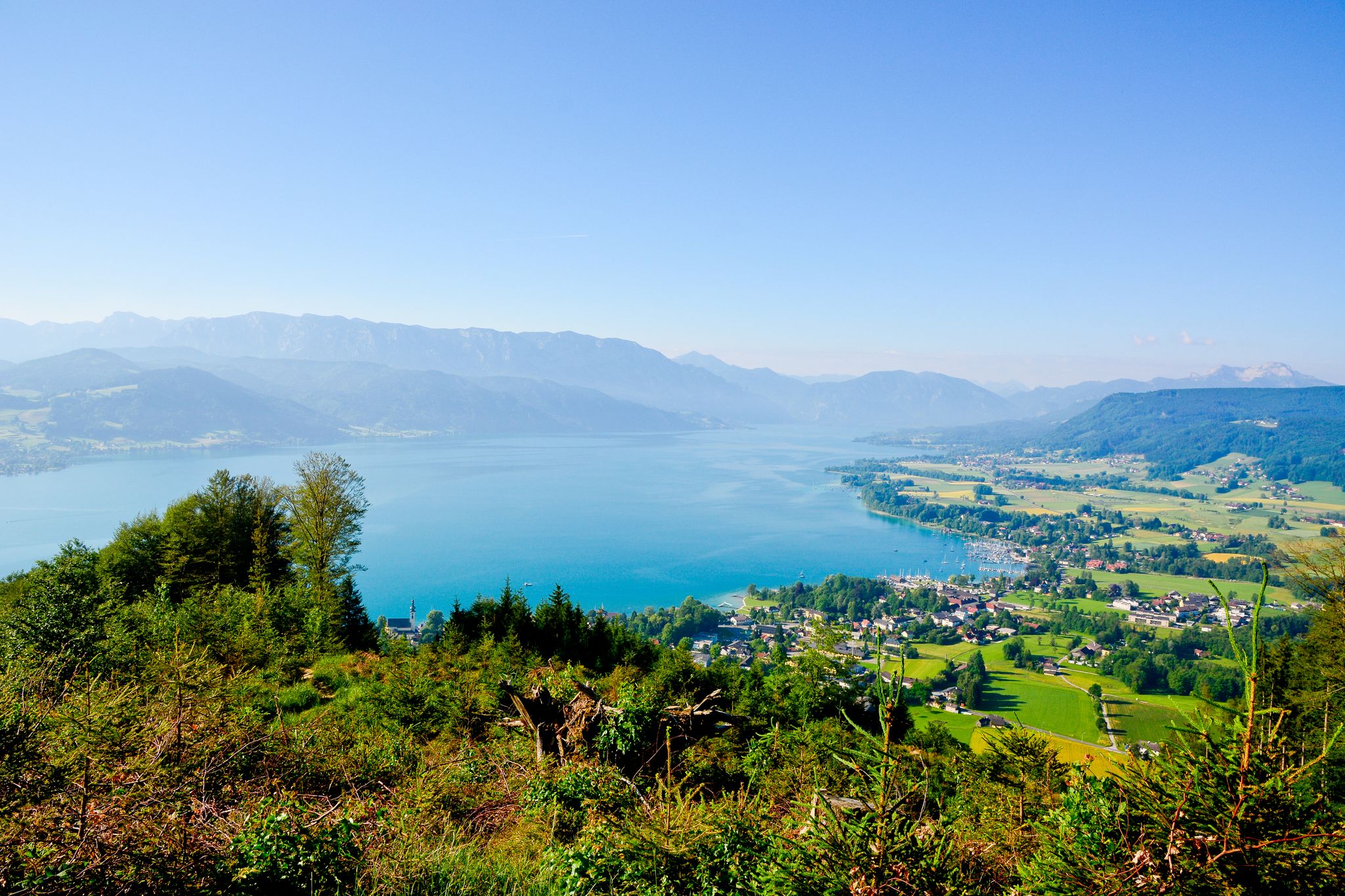
From Buchberg you have a beautiful view of the Attersee. In about 30 minutes, you are up relatively quickly.

翻訳者 Google •

役立つ情報

によるものです

ここでのハイキングを見る

スマートフォンに送信

保存

Kalteis小屋

ハイライト • 山小屋

It is a 734 meter high mountain in the Hausruck and Kobernausserwald range in the Hausruckviertel. The summit is in the municipality of Pöndorf. To the northwest, the Rabenbachtal leads …

翻訳者 Google •

役立つ情報

によるものです

保存

今すぐサインアップして、こんな場所を発見しよう

最高のシングルトラック、ピーク、その他のエキサイティングなアウトドアスポットのおすすめを受け取ろう。

無料新規登録

リヒテンベルク展望塔

ハイライト • 展望台

There is a lookout tower on the Lichtenberg (885 meters). You can climb another 32 meters via 208 steps. From the platform you have a fantastic view of the Traunstein, …

翻訳者 Google •

役立つ情報

によるものです

保存

Great panorama over the Attersee to Traunstein, Totes Gebirge, Höllengebirge to the Dachstein

翻訳者 Google •

役立つ情報

によるものです

保存

無料アカウントで今日から始めよう

次の冒険が待っています。

ログインまたは登録

フランケンマルクト周辺で人気

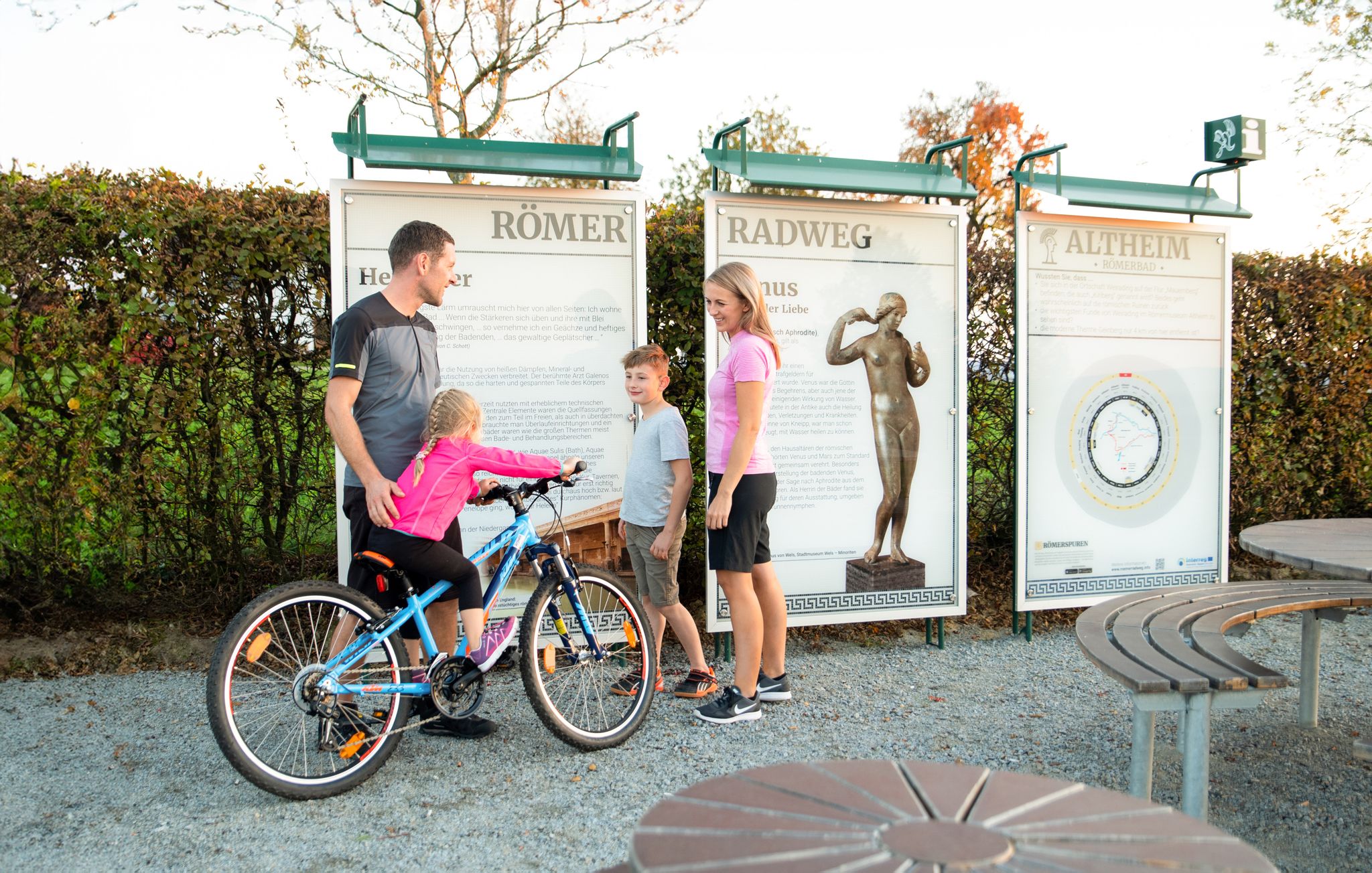
ローマ人の跡を追って – ローマ人の自転車道

Far away from everyday stress – hikes around the Attersee

フランケンマルクトでのサイクリング

フランケンマルクトのロードバイクルート

フランケンマルクトのMTBトレイル

フランケンマルクトでのハイキング

フランケンマルクトでののグラベルライド

フランケンマルクトのランニングコース

フランケンマルクトでのの他の冒険

ローマ人の跡を追って – ローマ人の自転車道

サイクリングのコレクション によって

Römerradweg

コミュニティからのヒント

Martin Hiller
7月 28, 2024, View of Attersee and the Mountains from Lichtenberg

The Lichtenberg offers a great view of the Attersee and the mountains.

Google翻訳による翻訳

0

0

The Lichtenberg is always worth a visit! Whether you start from Weißenkirchen or St. Georgen, there is always plenty of shade in the forest and so a bike ride is usually no problem even on hot days. It doesn't matter whether you visit the observation tower or the inn beforehand. That probably depends on how hungry you are. But you shouldn't miss out on "both", the fantastic view and the good food.

Google翻訳による翻訳

0

0

Great! The view is worth the climb!

Google翻訳による翻訳

0

0

The 36 m high observation tower can be reached either on foot, by bike or by car via the mountain road to Lichtenberg. No matter whether after a hike or the more comfortable journey, the view is always magnificent.

Google翻訳による翻訳

1

1

You have to enjoy the view, there are only 208 steps to the top. Unfortunately we weren't so lucky with the weather, it was foggy and the sun didn't come out until we had firm forest ground under our feet again 😄

Google翻訳による翻訳

1

0

It is a 734 meter high mountain in the Hausruck and Kobernausserwald range in the Hausruckviertel. The summit is in the municipality of Pöndorf. To the northwest, the Rabenbachtal leads to the Hochecker Schwemmbachtal and thus to Mattig and Inn, to the west is the Fornacher Redltal, which drains with the Bruckwiesenbach to the Vöckla and via the Ager to the Traun. The mountain is mostly counted towards the Kobernausserwald, partly also towards the Hausruck – the demarcation of which is seen somewhere in the room. The name is likely to be of Slavic origin, -eis is a typical Windian educational syllable. In the Franciscan cadastre of the 1830s, a small hilltop settlement of Branauer is listed here, as well as an important border tree. There is said to have been an inn here. A single hut still stands today. A chapel is said to have stood nearby even earlier, according to Carl Schütz in 1787, in the south towards Meisterholz there is a St. Wolfgang. It must have fallen into disrepair by the 1830s. The mountain can be reached from all sides on numerous forest roads, through the valleys as well as along the ridges. A forest road also runs along the ridge itself. This makes the area good for hiking and mountain biking

Google翻訳による翻訳

2

0

Easy forest mountain hike up an amazingly panoramic 808m high hill near Attersee. June 4, 2018

Google翻訳による翻訳

4

1

The destination of the Buchberg adventure forest trail announced in tourist flyers. Good for hiking with children.

Google翻訳による翻訳

0

1

フランケンマルクトでのの人気ルート

フランケンマルクトの交通量の少ないサイクリング

フランケンマルクトでのの人気観光スポット

Lakes

Store rating

komootモバイルアプリでインスピレーションを得よう

無料のkomootアカウントがあれば、無限のアウトドアコースを簡単に見つけてカスタマイズし、ナビで案内できます。

または

今すぐkomootに参加しよう

Store rating

さらに探索

これらのガイドでさらに素晴らしい頂上を見てみましょうフランケンマルクトでの:

Unterach am Atterseeオーバーヴァングインナーシュヴァントアムモンドゼーモンゼーゲマインデグラーベンヌスドルフアムアッターゼーシュタインバッハアムアッターゼーザンクト・ローレンツワイレック・アム・アッターシーツェル・アム・モースAttersee am AtterseeアッターゼーアウラッハアムホンガルSchörflingamAtterseeレーガウベルク・イム・アターガウSeewalchen am AtterseeデッセルブルンフランケンブルクアムハウサックStraßimAttergauレンチングティメルカンフェックラマルクトガンパーンアターゼートラウンゼー自然公園WeißenkirchenimAttergauザンクト・ゲオルゲン・イム・アッターガウフォルナッハNeukirchenanderVöcklaツェル・アム・ペッテンファーストオッタング・アム・ハウサックAmpflwang im HausruckwaldレドライテンプフキルヒェンアムトラットバーグヴォルフスエッグアムハウサックペンドルフAttnang-PuchheimウンゲナッハマニングアッツバッハニーダータールハイムピルスバッハピッツェンベルクルッツェンハムレドルハムオーベルンドルフベイシュワネンシュタットOberhofen am Irrsee

近くのアドベンチャーガイド

WeißenkirchenimAttergauでやるべきこと

background

新しいピークを征服する準備をしよう

無料でサインアップ

探検する
ルートルートプランナー機能ハイキングMTBトレイルロードバイクルートバイクパッキングサイトマップ
アプリをダウンロード
SNSでフォローする

© komoot GmbH

プライバシーポリシー