聖アウグスティヌスのおすすめランニングルート
4.3
(31)
702
ランナー
23
ランニング
聖アウグスティヌスでランニングを楽しめば、このエリアをより深く知ることができます。ランニングに適した美しいルートが見つかるように、komootが聖アウグスティヌスでのルートのコレクション全体を評価して選び抜いた、人気ランニングトレイルをご紹介します。ルートをクリックして詳細を表示し、他のユーザーがアップロードした役立つ情報や写真を閲覧しましょう。
最終更新日: 8月 21, 2026
4.8
(6)
28
ランナー
8.20km
00:51
50m
50m
中程度のジョギング. ある程度のフィットネスレベルが必要です。 全般的に舗装された状態です。あらゆるスキルレベルに適しています。
3
ランナー
8.78km
01:00
40m
40m
中程度のジョギング. ある程度のフィットネスレベルが必要です。 全般的に進みやすいルートです。一部で、安定して歩行できる技術が必要です。

無料新規登録
7
ランナー
22.0km
02:21
140m
140m
難しいジョギング. 標準以上のフィットネスレベルが必要です。 全般的に進みやすいルートです。一部で、安定して歩行できる技術が必要です。
7
ランナー
10.4km
01:05
50m
50m
中程度のジョギング. ある程度のフィットネスレベルが必要です。 全般的に舗装された状態です。あらゆるスキルレベルに適しています。
6
ランナー
21.7km
02:17
90m
90m
難しいジョギング. 標準以上のフィットネスレベルが必要です。 全般的に進みやすいルートです。一部で、安定して歩行できる技術が必要です。
さらに多くのルートや他のユーザーのおすすめ情報を確認できます。
無料新規登録
すでにアカウントをお持ちですか?
おすすめのツアーは他のkomootユーザーが実際に経験した何千ものアクティビティに基づいています。
無料アカウントで今日から始めよう
次の冒険が待っています。
ログインまたは登録

コミュニティからのヒント

Gironde川河口の南航路を示すために、Terre-Nègreの先端にあるSt-Palais-sur-Merの自治体に位置し、危険な砂州であるla barre à l'Anglaisの存在を知らせます。
0
0

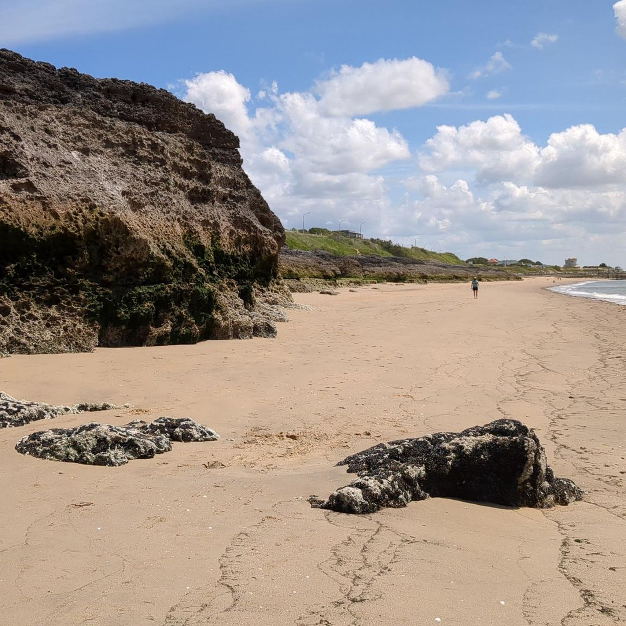
オートゥール井戸は、サン=パレ=シュル=メールの北にあるオートゥール井戸に位置する象徴的な自然の場所です。その名前はしばしば興味をそそり、その歴史は地質学、地元の伝統、そして海洋観測を組み合わせています。 🌊 起源と形成 オートゥール井戸は、人間が掘った井戸ではなく、自然の形成物です。 これは、海洋浸食によって石灰岩に掘られた空洞です。 波と浸水の作用により、岩石は徐々に崩壊し、海に向かって開いた垂直の縦穴のようなものを形成しました。 荒波や満潮時には、水が激しく流れ込み、劇的な渦を発生させます。 📜 名前の由来 「オートゥール」という言葉は、おそらく古フランス語または地元の俗語に由来しています。 「高さ」または「別」を意味する言葉に由来し、高い場所や孤立した場所を示唆している可能性があります。 別の仮説では、自然の空洞または開口部に関連する古い言葉の変形が示唆されています。 完全に確実な起源は正式に確立されておらず、それがこの場所の神秘性を増しています。 ⚓ 地元の歴史的な役割 この場所は、時間の経過とともにいくつかの用途または機能を持っていました。 👀 観察地点 岩場の断崖の上に位置し、海を監視するための自然の観察地点として機能していました。 住民や漁師は、船、嵐、危険を検知することができました。 🎣 漁業活動 ロワイヤン海岸の他の場所、特に有名なカレレット(網干場)の近くと同様に、この地域は漁師に利用されていました。 井戸の周りの岩は、岸釣りや釣り竿を使った釣りを可能にしました。 🌿 注目すべき自然の場所 今日、オートゥール井戸は主に以下の場所です。 海岸沿いの小道に沿った人気の散策場所。 景観および地質学的な関心のために指定された場所。 大西洋の素晴らしい眺め、特に日没時には。 ⚠️ 注意 この場所は壊れやすく、潜在的に危険なままです。 不安定な崖 嵐の際の強力な波 舗装された小道にとどまることをお勧めします。
0
0

Easily accessible place, only the last meters are prohibited for cyclists.
0
0
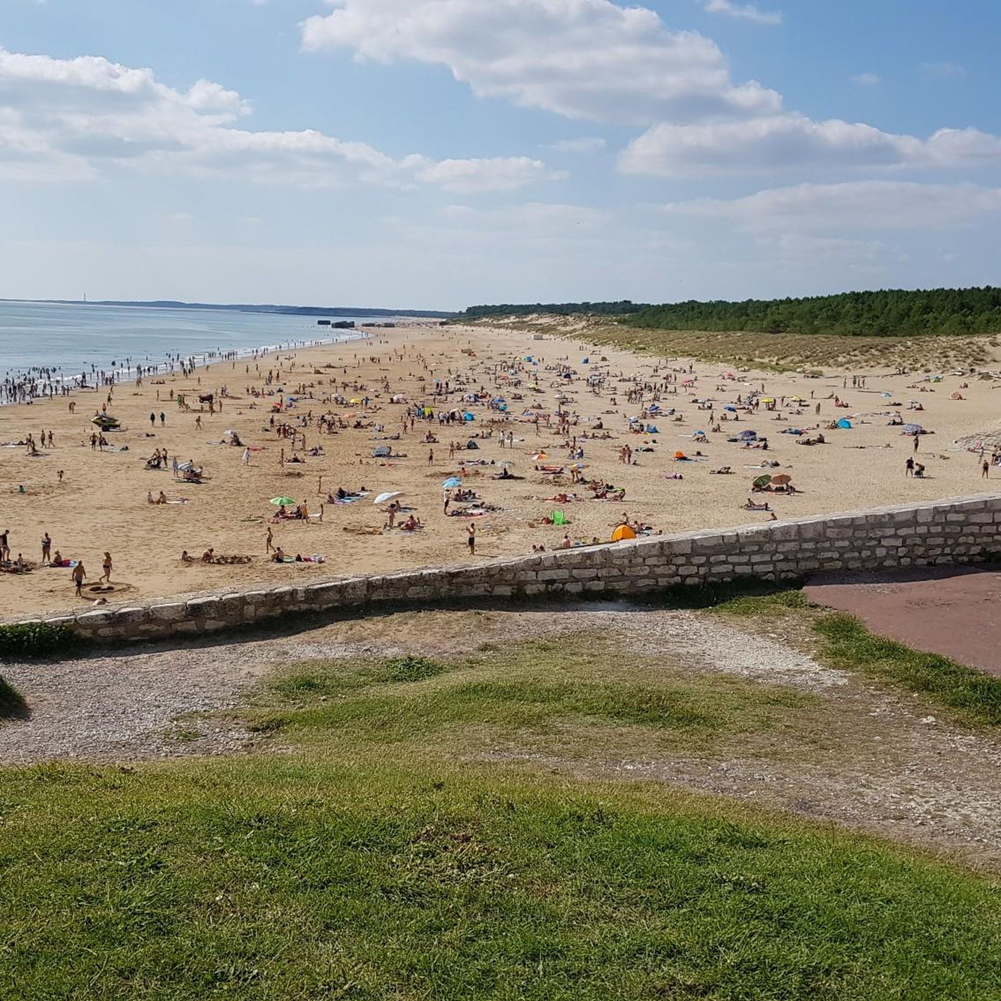
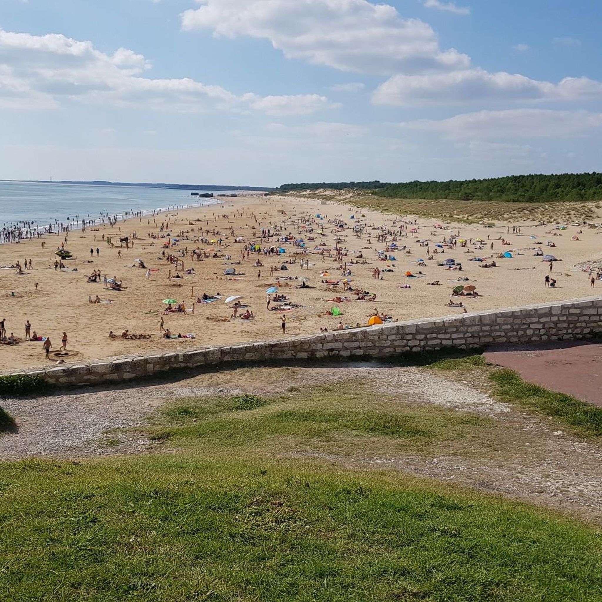
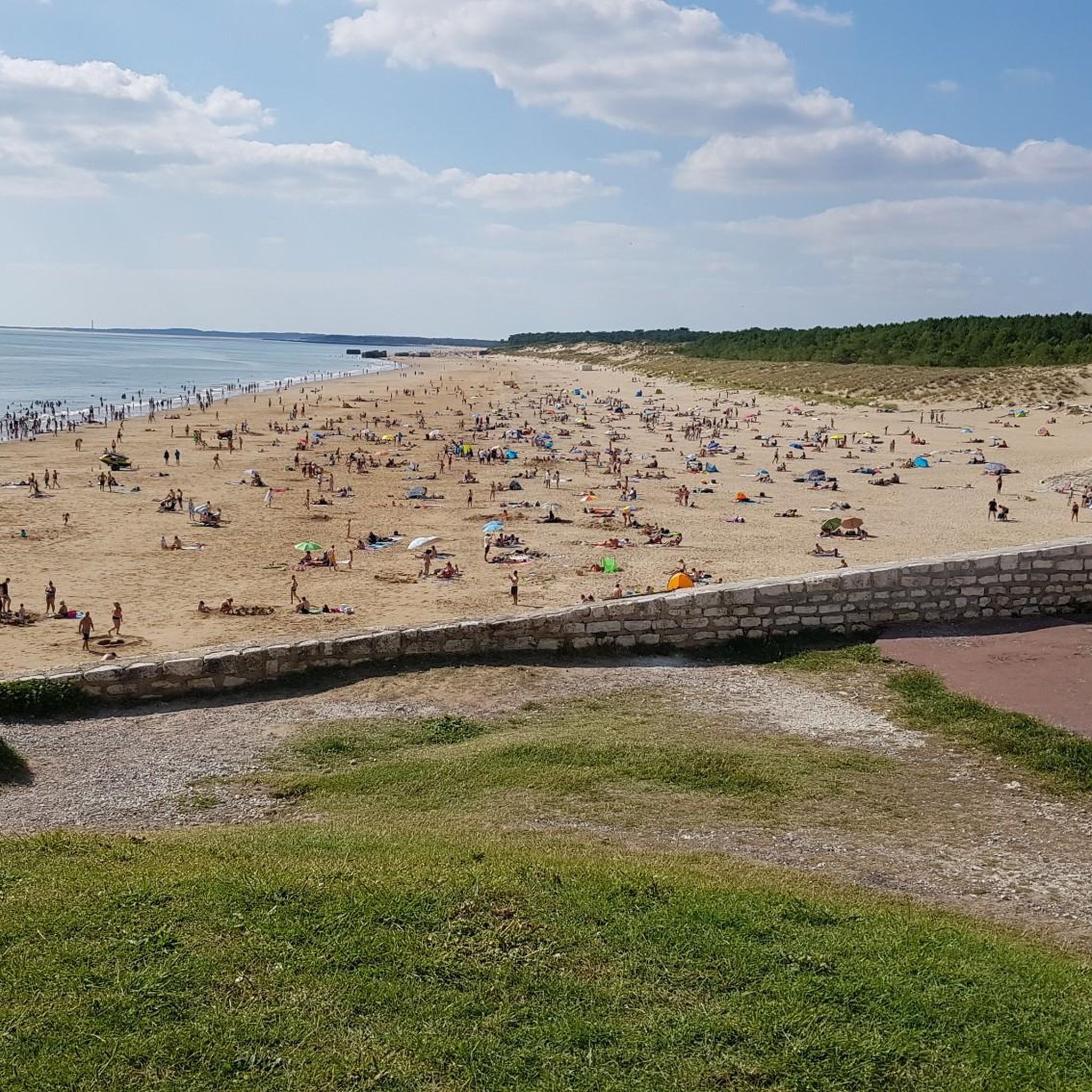
Forming a transitional space between the sandy coves and cliffs that characterize the surroundings of Royan, from Meschers-sur-Gironde to the tip of Terre-Nègre, and the vast straight expanse of the wild coast, exposed to the furious assaults of the ocean, the Grande-Côte presents itself as a large beach of fine sand, edged with dunes planted with pine trees. Overlooking the mouth of the Gironde and the Atlantic Ocean, it is often subject to a strong swell, taken advantage of by many surfers in the region. If the phenomena of rip currents are absent, strong currents require a certain amount of caution. The Grande-Côte is divided into 4 sectors: the beach of the Grande-Côte itself, the beaches of Combots and Lède, both partly naturist (over a length of 800 meters) and the beach of Pins de Cordouan. The Grande-Côte stretches from the tip of the Grande-Côte (Saint-Palais-sur-Mer) to the bay of Bonne Anse (La Palmyre, commune of Les Mathes). A vast, straight expanse bordered by a dune line and a pine forest, the Combots d'Ansoine forest (La Coubre massif), it announces, by its configuration and its geomorphological characteristics, the beaches of the Côte Sauvage and the Côte d'Argent. Its northwest/southeast orientation, however, differentiates it from the latter, which face due west. Less exposed to the swell, it is nonetheless occasionally subject to strong waves and rollers, which make it a favorite spot for surfers. Outside of the summer period, sports such as sand yachting are also practiced there. The site of the tip of the Grande-Côte, accessible from the city center by a wide avenue doubled by a cycle path, is a prime tourist site, where souvenir shops, bars, restaurants and fast food restaurants are located. Several parking areas have been set up there. It is a stopover on the EuroVelo 1 cycle route, a European route linking Norway to Portugal, known in its French part as the "Vélodyssée". Its section between the Grande-Côte and Ronce-les-Bains has been developed into a greenway, on a dedicated site for nearly thirty kilometers: the greenway from Ronce-les-Bains to Saint-Palais-sur-Mer thus goes back up towards La Palmyre and crosses part of the Arvert peninsula.
0
0

The Promenade des Deux Phares offers a picturesque mountain bike route along the Atlantic coast, with panoramic views of the sea and beaches. Between the two lighthouses, you will cross sandy paths, coastal paths and pine forests typical of Charente-Maritime.
1
0

This forest path offers breathtaking views of the coast. Bordering the Cambots d'Ansoine forest near La Palmyre, it is a place where nature and the sea meet. From the forest paths, the views open onto the sandbanks that change with the tides.
0
0
There you can explore a 2.5 kilometer beach lined with dunes and forests. This scenic expanse offers a variety of activities, including fishing, surfing, body boarding and windsurfing. Don't miss the historic blockhouses that line the shore.
2
0
From there, you can appreciate this immense white sand beach which stretches as far as the eye can see. If you can't walk it, this is the best thing to do. If you are going to walk, this is a place to visit before or after walking the beach itself.
2
0
聖アウグスティヌスでのの人気観光スポット

komootモバイルアプリでインスピレーションを得よう


さらに探索
他の地域の最高のランニングトレイル & ルートを見てみましょう。
