バシリーのおすすめウォーキング&ハイキングルート
4.6
(2149)
22,029
ハイカー
205
ハイキング
ハイキングは、フランス、ノルマンディー地方のマンシュ県にある多様な景観を提供します。この地域は、砂丘、ビーチ、潮間帯の入り江がある変化に富んだ海岸線が特徴で、内陸に進むと生垣と森林地帯に特徴づけられるボカージュ(田園地帯)へと移行します。湿地帯や丘陵地帯も起伏に富んだ地形に貢献しており、探検のためのさまざまな自然環境を提供しています。淡水小川と沿岸河川の密なネットワークが、この地域の自然の美しさをさらに高めています。
バシリー周辺の最高のハイキングトレイル
- 最も人気のあるハイキングルートは、モンサンミッシェルを望むヴァイン発の「シュマン・デュ・ドゥアニエ」ループで、距離10.5マイル(16.9 km)、所要時間4時間21分で、モンサンミッシェルの景色を楽しめます。 (www.komoot.com/ja-jp/smarttour/36077404)
- 地元のハイカーに人気のもう一つのルートは、ヴァイン発の「グルアン・デュ・スッド – サン・レオナール修道院」ループで、海岸地帯と潮間帯の入り江を探索する、距離3.8マイル(6.2 km)の簡単なコースです。 (www.komoot.com/ja-jp/smarttour/35408350)
- 地元のハイカーは、ジェネッツ発の「ジェネッツ」ループも気に入っています。距離3.0マイル(4.8 km)のこのトレイルは、ボカージュ(田園地帯)を通り抜け、所要時間は約1時間12分です。 (www.komoot.com/ja-jp/smarttour/36076942)
- バシリー周辺のハイキングは、海岸沿いの道、ボカージュ(田園地帯)、湿地帯が特徴で、多くのルートでモンサンミッシェルの景色を眺めることができます。このネットワークは、簡単な散策からより挑戦的なルートまで、さまざまなレベルの能力に対応するオプションを提供しています。
- バシリーのルートは、2,200件以上のレビューから平均4.6つ星という高い評価をkomootコミュニティから受けています。27,000人以上のハイカーがkomootを利用して、バシリーの多様な地形を探索しました。
最終更新日: 8月 28, 2026
4.8
(10)
52
ハイカー
16.9km
04:22
80m
80m
中程度のハイキング. ある程度のフィットネスレベルが必要です。 進みやすいルートです。あらゆるスキルレベルに適しています。
4.8
(16)
36
ハイカー
6.16km
01:36
40m
40m
初級者向けハイキング. あらゆるフィットネスレベルに適しています。 進みやすいルートです。あらゆるスキルレベルに適しています。

無料新規登録
5.0
(3)
23
ハイカー
4.89km
01:15
10m
10m
初級者向けハイキング. あらゆるフィットネスレベルに適しています。 進みやすいルートです。あらゆるスキルレベルに適しています。
5.0
(3)
1
ハイカー
7.20km
01:52
40m
40m
初級者向けハイキング. あらゆるフィットネスレベルに適しています。 進みやすいルートです。あらゆるスキルレベルに適しています。
5.0
(1)
8
ハイカー
9.36km
02:26
60m
60m
中程度のハイキング. ある程度のフィットネスレベルが必要です。 進みやすいルートです。あらゆるスキルレベルに適しています。
さらに多くのルートや他のユーザーのおすすめ情報を確認できます。
無料新規登録
すでにアカウントをお持ちですか?
おすすめのツアーは他のkomootユーザーが実際に経験した何千ものアクティビティに基づいています。
無料アカウントで今日から始めよう
次の冒険が待っています。
ログインまたは登録

コミュニティからのヒント

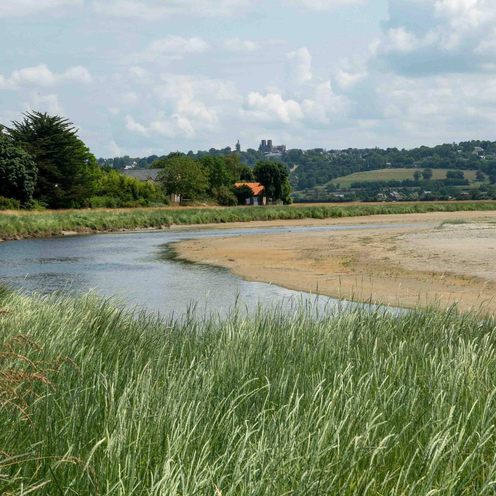
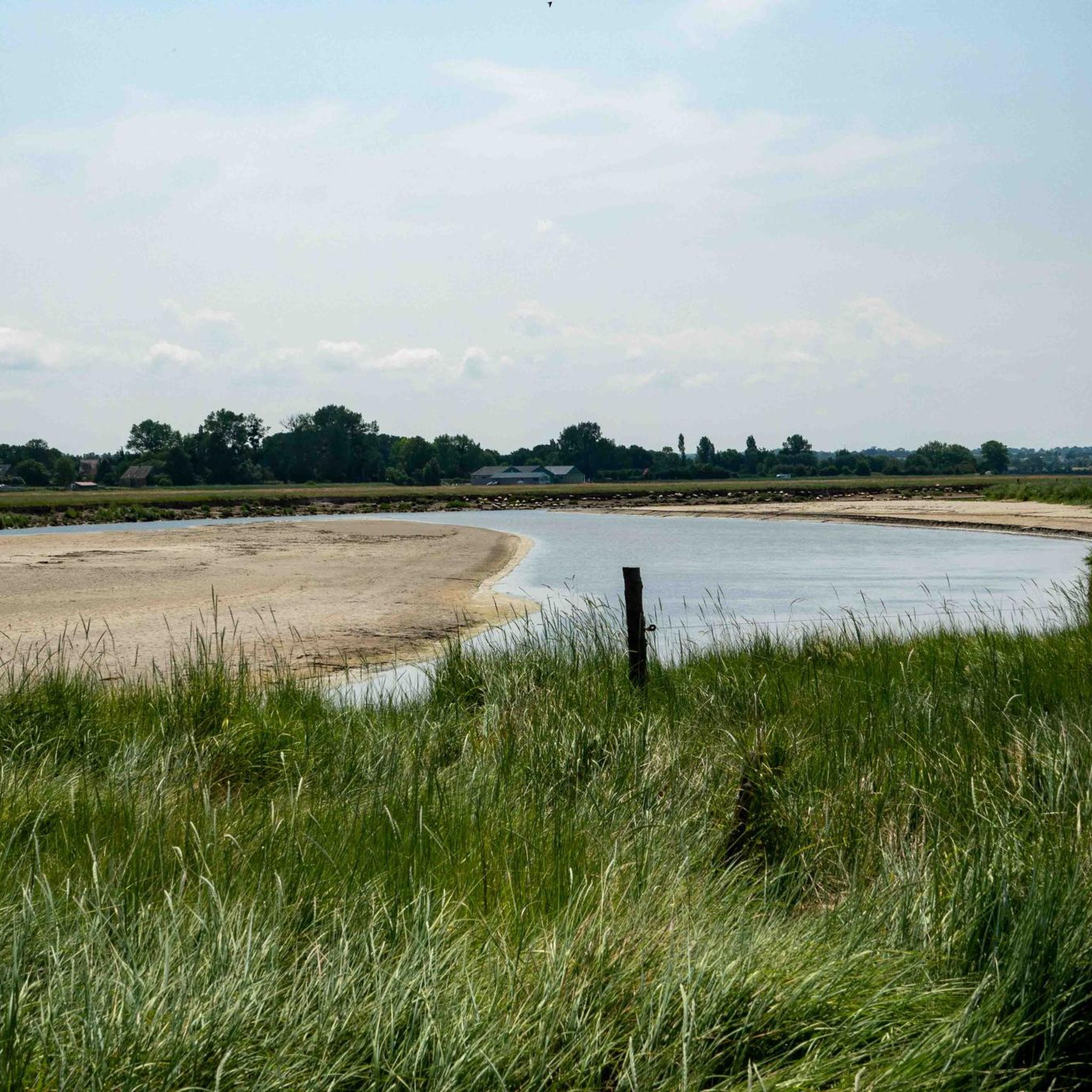
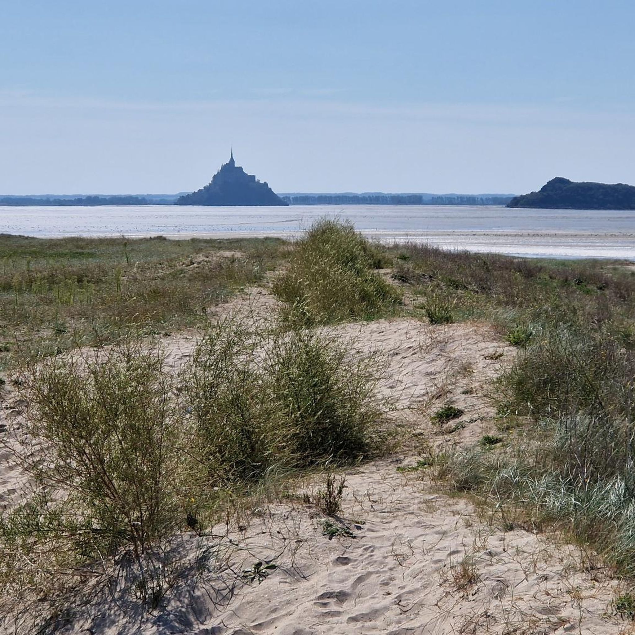
From this point, you have a panoramic view of the Bay of Mont Saint-Michel, including: 1/ Mont Saint-Michel itself in the distance, majestic on its rocky island, and 2/ the vast salt marshes ("herbus") and mudflats, which change dramatically depending on the tide.
1
0
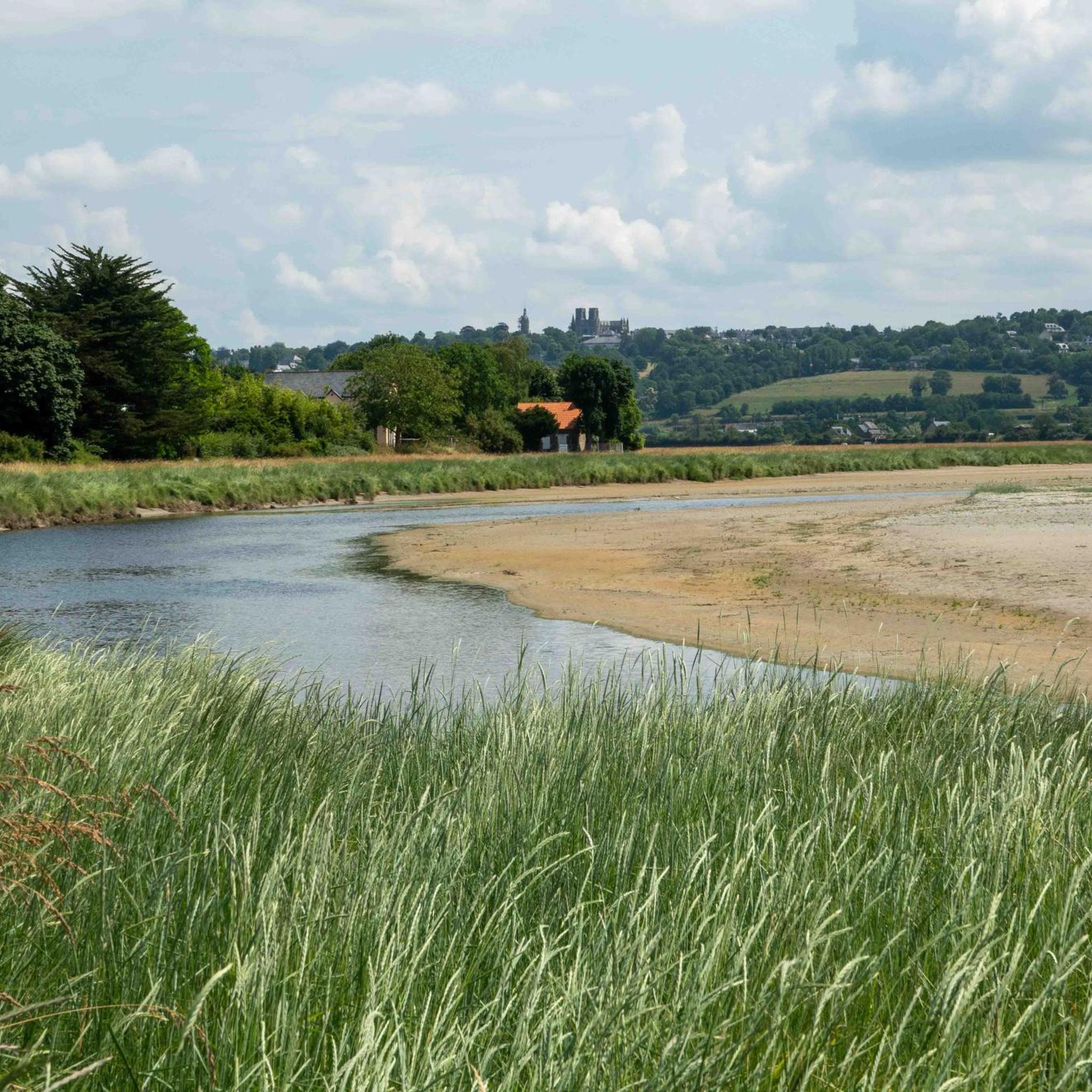
Its origins date back to the 6th century, when the future Saint Leonard worked in the region. In 1087, William the Conqueror granted the fief of Vains to the Abbey of Saint-Étienne in Caen, which subsequently founded the priory. The building dates back to the 11th century and has been restored several times over the centuries. Today, the priory serves as a holiday accommodation.
1
0
The Grouin du Sud is a natural headland offering impressive views of the bay and the famous Klosterberg. Depending on the tide, the landscape alternates between vast mudflats and ocean views, making the place particularly charming.
1
0
The mudflat hike to Mont Saint-Michel usually starts at the Le Grouin du Sud headland near Genêts. This is the official starting point for guided tours through the bay, which lead across the mudflats to Mont Saint-Michel at low tide. The trail should only be undertaken with a certified mudflat guide, as the area is potentially dangerous due to tides, currents, and quicksand. Popular providers such as Chemins de la Baie du Mont-Saint-Michel regularly organize safe tours from Genêts. Chemins de la Baie – Official website for guided tours through the bay: https://www.cheminsdelabaie.com/
1
0
The Route du Grouin du Sud, also known as the "Customs Officer's Path," is a 10- to 11.5-kilometer-long coastal hike near Genêts and Vains. It leads through the impressive bay of Mont Saint-Michel and offers beautiful views of the sea, Mont Saint-Michel, and the Tombelaine rock along long stretches. The route is mostly circular and takes between two and a half and three and a half hours, depending on your pace. It runs through meadows, coastal paths, and small country roads. It is unpaved in places, so sturdy footwear is recommended. A cultural highlight is the Prieuré Saint-Léonard with its historic chapel. The "Grouin du Sud" headland is particularly worth seeing; on a clear day, you can enjoy a panoramic view of the entire bay.
1
0
The Routout farm in Saint-Léonard was acquired by the Conservatoire du Littoral in 1994 and, after extensive renovations, opened as the Maison de la Baie/Relais de Vains in 2001. In 2011, it evolved into the Écomusée de la Baie du Mont-Saint-Michel, incorporating content from the Maison de la Baie/Relais de Courtils. Link: https://ecomusee-baie.manche.fr/lecomusee/histoire-du-site/
1
0
The Le Grand Port picnic area offers a beautiful vantage point of Mont Saint-Michel. From here, a wide view opens up across the bay, with the silhouette of the abbey visible on the horizon on a clear day. Especially in the early morning hours or at sunset, the light glides over the mudflats and salt marshes.
1
0

Very good coffee and cold drinks when he's there.
1
0
よくある質問
バシリー周辺にはハイキングコースがいくつありますか?
バシリー周辺には200以上のハイキングルートがあり、様々なスキルレベルや好みに対応しています。田園地帯の穏やかな散策から、大きな標高差のあるより挑戦的な遠足まで、幅広いコースが見つかります。
バシリー近郊のハイキング中にどのような景観が期待できますか?
バシリーはラ・マンシュの多様な地域に位置しており、豊かな景観のタペストリーを提供しています。海岸沿いの道からは、砂丘、ビーチ、潮入りの入り江を含む広大な海の景色を楽しむことができます。内陸部では、ヘッジや木々のある典型的なノルマンディーのボカージュ(生垣に囲まれた田園地帯)の風景、そして湿地帯や起伏のある丘へと景観が変化します。淡水小川や沿岸の川の密なネットワークが、自然の美しさをさらに高めています。
バシリーには初心者や家族向けの簡単なハイキングコースはありますか?
はい、バシリーには初心者や家族に最適な簡単なコースがたくさんあります。例えば、ヴァイン発の「Grouin du Sud – Priory of St Léonard loop from Vains」は、6.1kmの簡単なルートです。もう一つの穏やかな選択肢は、ジェネ発の「Genêts – Genêts loop from Genêts」で、5km弱で標高差もほとんどありません。
モン・サン=ミッシェルを眺めるのに最適なトレイルは何ですか?
バシリー周辺の多くのトレイルからは、象徴的なモン・サン=ミッシェルの壮大な眺めを楽しむことができます。人気の選択肢は、ヴァイン発の「Chemin du Douanier – View of Mont Saint-Michel loop from Vains」という中程度の難易度の16.9kmのルートで、景色の良い眺望を提供します。「モン・サン=ミッシェルの美しい眺め(ダム)」のような展望ポイントからも息をのむような景色を見ることができます。
バシリー周辺には周回ハイキングコースはありますか?
はい、バシリー周辺の多くのトレイルは周回コースになっており、同じ場所からスタートして同じ場所に戻ることができます。例としては、シャンセ発の「Hiking loop from Champcey」という7.2kmの簡単なルートや、バシリー発の「Hiking loop from Bacilly」という9.4kmをカバーする中程度の難易度のルートがあります。
ハイキングコース沿いにはどのような興味深いランドマークやアトラクションがありますか?
モン・サン=ミッシェル以外にも、この地域にはいくつかの注目すべきアトラクションがあります。セリュン川にかかる15世紀の建造物で、ピクニックスポットや潮見表の眺めを提供する歴史的な「ポンタボー橋」を訪れることができます。「Grouin du Sud」も素晴らしい展望ポイントを提供しています。ゆったりとした散策には、近くのアヴランシュにある植物園「Jardin des Plantes」が心地よい庭園です。
バシリーでハイキングするのに最適な時期はいつですか?
バシリーの多様な景観は、年間を通して楽しむことができます。春と秋は、涼しい気温と鮮やかな風景、そして少ない混雑で快適です。夏も人気がありますが、特に海岸沿いの散策には暑くなることがあります。冬のハイキングも美しいことがありますが、特にボカージュの田園地帯では、一部の海岸沿いの道は強い風にさらされる可能性があります。
バシリー周辺のハイキングコースは犬同伴可能ですか?
バシリー周辺の多くのトレイルは犬に適していますが、特に田園地帯や森林地帯を通るコースです。ただし、特に家畜がいる場所や保護された自然地域では、常に犬をリードにつないでおくことをお勧めします。特に海岸沿いや自然保護区エリアでは、特定の制限について現地の標識を確認してください。
バシリーのトレイルヘッドには駐車場がありますか?
はい、バシリー周辺の多くの人気のハイキングコースの出発点近くや、バシリー周辺の村には一般的に駐車場があります。特定の駐車場の情報は、komootの個々のルート説明や地元の観光ウェブサイトで確認できることが多いです。例えば、ヴァイン、ジェネ、シャンセ周辺のエリアには、通常ハイカー用の指定駐車場があります。
バシリーでのハイキングについて、他のハイカーが最も楽しんでいる点は何ですか?
この地域はkomootコミュニティから高く評価されており、2,200件以上の評価から平均4.6つ星を獲得しています。レビューでは、モン・サン=ミッシェルの素晴らしい眺め、ボカージュの田園地帯の静けさ、そして多様な景観を探索するのに本当にやりがいのある体験をさせてくれる整備された道が、しばしば称賛されています。
バシリーには経験豊富なハイカー向けの挑戦的なハイキングはありますか?
バシリーはアクセスしやすいトレイルで知られていますが、より経験豊富なハイカー向けの挑戦的なオプションもあります。この地域には10の難易度の高いルートがあり、通常は長距離とより大きな標高差を特徴としており、変化に富んだ地形を探索しながら限界を押し広げることができます。
バシリーでのの人気観光スポット

komootモバイルアプリでインスピレーションを得よう


さらに探索
他の地域の最高のハイキングを見てみましょう。
