Οι καλύτερες διαδρομές και πεζοπορίες στη Γκουάρντα
4,3
(1666)
6.937
Πεζοπόροι
144
Πεζοπορίες
Θέλετε να κάνετε πεζοπορία Γκουάρντα για να εξερευνήσετε περισσότερο αυτή τη γωνιά της περιοχής Πορτογαλία; Σε αυτόν τον οδηγό, εξετάσαμε ολόκληρη τη συλλογή πεζοπορικών διαδρομών Γκουάρντα για να σας φέρουμε τις καλύτερες διαδρομές στην περιοχή. Για να δείτε ποια από τις πεζοπορίες μας Γκουάρντα είναι η κατάλληλη για εσάς, δείτε πραγματικές συμβουλές και φωτογραφίες που ανέβασαν άλλοι πεζοπόροι — και δείτε τι είπαν για κάθε διαδρομή.
Τελευταία ενημέρωση: 30 Αυγούστου 2026
4,6
(192)
828
Πεζοπόροι
8,86km
02:32
210m
210m
Hike the moderate 5.5-mile Covão dos Conchos Trail in Serra da Estrela to see the unique bell-mouth spillway and stunning mountain views.
4,4
(128)
474
Πεζοπόροι
11,1km
03:22
200m
200m
This difficult 6.9-mile circular hike in Serra da Estrela features 5 lagoons and the unique Covão dos Conchos spillway.

Εγγραφή δωρεάν
4,8
(66)
701
Πεζοπόροι
11,9km
03:30
250m
420m
Hike the Passadiços do Mondego — Serra da Estrela, a moderate 7.4-mile (11.9 km) trail through the UNESCO Estrela Geopark.
4,9
(70)
310
Πεζοπόροι
11,6km
04:04
610m
610m
Hike the challenging 7.2-mile Boar Route (PR 2) in Serra da Estrela Natural Park, featuring forests, boulders, and Poço do Inferno waterfall
4,7
(83)
271
Πεζοπόροι
7,23km
02:26
360m
360m
Hike the moderate 4.5-mile Tour of Caniça (PR 10) in Serra da Estrela, featuring waterfalls, ancient forests, and unique rock formations.
4,7
(70)
182
Πεζοπόροι
14,3km
04:10
380m
380m
Hike the moderate 8.9-mile Fraga das Penhas Trail in Serra da Estrela, featuring the Rossim Valley and Nave da Mestra.
4,6
(45)
156
Πεζοπόροι
5,90km
01:59
290m
290m
Εύκολη πεζοπορία. Κατάλληλο για όλα τα επίπεδα φυσικής κατάστασης. Εύκολα προσβάσιμα μονοπάτια. Κατάλληλο για όλα τα επίπεδα δεξιοτήτων.
4,7
(39)
195
Πεζοπόροι
2,81km
01:04
110m
110m
Δύσκολη πεζοπορία. Κατάλληλο για όλα τα επίπεδα φυσικής κατάστασης. Απαιτείται σταθερό βάδισμα, ανθεκτικά παπούτσια και εμπειρία σε ορεινές διαδρομές.
4,3
(36)
170
Πεζοπόροι
10,4km
03:43
590m
590m
Hike the Serra da Estrela — Central Massif Route (PR 5), a moderate 6.4-mile trail with stunning glacial valleys and granite landscapes.
4,5
(26)
100
Πεζοπόροι
14,8km
04:31
490m
490m
Hike the moderate Ribeira de Loriga Route, a 9.2-mile (14.8 km) trail through a unique valley in Serra da Estrela Natural Park.
Πάρε πρόσβαση σε περισσότερες διαδρομές και προτάσεις από άλλους εξερευνητές.
Εγγραφή δωρεάν
Έχεις ήδη λογαριασμό;
Οι προτάσεις διαδρομών μας βασίζονται σε χιλιάδες πεζοπορίες, ποδηλασίες και τρεξίματα που ολοκληρώθηκαν από άλλους χρήστες στο komoot.
Ξεκίνα σήμερα με έναν δωρεάν λογαριασμό
Η επόμενη περιπέτειά σου σε περιμένει.
Σύνδεση ή εγγραφή
Άλλες περιπέτειες στη Γκουάρντα


Συμβουλές από την κοινότητα

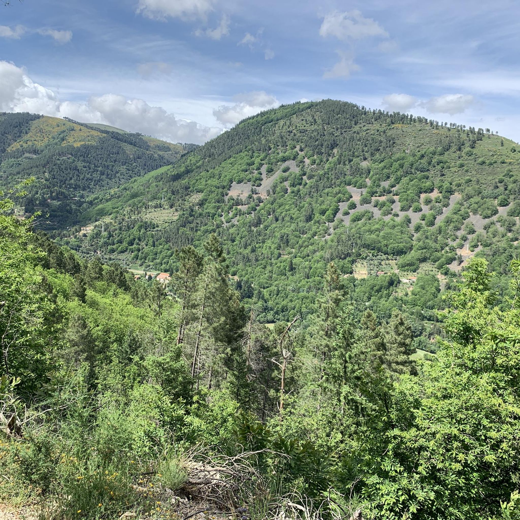
Η διαδρομή παραμένει κλειστή. Την περπατήσαμε παρόλα αυτά και πραγματικά δεν είναι εύκολη. Σχεδόν πρέπει να σκαρφαλώσεις στην πλαγιά ενός βουνού. 😅 Και ήμασταν τυχεροί που δεν είχε βρέξει πολύ πριν, αλλιώς τα περάσματα των ποταμών δεν θα ήταν βατά. Κατά τα άλλα, από άποψη τοπίου, μια από τις ομορφότερες πεζοπορίες της ζωής μου. 😍 Συνιστάται σταθερότητα στα πόδια, λίγη δόση περιπέτειας και καλά παπούτσια πεζοπορίας.
0
0

Η Κοιλάδα των Παγετώνων του Loriga είναι ένας εντυπωσιακός γεωλογικός σχηματισμός παγετώδους προέλευσης, μήκους περίπου 6,5 χιλιομέτρων, που βρίσκεται στον δήμο Seia, στην καρδιά του Φυσικού Πάρκου Serra da Estrela. Σμιλεμένη κατά την τελευταία εποχή των παγετώνων, αυτή η κοιλάδα σε σχήμα "U" ξεχωρίζει για τις απότομες γρανιτικές πλαγιές της, τις σκαλωτές κοιλότητες και το διάσημο χωριό Loriga, που συχνά αποκαλείται "Ελβετία της Πορτογαλίας" λόγω του ορεινού του περιβάλλοντος.👍🥾
0
0

Ο δρόμος είναι επίπονος, αλλά ο προορισμός αξίζει τον κόπο.
0
0
The Devil's Horns are a prominent granite rock formation with two horn-like points, located in the Serra da Estrela mountain range, near Lapa dos Dinheiros and Senhora do Desterro (not in Gerês, but in Seia, Portugal). They are the highlight of a famous circular hiking trail that follows a water channel and the Caniça stream, offering stunning landscapes, lagoons, and waterfalls. 👍🥾
0
0
The history of Manteigas is linked to the abundance of livestock and butter production, which gave rise to its name. It's a central location in the Serra da Estrela mountain range, known for its natural heritage, such as the Zêzere Glacial Valley, and its thermal springs, with sulphurous waters at CISE. Founded with its own municipality, the town has a rich cultural and ethnographic history, also standing out for its wool production (Burel Factory) and the beauty of the Serra da Estrela Natural Park, making it a strategic point for exploring the mountains. 👍🥾
0
0

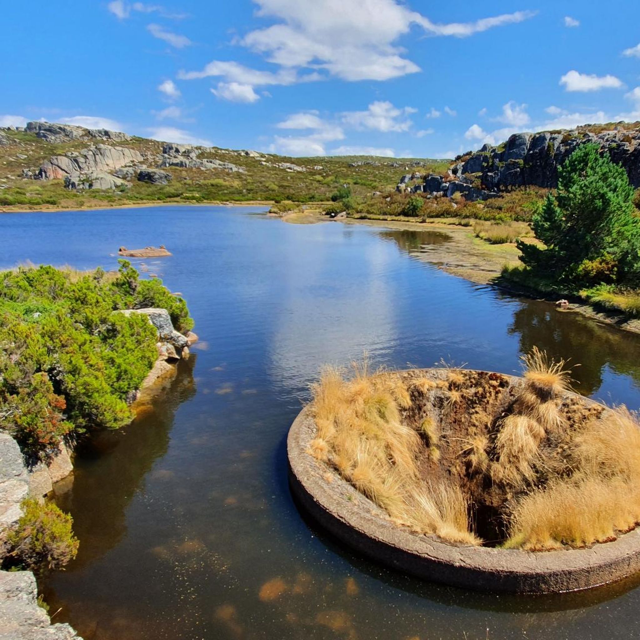
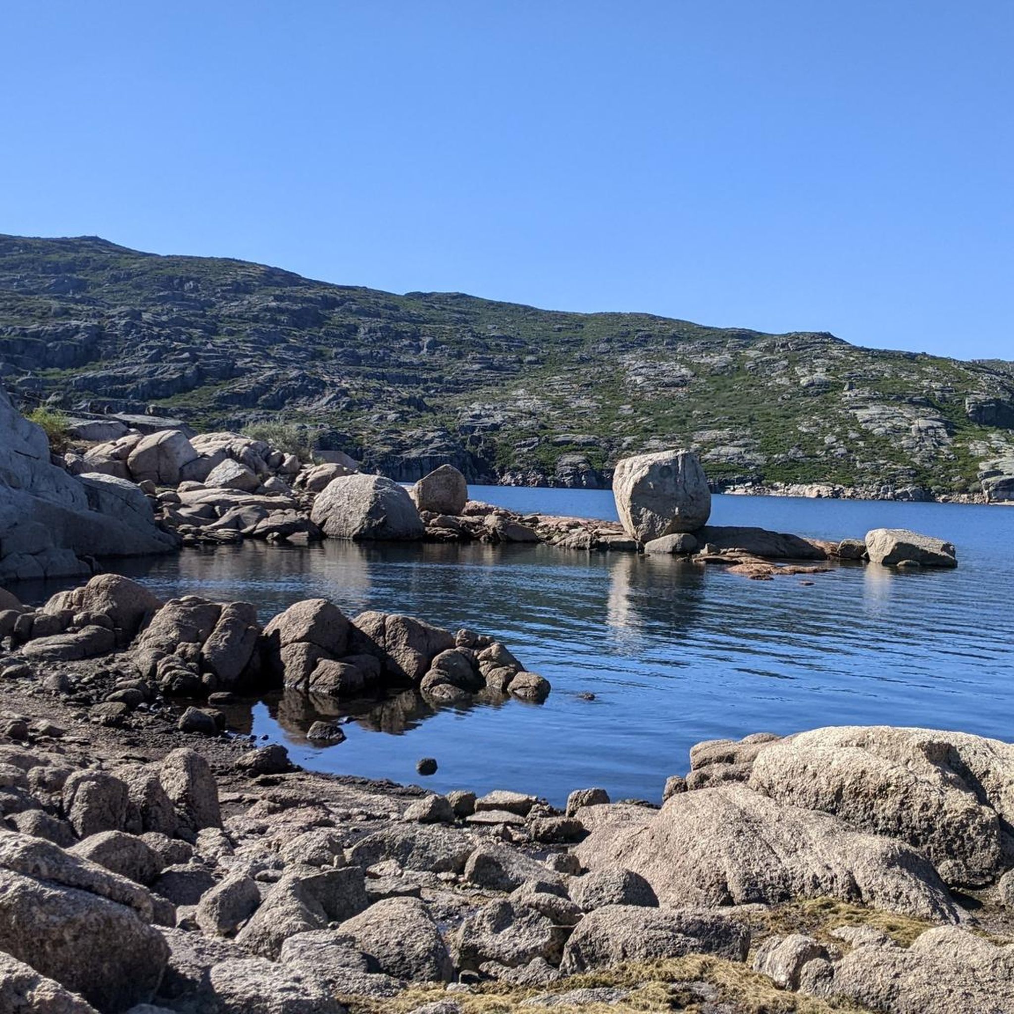
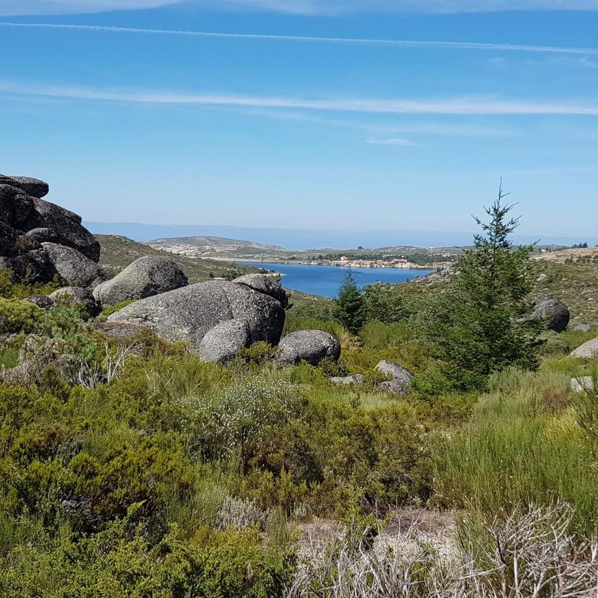
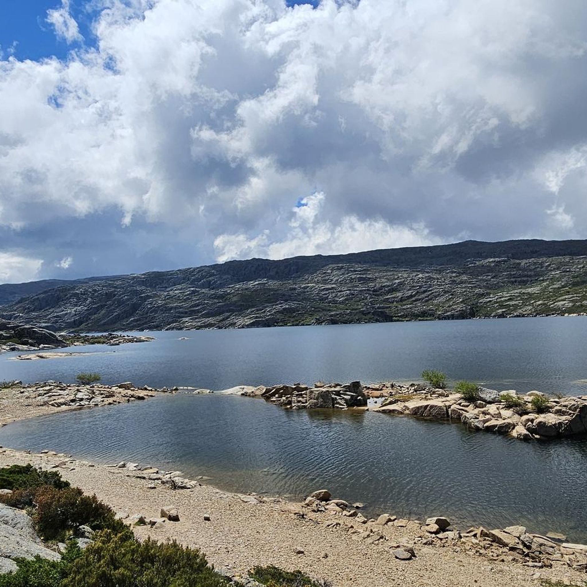
Covão dos Conchos is an artificial lagoon located in the Serra da Estrela Natural Park, Portugal, near the mountain village of Sabugueiro. Covão dos Conchos became famous for its bell-mouth spillway[1]. The spillway was built in 1955 to allow water to be transferred from the Ribeira das Naves River to Lagoa Comprida. It is part of the Serra da Estrela Hydroelectric System. This science fiction-style spillway became famous when photographs of the hole went viral on social media in 2016. Over the past 60 years, the growth of vegetation at the funnel's mouth has created extraordinary biodiversity and increased its ethereal allure. It is 4.6 meters high and 48 meters in circumference. The tunnel that collects the water is 1,519 meters long.
2
0
Covão dos Conchos is an artificial lagoon located in the Serra da Estrela Natural Park, Portugal, near the mountain village of Sabugueiro. Covão dos Conchos became famous for its bell-mouth spillway[1]. The spillway was built in 1955 to allow water to be transferred from the Ribeira das Naves River to Lagoa Comprida. It is part of the Serra da Estrela Hydroelectric System. This science fiction-style spillway became famous when photographs of the hole went viral on social media in 2016. Over the past 60 years, the growth of vegetation at the funnel's mouth has created extraordinary biodiversity and increased its ethereal allure. It is 4.6 meters high and 48 meters in circumference. The tunnel that collects the water is 1,519 meters long.
1
0
The Lapa dos Dinheiros river beach is in perfect harmony with nature. Located in the parish of Lapa dos Dinheiros, on the Caniça River, a right-bank tributary of the Alva River, this bathing area is nestled in a mountainous landscape dominated by the Lapa Souto (south of Lapa) and imposing granite outcrops. With clear water, very appealing for swimming, the beach boasts the award for accessible beach and has lifeguards and a bar available to visitors. The rugged terrain of the valley causes the river to form a succession of small waterfalls nearby. The Lapa Souto, in addition to its valuable collection of centuries-old chestnut trees, is also home to a high level of biodiversity. From the bridge, a pedestrian path leads to the Moura Hole and a viewpoint over the Caniça Waterfalls. The Buraco da Moura is a natural cave system created by the sliding and accumulation of large granite blocks, which formed a complex system of rooms and galleries. How to get there? Once in Seia, follow the EN231 to S. Romão. From there, continue uphill for about 5 km, toward Loriga/Lapa, until you find the sign for Lapa dos Dinheiros on the left. Once inside the town, simply follow the beach signs. Coordinates: 40º 23′ 07.0″ N / 7º 41′ 50.1″ W
1
0
Οι πιο δημοφιλείς διαδρομές στη Γκουάρντα
Τα πιο δημοφιλή αξιοθέατα στη Γκουάρντα

Εμπνεύσου με την εφαρμογή komoot για κινητά


Δεν βρήκες αυτό που ψάχνεις;
Δες περισσότερα Πεζοπορίες σε όλη την περιοχή Γκουάρντα παρακάτω και βρες την τέλεια διαδρομή στον προορισμό σου.
Ανακάλυψε περισσότερα
Περιηγήσου τα καλύτερα Πεζοπορίες σε άλλες περιοχές.
