Διαδρομές

Σχεδίαση

Χαρακτηριστικά

Ενημερώσεις

App

Σύνδεση ή εγγραφή

Κατέβασε την εφαρμογή

Σύνδεση ή εγγραφή

Διαδρομές
Πεζοπορίες
Ιταλία

Σικελία

Οι καλύτερες διαδρομές και πεζοπορίες στη Σικελία

4,4

(28041)

161.183

Πεζοπόροι

4.098

Πεζοπορίες

Θέλετε να κάνετε πεζοπορία Σικελία για να εξερευνήσετε περισσότερο αυτή τη γωνιά της περιοχής Ιταλία; Σε αυτόν τον οδηγό, εξετάσαμε ολόκληρη τη συλλογή πεζοπορικών διαδρομών Σικελία για να σας φέρουμε τις καλύτερες διαδρομές στην περιοχή. Για να δείτε ποια από τις πεζοπορίες μας Σικελία είναι η κατάλληλη για εσάς, δείτε πραγματικές συμβουλές και φωτογραφίες που ανέβασαν άλλοι πεζοπόροι — και δείτε τι είπαν για κάθε διαδρομή.

Τελευταία ενημέρωση: 3 Αυγούστου 2026

4,9

(392)

1.272

Πεζοπόροι

#1.

Grotta di Serracozzo e Serra delle Concazze – giro ad anello nel Parco dell'Etna

5,80km

02:49

440m

440m

Explore the unique volcanic landscape of Mount Etna on the Grotta di Serracozzo e Serra delle Concazze loop. This moderate hike covers 3.6 miles (5.8 km) with 1431 feet (436 metres) of elevation gain, typically taking around 2 hours and 49 minutes. You will traverse varied terrain, including gravel paths, alpine sections, and natural paths through rare "Aetnensis" birch woods, volcanic outcrops, and ancient lava fields. The route offers diverse scenery, from charming forests to open volcanic vistas, with views of Mount Etna and the vast Valle del Bove.

Planning your visit requires good physical fitness and sure-footedness, as some sections involve steep climbs, particularly towards the panoramic view of the Valle del Bove. The trail typically starts from the Citelli Refuge. It is important to stay on the marked path, as dangerous precipices exist in the surrounding valleys.

A highlight of this trail is the Grotta di Serracozzo, a fascinating lava flow cave formed during the 1971 eruption. This lava tube features smooth, almost glass-like walls polished by molten lava, creating a surreal atmosphere. You will also see the 1928 eruptive vents near Monte Frumento delle Concazze and pass through the Serra delle Concazze, which provides expansive views of Etna and the Valle del Bove.

Πλοήγηση με συσκευή

Αποστολή στο τηλέφωνο

Αποθήκευση

Μέτριο

4,7

(185)

2.576

Πεζοπόροι

4,81km

01:18

60m

60m

The Sacred Way Trail invites you on an easy hike through an ancient landscape, where history comes alive with every step. You will pass impressive ruins, including the grand Temple of Juno and the majestic Temple of Hercules, offering a direct connection to past civilizations. This route covers 3.0 miles (4.8 km) with a gentle elevation gain of 191 feet (58 metres), typically taking about 1 hour and 17 minutes to complete.

To access the trail, make your way to the Archaeological and Landscape Park of the Valley of the Temples in Agrigento, Sicily. Parking is readily available at the park entrance, providing convenient access to the trailhead. Before you go, remember to consult the park's official website for current opening hours and any applicable entrance fees.

This trail is a central part of the Archaeological and Landscape Park of the Valley of the Temples, offering a unique opportunity to explore a significant historical site. As you hike, you will experience the ancient Via Sacra and the Necropolis, gaining insight into the daily lives and beliefs of those who walked here long ago. The route also provides views of the Temple of Concordia, adding to the rich historical tapestry of your journey.

Εύκολο
guide_signup
Άσε μας να σου δείξουμε τον δρόμο με το εφαρμογή komoot για κινητά
Με έναν δωρεάν λογαριασμός komoot, μπορείς εύκολα να βρεις, να προσαρμόσεις και να πλοηγηθείς σε αμέτρητες υπαίθριες περιπέτειες.

Εγγραφή δωρεάν

4,8

(237)

1.019

Πεζοπόροι

Embark on the difficult Necropoli di Pantalica — ring tour, a challenging hike through a UNESCO World Heritage site in southeastern Sicily. This route spans 7.6 miles (12.2 km) with 1275 feet (389 metres) of elevation gain, typically taking about 3 hours and 52 minutes to complete. You will navigate diverse terrain, from rocky paths and shaded gorges to more accessible sections, all while surrounded by dramatic V-shaped canyons and over 5,000 ancient rock-cut chamber tombs.

To tackle this demanding route, you will need a good level of fitness and sure-footedness. Sturdy hiking shoes are essential, and some sections may require alpine experience. Remember to carry plenty of water, especially if you are hiking during warm weather, as the complete ring tour demands greater physical preparation than easier paths in the area.

This trail offers a unique blend of natural beauty and profound historical significance. Pantalica is recognized for its exceptional archaeological importance, featuring one of Sicily's largest prehistoric sites with tombs dating from the Bronze Age. Beyond the ancient burial chambers, you can discover Byzantine rock churches, the foundations of the Anaktoron, and the Pantalica Rock Tunnel, all set within a vibrant ecosystem of gorges and river valleys.

Δύσκολο

4,7

(213)

810

Πεζοπόροι

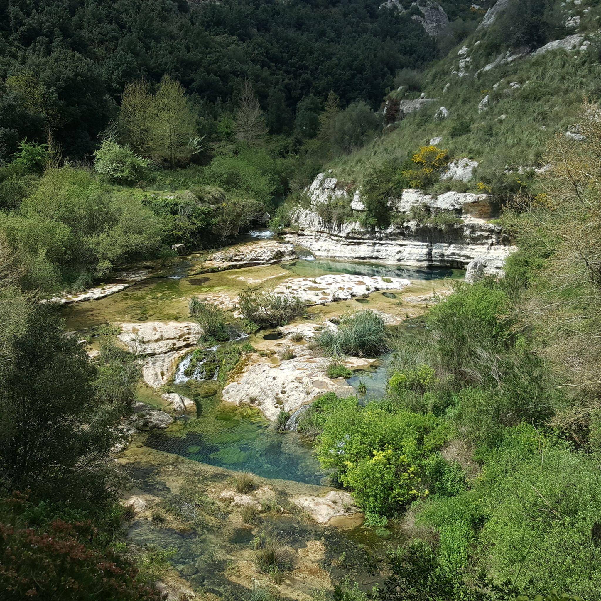
Embark on the Prisa-Carrubella Trail, a difficult hike through the dramatic canyon landscapes of Sicily's Cavagrande del Cassibile Nature Reserve. This challenging route spans 6.9 miles (11.1 km) and involves a significant elevation gain of 1207 feet (368 metres). You will navigate rugged and steep terrain, encountering natural paths, gravel, and unpaved sections, along with some stone steps. As you hike, lush Mediterranean vegetation surrounds you, opening up to expansive views of the gorge. A highlight is reaching the pristine, crystal-clear waters of the Cavagrande del Cassibile Natural Pools, perfect for a refreshing swim. Expect to complete this adventure in about 3 hours and 59 minutes.

Before you set out, be aware that the terrain is arduous, especially the ascent out of the canyon. Always wear sturdy shoes to handle the varied surfaces. It is important to note that some main trails leading to the natural pools, including Scala Cruci, have been officially closed since 2014 due to safety concerns. Plan your visit carefully and always check for the latest access information before heading to the trailhead.

This trail offers a unique opportunity to explore what is often called "Sicily's Grand Canyon." Beyond the natural beauty of the gorge and its refreshing pools, you might discover ancient rock-cut settlements carved directly into the cliffs. These historical elements add another layer of intrigue to the natural wonders of the Cavagrande del Cassibile Nature Reserve. The route provides a rewarding experience for fit hikers seeking both natural splendor and a glimpse into the past.

Δύσκολο

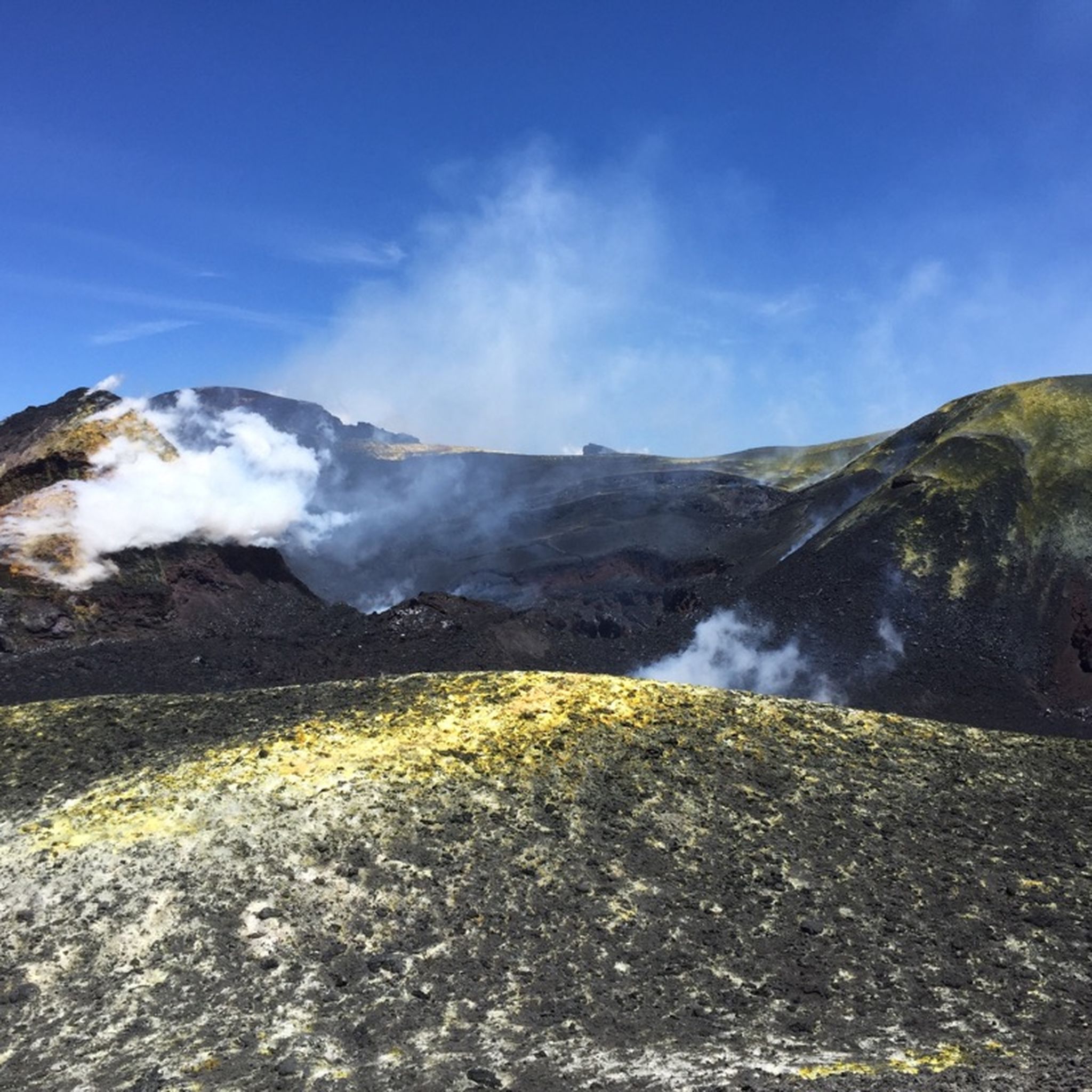
The Summit Craters Trail offers a challenging hike across an otherworldly volcanic landscape. You will traverse rugged, unpaved paths, often walking around the rim of a volcanic cone, with the Cratere Piano del Lago as a key feature. This difficult route covers 7.0 miles (11.2 km) and involves a significant elevation gain of 3147 feet (959 metres). Plan for approximately 4 hours and 40 minutes to complete this demanding journey, experiencing dramatic scenery where lava flows and ash continuously shape the terrain.

Before you set out, ensure you have very good fitness, sure-footedness, and sturdy hiking shoes for this difficult trail. The starting point at Rifugio Sapienza is a popular base on Mount Etna's southern side, where you can find amenities. Always check local conditions before your visit, as volcanic activity and weather patterns can change rapidly on the mountain. It is crucial to be prepared for varying conditions and potential closures.

This trail provides a unique opportunity to experience the raw power of Mount Etna up close. You might even feel warmth emanating from the ground through your shoe soles, a direct sign of the volcano's ongoing activity. From the craters, you can enjoy expansive views of Mount Etna and its surroundings, with vistas stretching towards the valley below on clear days. It is a truly immersive experience into a dynamic natural environment.

Δύσκολο

4,7

(273)

1.035

Πεζοπόροι

Embark on a moderate hike through Madonie Park, leading you from Piano Battaglia to Pizzo Scalonazzo. This 5.4-mile (8.7 km) route takes about 3 hours and 17 minutes to complete, climbing 1313 feet (400 metres) through varied mountainous terrain. You will traverse rugged paths, moving between dense beech forests and open high-altitude grasslands. Look for unique karst rocks and geological features like dolines along the way. As you gain elevation, the landscape opens up, offering expansive views, including the

Μέτριο

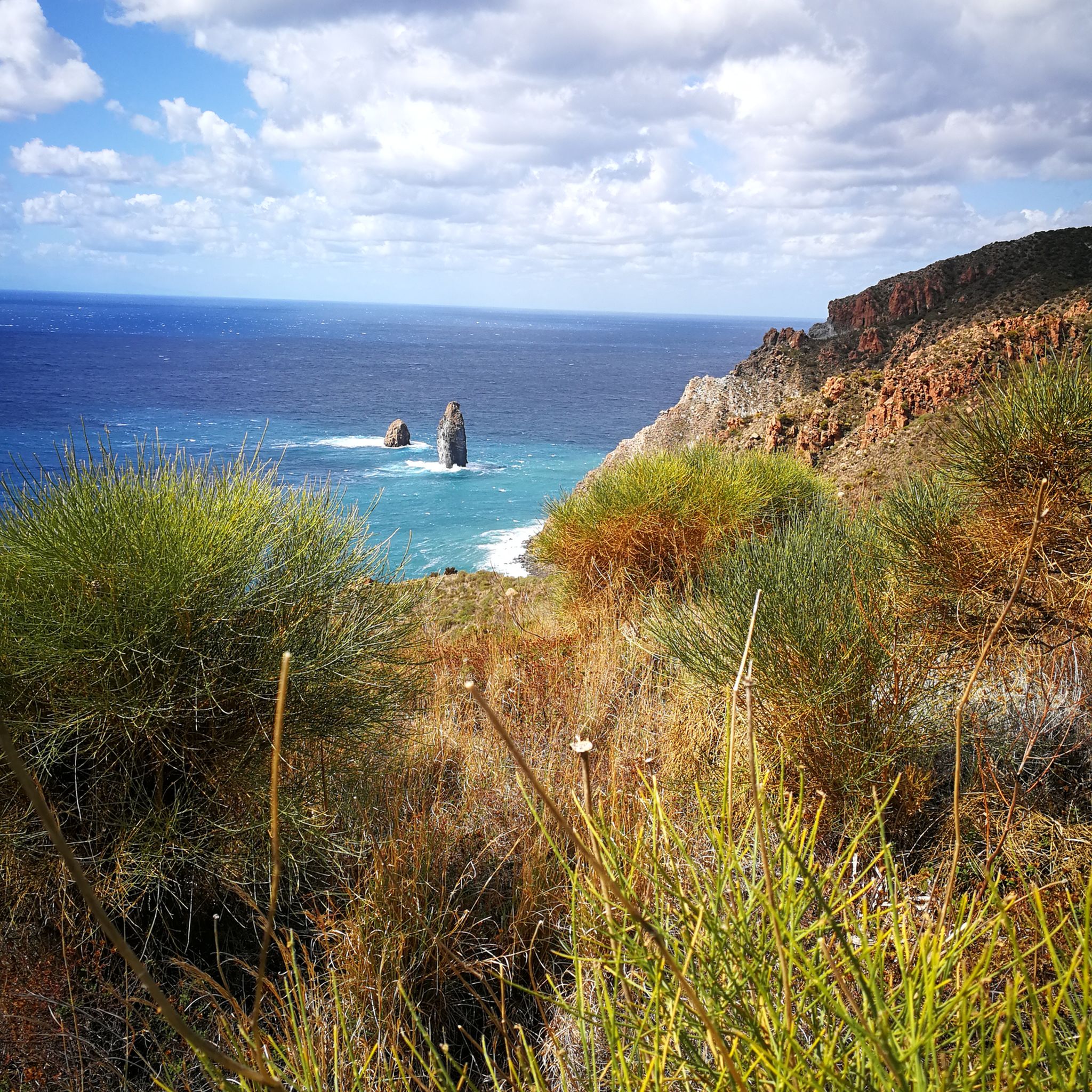
Embark on a challenging hike through Sicily's Riserva dello Zingaro, combining the Mezza Costa trail with a return along the Coastal Path. This difficult route covers 10.0 miles (16.0 km) with a significant elevation gain of 2271 feet (692 metres), typically taking around 5 hours and 31 minutes to complete. You will ascend into the mountains on the Mezza Costa trail, offering panoramic views of the dramatic coastline and lush Mediterranean vegetation, before descending to follow the sea. The terrain is rugged in places, requiring sure-footedness, but rewards you with a pristine natural environment free of cars and noise. You will pass by secluded coves like Cala Capreria and Cala dell'Uzzo, perfect for a refreshing swim.

This combined route is generally rated as difficult, so you should have very good fitness for the 5-and-a-half-hour journey. While the Coastal Path is easier, the Mezza Costa trail involves a substantial uphill climb. Be prepared for paths that can be rugged, especially if you visit during the hot summer months when shade is limited. Sturdy shoes are essential for navigating the varied terrain, which includes limestone and dolomite cliffs.

Riserva dello Zingaro holds historical significance as Sicily's first protected natural area, established in 1981 after local protests prevented a coastal road. This preservation effort means you will experience an authentic natural environment, home to over 650 plant species and around 40 species of nesting birds. Along the Mezza Costa path, you can also spot well-preserved rural buildings, offering a glimpse into the region's past.

Δύσκολο

4,8

(192)

1.280

Πεζοπόροι

Embark on the Gran Cratere di Vulcano Trail, a moderate hike that takes you across varied volcanic terrain. You will experience sandy paths giving way to rocky sections, often covered in fine volcanic ash. As you approach the summit, the landscape transforms into a striking Martian scene, with stones showing yellow-ochre and red hues from sulfur deposits. The highlight is reaching the Gran Cratere, where you can observe steaming fumaroles and enjoy sweeping 360-degree views of the Aeolian Islands and the Tyrrhenian Sea. This route covers 3.6 miles (5.9 km) with an elevation gain of 1167 feet (356 metres), typically taking about 2 hours and 7 minutes to complete.

The trailhead for this hike is conveniently located close to the port, making it very easy to access if you are arriving by ferry. It is wise to avoid hiking during the hottest hours, especially in summer, as temperatures can reach 40°C and the path offers no shade. For your comfort and safety, wear sturdy, comfortable shoes with socks, as the sandy soil can be challenging. Starting early in the morning or later in the afternoon is often the best approach to enjoy the experience.

This trail offers a unique opportunity to explore an active volcano on Vulcano Island, one of the Aeolian Islands. The distinct yellow-ochre and red patina on the stones near the crater are a direct result of the sulfur deposits from the volcanic activity. Witnessing the steaming fumaroles up close provides a direct connection to the powerful geological forces shaping this region. The panoramic views from the summit extend across the entire archipelago and the vast Tyrrhenian Sea, making it a memorable experience.

Μέτριο

4,8

(122)

580

Πεζοπόροι

3,79km

01:20

210m

210m

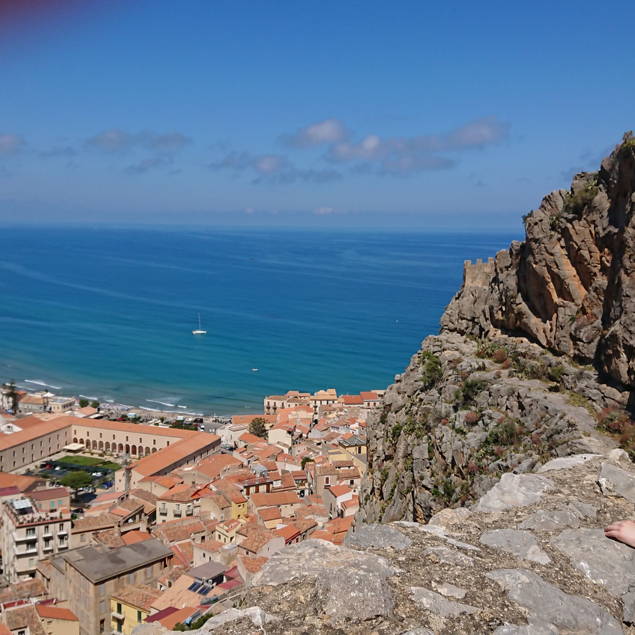
The Rock of Cefalu offers an easy 2.4-mile (3.8 km) hike, taking about 1 hour and 20 minutes to complete, with an elevation gain of 703 feet (214 metres). This route begins on stone paths and steps, gradually turning into a winding, gravelly footpath as you ascend. You will find sweeping views of Cefalù old town, its coastline, and the Tyrrhenian Sea. The path can become rocky and uneven, especially towards the Castello di Cefalù ruins at the summit. Along the way, you'll walk past medieval walls and through Mediterranean vegetation, including conifers and eucalyptus. From the highest points, the vista extends impressively from Palermo all the way to Capo D'Orlando. The limestone rock itself is characterized by cracks and caves.

Planning your visit requires a small entrance fee of around €5, with reduced rates available for children and seniors. The trail is largely exposed to the sun, making it more challenging during hot weather. It is advisable to hike in the cooler parts of the day or during spring and autumn for a more comfortable experience. You should wear appropriate hiking shoes, as flip-flops and open-toed footwear are often prohibited. Basic facilities like benches, picnic areas, and drinking water fountains are available, with a cafe and restrooms located near the entrance. Check the specific operating hours, as they vary by season.

This trail is rich in history and archaeology, believed to have given Cefalù its name from the Greek word "kephaloidion" meaning "head," referring to the rock's distinctive shape. Along the route, you can explore the ruins of a medieval castle at the summit and the ancient Temple of Diana, a megalithic monument dating back to the 9th century BC. Further archaeological sites include warehouses, ovens, and the Church of St. Ann, offering glimpses into past human settlements. The geological composition of the "Rocca" is organogenic limestone, locally known as "Pietra Lumachella" due to its well-preserved macrofossils. The Rocca is also a natural habitat for various fauna, including peregrine falcons, gulls, and hedgehogs.

Εύκολο

Embark on an easy 3.0-mile (4.8 km) hike through the unique volcanic landscape of Parco dell'Etna. This trail, which takes about 1 hour and 33 minutes to complete, guides you through diverse terrain, starting on an asphalt road before transitioning to a track with some rocky sections. You will gain 718 feet (219 metres) in elevation, leading you to spectacular views. Along the way, you will encounter pine forests and high-altitude meadows, contrasting with the lunar-like volcanic terrain.

This accessible route starts from Rifugio Sapienza, a well-known spot on Mount Etna's southern side. While the trail is generally easy, sturdy footwear is recommended due to potentially rocky or muddy sections, especially after rain. If you plan to hike during heavy winter snowfall, typically from late December to mid-March, snowshoes might be necessary. Always check weather forecasts before you begin, as strong winds can make the ridges dangerous.

The Panorama of the Valle del Bove and Schiena dell'Asino trail is notable for offering one of the most impressive viewpoints into the vast Valle del Bove. This massive caldera, formed about 65,000 years ago, appears as a huge expanse of dried lava, resembling a black lake. From the trail, you can see ancient lava flows, secondary volcanic cones, and on clear days, panoramic vistas stretching from the Catania coastline to Syracuse, encompassing the Ionian Sea.

Εύκολο
Εγγραφή δωρεάν για να δεις 4.089 ακόμα Πεζοπορίες στη Σικελία.

Πάρε πρόσβαση σε περισσότερες διαδρομές και προτάσεις από άλλους εξερευνητές.

Εγγραφή δωρεάν

Έχεις ήδη λογαριασμό;

Οι προτάσεις διαδρομών μας βασίζονται σε χιλιάδες πεζοπορίες, ποδηλασίες και τρεξίματα που ολοκληρώθηκαν από άλλους χρήστες στο komoot.

Ξεκίνα σήμερα με έναν δωρεάν λογαριασμό

Η επόμενη περιπέτειά σου σε περιμένει.
Σύνδεση ή εγγραφή

Δημοφιλή γύρω από Σικελία

Πεζοπορία Κατάνια

Πεζοπορία Παλέρμο

Πεζοπορία Συρακούσες

Πεζοπορία Τράπανι

Πεζοπορία Μεσσήνη

Πεζοπορία Αγκριτζέντο

Πεζοπορία Ραγκούζα

Πεζοπορία Έννα

Πεζοπορία Καλτανισσέττα

Magna Via Francigena – Sicily between the two seas

Άλλες περιπέτειες στη Σικελία

Magna Via Francigena – Sicily between the two seas

Συλλογή πεζοπορίας από

Federica

Συμβουλές από την κοινότητα

Janna
11 Απριλίου 2026, Temple of the Dioscuri (Valley of the Temples)

Υπέροχο, εκτεταμένο και καλοδιατηρημένο συγκρότημα ναών.

Μεταφράστηκε από το Google

0

0

D. G.
10 Απριλίου 2026, View of Cefalù

Όταν ήμασταν εδώ στις αρχές Απριλίου 2026, δεν μπορέσαμε να κάνουμε την κυκλική διαδρομή (κλειστή), αλλά ήταν δυνατόν να περπατήσουμε στο Castel αφού πληρώσαμε την είσοδο. Αξίζει σίγουρα, υπέροχη θέα

Μεταφράστηκε από το Google

1

0

Απολαύσαμε πολύ αυτήν την βόλτα σε ένα όμορφο, ανθισμένο τοπίο τον Απρίλιο. Πολλά περάσματα μπροστά από τα κελιά της νεκρόπολης, με ευρύτερη θέα της νεκρόπολης στο σημείο 9. Σημειώνεται: 1) Η παράκαμψη της σήραγγας Galleria bisanti μεταξύ των σημείων 1 και 3 είναι χαοτική. 2) Στο τέλος της διαδρομής μεταξύ των σημείων 10 και 11, η διάβαση του ποταμού με τα πόδια μέσα στο νερό δεν είναι εγγυημένη ανάλογα με την εποχή. Την κάναμε αρχές Απριλίου και είχαμε νερό μέχρι τους μηρούς. Εντοπίστε το πέρασμα από την αρχή της διαδρομής προς το σημείο 1 ή 2 για να δείτε τη στάθμη του νερού και να συνεχίσετε, ή όχι, τη διαδρομή σας.

Μεταφράστηκε από το Google

0

0

AJ
1 Δεκεμβρίου 2025, Temple of Heracles

The temple is a highlight, but that doesn't mean it needs five identical highlight entries.

Μεταφράστηκε από το Google

1

0

AJ
1 Δεκεμβρίου 2025, Temple of Heracles

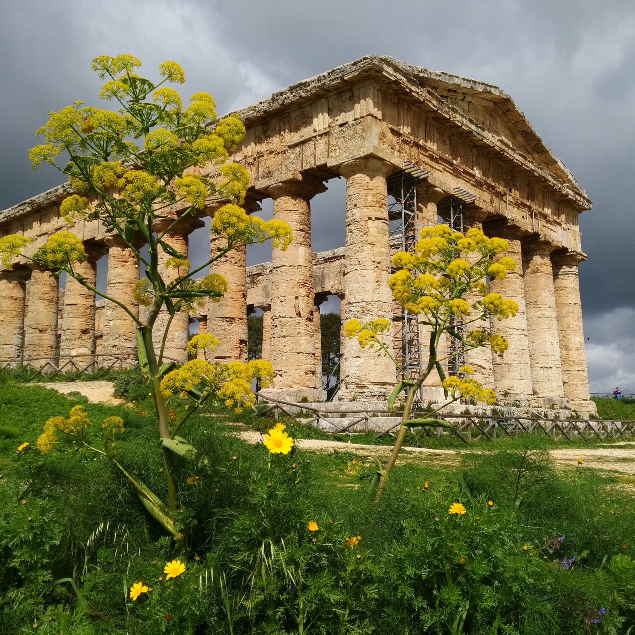
Ο Ναός του Ηρακλή είναι ο αρχαιότερος ναός στη νότια τείχος πόλης και χρονολογείται από την αρχαϊκή εποχή στις αρχές του 5ου αιώνα π.Χ. Βασίζεται σε μια τριώροφη θεμελίωση. Οι οκτώ κίονες στη νότια πλευρά επαναστηλώθηκαν το 1924, ενώ ο κορμός του κίονα στη βόρεια πλευρά ήδη από τον 19ο αιώνα. https://de.wikipedia.org/wiki/Arch%C3%A4ologische_St%C3%A4tten_von_Agrigent#Heraklestempel

Μεταφράστηκε από το Google

1

0

Beautiful view. Great photo perspective.

Μεταφράστηκε από το Google

4

0

Definitely worth seeing if you're in the area. Ideally, go at off-peak times when there are no tourist buses.

Μεταφράστηκε από το Google

3

0

Beautiful view of the temple. Plan a photo stop! 🤩

Μεταφράστηκε από το Google

3

0

Οι πιο δημοφιλείς διαδρομές στη Σικελία

Εύκολες πεζοπορίες Σικελία

Τα πιο δημοφιλή αξιοθέατα στη Σικελία

Places to see

Store rating

Εμπνεύσου με την εφαρμογή komoot για κινητά

Με έναν δωρεάν λογαριασμός komoot, μπορείς εύκολα να βρεις, να προσαρμόσεις και να πλοηγηθείς σε αμέτρητες υπαίθριες περιπέτειες.

ή

Γίνε μέλος στο komoot τώρα

Store rating

Δεν βρήκες αυτό που ψάχνεις;

Δες περισσότερα Πεζοπορίες σε όλη την περιοχή Σικελία παρακάτω και βρες την τέλεια διαδρομή στον προορισμό σου.

ΑγκριτζέντοΣυρακούσεςΡαγκούζαΤράπανιΚαλτανισσέτταΚατάνιαΈνναΠαλέρμοΜεσσήνη

Ανακάλυψε περισσότερα

Περιηγήσου τα καλύτερα Πεζοπορίες σε άλλες περιοχές.

AlpsΝότιο ΤιρόλοΒένετοApennine MountainsΤρεντίνοΛιγουρίαΛομβαρδίαΠεδεμόντιοΚοιλάδα της ΑόσταΣαρδηνίαΕμίλια-ΡομάνιαArea Naturale Marina Protetta delle Cinque TerreΚαμπανίαΦριούλι-Βενέτσια ΤζούλιαΤοσκάνηΛάτιοΜάρκεΑμπρούτσοΛιβόρνοParco Nazionale dell'Arcipelago ToscanoΟύμπριαΑπουλίαΚάλιαριΜπαζιλικάταLipariΚαλαβρίαΡίμινιArea Marina Protetta Regno di NettunoAeolian IslandsΜολίζεParco Naturale Regionale di Porto ConteCapoliveriCampo Nell'ElbaFavignanaPortoferraioFondali Capo Mele - AlassioRiserva Naturale Di PonzaGoroZona Di Protezione Speciale Capo CarbonaraParco Naturale Regionale Costa Otranto - Santa Maria di Leuca e Bosco di TricaseFondali Loano - AlbengaPosthudorra/Porto TorresParco Nazionale dell'AsinaraParco regionale dei Campi FlegreiAmp "Capo Gallo - Isola Delle Femmine" Zona CArea Marina Protetta di Torre Guaceto - Zona C (riserva parziale)Riserva Naturale Orientata Isola BellaLampedusa E LinosaParco Naturale Regionale Isola di Sant'Andrea e Litorale di Punta PizzoArea marina protetta Isole PelagieRiserva Isole dello Stagnone di MarsalaArea Marina Protetta Isole CiclopiParco Archeologico Sommerso Di BaiaSic Costa Ionica Foce AgriArea Marina Protetta Secche della MeloriaArea Naturale Marina Protetta Capo Gallo - Isola delle FemmineSic Costa Ionica Foce CavoneSecche Di Tor Paterno

Άλλα μέρη για εξερεύνηση

Καταφύγια άγριας ζωής στην περιοχή Σικελία

Adventure guides κοντά σου

Τι να κάνετε Villarosa

background

Ετοιμάσου να κατακτήσεις νέες κορυφές

Εγγράψου δωρεάν

Εξερεύνησε
ΔιαδρομέςΣχεδιαστής διαδρομώνΧαρακτηριστικάΕξαργύρωσε ένα κουπόνιΠεζοπορίεςΜονοπάτια MTBΔιαδρομές δρόμουBikepackingΧάρτης ιστοτόπου
Κατέβασε την εφαρμογή
Ακολούθησέ μας στα social

© komoot GmbH

Πολιτική απορρήτου