Οι καλύτερες ποδηλατικές διαδρομές στην Καλιφόρνια
4,6
(8143)
148.745
Ποδηλάτες
6.784
Ποδηλασίες
Η ποδηλασία Καλιφόρνια είναι ένας από τους πιο ευχάριστους τρόπους να εξερευνήσετε αυτό το μέρος της περιοχής Ηνωμένες Πολιτείες της Αμερικής. Για να βρείτε την τέλεια ποδηλατική εκδρομή στην περιοχή Καλιφόρνια, εξετάσαμε ολόκληρη τη συλλογή ποδηλατικών διαδρομών. Κάντε κλικ σε κάθε διαδρομή για αναλυτικά στοιχεία με υψομετρικά προφίλ και αναλύσεις επιφάνειας, και δείτε συμβουλές και φωτογραφίες από μέλη της κοινότητας komoot.
Τελευταία ενημέρωση: 25 Οκτωβρίου 2026
5,0
(1)
3.852
Ποδηλάτες
18,3km
01:05
220m
390m
Cycle the Newton B. Drury Scenic Parkway, a moderate 11.4-mile route through ancient redwood groves in Prairie Creek Redwoods State Park.
5,0
(7)
7.196
Ποδηλάτες
If you're looking for a truly immersive way to experience Yosemite Valley's iconic landscapes, the Yosemite Valley Loop Trail is an excellent choice for touring cycling. This easy 13.0-mile (20.9 km) route, with a minimal 366 feet (112 metres) of elevation gain, offers close-up views of natural wonders like El Capitan and Yosemite Falls. You'll cycle through serene meadows and along the Merced River, enjoying the scenery from a unique perspective that avoids traffic, making it a fantastic option for families and beginners.
Planning your ride is straightforward, as the trail is generally accessible year-round, though spring can bring localized flooding and winter snow. The route primarily follows paved bike paths, ensuring a smooth journey. Bike rentals are readily available within Yosemite National Park, and there's even a free bike-share program for shorter excursions, making it easy to get on two wheels and explore.
What makes this route particularly special is its ability to provide a comprehensive tour of the Valley's grandeur without the usual crowds and parking hassles. It allows you to appreciate the scale and beauty of Yosemite from a different vantage point, stopping frequently for photos. This trail is a prime example of Yosemite Valley bike trails popularity, offering a relaxed yet rewarding way to connect with the park's natural features.

4,9
(75)
1.394
Ποδηλάτες
38,2km
02:34
590m
590m
Cycle the difficult 23.8-mile San Francisco Bay Trail and Marin Headlands Loop for stunning views of the Golden Gate Bridge and Pacific Ocea
4,9
(20)
299
Ποδηλάτες
40,0km
02:30
400m
400m
Cycle the Sausalito, Tiburon, Paradise Cay Loop, a moderate 24.8-mile route with 1302 feet of gain, offering stunning Bay Area views.
251
Ποδηλάτες
19,7km
02:41
1.420m
10m
The Whitney Portal Road offers a truly epic touring cycling experience, winding through dramatic landscapes that transform from the otherworldly rock formations of the Alabama Hills to the towering granite cliffs of the Eastern Sierra Nevada. As you climb, you'll be treated to sweeping views of the Owens Valley and a unique perspective of Mount Whitney, the highest peak in the contiguous United States. It's a journey of constantly changing scenery, from high desert to mountainous terrain, culminating at the famous Whitney Portal.
This is a demanding ride, so plan your visit carefully. The road is typically open from early May to November, but snow closes it during the winter months, though it might be accessible to bikes even when closed to cars in spring. Be prepared for a sustained and difficult climb, but know that amenities like a store and restaurant await you at Whitney Portal, making it a great place to refuel before your descent.
Consistently ranked among the toughest bike climbs in the U.S., this 12.2-mile (19.7 km) route features a staggering 4670 feet (1423 metres) of elevation gain, taking around 2 hours and 41 minutes to complete for a difficult touring cyclist. The average gradient hovers around 7.4-7.7%, with some sections hitting a brutal 14%, especially around the prominent hairpin turns. The road was repaved recently, offering excellent conditions for the ascent, though watch out for expansion joints on the descent.
234
Ποδηλάτες
30,7km
03:09
1.330m
180m
Tackle the difficult 19.1-mile Mount Hamilton Ride, gaining 4362 feet in elevation to the historic Lick Observatory with panoramic views.
4,9
(24)
174
Ποδηλάτες
28,6km
02:04
560m
530m
This difficult 17.7-mile touring cycling route offers challenging climbs, rewarding descents, and panoramic views of the San Francisco Bay.
4,8
(33)
630
Ποδηλάτες
This difficult 27.8-mile touring cycling loop in Marin Headlands offers challenging climbs, stunning views of the Golden Gate Bridge, and hi
5,0
(5)
96
Ποδηλάτες
37,9km
02:38
680m
600m
Embark on the Three Bears Loop, a difficult touring cycling route spanning 23.5 miles (37.9 km) with a significant elevation gain of 2219 feet (676 metres). You can expect to complete this challenging ride in about 2 hours and 37 minutes. As you pedal, you will pass through idyllic backcountry scenery, enjoying views of the San Pablo Reservoir and rolling hills, with a notable vista of the Briones Reservoir along Bear Creek Road. The route features a mix of tree-lined sections and open, unshaded roads, providing a varied experience.
When planning your ride, be aware that while the road surface is mostly paved, you might encounter gravel and debris, especially on descents. Given the lack of shade on some of the climbs, remember to carry plenty of water and snacks to stay hydrated. For the best experience of the route's famous climbs, it is recommended that you ride the loop in a clockwise direction. This will help you tackle the 'bears' as intended.
This well-known East Bay ride is particularly famous for its challenging climbs, affectionately known as the 'three bears': Mama Bear, Papa Bear, and Baby Bear. These distinct and demanding ascents are all found on Bear Creek Road, making the route a true test of endurance for touring cyclists. The unique sequence of these climbs sets the Three Bears Loop apart as a notable and rewarding cycling adventure in the region.
90
Ποδηλάτες
20,9km
02:47
1.460m
10m
The Mount Baldy Cycling Route presents a difficult touring bicycle challenge, ascending 4783 feet (1458 metres) over 13.0 miles (20.9 km). This demanding climb is estimated to take 2 hours and 47 minutes. As you pedal, you will experience expansive views of the San Gabriel Mountains and immense canyons, with the landscape changing as you gain elevation towards the summit.
When planning your ride, be aware that the initial eight miles of the direct Mt. Baldy Road approach can have significant, fast-moving traffic due to an older road surface. Conditions vary greatly from the heat at lower elevations to cooler temperatures at the summit, so dressing in layers is advisable. Some sections, particularly as you approach "the Notch," involve unpaved gravel that can be difficult for road bikes.
This route is renowned as one of Southern California's most iconic and demanding cycling climbs. Reaching the summit of Mount Baldy, the highest point in the San Gabriel Mountains, offers a unique sense of accomplishment. You will be rewarded with sweeping views of wooded peaks and the Los Angeles coastal plains, making this a notable achievement for touring cyclists in the region.
Πάρε πρόσβαση σε περισσότερες διαδρομές και προτάσεις από άλλους εξερευνητές.
Έχεις ήδη λογαριασμό;
Οι προτάσεις διαδρομών μας βασίζονται σε χιλιάδες πεζοπορίες, ποδηλασίες και τρεξίματα που ολοκληρώθηκαν από άλλους χρήστες στο komoot.
Ξεκίνα σήμερα με έναν δωρεάν λογαριασμό
Η επόμενη περιπέτειά σου σε περιμένει.
Δημοφιλή γύρω από Καλιφόρνια
Ποδηλατικές διαδρομές Coast Range

Ποδηλατικές διαδρομές Sierra Nevada
Ποδηλατικές διαδρομές Marin County

Ποδηλατικές διαδρομές Santa Clara County

Ποδηλατικές διαδρομές Los Angeles County
Ποδηλατικές διαδρομές San Diego County

Ποδηλατικές διαδρομές Alameda County
Ποδηλατικές διαδρομές Contra Costa County
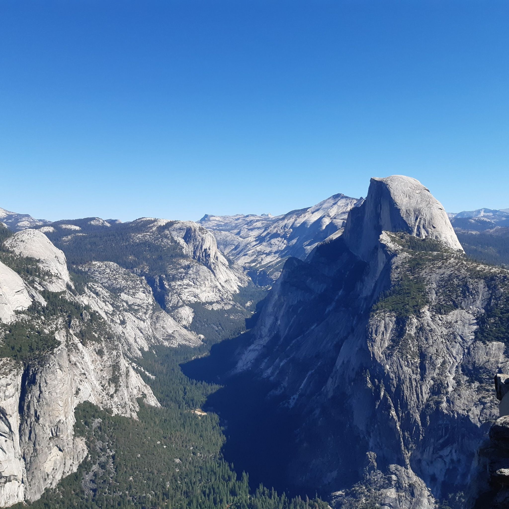
Ποδηλατικές διαδρομές Mariposa County

Ποδηλατικές διαδρομές Orange County
Άλλες περιπέτειες στην Καλιφόρνια


Συμβουλές από την κοινότητα

φτάστε στον καταρράκτη στο τέλος του δρόμου
0
0
κρυμμένος καταρράκτης στο τέλος του δρόμου
0
0

Well signposted and close by you can park next to the beautiful access road along the side (just opposite the university entrance).
1
0

Bayfront Park with gazebo, large lawns, picnic tables, boule courts, kayak/boat launch. Often used for free outdoor concerts
0
0
I object to this user "Mirsaid Abdullaev" stealing my images and passing them off as his. Please stop this. He has been to none of these locations, so cannot create highlights there, and should not create highlights with other people's IP.
0
0

Beautiful peak with 40 community images. All images will be uploaded for background filtering.
0
1

Good vantage point.
0
0

In this area of the Sobrante Ridge Regional Preserve, visitors can find the Sobrante Ridge Trailhead. The preserve is 277 acres in size and is a parkland that preserves the habitat of the extremely rare Alameda manzanita. It is an important home to indigenous plants and animals in this area.
0
0
Οι πιο δημοφιλείς διαδρομές στην Καλιφόρνια
Τα πιο δημοφιλή αξιοθέατα στην Καλιφόρνια

Εμπνεύσου με την εφαρμογή komoot για κινητά


Δεν βρήκες αυτό που ψάχνεις;
Δες περισσότερα Διαδρομές ποδηλασίας σε όλη την περιοχή Καλιφόρνια παρακάτω και βρες την τέλεια διαδρομή στον προορισμό σου.
Ανακάλυψε περισσότερα
Περιηγήσου τα καλύτερα Διαδρομές ποδηλασίας σε άλλες περιοχές.
