Tidslinje
Goldsteig Wandern planlagde en vandretur
3. august 2018
Tid
Afstand
Hastighed
Stigning
Nedstigning
Goldsteig Wandern planlagde en vandretur
2. august 2018
Tid
Afstand
Hastighed
Stigning
Nedstigning
Mike, Uwe Stanke og Josi kan lide dette.
25. juli 2018
After the place Kulz and the Prackendorfer moss, the Goldsteig divides at a forest crossing in the north and the south route. The southern route is not to be underestimated. While the North Tour promises a steady, exhausting climb, the route over the southern Vorwald is characterized by many ascents
Oversat af Google •
Goldsteig Wandern planlagde en vandretur
2. august 2018
Tid
Afstand
Hastighed
Stigning
Nedstigning
Mike, Uwe Stanke og Josi kan lide dette.
25. juli 2018
The circuit offers you pure variety and is especially suitable for trained excursionists. In addition to getting to know the villages of Elisabethszell, Haibach, Denkzell and Konzell, you can admire the many facets of nature here. Whether prospects in the Bavarian Forest and the Danube plain or colorful
Oversat af Google •
Goldsteig Wandern planlagde en vandretur
2. august 2018
Tid
Afstand
Hastighed
Stigning
Nedstigning
Mike, Uwe Stanke og Josi kan lide dette.
26. juli 2018
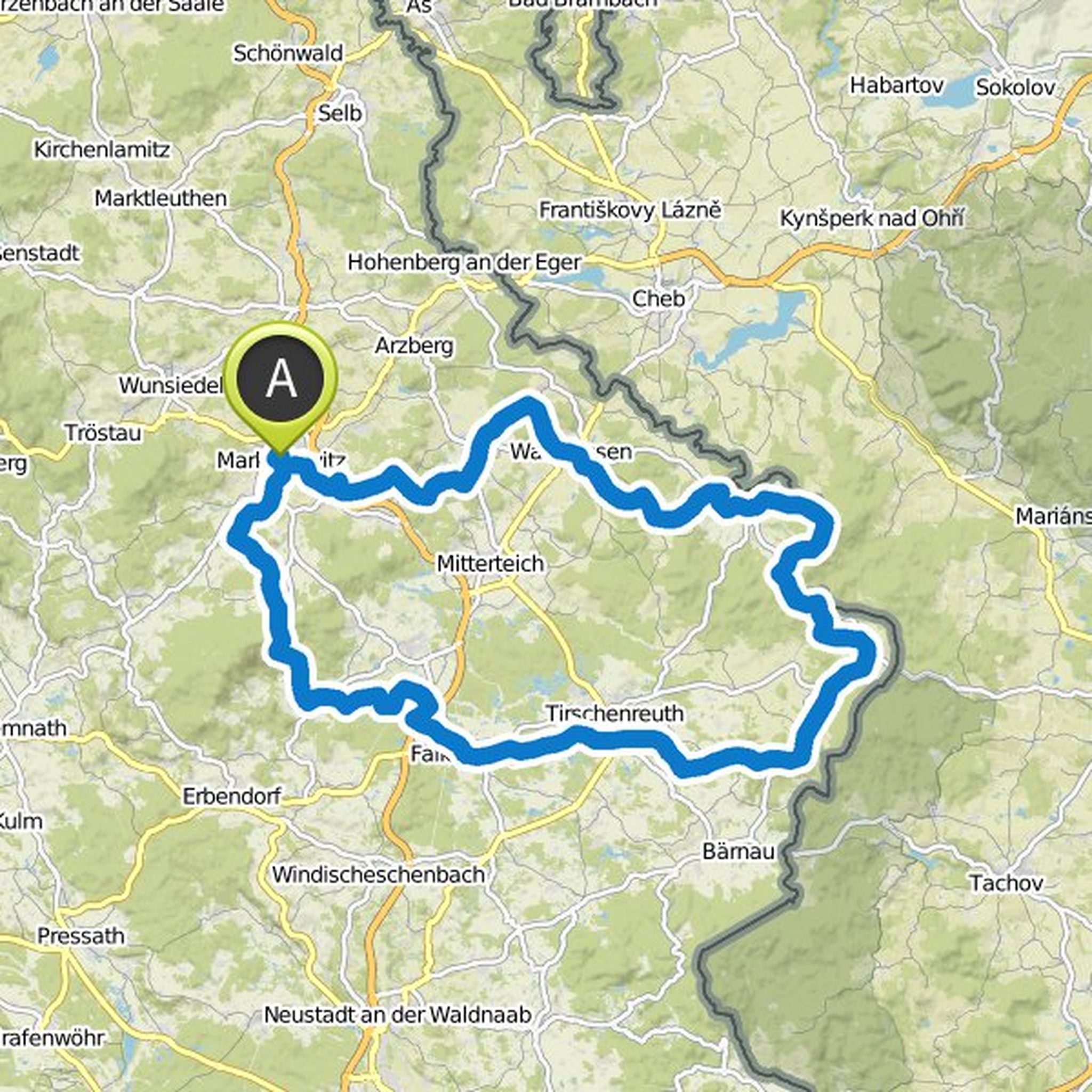
Starting at the starting point of the Goldsteig in the Marktredwitz you go to Konnersreuth. On the way to the monastery town of Waldsassen you also have the opportunity to admire the baroque Kapplkirche and the volcano Hirschentanz. About the quality route Nurtschweg the round continues over the Sibyllenbad
Oversat af Google •
Goldsteig Wandern planlagde en vandretur
1. august 2018
Tid
Afstand
Hastighed
Stigning
Nedstigning
Mike, Uwe Stanke og Josi kan lide dette.
26. juli 2018
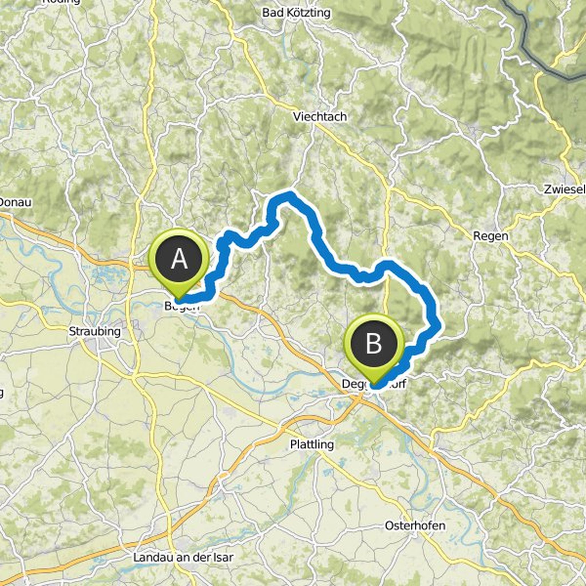
The round on the Goldsteig, Baierweg and Böhmweg invites you on three stages to an extraordinarily varied hike. The start is at Bogener station. From there you move on the Baierweg through the Danube plain and pristine forests to the monastery village of Windberg. Continue on to the idyllic Perlbach
Oversat af Google •
Goldsteig Wandern planlagde en vandretur
1. august 2018
Tid
Afstand
Hastighed
Stigning
Nedstigning
Mike, Uwe Stanke og Josi kan lide dette.
25. juli 2018
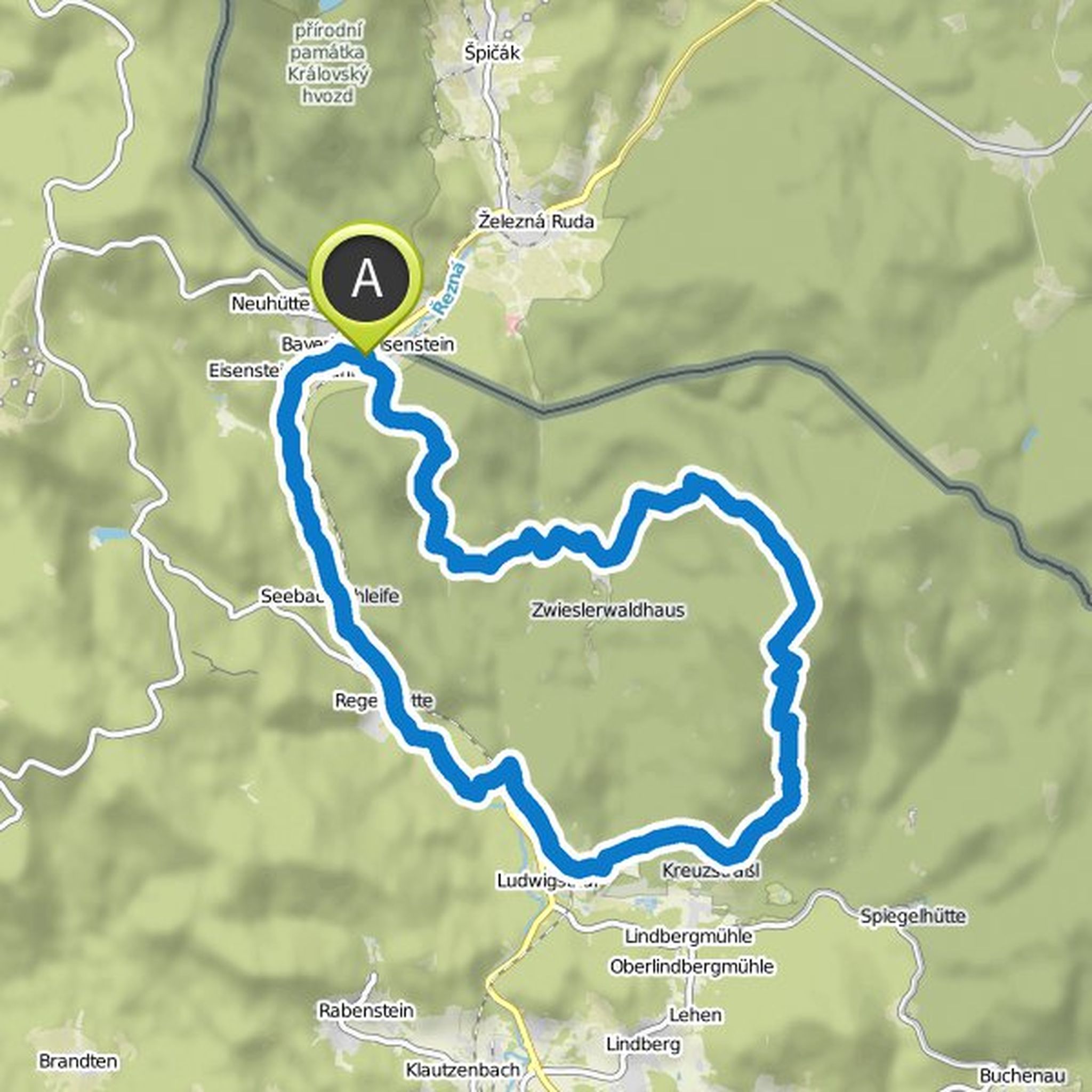
The tour through the National Park and over the Great Falkenstein is ideal for adventurous hikers. Starting in the hiking park in Bayerisch Eisenstein, the trail leads through the wild jungle Watzlik-Hain, which impresses with its giant trees. From there it goes over the Ruckowitzschachten on the Great
Oversat af Google •
Goldsteig Wandern planlagde en vandretur
1. august 2018
Tid
Afstand
Hastighed
Stigning
Nedstigning
Mike, Uwe Stanke og Josi kan lide dette.
25. juli 2018
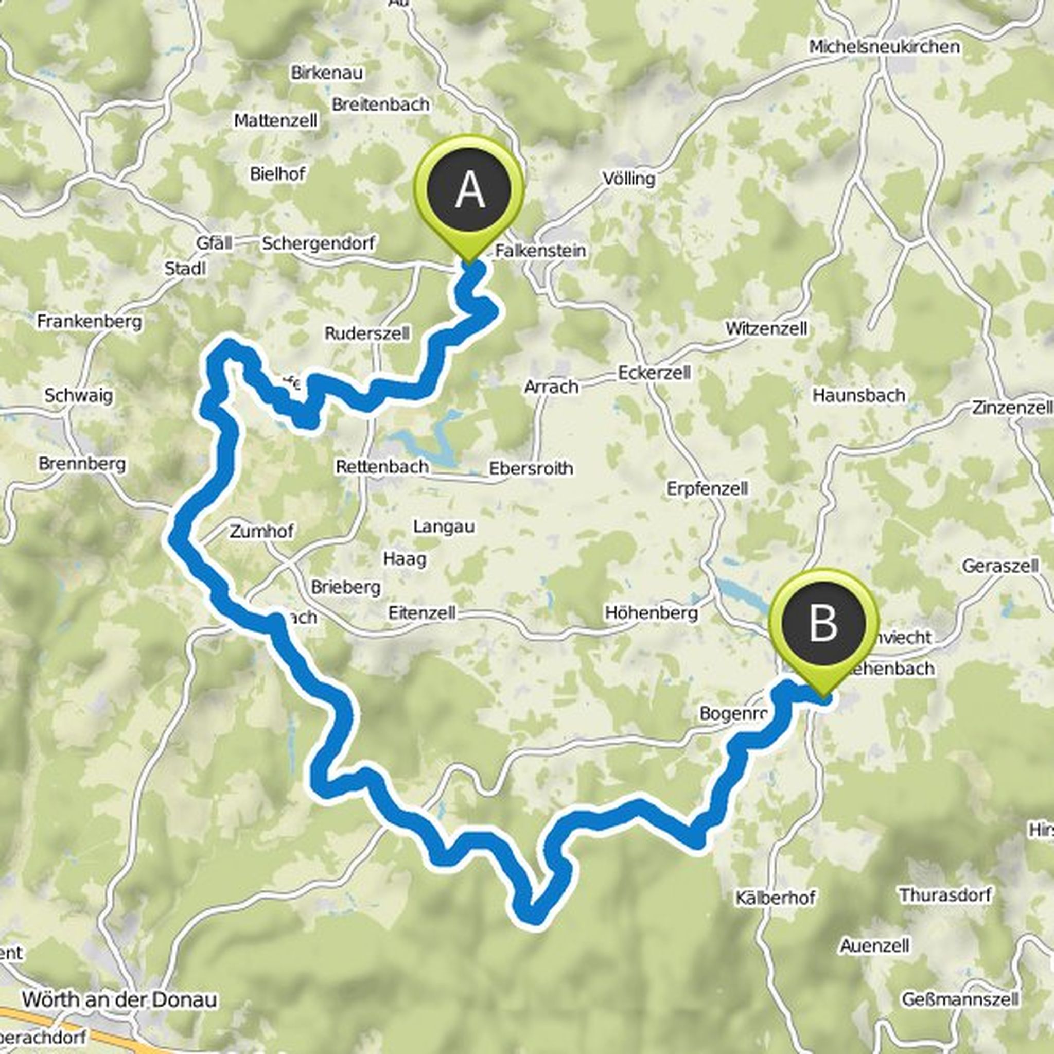
The stage from Falkenstein to Wiesenfelden starts at the pavilion between the trail parking lot and Falkenstein. The tour begins with a leisurely walk to the pilgrimage chapel Tannerl on a forest clearing and continues around the lake of Postfelden - then you reach the climax of the tour. A signpost
Oversat af Google •
Goldsteig Wandern planlagde en vandretur
1. august 2018
Tid
Afstand
Hastighed
Stigning
Nedstigning
Mike, Uwe Stanke og Josi kan lide dette.
25. juli 2018
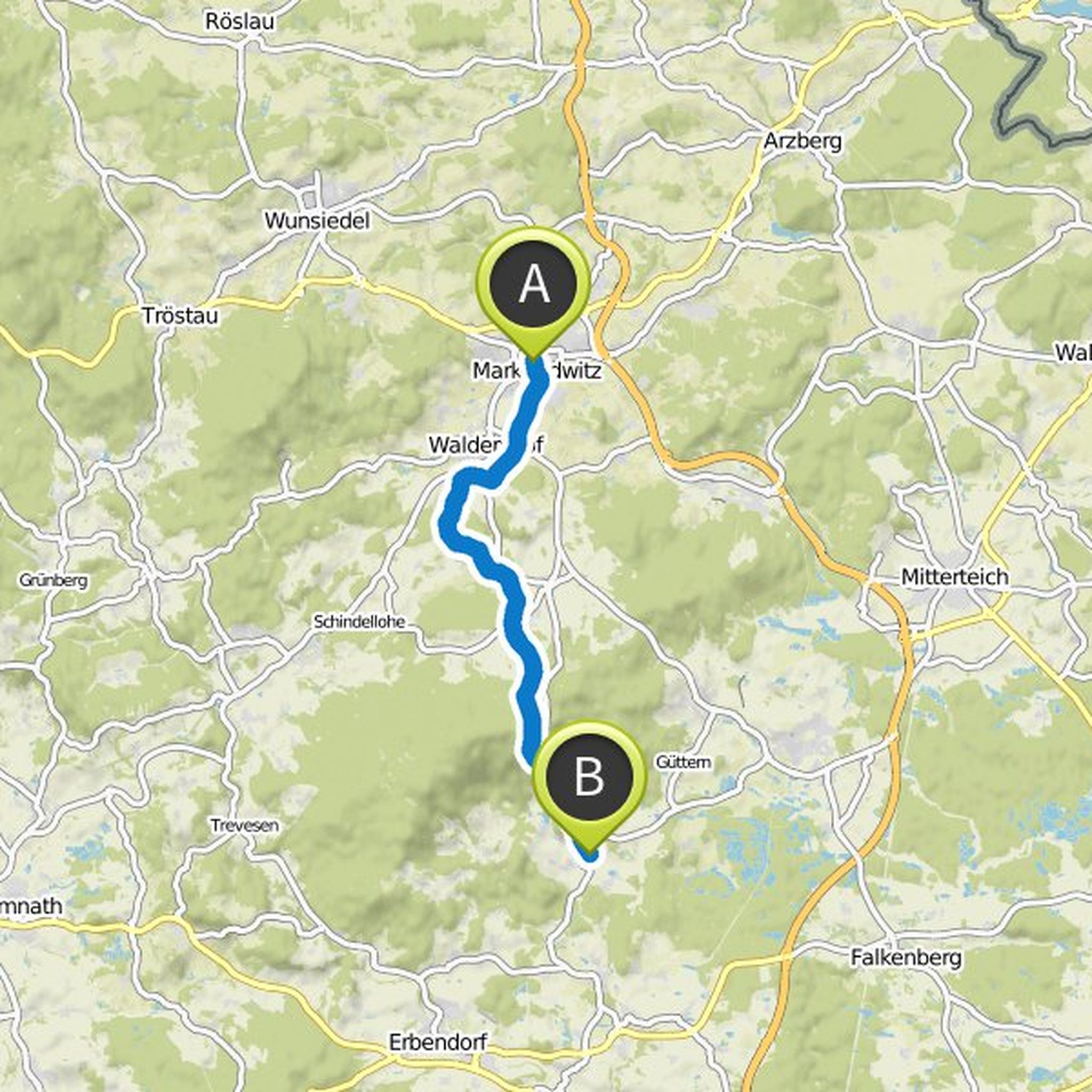
At the Gerberhaus in Marktredwitz is the starting point of the Goldsteig. From there you walk along the floodplain in the direction of Waldershof, after 1.5 kilometers you cross the state road and on the meadow path in the district Rosenhammer. Continue on the field and meadow path to Neumühle, direction
Oversat af Google •
Goldsteig Wandern planlagde en vandretur
26. juli 2018
Tid
Afstand
Hastighed
Stigning
Nedstigning
Mike, Uwe Stanke og Josi kan lide dette.
25. juli 2018
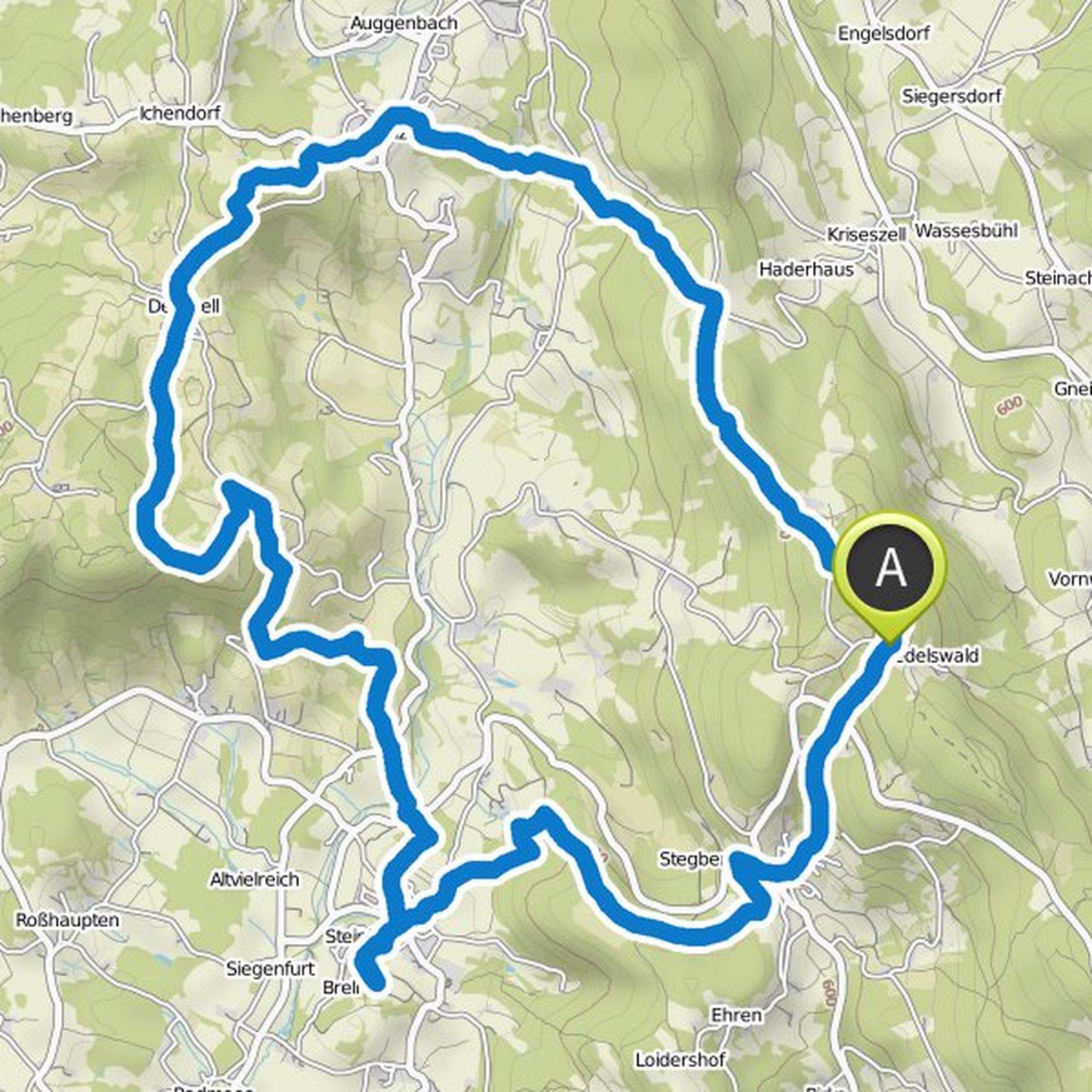
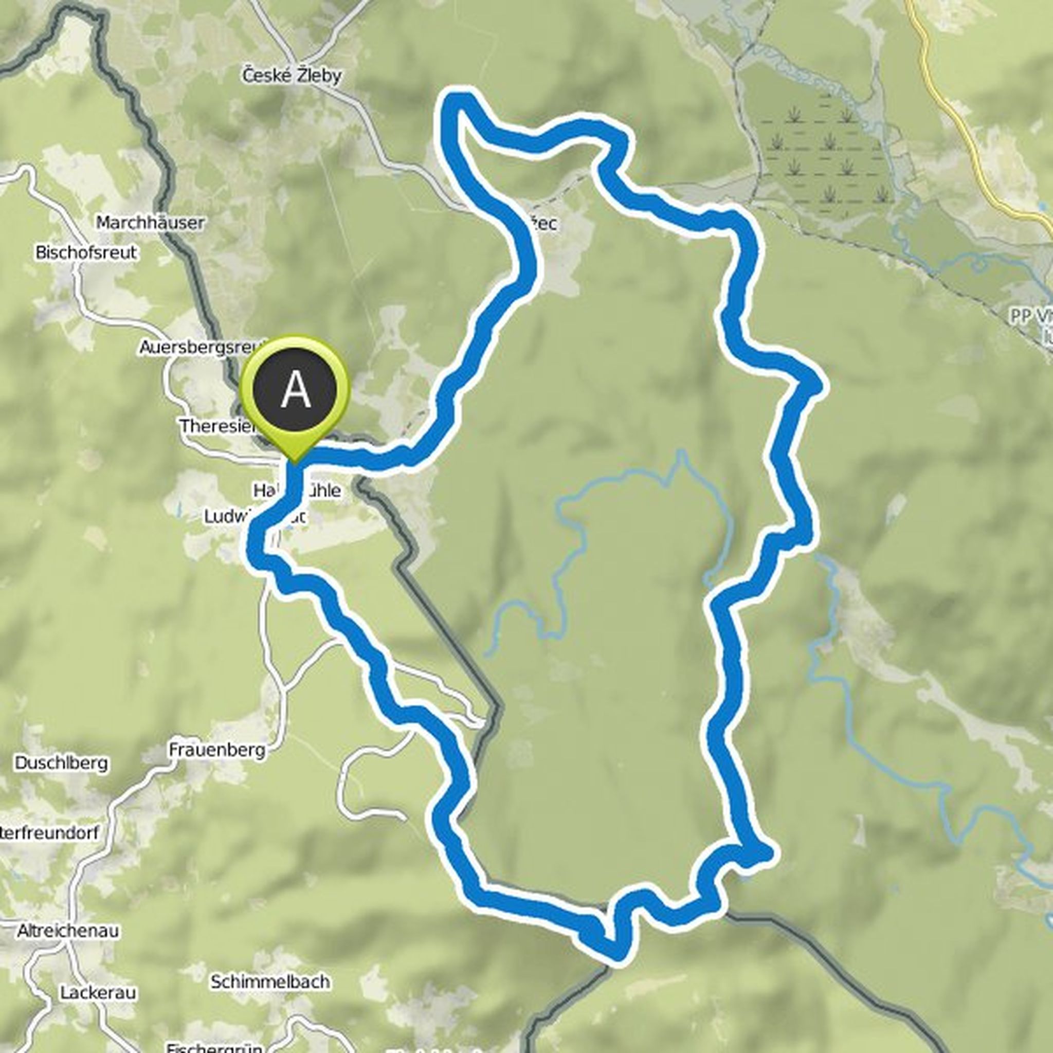
The Dreiländereckrunde impresses with a varied route through the Bohemian Forest. Starting from Haidmühle, you first go through the Šumava Biosphere Reserve to the first stage. After Stožec you have the opportunity to marvel at the Tusset Chapel below the Stožecká Rock with its medicinal spring. Continue
Oversat af Google •
Goldsteig Wandern planlagde en vandretur
26. juli 2018
Tid
Afstand
Hastighed
Stigning
Nedstigning
Mike, Uwe Stanke og Josi kan lide dette.
25. juli 2018
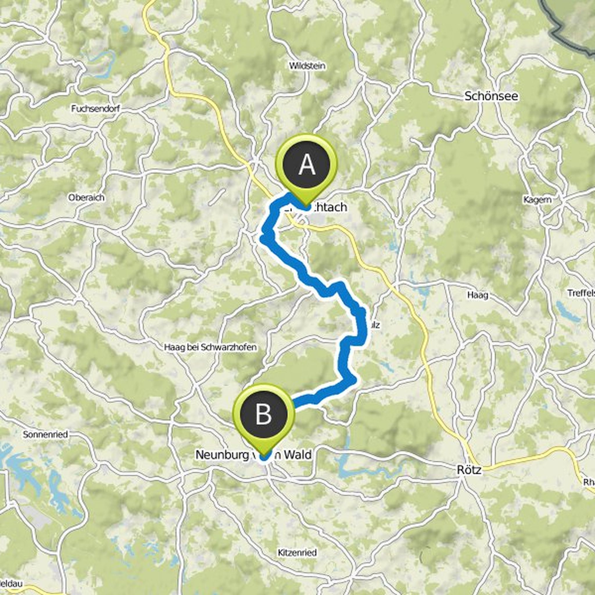
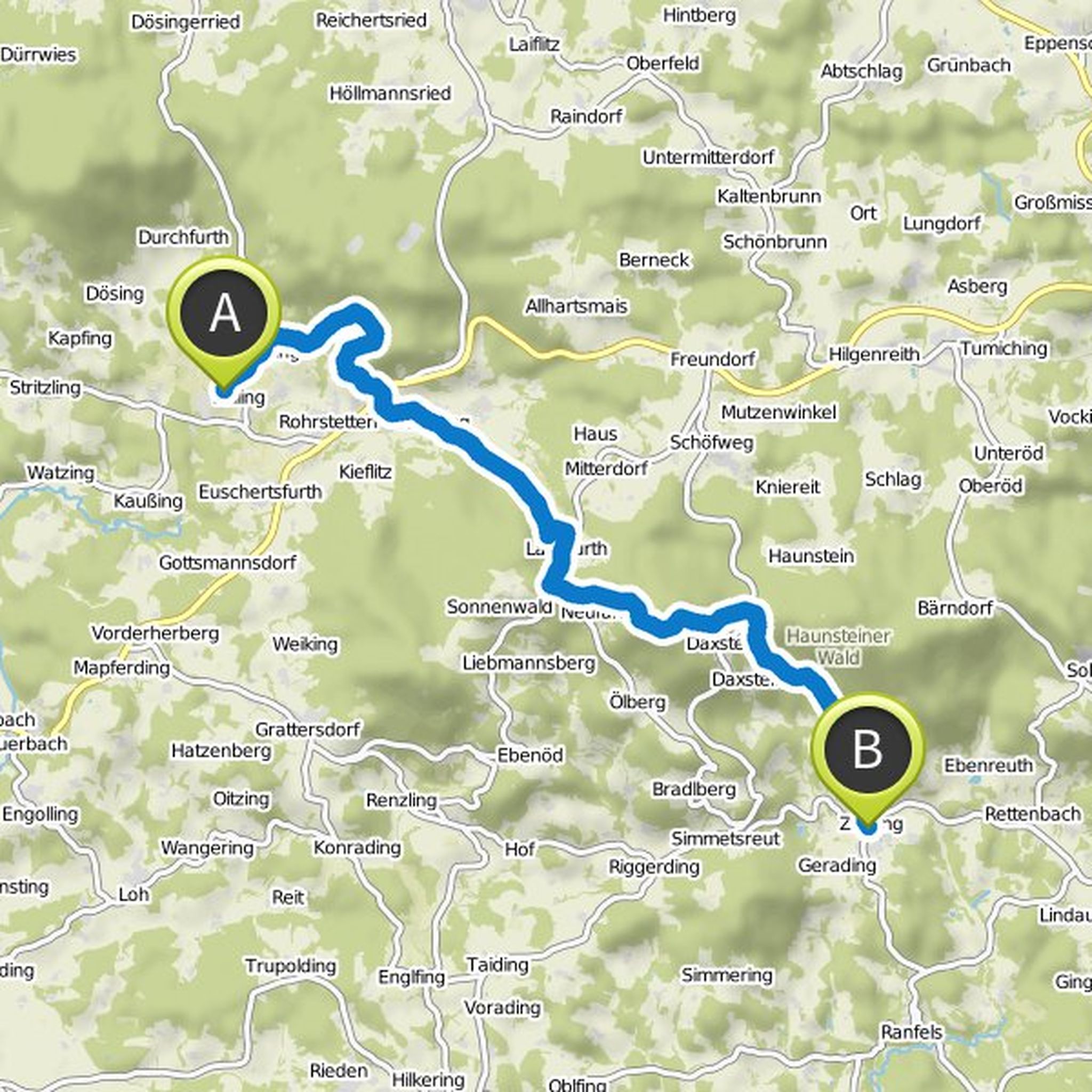
On the way from Lalling to Zenting you can expect several special highlights: First, there is a fruit trail at Panholling, which is pleased about visitors. On the other hand, the ascent to the Brotjacklriegel is a special challenge. But it's worth it - on the Brotjacklriegel you will find beautiful forest
Oversat af Google •
Goldsteig Wandern planlagde en vandretur
26. juli 2018
Tid
Afstand
Hastighed
Stigning
Nedstigning
25. juli 2018
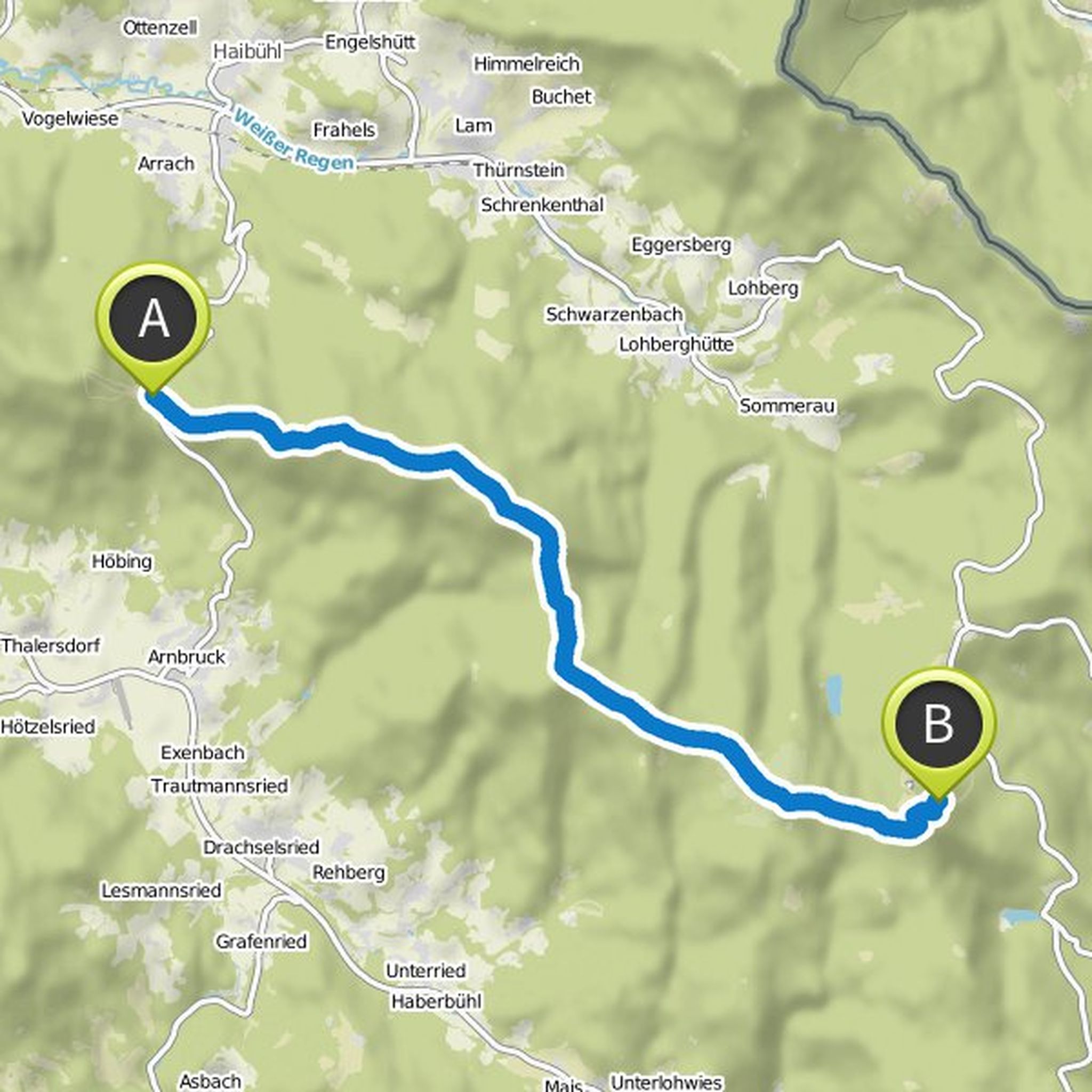
The eight-thousander tour is one of the most exciting, but also the most strenuous Goldsteig stages. On the entire route you will be rewarded with fantastic views and summit views. Alternating sweaty ascents and descents, and wild, wild, romantic landscapes are some of your companions on this stage of
Oversat af Google •
Goldsteig Wandern planlagde en vandretur
26. juli 2018
Tid
Afstand
Hastighed
Stigning
Nedstigning
26. juli 2018
This tour is easy to reach. The starting point of the hike, the town of Weiden in the Upper Palatinate, is the ideal place to start a Goldsteig tour. The city of Weiden impresses with its cultural diversity. Even the market square with its distinctive Old Town Hall shows its incomparable charm. Numerous
Oversat af Google •
Goldsteig Wandern planlagde en vandretur
26. juli 2018
Tid
Afstand
Hastighed
Stigning
Nedstigning
26. juli 2018
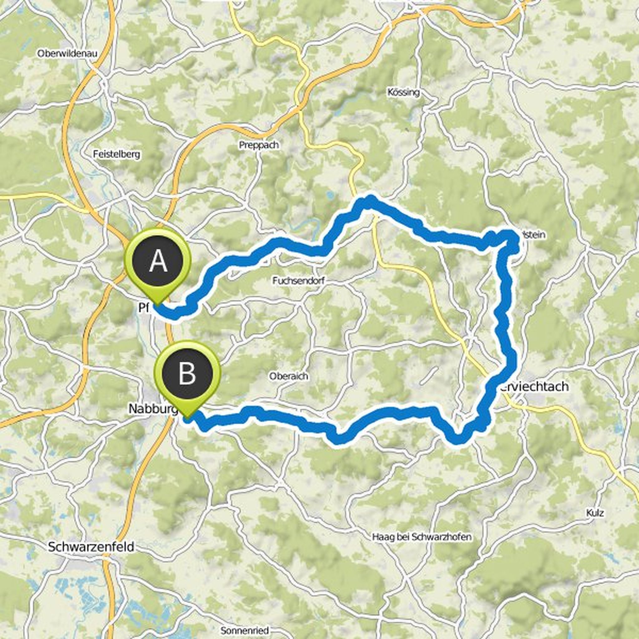
The following Goldsteig circular walk is ideal for a three- to four-day excursion to the Upper Palatinate Forest. Starting from Pfreimd you first go along the creek of the same name and cross a forest area before you arrive in Trausnitz. There you should definitely visit the castle from the 12th century
Oversat af Google •
Goldsteig Wandern planlagde en vandretur
25. juli 2018
Tid
Afstand
Hastighed
Stigning
Nedstigning
Mike, Uwe Stanke og Josi kan lide dette.
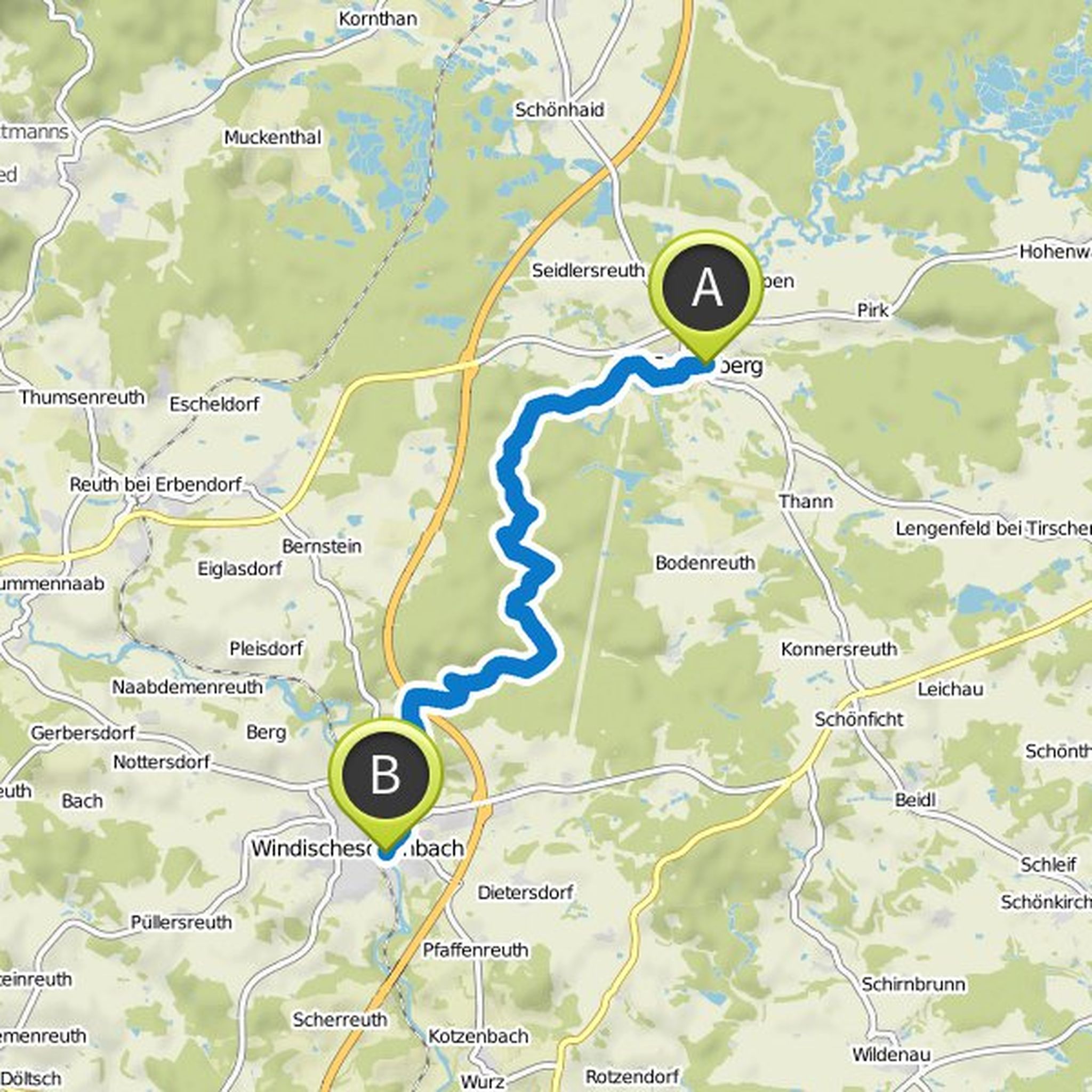
25. juli 2018
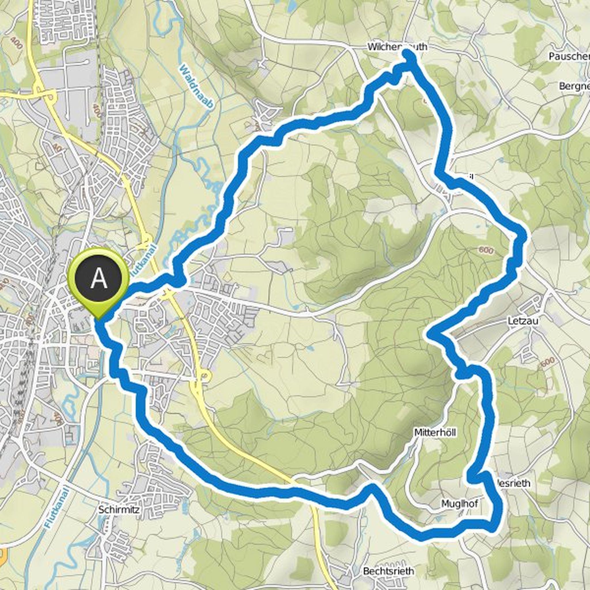
Falkenberg boasts a 1,000-year-old castle, a wackelstein and a historic Zoiglbierbrauhaus. It is worthwhile to explore the town on a short walk. The adjoining nature reserve Waldnaabtal offers you an incomparable nature experience. The shore path leads between the log cabin and Neuhaus through a 12-kilometer
Oversat af Google •
26. juli 2018
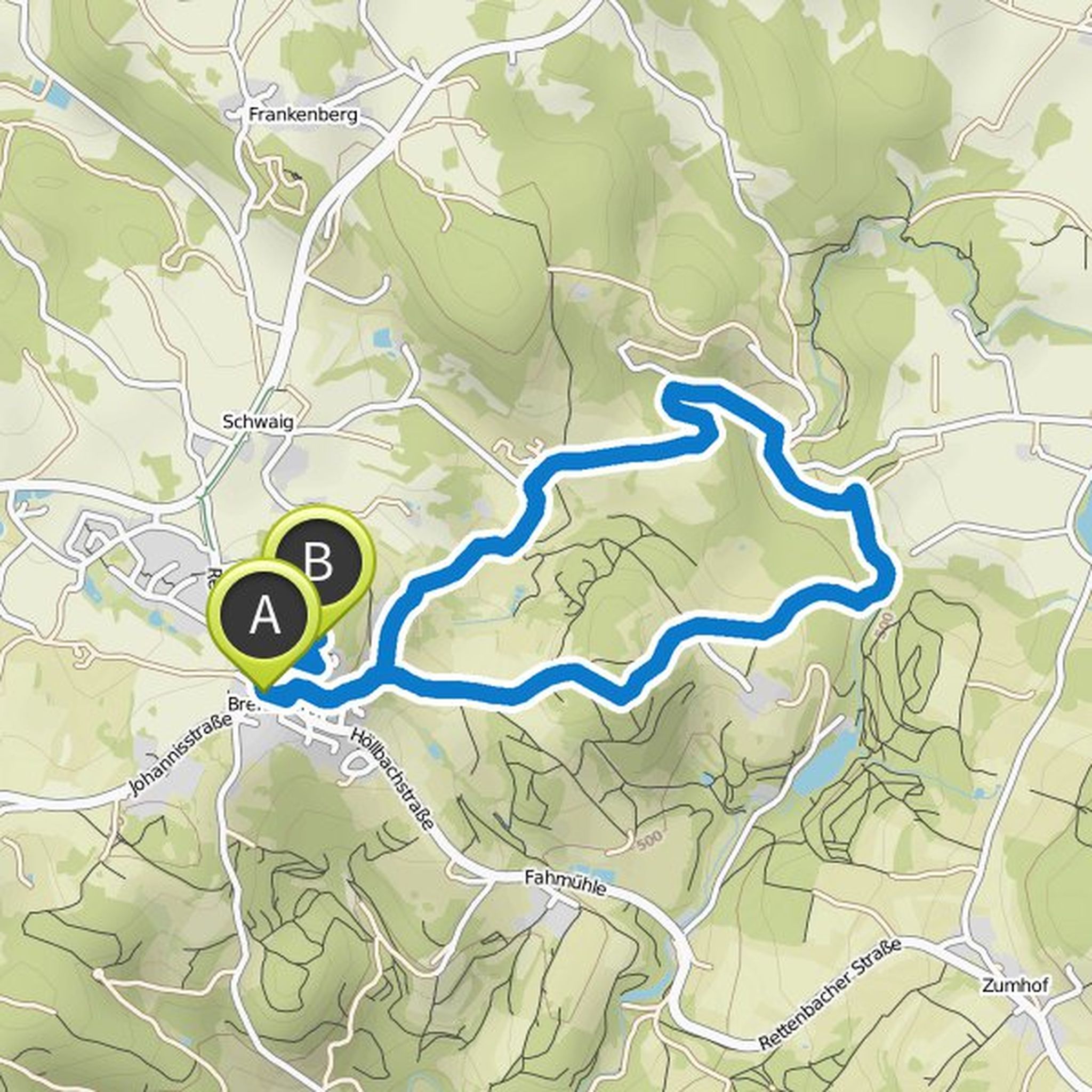
The approximately six-kilometer circular trail is perfect for a family outing. Starting from the town hall in Brennberg, it goes uphill to the castle ruins, which is located on a 653 meter high granite rock and is completely accessible. In addition, the observation tower there is a special highlight
Oversat af Google •