Tidslinje
Tid
Afstand
Hastighed
Stigning
Nedstigning

Tid
Afstand
Hastighed
Stigning
Nedstigning
Tid
Afstand
Hastighed
Stigning
Nedstigning
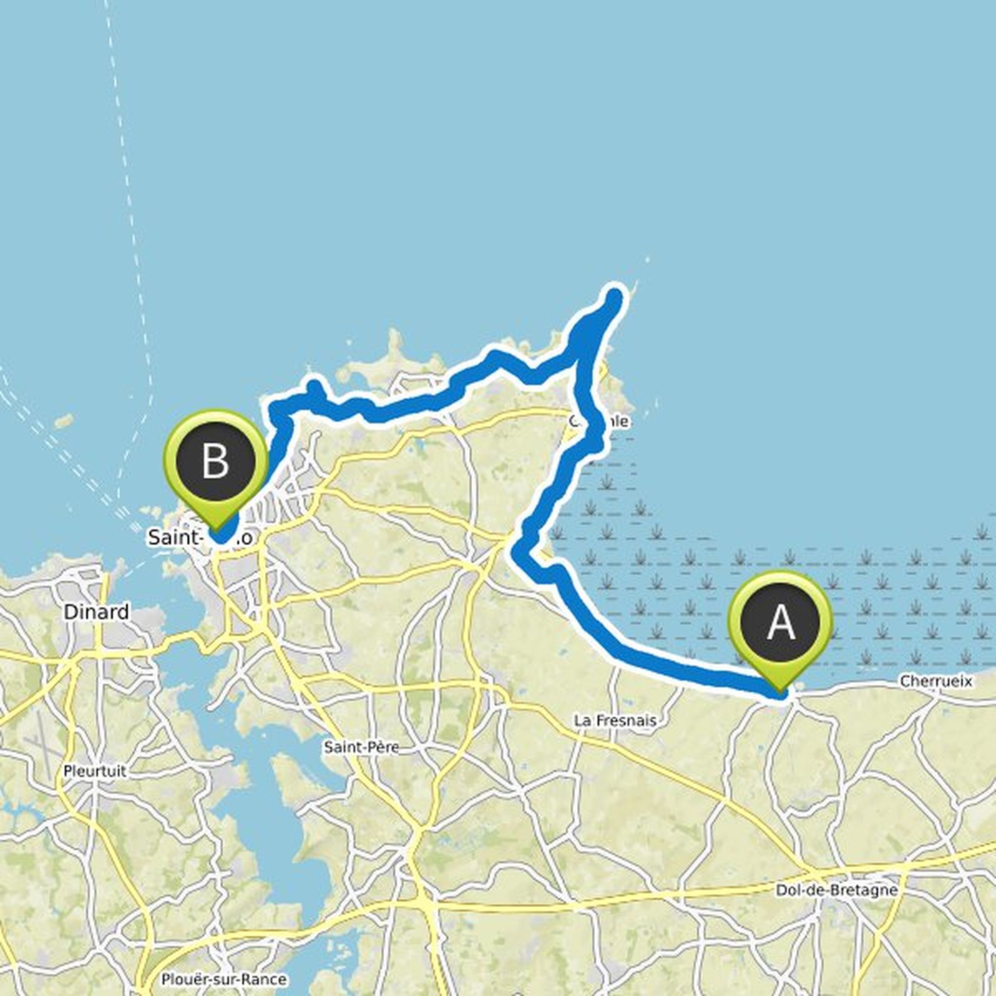
29. juni 2019
Quite a large part along Eurovelo4. Flat and light.
Oversat af Google •
Tid
Afstand
Hastighed
Stigning
Nedstigning

27. juni 2019
Lunch eg in Les Falaises after 36.7 km "La grange de Tom". There are many places to choose from in the communities along the coast.
Avranches also look nice (after about 61 km)
Oversat af Google •
Tid
Afstand
Hastighed
Stigning
Nedstigning

23. juni 2019
If you want to climb the Clecy viaduct you have to take the bike path about 500 m before (and follow "La Vélo Francette.") To come down again you probably have to cycle back or drive over to the other side (and then on until you can come back to the route).
Small roads in the country virtually all the
Oversat af Google •
Tid
Afstand
Hastighed
Stigning
Nedstigning

22. juni 2019
Cider in Cambremer - guided tour in French at. 11 for 3 €. Reserve?
Vineyard in Grisy, though it is probably closed on Sundays. Check opening hours when July comes on the website.
Viewpoint La Roche D'Oetre, possibly hiking instead of cycling there?
There are eateries on the road, eg. what I marked after
Oversat af Google •
Tid
Afstand
Hastighed
Stigning
Nedstigning

20. juni 2019
Most small roads in the country. Ferry across the Seine. Go often, but check the timetable (pause for a while at lunch, for example). Probably free.
If we want to ride longer then Le-Bec-Hellouin or Jumieges is probably a detour.
Remember to walk / cycle into Pont l´Evêque (about 2 km from the accommodation
Oversat af Google •
Tid
Afstand
Hastighed
Stigning
Nedstigning

18. juni 2019
Big part along Eurovelo 4. Lunch eg in Fecamp after about 40 km. A little weird roads in Fecamp, probably go a little over if we want and maybe skip some waypoint inside Fecamp. If it is good weights and we are keen, you can follow the coast more between Fecamp and Etreat, look like there are cool cliffs
Oversat af Google •
Tid
Afstand
Hastighed
Stigning
Nedstigning

18. juni 2019
Along Eurovelo 4 almost all the way. If we are tired or bad weather, we can slope a little at the beginning (not drive around the headland with the seal colony) and save about 10 km. Food eg in Treport after 40 km and in Dieppe after 70 km. There are many other smaller communities along the way as well.
Oversat af Google •
Tid
Afstand
Hastighed
Stigning
Nedstigning

18. juni 2019
Small roads in the countryside. Nature reserve at lake. Bakery after about 40 km "Boulangerie de Wally" in Wally-Beaucamp.
Oversat af Google •
Tid
Afstand
Hastighed
Stigning
Nedstigning

18. juni 2019
Big part along Eurovelo 4. Along the sea, because it was well where it would be nice. Lunch in Calais center (old town). Many villages and possible rest and eating places along the way.
Oversat af Google •
Tid
Afstand
Hastighed
Stigning
Nedstigning

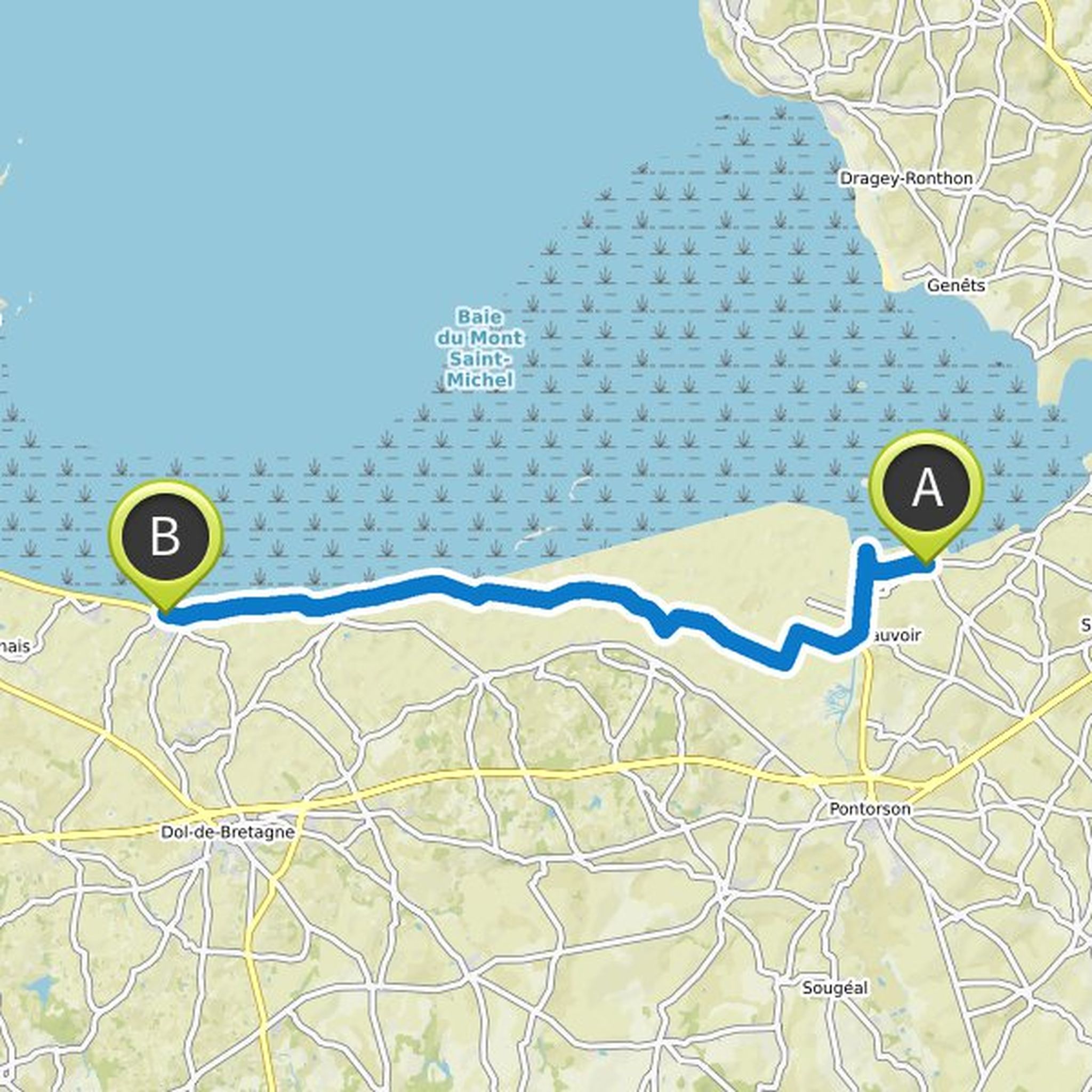
29. juni 2019
Lunch eg in Pontorson after about 50 km. There are even more alternatives in villages we pass earlier.
Oversat af Google •
29. juni 2019
Cancale after 14 km is known for its oysters.
Oversat af Google •