Timeline
Travel Charme planned a mountain bike ride
August 2, 2024
Time
Distance
Speed
Ascent
Descent
Travel Charme and Hotel Ifen planned a hike
July 20, 2022
Time
Distance
Speed
Ascent
Descent
mücke-bike, schreivogel and Iris like this.
Travel Charme planned a mountain bike ride
July 31, 2019
Time
Distance
Speed
Ascent
Descent
Mercader and Martin Wellner like this.
Travel Charme planned a mountain bike ride
July 31, 2019
Time
Distance
Speed
Ascent
Descent
August 1, 2019
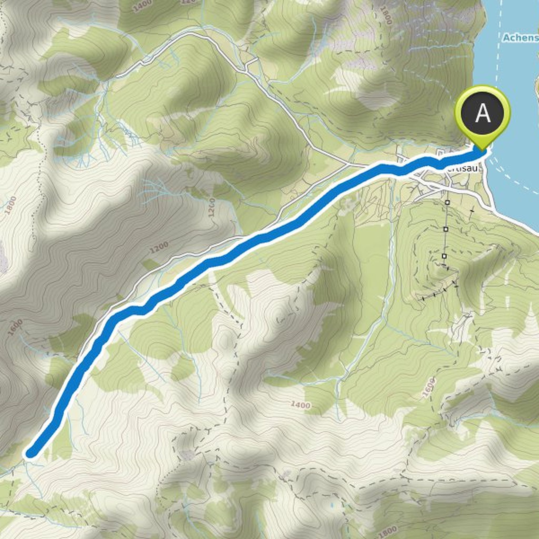
Although this beautiful round is only about 17 kilometers long, it still has something in it. Because it leads you up to over 1,600 meters to the idyllic Weißenbachalm. You usually drive over loose paths and demanding single trails. If you are looking for a small but challenging mountain adventure, then
Translated by Google •
Travel Charme planned a mountain bike ride
July 31, 2019
Time
Distance
Speed
Ascent
Descent

August 1, 2019
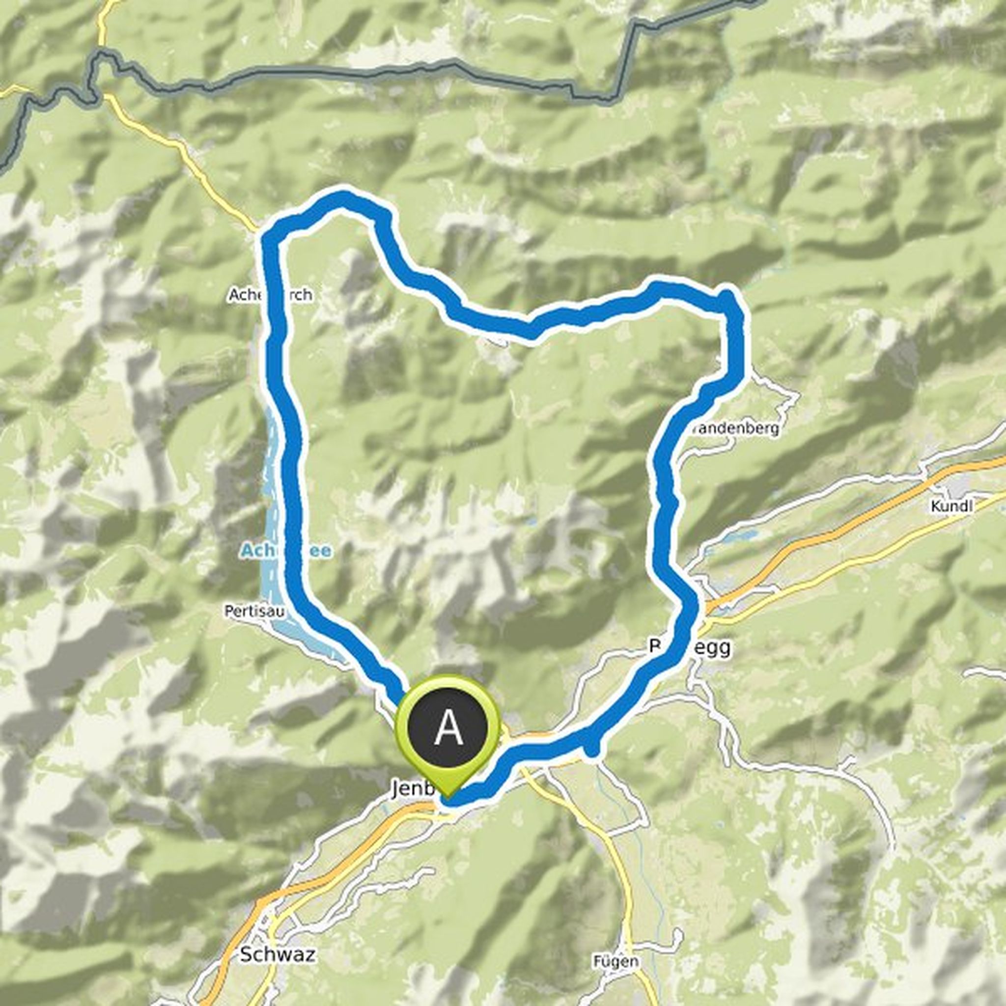
This challenging tour is just right for you if you want to spend a wonderful day in the mountains. It combines all the natural highlights that you can experience around the Achensee. You drive along the picturesque lake shore and make a detour to the Inn Valley. You master demanding climbs and enjoy
Translated by Google •
Travel Charme planned a mountain bike ride
July 31, 2019
Time
Distance
Speed
Ascent
Descent
August 1, 2019
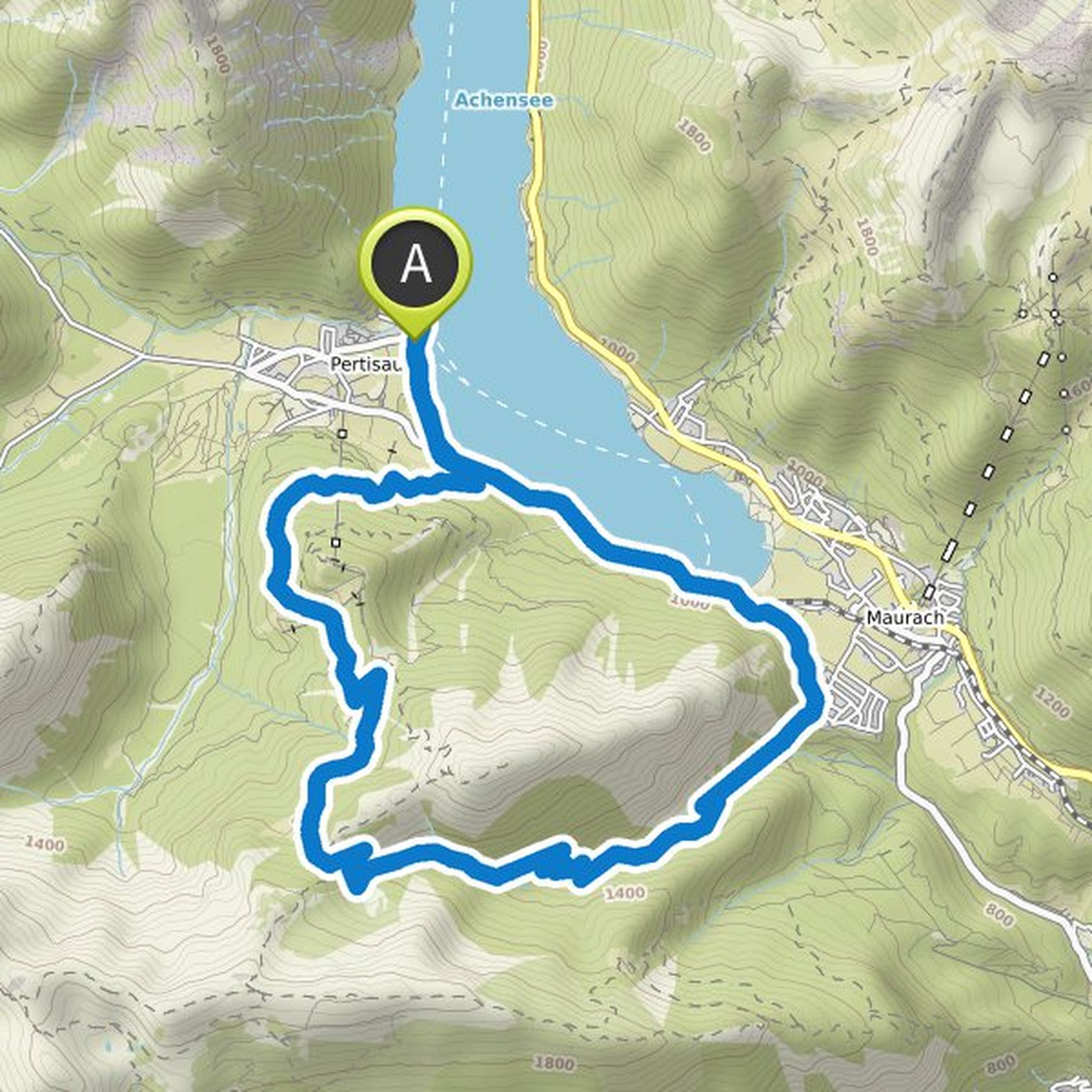
This short round is just right for you if you want to get to know the surrounding area around Pertisau in all its facets, without spending too much time and without wasting your time. It combines wonderful panoramic views, idyllic nature, wonderful tranquility and a rustic Refreshments on just about
Translated by Google •
Travel Charme planned a mountain bike ride
July 31, 2019
Time
Distance
Speed
Ascent
Descent

July 31, 2019
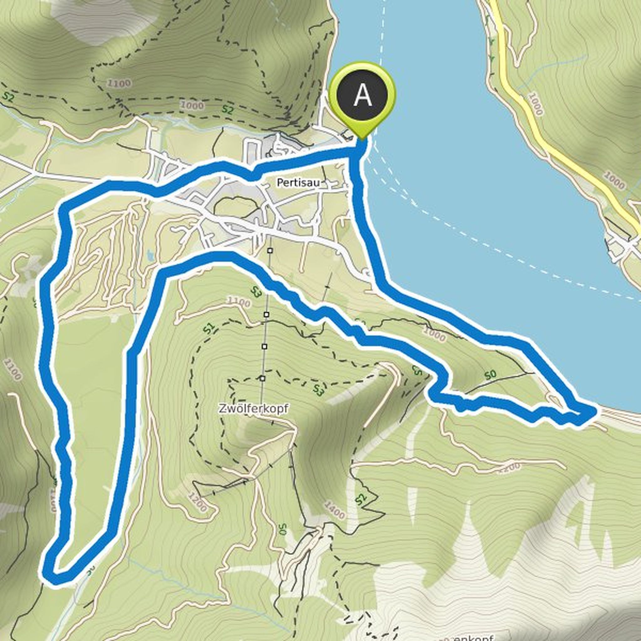
"Small but powerful," they say. Okay, for a bike tour fits "short but good" probably better. In any case, but it can be stated that it is less than six kilometers of this short tour fustdick behind the ears. For the first three kilometers, you'll master 480 altitude meters. Which also makes it clear
Translated by Google •
Travel Charme planned a mountain bike ride
July 31, 2019
Time
Distance
Speed
Ascent
Descent
July 31, 2019
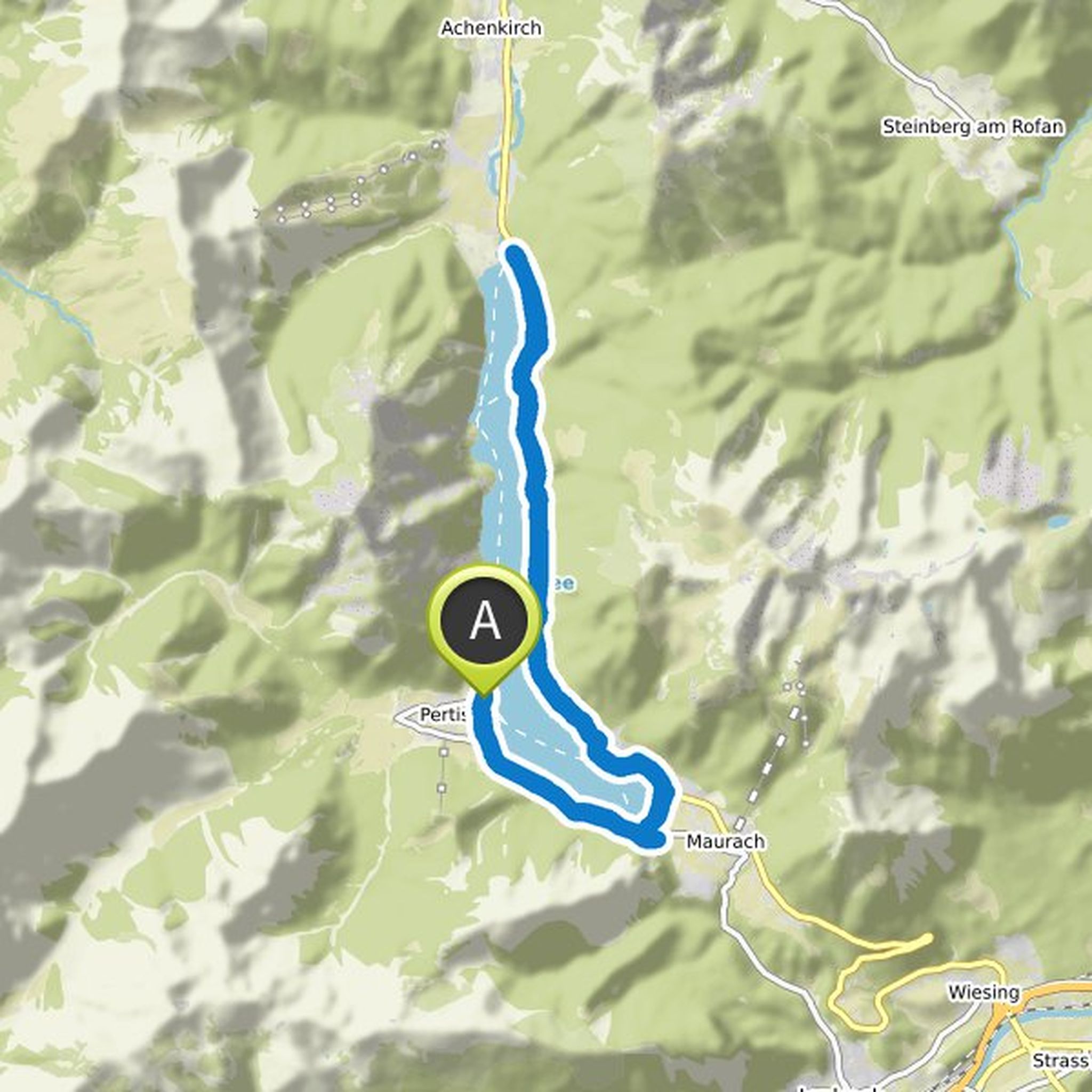
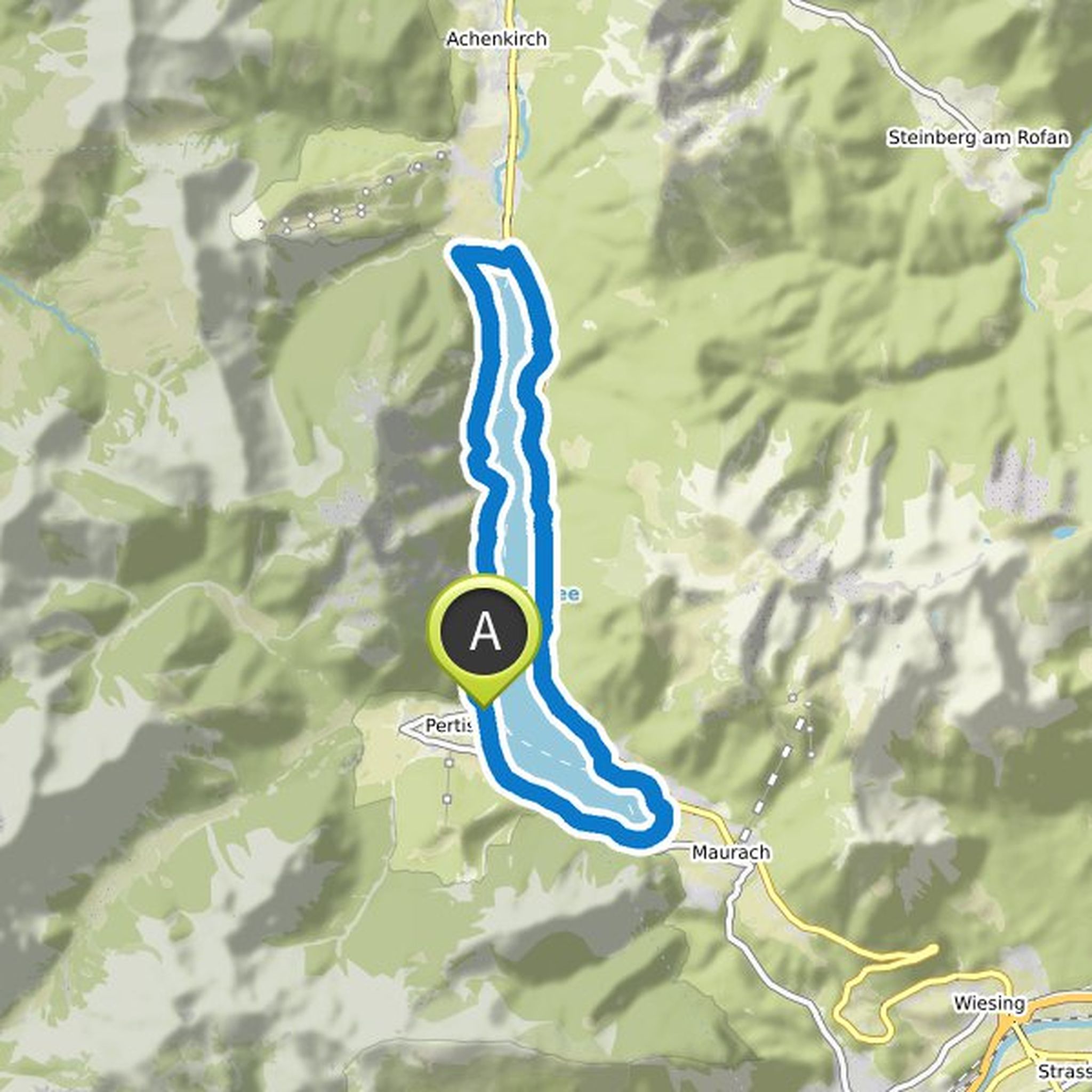
Turquoise blue water, excursion boats, swimming pools and surfers - on the shores of Lake Achen comes immediately holiday feeling on. On this tour, the perfect mix of beach, water and mountain panorama awaits you - and all this relaxed. Because the bike path on the shores of the Achensee runs almost
Translated by Google •
Travel Charme planned a mountain bike ride
July 31, 2019
Time
Distance
Speed
Ascent
Descent

July 31, 2019
From the shore of the Achensee, you set off. This tour takes you up to the summit of the Feilkopf, where a beautiful view awaits you. On the way you come to beautiful vantage points and cozy pastures over. Back on the same way - but only downhill!
The Feilkopf is 1,562 meters high - above you have a great
Translated by Google •
Travel Charme planned a hike
July 30, 2019
Time
Distance
Speed
Ascent
Descent
August 1, 2019
At 1,957 meters above sea level, the summit cross of the Ebner Joch sits at the southern tip of the Rofan. This twelve kilometer long hike takes you up there on a circular path. So that you can easily cope with the 900 meters in altitude, two refreshment stations are planned on the tour.
The hike starts
Translated by Google •
Travel Charme planned a hike
July 30, 2019
Time
Distance
Speed
Ascent
Descent
August 1, 2019
From the lake to the pasture, through the valley and on to the next pasture - that sounds like a perfect hiking day. This 17 kilometer long hike starts on the shores of Lake Achen in Pertisau. You walk through the village and start your climb to Falzthurnalm. On the way you already have beautiful views
Translated by Google •
Travel Charme planned a hike
July 30, 2019
Time
Distance
Speed
Ascent
Descent
August 1, 2019
In this good six-kilometer hike to Dalfazalm you can look forward to pure alpine idyll. The tour starts in Buchau on the shore of the Achensee. Although 720 meters are waiting for you, but the slope is moderate and the landscape is beautiful.
After just over a kilometer, the first highlight is the Dalfaz
Translated by Google •
Travel Charme planned a mountaineering activity
July 30, 2019
Time
Distance
Speed
Ascent
Descent
August 1, 2019
The Achensee forms the border between the Karwendel Mountains in the west and the Brandenberger Alps in the east. It is up to 133 meters deep and the largest lake in Tyrol. By the way, with excellent water quality. Reason enough to get to know the beautiful lake. This hike takes you around, almost exclusively
Translated by Google •
Travel Charme planned a hike
July 30, 2019
Time
Distance
Speed
Ascent
Descent

July 31, 2019
On this seven-kilometer circular walk you have almost always the Achensee in view - but from different perspectives. Let's start the leisurely hike on the lakeshore in Pertisau.
You walk through the village and then leisurely uphill to Rodlhütte. In winter, you can start to tobogganing here, in summer
Translated by Google •
Travel Charme planned a mountaineering activity
July 30, 2019
Time
Distance
Speed
Ascent
Descent
August 1, 2019
Today you experience a tightrope walk like a picture book. From the Seekarspitze to the Seebergspitze, you can walk along a narrow path along the ridge and have spectacular views of the Achensee and the surrounding mountain peaks. With more than 1,500 vertical meters, it has a good 15-kilometer hike
Translated by Google •
August 1, 2019
Wonderful mountains, cozy mountain pastures and also a boat trip - this tour really offers everything for a pleasurable mountain bike ride around the "Unnütze", a mountain massif northeast of the Achensee. And best of all: Even if the round requires some stamina, it is still suitable for beginners. Most
Translated by Google •