グリューネンダイヒのおすすめランニングルート
4.4
(442)
5,420
ランナー
12
ランニング
グリューネンダイヒでランニングを楽しめば、このエリアをより深く知ることができます。ランニングに適した美しいルートが見つかるように、komootがグリューネンダイヒでのルートのコレクション全体を評価して選び抜いた、人気ランニングトレイルをご紹介します。ルートをクリックして詳細を表示し、他のユーザーがアップロードした役立つ情報や写真を閲覧しましょう。
最終更新日: 10月 22, 2026
5.0
(2)
31
ランナー
11.0km
01:10
10m
10m
中程度のジョギング. ある程度のフィットネスレベルが必要です。 ほとんどが舗装路です。
13
ランナー
13.6km
01:28
10m
10m
中程度のジョギング. ある程度のフィットネスレベルが必要です。 ほとんどが舗装路です。

15
ランナー
4.22km
00:26
0m
0m
初級者向けランニング. ほとんどが舗装路です。
10
ランナー
16.0km
01:44
10m
10m
難しいジョギング. 標準以上のフィットネスレベルが必要です。 ほとんどが舗装路です。
11
ランナー
4.61km
00:28
10m
10m
初級者向けランニング. ほとんどが舗装路です。
さらに多くのルートや他のユーザーのおすすめ情報を確認できます。
すでにアカウントをお持ちですか?
おすすめのツアーは他のkomootユーザーが実際に経験した何千ものアクティビティに基づいています。
無料アカウントで今日から始めよう
次の冒険が待っています。


コミュニティからのヒント

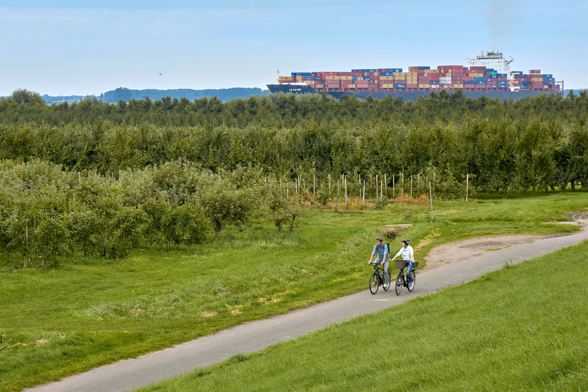
アルテス・ラントのリューエ・アンレーガーは、エルベ川沿いの人気の観光地です。ここには、ニーダーザクセン州とシュレースヴィヒ=ホルシュタイン州(ヴェーデル)を結ぶリューエ=シュラウ・フェリーがあります。この港は、サイクリスト、ハイカー、観光客、船愛好家にとって中心的な待ち合わせ場所です。周辺はアルテス・ラントの果樹園が特徴で、ハンブルクの近くにあります。
1
0
ゾムフレーターヴィシュ上部灯台は、ヨルクのヴィシュ地区にある歴史的な高さ35メートルの六角形の鋼鉄格子塔です。1907年の運用開始以来、下部灯台と共に、エルベ川下流の船舶交通のための重要な灯台線路を形成しています。一目でわかるデータ塔の高さ、35.4メートル。灯火の高さ、32メートル。航続距離、最大16海里約30km。構造、赤と白の縞模様の鋼鉄格子塔。場所、エルベ川岸のクライナー・シュトランドの近く。この塔は無人で遠隔操作されています。1991年には、歴史的な光学装置が最新の精密投光器に置き換えられました。エルベ川を上る船の方向指示灯として機能します。エルベ川の船の船体は年々高くなったため、灯台線を引き続き最適に利用するために、2010年に新しい、少し先に位置する下部灯台が設置されなければなりませんでした。 素晴らしい日帰り旅行先であり、素晴らしいサイクリングコースやハイキングコースがここを通っています。
2
0
リューエ・アンレーガー沿いの素晴らしいサイクリングコースとハイキングコースです。一年中いつでも訪れる価値があります。リューエ・シュラウ・フェリーは、一日に何度もシュラウへ向かって運航しています。大きな子供の遊び場があり、美しい休憩スペースがたくさんあります。多くのキオスクが美味しい軽食を提供しており、訪れる価値があります。 リューエ・アンレーガーの向かい側には、観光案内所のすぐ隣に公衆トイレがあります。
7
0
美しい自然の中、リューデヒ(Lühe Deich)沿いに素晴らしいサイクリングコースとハイキングコースがあります。
1
0

A great cycling and hiking trail leads along here amidst beautiful nature.
1
0
This is what defines the Altes Land: Fruit growing and shipping. The proximity to the Elbe River and the metropolis of Hamburg has shaped the Altes Land for centuries. Whether in spring during cherry blossom season or in summer and autumn during harvest time, visitors can discover a wealth of attractions here. Above all, the enchanting landscape, as well as cultural events and its sights, from the lighthouse to the Arp Schnitger organ. The Altes Land is a wonderful and unique region. It stretches from the outskirts of Hamburg for over 30 km south of the Elbe to the Hanseatic city of Stade. The area encompasses the entire municipality of Jork, the collective municipality of Lühe, and the Neu Wulmstorf district of Rübke in Lower Saxony, as well as the Hamburg districts of Neuenfelde, C.ranz, and Francop. The Elbe's tributaries—the Schwinge, the Lühe, and the Este—divide the Altes Land into three sections: the first, second, and third mile from west to east.
1
0
The Lühe landing stage is always worth a visit; it's beautiful here, with ever-changing scenery and large ships to see. Ample parking is available, as well as numerous restaurants offering a variety of delicious options. There are plenty of seating areas and a children's playground, as well as parking for camper vans and motorcycles. Due to the risk of storm surges or flooding, the stalls at the Lühe landing stage are removed in late autumn. When flood warnings are issued, the floodgate is also closed, as was the case today following yesterday's weather warning.
1
0
グリューネンダイヒでのの人気観光スポット

komootモバイルアプリでインスピレーションを得よう


さらに探索
他の地域の最高のランニングトレイル & ルートを見てみましょう。
