バリーレッソンのおすすめライド
4.5
(110)
5,666
ライダー
383
ライド
ロードサイクリングルートは、ラガン川と周囲の森林が特徴的な景色の良いラガンバレーに位置しています。このエリアは、川沿いの道や緩やかな上り坂など、多様な地形を提供しており、様々なサイクリングスキルレベルに適しています。ラガン・トウパス(Lagan Towpath)に近いことから、ほとんど交通のない道へのアクセスが可能です。この景観は、自然の美しさと歴史的な見どころが融合しており、ルートはしばしばラガンバレー・リージョナルパークを通過したり、その近くを通ったりします。
Ballylesson周辺の最高のロードサイクリングルート
- 最も人気のあるロードサイクリングルートは、フォー・ウィンズ発キルムッド教会ループで、距離34.4マイル(55.4 km)、所要時間2時間28分です。この中程度の難易度のルートは、地元の田園地帯を巡る充実した周回コースです。
- 地元のロードサイクリストに人気のもう一つのルートは、フォースター・グリーン病院発キン・アンド・フォーク・カフェ – ヒルトップ・ビュー・ループで、距離30.9マイル(49.7 km)の中程度の難易度のコースです。このルートからは、周囲の景色の高い場所からの眺めを楽しむことができます。
- 地元のロードサイクリストに愛されているのは、キャリダフ発キン・アンド・フォーク・カフェ – キルムッド教会ループで、距離29.7マイル(47.9 km)のこのルートは、変化に富んだ地形と田園風景を通り抜け、所要時間は約2時間2分です。
- Ballylesson周辺のロードサイクリングは、ラガン川沿いの川沿いの道、静かな森林、そしてアクセスしやすいラガン・トウパスによって特徴づけられます。このネットワークは、ゆったりとしたライドから適度な獲得標高のあるより挑戦的なルートまで、様々なスキルレベルに対応するオプションを提供します。
- Ballylessonのルートは、100件以上のレビューで平均4.6つ星を獲得しており、komootコミュニティから高く評価されています。6,000人以上のロードサイクリストがkomootを利用して、Ballylessonの多様な地形を探索しています。
最終更新日: 8月 26, 2026
15
ライダー
54.6km
02:25
390m
390m
中程度のロードライド. ある程度のフィットネスレベルが必要です。 全般的に舗装状態が良好で走行しやすい道です。
8
ライダー
49.8km
02:18
410m
410m
中程度のロードライド. ある程度のフィットネスレベルが必要です。 全般的に舗装状態が良好で走行しやすい道です。

無料新規登録
6
ライダー
47.9km
02:02
330m
330m
中程度のロードライド. ある程度のフィットネスレベルが必要です。 全般的に舗装状態が良好で走行しやすい道です。
6
ライダー
中程度のロードライド. ある程度のフィットネスレベルが必要です。 全般的に舗装状態が良好で走行しやすい道です。
7
ライダー
14.7km
00:34
50m
50m
初級者向けロードバイクライド. あらゆるフィットネスレベルに適しています。 全般的に舗装状態が良好で走行しやすい道です。
さらに多くのルートや他のユーザーのおすすめ情報を確認できます。
無料新規登録
すでにアカウントをお持ちですか?
おすすめのツアーは他のkomootユーザーが実際に経験した何千ものアクティビティに基づいています。
無料アカウントで今日から始めよう
次の冒険が待っています。
ログインまたは登録
コミュニティからのヒント

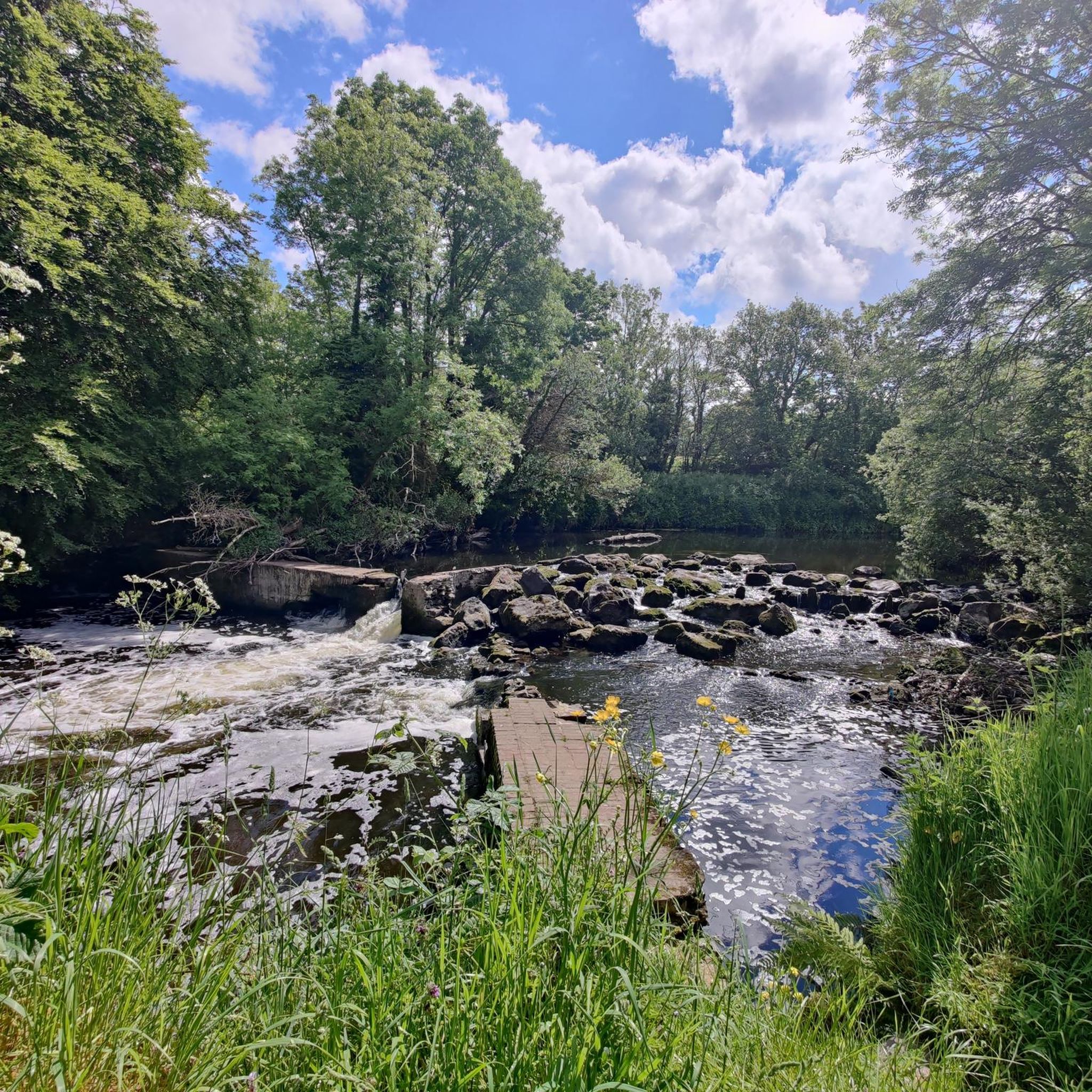
The path, which is part of National Cycle Route 9, offers a peaceful atmosphere that is ideal for relaxed bike rides - but walkers, joggers and dog owners also appreciate the route. The contrast between the quiet river and the partially flooded sections that can appear after heavy rain is particularly exciting. Sometimes the path leads directly to the water, and it almost seems as if the Lagan wants to reclaim a bit more space. The trees are reflected in the calm waters, which creates an almost mystical atmosphere in cloudy weather. Another highlight are the small, branching mountain bike trails that bring a bit of adventure to the tour. If you want a change and don't just want to follow the river, these trails offer a welcome change.
1
0
The path, which is part of National Cycle Route 9, offers a peaceful atmosphere that is ideal for relaxed bike rides - but walkers, joggers and dog owners also appreciate the route. The contrast between the quiet river and the partially flooded sections that can appear after heavy rain is particularly exciting. Sometimes the path leads directly to the water and it almost seems as if the Lagan wants to reclaim a bit more space. The trees are reflected in the calm waters, which creates an almost mystical atmosphere in cloudy weather. Another highlight are the small, branching mountain bike trails that bring a bit of adventure to the tour. If you want a change and don't just want to follow the river, these trails offer a welcome change.
0
0
The park covers almost 130 hectares and offers a variety of landscapes - from wide meadows and shady woodlands to manicured rose and Japanese gardens. The International Rose Trials, which take place here every year, are particularly exciting. If you come at the right time, you can admire an impressive variety of roses, which are judged by international experts. But the park has a lot to offer away from the roses in bloom: whether you just want to take a quiet walk in the Walled Garden, explore the Japanese Garden or challenge yourself on the orienteering course - everyone will find a favorite spot here. A small café provides refreshments and the playground also has something for younger visitors. The park has many hidden corners that make it an ideal stop to recharge.
0
0
The truncated round tower rises from afar, its massive structure still preserved up to 10.7 metres. Originally, the tower served not only as a spiritual place, but also offered a strategic view over the valley - a real advantage for spotting any Viking raids early on. The history of the nearby monastery, which is associated with St. Mochumma, is also interesting. It is said that the site was looted in 1130 and that the remains of a church were discovered near the tower as late as the 18th century. The beam holes inside suggest that the six floors were made of wood and offered a certain level of comfort.
1
0


The Sir Thomas and Lady Dixon Park is one of the most popular green spaces in Belfast. The park covers a huge area – 130 acres (52 ha) in total. The park has lots of diverse landscapes including woodland, formal rose gardens, meadows, riverside fields, a Japanese garden and a walled garden.
2
0

One of the most popular outdoor spots in the province. The Towpath is part of the Ulster Way. You can walk, run or cycle completely traffic free from the Castlereagh hills to Lisburn.
1
0
A familiar sight for anyone travelling through the village of Drumbo. The monastery is associated with St Mochumma, a brother of St Domangard. The site was plundered by Connor, son of Artgal McLochlin in 1130. Remains of a church were noted in the 18th century close to the Round Tower. This truncated Irish round tower survives to a height of 10.7m. Inside there are beam holes indicating that the internal floors were of timber. There are six surviving levels including the basement. Wonderfully placed with the hills in the background.
0
0
バリーレッソンでのの人気観光スポット

komootモバイルアプリでインスピレーションを得よう


さらに探索
他の地域の最高のロードサイクリングルートを見てみましょう。
