グレートシェルフォード教区のおすすめツーリングルート
4.6
(35)
442
ライダー
36
ライド
グレートシェルフォード教区でおすすめのサイクリングルートをお探しですか?行きたいルートを簡単に決められるように、このページではグレートシェルフォード教区周辺の人気バイクライドをご紹介します。 ぜひ、お気に入りのルートを見つけてください。
最終更新日: 7月 20, 2026
3.5
(4)
50
ライダー
19.6km
01:07
70m
70m
初級者向けバイクライド. あらゆるフィットネスレベルに適しています。 全般的に舗装された状態です。あらゆるスキルレベルに適しています。
47
ライダー
11.5km
00:39
20m
20m
初級者向けバイクライド. あらゆるフィットネスレベルに適しています。 全般的に舗装された状態です。あらゆるスキルレベルに適しています。

無料新規登録
3.8
(4)
30
ライダー
89.2km
05:15
420m
420m
難しい自転車ライド. 標準以上のフィットネスレベルが必要です。 全般的に舗装された状態です。あらゆるスキルレベルに適しています。
22
ライダー
42.1km
03:21
340m
340m
中程度の自転車ライド. ある程度のフィットネスレベルが必要です。 全般的に舗装された状態です。あらゆるスキルレベルに適しています。
4.3
(7)
33
ライダー
40.4km
02:26
90m
90m
中程度の自転車ライド. ある程度のフィットネスレベルが必要です。 全般的に舗装された状態です。あらゆるスキルレベルに適しています。
さらに多くのルートや他のユーザーのおすすめ情報を確認できます。
無料新規登録
すでにアカウントをお持ちですか?
おすすめのツアーは他のkomootユーザーが実際に経験した何千ものアクティビティに基づいています。
無料アカウントで今日から始めよう
次の冒険が待っています。
ログインまたは登録

コミュニティからのヒント

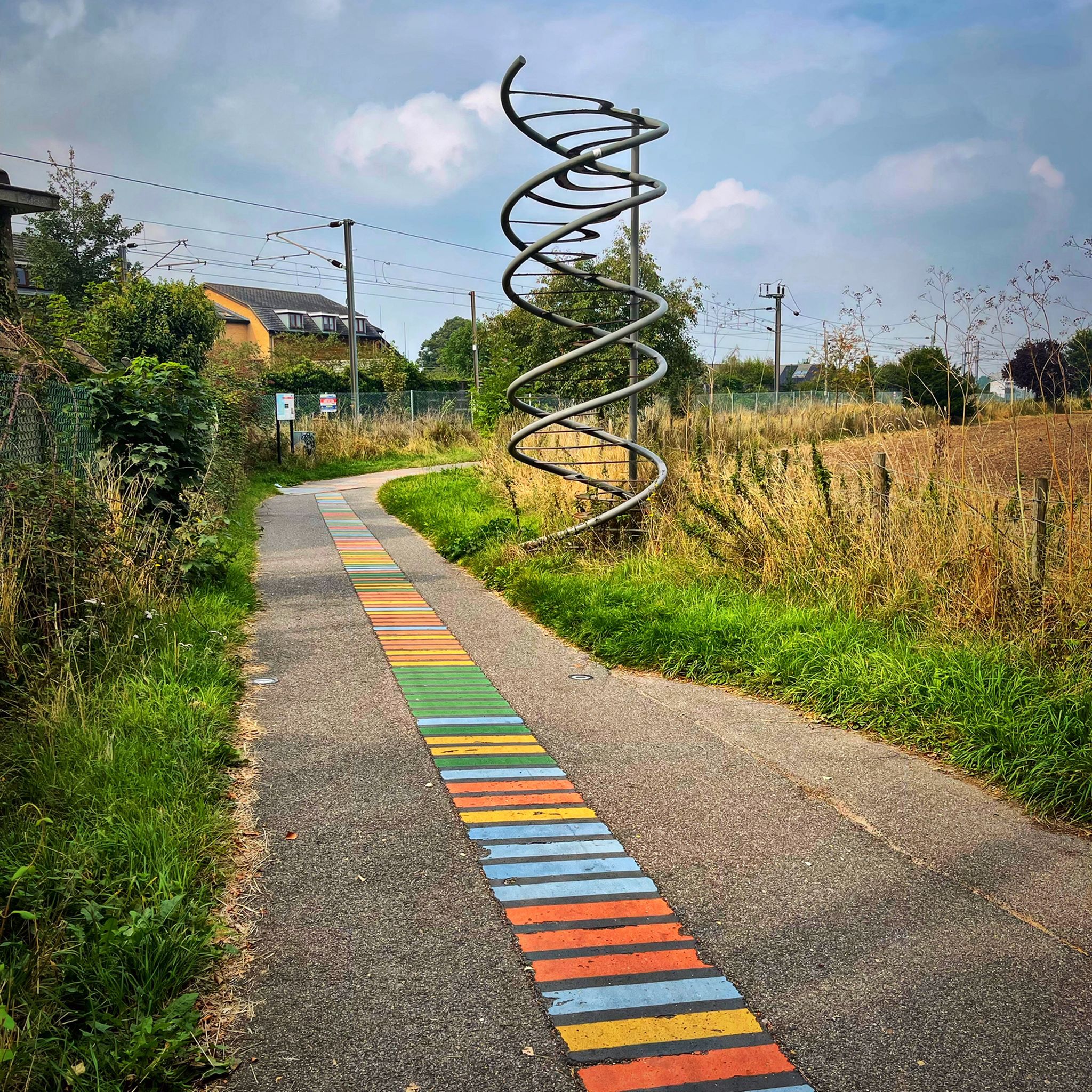
Lovely bit of street art on the side of the Chisholm Trail bridge.
1
0

The Windmill at Fulbourn stands on an outlier of the Gog Magog Hills 4 miles east of the City of Cambridge. Low chalk hills run to the south of it; northwards the Windmill overlooks the Fens which are at most only a few feet above sea level. The cap of the Windmill rises to 160 feet above sea-level and from it there is an uninterrupted view of the roofs and towers of Ely Cathedral. It has long been an outstanding landmark in the south Cambridgeshire countryside. It was the enclosure of the parish for the improvement of cultivation that led to the building of the present Windmill. Much of the land in the north of the parish was low-lying and waterlogged and needed draining to convert it into profitable arable land. Fulbourn Fen was a peat fen only 20 feet above sea level over which the Great Wilbraham River spread its waters in times of flood. The Act of Enclosure for Fulbourn was passed in 1806 and the Commissioners completed their work two years later. The drainage of the parish reduced the level of water in the upper reaches of the Great Wilbraham River on which the manorial watermill was situated. The loss of power brought to an end the life of a mill which had first been recorded in Domesday Book. In 1808 the machinery of the watermill was put up for sale. A new mill was therefore needed and the Enclosure Commissioners allotted one acre on Mill Hill, on which to build a mill and miller’s cottage, to John Chaplin, a considerable landowner and farmer. He used copies of Old Moore’s Almanack as a diary, entering personal events and business notes in the margins of the calendar. In 1808 he recorded against 11 July, ‘I laid the first brick of my mill’; 22 November, ‘Mill sails put up’; 15 December, ‘Began grinding’. It is a large octagonal smock mill with a brick base and wooden superstructure. Its outline is squat with a shallow conical cap. The fantail, as usual in Cambridgeshire mills, is close against the cap. The mill holds three stones, one of French burr and two of Derbyshire stone. With floors 24 feet in diameter, there is exceptional space for working the mill. (https://fulbournwindmill.org.uk/history.html)
1
0

As you go past the water tower, turn right (straight is Rivey Lane) down the gravel access road onto the Icknield way. Keep heading straight. After the woods on the left you'll see a small farmer's field, and a path on the left taking you down to Linton.
0
0

A nice peaceful towpath ( if it’s quiet) runs from Chesterton, past Milton and ends at Clayhithe bridge.
0
0
A good place to cross the river Cam, makes a good short cut from Newmarket Road to Chesterton.
0
0
A pleasant ride along the river Cam, cycle paths are smooth and fast flowing, look out for cows, they have a habit of hanging out near the gates!
0
0

グレートシェルフォード教区でのの人気観光スポット

komootモバイルアプリでインスピレーションを得よう


さらに探索
他の地域の最高のサイクリングルートを見てみましょう。
