コピアーノのおすすめランニングルート
4.4
(12)
605
ランナー
66
ランニング
コピアーノ周辺のジョギングは、ポー平野の農耕地、川沿いの小道、静かな田園風景を特徴とする田園地帯を巡るルートを提供します。地形は一般的に平坦または緩やかに起伏しており、様々な体力レベルに適しており、アクセスしやすいランニングが可能です。この地域は、ユネスコ生物圏保護区であるティチーノ川流域自然公園に近接しているという利点があり、森や湿地帯を含む多様な環境と小道のネットワークを提供しています。
コピアーノ周辺のベストジョギングルート
最も人気のあるジョギングルートは、所要時間46分、距離7.2kmのベルジョイオーゾからのランニングループです。この中程度の難易度のルートからは、周囲の田園風景を眺めることができます。
地元のランナーに人気のもう一つのルートは、所要時間約46分、距離11.3kmの中程度の難易度のインヴェルノ・エ・モンテレオーネからのランニングループです。このルートは開けた畑や田舎道を通り、一貫したランニングサーフェスを提供します。
地元のランナーに愛されているのは、距離7.2km、所要時間約46分のリナローロからの緑のループにある景色の良い道です。このルートは農耕地を通り抜けます。
コピアーノ周辺のジョギングは、平和な田園地帯の小道、農耕地、そしてヴィア・フランチェーナのような歴史的なルートによって特徴づけられます。このネットワークは、簡単なジョギングから長いランニングルートまで、様々なスキルレベルに対応するオプションを提供します。
コピアーノのルートは、5件以上のレビューから平均4.8つ星という高評価をkomootコミュニティから受けています。400人以上のランナーがkomootを利用して、コピアーノの多様な地形を探検しました。
最終更新日: 8月 25, 2026
10
ランナー
25.9km
02:56
360m
360m
難しいジョギング. 標準以上のフィットネスレベルが必要です。 全般的に舗装された状態です。あらゆるスキルレベルに適しています。
12
ランナー
11.3km
01:16
130m
130m
中程度のジョギング. ある程度のフィットネスレベルが必要です。 全般的に舗装された状態です。あらゆるスキルレベルに適しています。

無料新規登録
13
ランナー
7.15km
00:46
10m
10m
中程度のジョギング. ある程度のフィットネスレベルが必要です。 全般的に舗装された状態です。あらゆるスキルレベルに適しています。
5.0
(1)
9
ランナー
14.5km
01:30
50m
50m
中程度のジョギング. ある程度のフィットネスレベルが必要です。 全般的に舗装された状態です。あらゆるスキルレベルに適しています。
5.0
(1)
5
ランナー
7.15km
00:46
10m
10m
中程度のジョギング. ある程度のフィットネスレベルが必要です。 全般的に舗装された状態です。あらゆるスキルレベルに適しています。
さらに多くのルートや他のユーザーのおすすめ情報を確認できます。
無料新規登録
すでにアカウントをお持ちですか?
おすすめのツアーは他のkomootユーザーが実際に経験した何千ものアクティビティに基づいています。
無料アカウントで今日から始めよう
次の冒険が待っています。
ログインまたは登録

コミュニティからのヒント

ミラドロ・テルメの丘は、バニーネの丘の麓に位置し、ロンバルディア州パヴィア県にあるコッリナ・ディ・サン・コロンバーノの地域間関心地域公園内にあります。この森林地帯からは、ポー平原とオルトレポ・パヴェーゼのパノラマビューが楽しめ、自然の小道、マウンテンバイクコース、歴史的な温泉が豊富にあります。
0
0

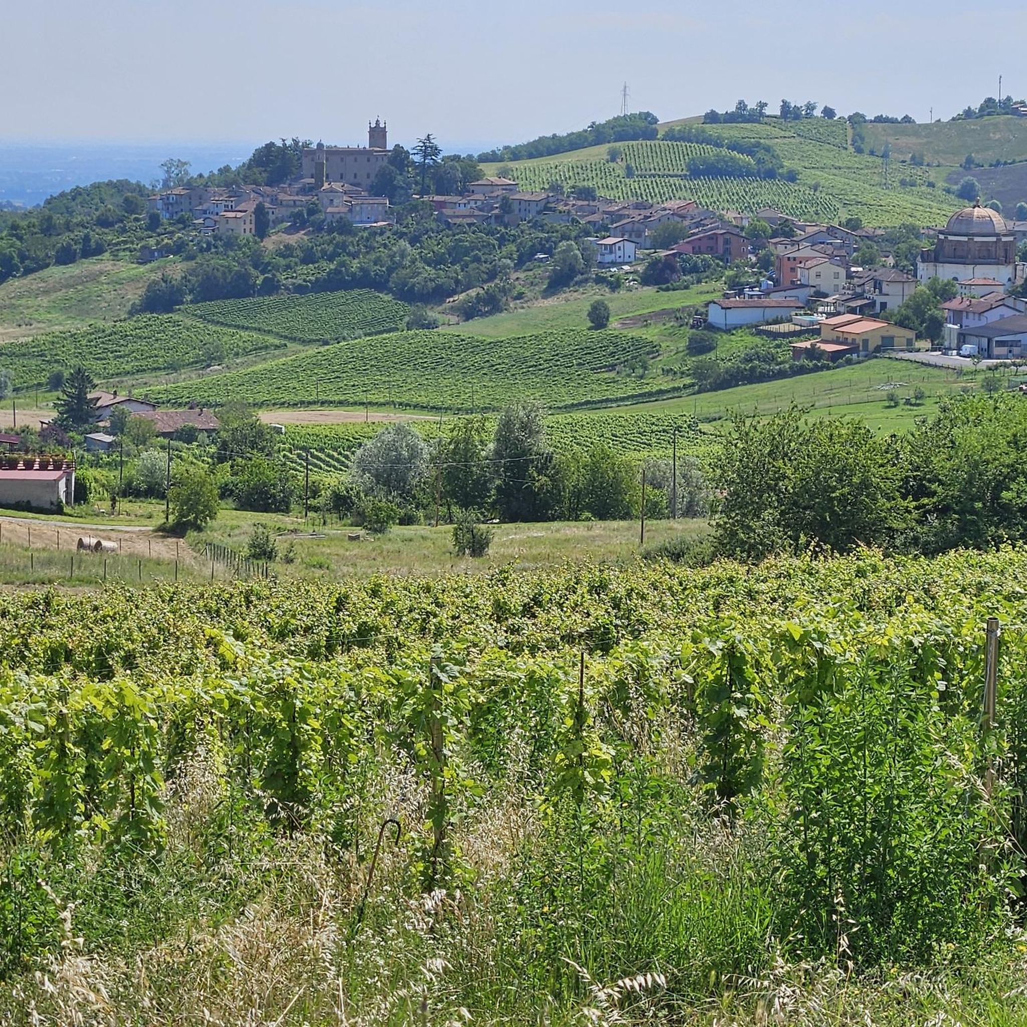
サン・コロンバーノ城(またはベルジョイオーソ城)は、そのブドウ畑とミラノ県における飛び地として有名な中世の村にあります。6世紀にさかのぼり、1164年にバルバロッサによって再建されたこの城は、私有地(ロッカ)と市営地(リチェット)に分かれています。
0
0

The Via Francigena passes through the municipality of Linarolo, which belonged to the Order of the Knights Templar. The passage of pilgrims is confirmed by the existence, in the past, of a hospital for the Romans, mentioned by the Duke of Milan Gian Galeazzo Visconti in his Itinerary for pilgrims on the way to Rome, dated 1400. The woods and the proximity of the river were the ideal setting for nature walks and the re-enactment of an evocative history. The city is located in an area that was very popular in the Middle Ages, where the Strada Regina passed, via San Leonardo and Ospedaletto. The road connected Piacenza with Pavia along the Po and was the continuation of the Via Emilia (Rimini-Piacenza).
3
0

It's impossible to think of passing through here without visiting the town's castle. Its origins seem to date back to the 6th century but over time it underwent numerous transformations and rearrangements, resulting from the needs of the owners who followed one another over the centuries. First there was Frederick I, known as Barbarossa, who destroyed the previous castle to rebuild it. There were the Visconti-Sforzas and finally the Belgioioso family. The structure of the castle is divided into two parts: on one side the shelter, i.e. the area where daily life took place, on the other the fortress, with military functions and for this reason located high up on the hillside.
1
0
The Via Francigena runs through the municipality of Linarolo, which belonged to the Order of the Knights Templar. The passage of pilgrims is confirmed by the existence, in the past, of a hospital for the Romans, mentioned by the Duke of Milan Gian Galeazzo Visconti in his Itinerary for pilgrims on their way to Rome, dated 1400. The forests and the proximity of the river provided the ideal setting for nature walks and reenacting an evocative history. The town is located in an area that was very popular in the Middle Ages, where the Strada Regina passed, via San Leonardo and Ospedaletto. The road connected Piacenza with Pavia along the Po and was the continuation of the Via Emilia (Rimini-Piacenza). Wikipedia
7
0


It is a house with a farmhouse, attached to other buildings that are now empty or have become homes but which were once a convent of the Diocese of Pavia. The building was built shortly after 1881 when the entire area was purchased by the bishop of Pavia, Mons. Agostino Riboldi, as a holiday home and from there began restoration work and adaptation to the new use.
1
0
The "Colle di San Colombano" rises between the Lodi plain and the lower Pavia area, in an area located about 40 km south of Milan and 30 km east of Pavia. The soil, which alternates sandy areas with limestone areas, the subsoil rich in minerals (as evidenced by the spring waters of the Terme di Miradolo and the Mineral Fonti Gerette di San Colombano), the exposure to the sun of its slopes, make the Colle an environment ideal and suited for the cultivation of vines.
2
1
コピアーノでのの人気観光スポット

komootモバイルアプリでインスピレーションを得よう


さらに探索
他の地域の最高のランニングトレイル & ルートを見てみましょう。
