ラペルニア周辺のおすすめ交通量の少ないサイクリングルート
4.0
(1)
16
ライダー
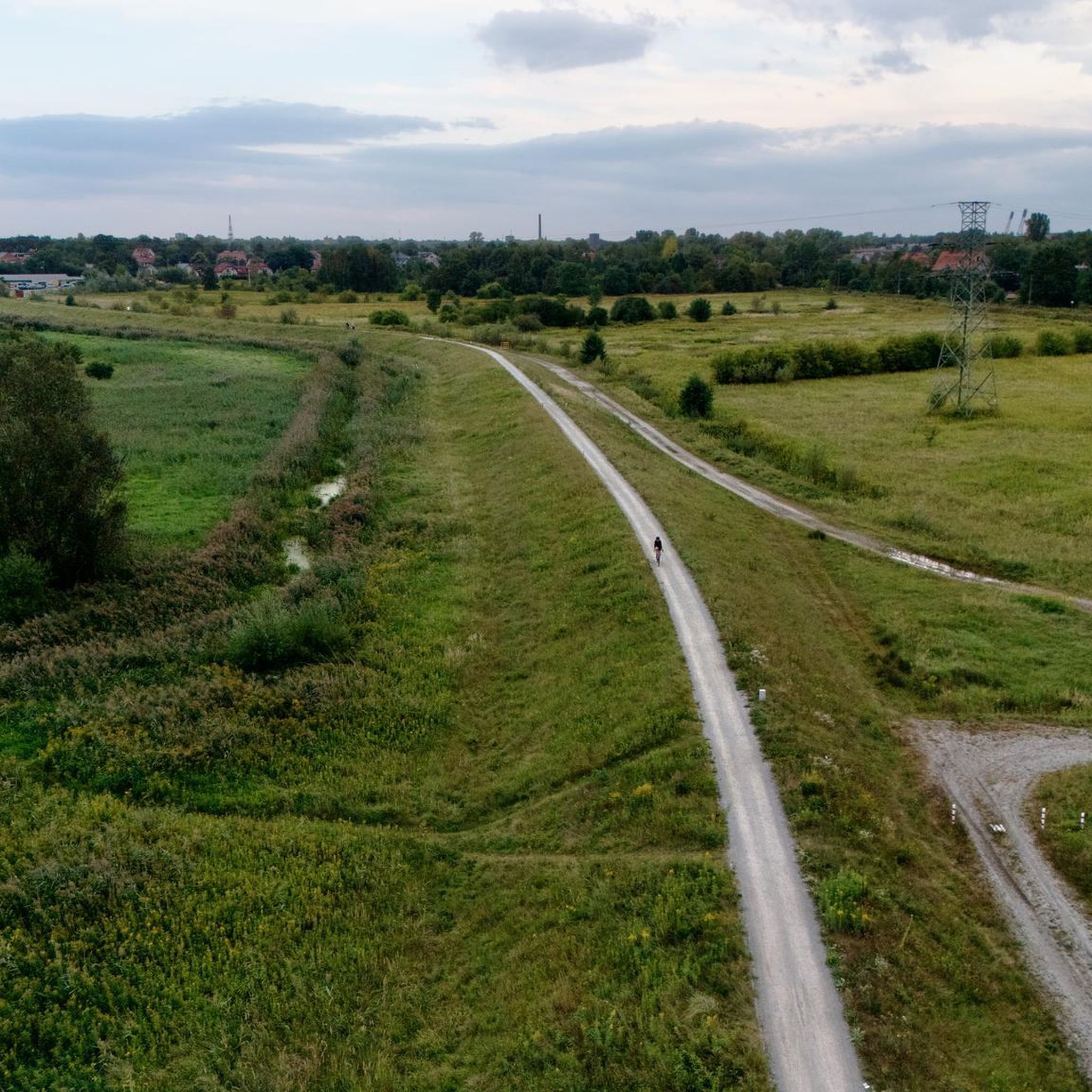
ラ・ペルニア周辺のグラベルサイクリングは、モンターニャ・パレンティーナ自然公園内の多様な地形を提供し、豊かな自然、緑豊かな谷、美しい峰々が特徴です。この地域には、コンパクトな農道や林道があり、グラベルサイクリングに適した変化に富んだ地形を提供しています。ルートは、川沿いの道から山の登攀まで多岐にわたり、標高は800メートルを超えます。このエリアは、二輪で自然の景観や史跡を探索するのに静かな環境を提供します。
ラ・ペルニア周辺で交通量の少ない最高のグラベルバイクコース
- 最も人気のある交通量の少ないグラベルバイクコースは、セルベラ・デ・ピスエルガ発セルベラ・デ・ピスエルガ周回コースです。このコースは26.3マイル(42.3 km)で、所要時間は3時間9分、変化に富んだ風景の中をかなりの獲得標高を伴います。
- 地元のグラベルバイカーに人気のもう一つのコースは、セルベラ・デ・ピスエルガ発サリナス・デ・ピスエルガ橋 – サン・ミゲル大学教会周回コースです。これは44.5マイル(71.6 km)の難易度の高いルートで、谷を横切り、歴史的建造物の景色を楽しめます。
- 地元のグラベルバイカーに愛されているのは、セルベラ・デ・ピスエルガ発サリナス・デ・ピスエルガ橋 – セルベラ・デ・ピスエルガ周回コースです。これは17.2マイル(27.7 km)のルートで、川沿いの谷や森林地帯を通り抜け、所要時間は約1時間41分です。
- ラ・ペルニア周辺のグラベルサイクリングは、豊かな自然、緑豊かな谷、美しい峰々が特徴で、コンパクトな農道や林道を利用したルートがあります。このネットワークは、中級から上級まで、さまざまなレベルのサイクリストに対応しています。
- このガイドには、この地域の景色の素晴らしさを紹介する高評価のルートが含まれています。
最終更新日: 9月 2, 2026
4.0
(1)
6
ライダー
42.3km
03:10
560m
560m
難しいグラベルライド. 標準以上のフィットネスレベルが必要です。 全般的に舗装された状態です。あらゆるスキルレベルに適しています。
5
ライダー
27.7km
01:41
180m
180m
中程度のグラベルライド. ある程度のフィットネスレベルが必要です。 全般的に舗装された状態です。あらゆるスキルレベルに適しています。

無料新規登録
3
ライダー
40.2km
02:58
530m
530m
難しいグラベルライド. 標準以上のフィットネスレベルが必要です。 ツアーの一部で自転車を押して歩く必要があるかもしれません。
2
ライダー
30.7km
02:14
410m
410m
中程度のグラベルライド. ある程度のフィットネスレベルが必要です。 全般的に舗装された状態です。あらゆるスキルレベルに適しています。
おすすめのツアーは他のkomootユーザーが実際に経験した何千ものアクティビティに基づいています。
無料アカウントで今日から始めよう
次の冒険が待っています。
ログインまたは登録



コミュニティからのヒント

セルベラ・デ・ピスエルガ(Cervera de Pisuerga)の美しい木造吊り橋。
0
0

A cozy restaurant with a pleasant atmosphere and excellent service. We had a wonderful meal and rest. Dish of the day (red bean stew) €8, beer €2.20.
0
0
Officially, it's the source of the Ebro River, in Fontibre. However, according to what we were told at the tourist office, the waters of the spring pools come underground from the Hijar River, which rises in Alto Campoo. Specifically, in Tresmares, where the Hijar-Ebro begins, flowing into the Mediterranean; the Pisuerga (a tributary of the Duero) flows into the Atlantic; and the Nansa flows into the Cantabrian Sea.
0
0

How hard would life be in those 8th, 9th and 10th centuries? Hope... a small hermitage dug into a rock and the tomb? as close as possible to the altar, as close as possible to Christ, when the end of the world and the resurrection of the dead arrived. It... overwhelms me.
1
0

Stage 2. Cervera de Pisuerga/Alar del Rey 72 kilometers. 920 positive meters. The second day has common sections with the previous stage and a small road connection. The first kilometers are known and it is a mental help to overcome the Peña Umoma slope from Vado in the opposite direction. The exit from Cervera through the old town is comfortable and pleasant. And almost without pedaling we enter Vado, connect with the red milestones and begin the cycling adventure through the fields of the Valdeados plain. In reality, only the last kilometer is hard, we overcome the panoramic hill and stop at the La Estación viewpoint, always contemplating the magnificent rocky backdrop of the Curavacas peak in the background. In Dehesa de Montejo, the Perazancas de Ojeda alternative detour leaves and a new route begins through the towns and rural landscapes of La Ojeda. The rural road has a good surface and without stopping we reach Colmenares de Ojeda. The entrance to the church of San Fructuoso is fantastic, it has three arches with a cross vault and a Romanesque portico. The jewel is a baptismal font from the 12th century kept inside, one of the best of the Palencia Romanesque, it is a sandstone rock font carved with high reliefs of religious scenes and ceremonies. The towns are small, people barely appear on the streets, and it is surprising to find so much artistic wealth in each rural center. The path does not have slopes as hard as the previous day, it is still a constant ups and downs through holm oak mountains, fallow lands and agricultural meadows but without slopes of five per hour. The valley of the Fuente de los Moros stream is delicious, the bicycles glide over the crops to Pisón de Ojeda. The church of San Pelayo dominates the town's plain from a hill, preserving the Romanesque apse from the 13th century. And then comes the hardest slope of the day, although it has a lot of uncomfortable gravel, it is short and immediately a new plateau appears with views and the descent to Montoto de Ojeda. The church is also on the hill of the town and we went straight up, shortcutting the milestones of the Natural Trail. The best part of the temple is the apse, from the 12th century, inside it has capitals and wall paintings. The portico is Cistercian from the 13th century, it is a temple that has more content than meets the eye. The route continues along the gravel road, jumps over the mountain through a plain of crops and descends to Perazancas de Ojeda. The parish church has a beautiful Romanesque doorway with three archivolts on carved capitals, from the 12th century. And at the exit of the town is the hermitage of San Pelayo, with interesting mural paintings from the 12th century and a portico with a semicircular arch on Mozarabic capitals, a valuable artistic complex declared a National Monument in 1931. The red milestone posts continue towards the connection with the Coal Route of Cok and Cozuelos de Ojeda, returning directly towards Alar del Rey. The route leaves the Nature Trail for now and continues along the road towards Olmos de Ojeda. Before arriving, pass by the Monastery of Santa Eufemia, former residence of kings, princes and nobles, it is one of the most valuable monumental complexes of the Palencia Romanesque, it was declared a Historic-Artistic Monument in 1931 and can be visited on weekends. The price of the visit is four euros per person. In Olmos de Ojeda the red indications appear again and shortly after the Payo de Ojeda variant appears. The town is on a hill along a lonely rural road of bowling alleys and boulders. The church is outside the hamlet, it has a walk of acacias and a beautiful doorway composed of a pointed arch and an archivolt, inside it houses a Romanesque baptismal font with carved ornaments. The route returns along the same path to the Olmos de Ojeda intersection and turns to the right to visit the last enclaves of the gravel journey through the Romanesque of Palencia. The first town is Moarves de Ojeda, which has one of the most precious jewels of the Palencia rural Romanesque in the façade of the church of San Juan Bautista, declared a Historic-Artistic Monument in 1931. The entrance has an elegant portico with five semicircular archivolts on capitals decorated with great detail and artistic level. The cake goes to the upper frieze, presided over by a Pantocrator surrounded by the tetramorphs and the twelve apostles, a marvel of Romanesque sculpture that especially attracts attention being in a small town in the Palencia wasteland. The attraction may also be due to the reddish color of the stone or the careful details of the sculptures. Inside it has a Romanesque baptismal font.
0
0
The visit to the neighborhoods of San Pedro and Santa María is worth it for the heritage and landscapes but it has a price on the legs, you have to climb Monte de la Ruya again to connect with the main itinerary and overcome the infernal slope that We saw before the detour, which also has a trap because after a short descent there is another similar section to a hill, the prize is fantastic views of the Palentina Mountain. The road enters the meadows and mountains of La Ojeda again and there is a fun stretch, climbing the GPS average for several kilometers until Dehesa de Montejo, where the detour for the Perazancas variant comes out on the left. The route continues to the right, crosses the Cervera de Pisuerga road and climbs the slope of Peña Umoma to a hill that finally marks the entrance to the Pisuerga valley through the beautiful valley of Valdeados. The descent ends in Vado, it is noon, time for a snack but there is no bar or grocery store. Cervera is three kilometers away but it is the place where we plan to finish the stage and we decided to continue and spend the afternoon with the energy bars. The path continues along the charming bank of the Pisuerga River, favorable terrain, river landscape, good climate and change of environment. On the route there are yellow arrows of the Camino Olvidado or Camino de la Montaña, a Camino de Santiago very popular in the 12th and 13th centuries, starting from Bilbao, running along the southern slope of the Cantabrian Mountains and connecting with the Camino Francés in El Bierzo. In Barcenilla de Pisuerga, the milestones of the Natural Trail cross the Pisuerga River via a pedestrian walkway and change course, beginning the climb through the Mudá valley until the connection with the GR-1. The climb begins in Rueda de Pisuerga, the route passes by the church of San Cristóbal, which preserves the Romanesque doorway from the 12th century, and continues through Vallespinoso de Cervera to San Cebrián de Mudá, a town with a mining tradition and the last town on the Natural Trail of the Palentine Romanesque. In the square there are some wagons from the mining era, when the Cok Coal Route was the main economic channel of the valley. The church of San Cornelio and San Cipriano is on a hill, is Romanesque from the 13th century and was declared a Site of Cultural Interest in 1993. The climb to the Historical Trail passes through the European Bison Interpretation Center, runs through a mountain oak grove and ends at a small hill below the imposing Valdecebollas (2,143 m), entrance to the La Pernía valley and the upper Pisuerga. The views are stunning. The end of the stage is Cervera de Pisuerga, with accommodation, camping and complete services. The final stretch to complete a great day of gravel cycling continues through the Castillería valley and at the Estalaya crossroads, where the climb to the Verdeña Fossil Forest is, a path leaves on the left that leads to Vañes off the road. In this section it is important to have the track downloaded because there are no milestones on the route. You must continue along the road for about 500 meters towards Cervera and at the fork of the road take a detour to the left towards Rabanal de los Caballeros and Valdasornín. The rest of the way follows the road that goes down to the urban complex of Cervera de Pisuerga.
0
0

Interesting to visit, if you are in the area.
3
0

The Church of the Assumption, located in Barrio de Santa María, is an outstanding example of the Romanesque in the Palencia Mountain. Built in the 16th century on the remains of a 12th-century Romanesque church, it preserves elements such as the apse and the nave of the Gospel.
2
0
よくある質問
ラ・ペルニアには、交通量のないグラベルバイク用トレイルがいくつありますか?
このガイドでは、ラ・ペルニア周辺の交通量のないグラベルバイク用トレイルを5つ紹介しています。これらのルートは、車両の交通から離れて、この地域の多様な景観を探索する素晴らしい方法を提供します。
ラ・ペルニアの交通量のないグラベルバイク用ルートの一般的な難易度はどのくらいですか?
ラ・ペルニアの交通量のないグラベルバイク用ルートは、難易度が異なります。中程度のルートとしてはサリナス・デ・ピスエルガ橋 – セルベラ・デ・ピスエルガ周回ルートがあり、より難しいオプションとしてはセルベラ・デ・ピスエルガ周回ルートなどがあります。この多様性により、さまざまなスキルレベルに対応でき、交通のない道を楽しみながら走ることができます。
ラ・ペルニアには、交通量のないグラベルバイク用の周回ルートはありますか?
はい、このガイドで紹介されている交通量のないグラベルバイク用ルートはすべて周回ルートになっており、同じ場所から出発して同じ場所に戻ることができます。例としては、サリナス・デ・ピスエルガ橋 – サン・ミゲル大学教会周回ルートやエブロ川源流周回ルートなどがあります。
これらの静かなグラベルトレイル沿いでは、どのような自然の特徴に出会えますか?
ラ・ペルニアはモンターニャ・パレンティーナ自然公園内にあり、緑豊かな自然、緑の谷、美しい山々が広がっています。ピスエルガ川に注ぐ渓流に出会い、豊かな自然環境を体験できます。この地域は「熊の土地」としても知られ、豊かな野生生物を示唆しています。素晴らしい景色を楽しむには、ピエドラスルエンガス展望台を通過するルートを検討してみてください。
これらのルート沿いには、文化や歴史的なランドマークはありますか?
もちろんです。ラ・ペルニアは伝統と歴史が豊かです。サイクリングをしながら、小さな山間の村、ロマネスク様式の建築、そして古代の要塞や橋などを探索できます。この地域は巡礼路であるカミノ・レバニエゴ・カステリャーノの一部であり、ライドに歴史的な次元を加えています。町であるセルベラ・デ・ピスエルガはこの地域で注目すべき集落です。
他のグラベルバイカーは、ラ・ペルニアの交通量のないトレイルのどのような点を最も楽しんでいますか?
komootコミュニティはラ・ペルニアでのアウトドア体験を高く評価しており、平均スコアは4.0つ星です。ライダーは、静かで手つかずの環境、グラベルバイクに適した変化に富んだ地形、そして交通から離れて地域の自然の美しさや文化遺産に浸れる機会をしばしば称賛しています。
これらのグラベルトレイルのスタート地点の近くに駐車場はありますか?
各トレイルの具体的な駐車場の詳細は、個別のルートページで確認するのが最も良いですが、この地域、特にセルベラ・デ・ピスエルガのような町から始まる多くのルートでは、通常、駐車オプションがあります。ライドに出かける前に、最も正確な情報をツアー詳細で確認することをお勧めします。
公共交通機関で交通量の少ないグラベルバイクのトレイルにアクセスできますか?
ラ・ペルニアのトレイルヘッドへの公共交通機関の選択肢は、この地域の田舎の性質上、限られている場合があります。いくつかの大きな町にはバスの接続があるかもしれませんが、グラベルトレイルの特定のスタート地点にアクセスするには、個人の交通手段が必要になることがよくあります。アクセスを容易にするために、地元のバスの時刻表を確認するか、カープールを検討することをお勧めします。
ラ・ペルニアには家族向けの交通量の少ないグラベルバイクのトレイルはありますか?
すべてのルートは交通量がありませんが、難易度は中程度から困難まで様々です。ご家族向けには、各ルートの標高と距離の詳細を慎重に確認することをお勧めします。サリナス・デ・ピスエルガ橋 – セルベラ・デ・ピスエルガ周回ルートは中程度の難易度なので、経験豊富なご家族にとって良い出発点になるかもしれませんが、常に家族の体力とスキルレベルを評価してください。
ラ・ペルニアの交通量の少ないグラベルバイクのトレイルに犬を連れて行っても良いですか?
一般的に、モンターニャ・パレンティーナのような自然公園の多くの屋外トレイルでは、特に野生生物の存在を考慮して管理下におけば、犬は歓迎されます。ただし、特定の規制は異なる場合があります。ペットをトレイルに連れて行くことに関する最新の情報については、常に地元の標識または公園のガイドラインを確認するのが最善です。
ラ・ペルニアでグラベルバイクに乗るのに最適な季節は何ですか?
ラ・ペルニアの多様な地形と自然の美しさは、どの季節でも楽しめます。春と秋は一般的に快適な気温と鮮やかな風景を提供します。夏は暑くなることがありますが、標高の高い場所を探索するのに理想的です。冬には雪が降りますが、それは美しいかもしれませんが、一部のトレイルは通行不能になる可能性があります。出発前に必ず天気予報を確認してください。

komootモバイルアプリでインスピレーションを得よう


さらに探索
他の地域の最高のグラベルライドを見てみましょう。
