サンリー=シュル=ニード周辺のおすすめ交通量の少ないサイクリングルート
4.9
(8)
133
ライダー
23
ライド
Gravel biking around Sanry-Sur-Nied offers diverse terrain within the Moselle department and the Lorraine Regional Natural Park. The landscape features deciduous forests, tranquil rivers, and rolling wooded hills, alongside agricultural plateaus. Many existing cycling paths, bridleways, and agricultural roads include unpaved sections suitable for gravel bikes. This region provides a mix of environments for exploration, from riverside paths to forest tracks.
Best no traffic gravel bike trails around Sanry-Sur-Nied
- The most popular no traffic gravel bike trail is La Croix…
最終更新日: 9月 11, 2026
4.5
(2)
16
ライダー
38.6km
02:09
190m
190m
中程度のグラベルライド. ある程度のフィットネスレベルが必要です。 全般的に舗装された状態です。あらゆるスキルレベルに適しています。
6
ライダー
27.6km
01:32
160m
160m
中程度のグラベルライド. ある程度のフィットネスレベルが必要です。 全般的に舗装された状態です。あらゆるスキルレベルに適しています。

6
ライダー
26.4km
01:28
140m
140m
初級者向けグラベルライド. あらゆるフィットネスレベルに適しています。 全般的に舗装された状態です。あらゆるスキルレベルに適しています。
5.0
(1)
8
ライダー
57.1km
03:17
390m
390m
中程度のグラベルライド. ある程度のフィットネスレベルが必要です。 全般的に舗装された状態です。あらゆるスキルレベルに適しています。
4
ライダー
34.2km
01:58
240m
240m
中程度のグラベルライド. ある程度のフィットネスレベルが必要です。 全般的に舗装された状態です。あらゆるスキルレベルに適しています。
さらに多くのルートや他のユーザーのおすすめ情報を確認できます。
すでにアカウントをお持ちですか?
おすすめのツアーは他のkomootユーザーが実際に経験した何千ものアクティビティに基づいています。
無料アカウントで今日から始めよう
次の冒険が待っています。
サンリー=シュル=ニード周辺で人気
コミュニティからのヒント

A spectacular building from 2010, the first branch of Paris's famous Centre Pompidou, a museum of contemporary art. A white, curved roof is stretched across many exposed wooden beams. Inside, the tube-like exhibition spaces are stacked one above the other in a star shape, with enormous panoramic windows at the ends offering views of the city and the surrounding area.
4
1

Memorial to the fallen of the two world wars 🕊️
0
0
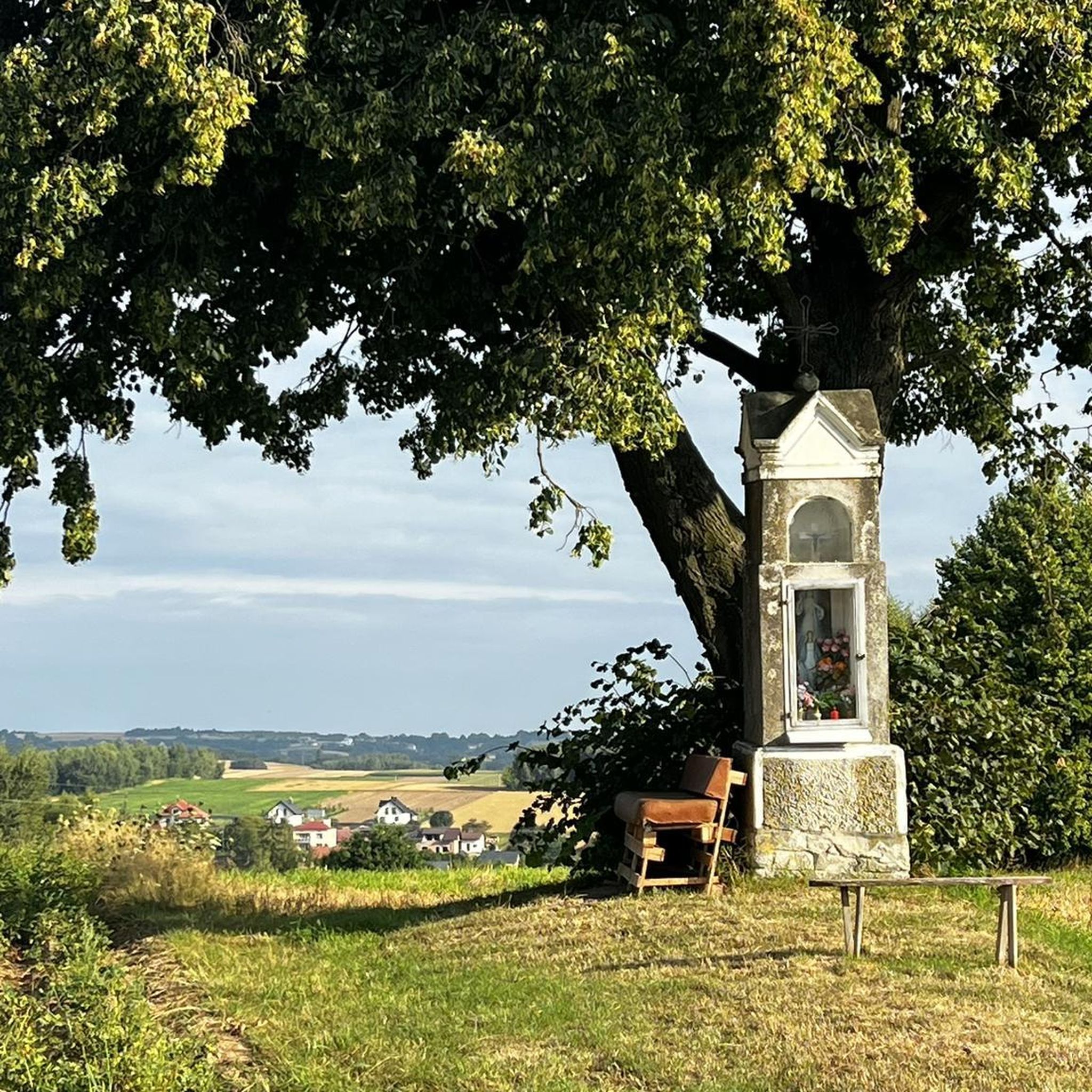
This beautiful rest area is located on the former railway line, at the old train station in Pange.
0
0

The Center Pompidou-Metz is a well-known contemporary art museum located in the Amphitheater district. Created in 2010 as part of a development project, it is one of the most visited museums in France outside of Paris. Its creation represented the first example of decentralization of a public cultural building, in this case the Center Georges Pompidou in Paris. The idea of creating a "branch" came to the now director Jean-Jacques Aillagon in 1997, when the Pompidou in Paris was closed for works (1997-2000). To continue exhibiting the various collections it was decided to create the “Outside the Walls” project, with exhibitions in various French cities. Given the success, concrete thought was given to a second location for the Pompidou Center. Input to the project was given by Aillagon himself when, in 2002, he was appointed Minister of Culture. Various cities showed interest, including Caen, Montpellier, Nancy and Lille, but in January 2003 the final choice was announced: Metz. The following March the tender for the project was launched, won by architects Shigeru Ban, Jean de Gastines and Philip Gumuchdjian. The construction was part of the urban redevelopment project of the Amphitheater district which, in addition to the Pompidou Centre, led to the construction of the Seille Park, the "Robert Schuman" conference centre, the Muse shopping center as well as various buildings of housing and green areas. The official inauguration took place on 11 May 2010 in the presence of President Sarkozy. The Pompidou Center in Metz has a hexagonal plan. The structure develops around a central body with a 77 meter high tower and is characterized by the presence of three self-supporting tunnels that cross each other transversally. The three galleries are oriented towards different points of the city, so as to provide the most complete overview possible. The cover, entirely made of wood, recalls the shape of a traditional Chinese hat owned by Shigeru Ban himself. In addition to the vast exhibition space, which extends over 5,000 m², the structure includes places to welcome the public, a studio for the presentation of shows and performances, gardens, an auditorium, a bookshop, a restaurant and a café. www.centrepompidou-metz.fr
1
0

The origin of “Pont-à-Domangeville is lost in the mists of time. The Roman road from Metz to the Rhine already passed through there. Under the old regime, it was a tiny separate lordship, with a toll bridge. Usually blocked and padlocked, to cross it you had to pay a fee, depending on the livestock and products passed through. The lordship belonged in the 13th century to the Saint-Vincent de Metz abbey, then to the successive lords of Domangeville; in 1716, to the Laubrussels, then to the Leuryses, finally to the Thomas de Pange. It included, in addition to the bridge, the road - 50 toises on this side, 18 beyond - the bed of the Nied on both sides and, on the south-east bank, land with a hostelry (current Mayot farm) . In 1789, the community of Bazoncourt declared in its list of grievances “the enlightenment of the State and the kindness of the King will undoubtedly eliminate a right of final injustice perceived at Pont-à-Domangeville. However poor a plowman he may be, he pays three does and several pay without passing through.” After the revolution, the bridge had to be repaired. Paradoxically, the general council had the expenditure entered in the 1814 and 1815 rolls of the localities which had subscribed to the bridge in 1766. On this ordeal is inscribed: “This monument of our redemption was erected by the care of MM. De Pange, de Courten, Devaux and Dauphin, Commissioners responsible for the reconstruction of this bridge, in the year of our Lord 1816. During the reconstruction work and near the bridge, Joseph GRANDIDIER de Hernicourt and François ANIEL perished in the waters on July 20 from Domangeville, both attached to the service of the neighboring farm »
1
0

Two people died during the reconstruction of the bridge over the Nied Française in Domangeville in 1816.
1
0

The Centre Pompidou-Metz in Metz is a centre for all forms of contemporary art and a branch of the Centre Georges Pompidou in Paris, with which it shares collections and founding philosophy. It has existed since 2010 (Wikipedia).
5
1
Memorial to the fallen of the two world wars.
0
0
よくある質問
Sanry-sur-Nied周辺には、交通量のない砂利道サイクリングロードはいくつありますか?
Sanry-sur-Nied周辺には、komootに約10件の交通量のない専用砂利道サイクリングロードが掲載されています。これらのルートは、車両の交通から離れた静かなサイクリング体験を提供するために設計されており、しばしばロレーヌ地域自然公園内の森林道、川沿いの道、農道を利用しています。
この地域の交通量のない砂利道では、どのような地形が期待できますか?
Sanry-sur-Nied周辺の交通量のない砂利道は、多様な地形が混在しています。ロレーヌ地域自然公園の特徴である、未舗装の区間、森林道、農耕地を通る道などがあります。一部の区間は未舗装ですが、一般的にグラベルバイクに適しており、変化に富んだ楽しいライドを提供します。
Sanry-sur-Niedの近くに、簡単で家族向けの交通量のない砂利道ルートはありますか?
はい、簡単なライドを求める家族に適したオプションがあります。例えば、レ・ゼタンからの「母と子の像 – パンジュ城」ループは、距離30.7km、適度な高低差で、交通量の少ないリラックスした外出に良い選択肢です。
これらのトレイル沿いで見つけられる注目すべきランドマークや景観ポイントはありますか?
この地域にはいくつかの見どころがあります。パンジュ城やメルシー城のような史跡を通り過ぎてサイクリングできます。景色の良い場所としては、モゼル県の絵のように美しい風景を提供するモン・サン・ピエールの近くを通るルートを検討してみてください。
Sanry-sur-Niedでのグラベルサイクリングに最適な時期はいつですか?
Sanry-sur-Nied周辺でのグラベルサイクリングに最適な時期は、通常、春から秋(4月から10月)です。これらの月は一般的に天候が穏やかで、トレイルが泥だらけになったり、草が生い茂ったりする可能性が低いため、ロレーヌ地域自然公園の多様な景観を探索するのに最適な条件を提供します。
交通量のない砂利道の円形ルートはありますか?
Sanry-sur-Nied周辺の交通量のない砂利道の多くは円形ループとして設計されており、同じ場所からスタートして終了することができます。例として、プルノワ・ラ・グラッスからの「シュッド・メッサン – ヴェルニー – セイユ放水路」マウンテンバイクルートがあり、変化に富んだ地形を38.3km走ることができます。
これらの交通量のない砂利道の駐車場はどこにありますか?
駐車場は、プルノワ・ラ・グラッス、レ・ゼタン、ペルトルなどの村にある多くのルートの出発点、またはその近くで一般的に利用可能です。出発前にkomootで特定のルートの詳細を確認し、推奨される駐車場を確認することをお勧めします。
この地域の交通量のない砂利道の難易度はどのくらいですか?
Sanry-sur-Nied周辺の交通量のない砂利道は、さまざまなスキルレベルに対応しています。「母と子の像 – パンジュ城」ループのような簡単なルートから、63.5kmにわたる大きな高低差が特徴のペルトルからの「ラ・クロワ・サン・クレマン – ターニング・ストーン」ループのようなより難しいオプションまで見つけることができます。
犬は交通量のない砂利道サイクリングロードで許可されていますか?
特定の規則は異なる場合がありますが、ロレーヌ地域自然公園の多くの自然エリアや公共の道は、特にリードにつないでおけば、犬に優しいです。ペットに関する制限については、常に現地の標識や特定のルート情報を確認するのが最善です。
トレイルの近くにサイクリスト向けのカフェやアメニティはありますか?
Sanry-sur-Nied自体や、メスのような近くの大きな町など、トレイルの出発点に近い村や町には、カフェ、レストラン、宿泊施設など、さまざまなアメニティがあります。これらは、ライドの前後にエネルギー補給や休憩をするのに良い場所となります。
他のグラベルバイカーは、Sanry-sur-Niedの交通量のないトレイルのどこを最も楽しんでいますか?
この地域はkomootコミュニティから高い評価を得ており、平均スコアは3.6つ星です。レビューでは、ルートの静けさ、ロレーヌ地域自然公園の美しい自然景観、そして交通から離れた多様な景観を探索できる機会がしばしば称賛されています。
サンリー=シュル=ニードでのの人気観光スポット

komootモバイルアプリでインスピレーションを得よう


さらに探索
他の地域の最高のグラベルライドを見てみましょう。
