ヴァル・デ・ガリネラ周辺のおすすめ交通量の少ないサイクリングルート
5.0
(7)
98
ライダー
6
ライド
la Vall de Gallinera周辺の交通量の少ないグラベルバイクコースは、険しい山岳地帯、肥沃な谷、そして農道のネットワークを特徴とする風景を横断します。この地域はシエラ・デ・フォラダーダとセーラ・デ・ルミラルに抱かれ、広大なサクランボ畑、松林、オリーブの木立があります。急峻な岩肌からは無数の清らかな泉が流れ、セルピス川は多くのルートで際立った自然の特徴となっています。この多様な地形は、グラベルバイクに適した様々な路面を提供します。
la Vall de Gallinera周辺の交通量の少ないグラベルバイクコース ベストセレクション
- 最も人気のある交通量の少ないグラベルバイクコースは、セルピス川 – アスド・デル・インフェルノまたはデル・フォルン ループ(L'Udol Reprimala発)で、距離15.4マイル(24.8 km)、難易度が高く、所要時間1時間38分です。セルピス川沿いの変化に富んだ地形をたどります。
- 地元のグラベルバイカーに人気のもう一つのコースは、セルピス川 – アスド・デル・インフェルノまたはデル・フォルン ループ(Beniarrés発)で、距離22.5マイル(36.2 km)、難易度が高く、川沿いの谷と周囲の農地を探検する道です。
- 地元のグラベルバイカーに愛されているのは、セルピス川 – アスド・デル・インフェルノまたはデル・フォルン ループ(Planes発)で、距離35.2マイル(56.6 km)、所要時間約3時間49分です。川沿いの風景と山岳地帯を抜けるコースです。
- la Vall de Gallinera周辺のグラベルバイクは、険しい山岳地帯、川沿いの谷、農道によって特徴づけられ、挑戦的な登りから果樹園を抜ける景色の良いループまで、様々なルートを提供しています。このネットワークは、困難な登りやテクニカルな下り坂を求める経験豊富なグラベルバイカーに選択肢を提供します。
- la Vall de Gallineraのルートは、komootコミュニティから高く評価されており、4件以上のレビューから平均5.0つ星の評価を得ています。80名以上のグラベルバイカーがkomootを利用して、la Vall de Gallineraの多様な地形を探検しています。
最終更新日: 10月 19, 2026
5.0
(2)
16
ライダー
24.8km
01:38
450m
450m
難しいグラベルライド. 標準以上のフィットネスレベルが必要です。 全般的に舗装された状態です。あらゆるスキルレベルに適しています。
5.0
(1)
16
ライダー
36.2km
02:15
540m
540m
難しいグラベルライド. 標準以上のフィットネスレベルが必要です。 全般的に舗装された状態です。あらゆるスキルレベルに適しています。

13
ライダー
56.8km
03:50
1,130m
1,120m
難しいグラベルライド. 標準以上のフィットネスレベルが必要です。 全般的に舗装された状態です。あらゆるスキルレベルに適しています。
5.0
(1)
12
ライダー
26.2km
01:42
420m
420m
中程度のグラベルライド. ある程度のフィットネスレベルが必要です。 全般的に舗装された状態です。あらゆるスキルレベルに適しています。
3
ライダー
31.3km
02:24
710m
710m
難しいグラベルライド. 標準以上のフィットネスレベルが必要です。 全般的に舗装された状態です。あらゆるスキルレベルに適しています。
おすすめのツアーは他のkomootユーザーが実際に経験した何千ものアクティビティに基づいています。
無料アカウントで今日から始めよう
次の冒険が待っています。
ヴァル・デ・ガリネラ周辺で人気

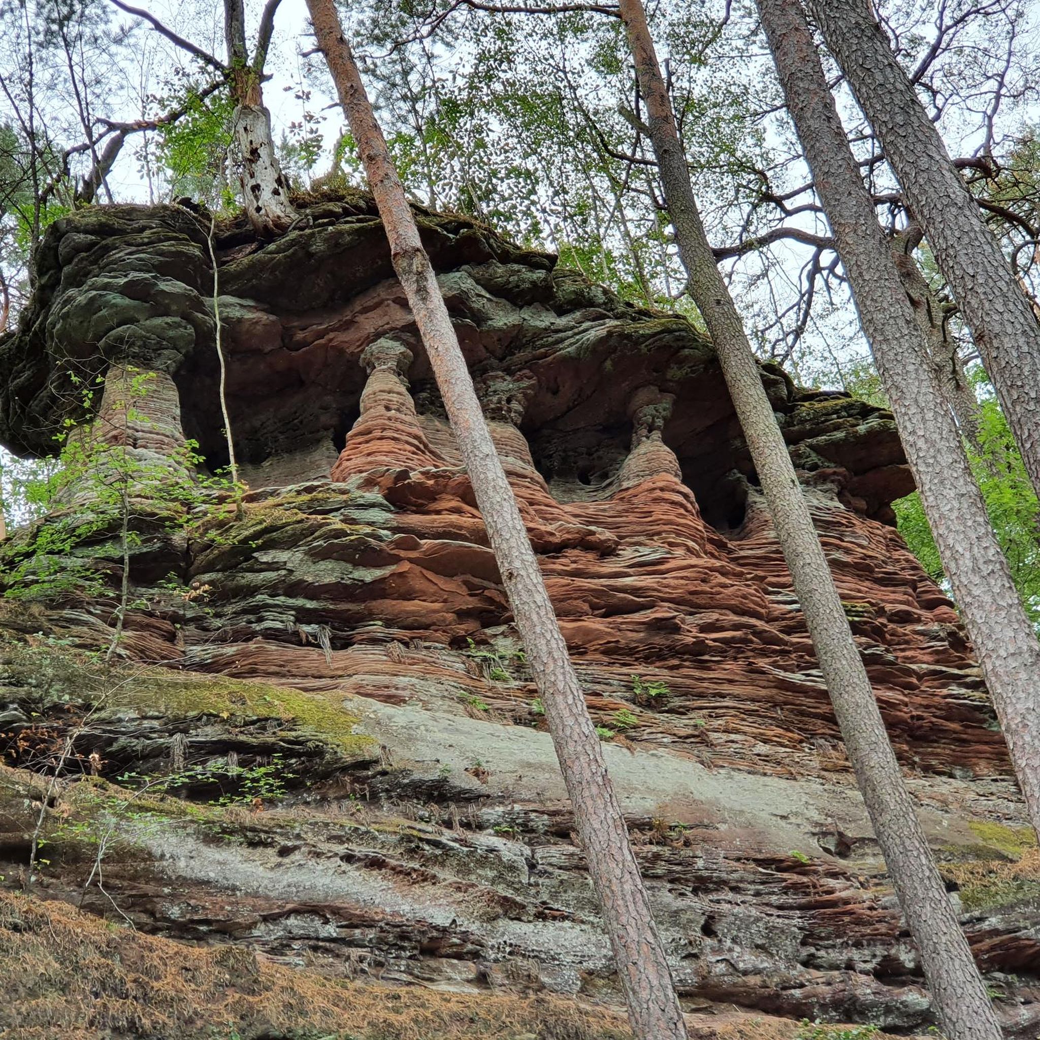
コミュニティからのヒント

La ruta de la Via Verda del Serpis es troba en un preciós congost d'este riu als peus de la Serra de la Safor. És un recorregut senzill i interessant, esguitat de ponts, rescloses, túnels i antigues construccions ferroviàries, però en alguns trams s'ha convertit en una pedrera. També es coneix per ser el traçat de l'antic Tren dels Anglesos.
2
0

川を渡る唯一の通路。ピクニックに最適な場所。ここからVillalongaまではもうすぐです。
3
0
駅のすぐそばに全てがあります。その上には、一見の価値がある城がそびえ立っています。
3
0
コース上にはいくつかのトンネルがあります。2、3は長めなので、ライトは必須です。そうでないと、真っ暗になります。
3
0

A beautiful hike through the Hell's Gorge. The actual route along the railway line, and probably the most interesting section between L'Orcha and Mare de Deu (Barranco del Infierno = Hell's Gorge), is unpaved and unpaved, in some parts very gravelly and rough. Five metal bridges are missing, two stone bridges remain, and six tunnels are traversed, all without lighting.
2
0

On Grabel, it's advisable to keep your tire pressures correct. I recommend over-inflating rather than underinflating. There are some cobblestone areas.
1
0

Tollos is a peaceful mountain village along the Ruta 99, a scenic route connecting the smallest villages of the Valencian Community. It’s a perfect turnaround point for cyclists riding from Alcalalí or the Vall de Pop. The approach from Fageca offers a quiet, steady climb, mostly shaded in the morning. Tollos itself is small but charming, and cyclists love stopping here for a classic bocadillo at the local bar — simple, delicious and authentic. For those looking to add an extra challenge, you can continue from Tollos to the Muro de Tollos, a steep climb that rewards you with stunning views. From the top, you can descend towards Beniaia, opening up loop options through the Vall d’Alcalà.
3
0
Just off the main CV‑720 near Benimassot but still on the roadside, you’ll find a traditional stone fountain serving as a convenient water refill point for cyclists—no detour needed. It offers fresh mountain spring water, ideal for topping up your bottles on a hot ride, adding a simple yet charming break to your journey along this scenic interior valley route.
2
0
よくある質問
ラ・バジェ・デ・ガリネラには、交通規制のないグラベルバイク用トレイルはいくつありますか?
このガイドでは、ラ・バジェ・デ・ガリネラに5つの専用交通規制なしグラベルバイク用トレイルが掲載されています。これらのルートは、車両の交通から離れて地域の自然の美しさを探求する素晴らしい方法を提供します。
ラ・バジェ・デ・ガリネラでの交通規制のないグラベルバイクの一般的な難易度はどのくらいですか?
このガイドで紹介されているラ・バジェ・デ・ガリネラの交通規制のないグラベルバイク用トレイルは、一般的に難しいと分類されています。これらはしばしばかなりの標高差と長い距離を伴い、経験豊富なグラベルバイカーにとってやりがいのある挑戦となります。例えば、プラネス発セルピス川 – アスド・デル・インフェルノまたはデル・フォルン・ループは、56km以上にわたり1100メートル以上の標高差があります。
この地域には、交通規制のない円形のグラベルルートはありますか?
はい、このガイドで紹介されている交通規制のないグラベルバイク用トレイルはすべて円形ルートであり、同じ地点からスタートして終了することができます。例としては、ラウドル・レプリマラ発セルピス川 – アスド・デル・インフェルノまたはデル・フォルン・ループや、ベニマソ発ポルト・デ・トジョス – ファチェカ・マウンテン・ビレッジ・ループがあります。
これらの交通規制のないグラベルトレイル沿いでは、どのような自然景観が期待できますか?
ラ・バジェ・デ・ガリネラの交通規制のないグラベルトレイルは、多様で風光明媚な景観の中を蛇行しています。ドラマチックな山岳地帯、広大なサクランボ畑(特に2月から3月の開花期には美しい)、芳香のある松林、オリーブ畑、アーモンドの木に出会えます。多くのルートは、セラ・フォラダから流れる新鮮な泉(フォント)のそばも通ります。ガリネラ渓谷自体も著名な自然景観です。
これらのルートで探索できる史跡や村はありますか?
もちろんです。この地域は歴史が豊かです。トレイルは、ベニアルイやベニシジリなど、ラ・バジェ・デ・ガリネラの8つの趣のある村々を接続したり、その近くを通ったりすることがよくあります。また、ムーア人の段々畑、ベニラマ城の遺跡のような古代の城、古い共同洗濯場や噴水に出会うこともあります。ベニラマやベニアルイなどの地域では、先史時代の洞窟壁画も見られます。
ラ・バジェ・デ・ガリネラで交通規制のないグラベルバイクに乗るのに最適な時期はいつですか?
春、特に2月から3月は、見事な桜の開花のため強くお勧めします。サイクリングには一般的に快適な気候です。秋も快適な気温と美しい紅葉を提供します。冬でも乗車可能ですが、山岳地帯は寒くなることがあるため、常に現地の気象条件を確認してください。夏は暑くなることがあるため、早朝または夕方のライドが推奨されます。
交通規制のないグラベルバイクルート沿いには、特別なアトラクションや興味深い場所はありますか?
はい、これらのルートの近くや沿道にはいくつかの興味深い場所があります。例えば、セルピス川グリーンウェイや、バランク・デル・インフェルン旧ダムを通過するかもしれません。この地域には、フォラ・デ・ラ・ジュベアやコバ・オブラダ・デル・モロなどの洞窟もあり、興味深い寄り道ができます。
交通規制のないトレイルについて、他のグラベルバイカーが最も楽しんでいる点は何ですか?
komootコミュニティはラ・バジェ・デ・ガリネラでのグラベルバイク体験を高く評価しており、平均スコアは5.0つ星です。レビューでは、地域の静かで交通のない道路、素晴らしい自然の美しさ、そして登りのやりがいのある挑戦がしばしば称賛されています。絵のように美しい村々や、自然に没頭できる感覚が頻繁にハイライトされています。
これらのグラベルトレイルの開始地点の近くに駐車場はありますか?
具体的な駐車場の詳細は開始地点によって異なりますが、ルートはラウドル・レプリマラ、ベニアレ、プラネス、ビジャロンガ、またはベニマソなどの村から始まることが多いです。これらの村には通常公共の駐車場があり、トレイルへのアクセスが便利です。到着時に現地の駐車規制を確認することをお勧めします。
交通規制のないグラベルルート沿いには、カフェや休憩できる場所はありますか?
ルートは、ベニアルイ、ベニラマ、ベニタイア、ベニシバ、ラ・カロハ、アルパトロ、リョムバイ、ベニシジリを結ぶ「8つの村のルート」のような、ラ・バジェ・デ・ガリネラの魅力的な村々を通過したり、その近くを通ったりすることがよくあります。これらの村には、休憩したり地元の料理を楽しんだりできる小さなカフェや地元の店がある可能性が高いです。ただし、特に長い区間では、十分な水と軽食を持参することをお勧めします。
何か隠れた名所やユニークな自然現象はありますか?
ユニークな自然現象の一つに、特徴的なアーチを持つ険しい岩場であるペニャ・フォラダがあります。年に2回、3月と10月に、太陽光線がこのアーチを通過し、かつてのフランシスコ会修道院の跡地を照らす太陽の配置が発生します。すべてのグラベルルートのすぐそばにあるわけではありませんが、探し出す価値のある重要な地元のランドマークです。
ヴァル・デ・ガリネラでのの人気観光スポット

komootモバイルアプリでインスピレーションを得よう


さらに探索
他の地域の最高のグラベルライドを見てみましょう。
