スハル周辺のおすすめ交通量の少ないサイクリングルート
4.4
(12)
435
ライダー
12
ライド
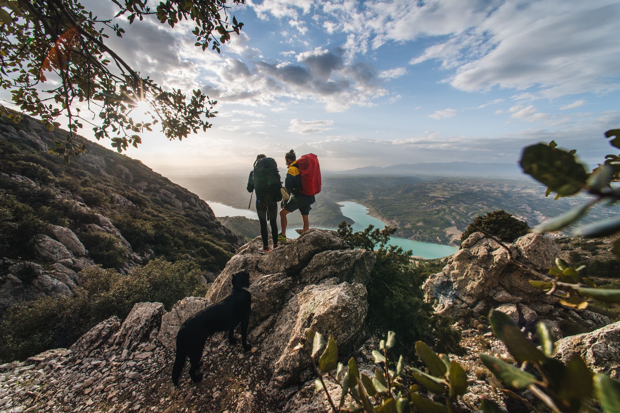
Zújar周辺の交通量の少ないロードサイクリングルートは、そびえ立つセルロ・デル・ハバルコン、広大なネグラティン貯水池、そして乾燥した砂漠の峡谷と灌漑された谷が混在する多様な景観を横断します。この地域の地形は、水によって浸食された高台に峡谷と小川のネットワークが形成されています。この変化に富んだ地形は、挑戦的な登りと景色の良いルートを組み合わせており、標高の上昇と絵のように美しい景色の両方を求めるロードサイクリストに適しています。
Zújar周辺の交通量の少ないロードサイクリングルート
- 最も人気のある交通量の少ないロードサイクリングルートはピコ・ハバルコン・ループで、25.9マイル(41.6 km)のトレイルで、所要時間は2時間8分です。周囲の山々の景色を楽しめます。
- 地元のロードサイクリストに人気のもう一つのルートはピコ・ハバルコンとネグラティン貯水池のループで、適度な23.0マイル(36.9 km)のルートです。このルートは、ピコ・ハバルコンへの登りとネグラティン貯水池沿いの景色の良い区間を組み合わせています。
- 地元のロードサイクリストに人気のバサ – バサからのバサ歴史地区ループは、47.5マイル(76.5 km)のトレイルで、バサ周辺の多様な地形を通り抜け、所要時間は約3時間54分です。
- Zújar周辺のロードサイクリングは、そびえ立つセルロ・デル・ハバルコン、ターコイズブルーのネグラティン貯水池の水、そしてユニークな乾燥した砂漠の峡谷によって特徴づけられます。このネットワークは、さまざまなレベルの能力に対応する、中程度から困難なルートのオプションを提供します。
- Zújarのルートは、komootコミュニティから高く評価されており、10件以上のレビューで平均4.8つ星を獲得しています。300人以上のロードサイクリストがkomootを利用して、Zújarの多様な地形を探索しています。
最終更新日: 8月 26, 2026
4.0
(1)
32
ライダー
41.6km
02:08
470m
470m
Cycle 25.9 miles around Jabalcón mountain, visiting Alcazaba de Zújar and Baños Romanos de Negratín, on this moderate road cycling route.
4.0
(1)
26
ライダー
36.9km
01:31
480m
480m
Cycle 23.0 miles (36.9 km) with 1567 feet (478 metres) of gain on this moderate racebike route near Baza, exploring the Geoparque de Granada

無料新規登録
29
ライダー
76.5km
03:54
1,310m
1,310m
難しいロードライド. 標準以上のフィットネスレベルが必要です。 全般的に舗装状態が良好で走行しやすい道です。
23
ライダー
30.6km
01:39
490m
490m
中程度のロードライド. ある程度のフィットネスレベルが必要です。 ツアーの一部に、未舗装のため走行が難しい箇所があるかもしれません。
15
ライダー
70.2km
03:30
720m
720m
中程度のロードライド. ある程度のフィットネスレベルが必要です。 ツアーの一部に、未舗装のため走行が難しい箇所があるかもしれません。
さらに多くのルートや他のユーザーのおすすめ情報を確認できます。
無料新規登録
すでにアカウントをお持ちですか?
おすすめのツアーは他のkomootユーザーが実際に経験した何千ものアクティビティに基づいています。
無料アカウントで今日から始めよう
次の冒険が待っています。
ログインまたは登録





コミュニティからのヒント

The water level has rised so much that the pool has been swallowed by the water reservoir. So no bath posible, unless you go to the restaurants pool, but that is not the same experience.
0
0

It is the most important monument in the city. It was built in the Nasrid period between the 13th and 15th centuries and consists of a tower, two sections of wall, a cistern and a parapet next to it.
8
0

Baza is a city whose municipal area is the largest in the province of Granada, whose population centers depend on it: Baúl (where the section of the greenway begins), La Jamula and Benacebada.
6
0

Everything is going well until the Vía Verde draws a large arc towards the south, enters the large channel of the Rambla de Baza and the Caniles iron bridge appears. The central planks have disappeared and you have to walk carefully along the sides. A sign at the entrance to the bridge recommends the parallel lane to avoid unnecessary risks. The tall chimney of the old Nuestra Señora de las Mercedes sugar factory announces the arrival at the Caniles station, which had an important weight in railway trade from its inauguration, in 1894, until the middle of the 20th century, when the decline of the road that connected Andalusia and the Levant. The buildings have been restored and converted into the Geodiversity Interpretation Center of the Granada Altiplano. In Baza you have to leave the route of the Greenway and visit the historical complex, passing by the Fuente de los Caños Dorados, the Plaza Mayor, the Barrio de San Juan, the alleys of the Jewish quarter, the Old Butcher Shops, the Arrabal de Marzuela , even entering the Arab Baths, and taking the opportunity to have some local delicacies and recover energy for the rest of the stage.
0
0

The Bastetano municipality is the largest in all of Granada and includes the population centers of Baza (municipal, regional capital of the entire Granada Altiplano and seat of its own judicial district), Baúl, La Jamula, Río de Baza and Benacebada. The city has a rich historical and artistic heritage that reflects its different cultures. Its shield and flag are official symbols that represent its history and tradition. 🌿🏰
1
0
The Alcazaba de Baza was a fortification located in the urban area of the Granada town of Baza, Spain. Although only some sections of the wall and remains of several towers remain today, the Alcazaba de Baza was once an almost impregnable fortress. Its walls present three construction phases: a first from the 11th-12th century, another Nasrid and a last, already Christian, from the 16th century. It is located in the heart of the Historic Center of the city, dominating the old medina. 🌿🏰
1
0

Beautiful locality that gives its name to Hoya de Baza since this town is located north of the mountain range that also bears its name. The Sierra de Baza.
0
0

The typical Andalusian white houses and the views of the mountains make Zújar a place worth visiting. If you are looking for nature and lovely quiet streets then look no further.
0
0
よくある質問
Zújar周辺には、交通量の少ないロードサイクリングルートはいくつありますか?
このガイドでは、Zújar周辺に10本の専用の交通量の少ないロードサイクリングルートを紹介しています。その大半は9本が中級レベルと評価されており、1本は上級レベルと見なされており、経験豊富なサイクリストに幅広い選択肢を提供しています。
これらの交通量の少ないロードサイクリングルートでは、どのような地形が予想されますか?
Zújar周辺の地形は驚くほど多様で、挑戦的な登りと景色の良い道が組み合わさっています。乾燥した砂漠の渓谷、緑豊かな灌漑された谷、そして水によって削られた高台を蛇行するルートに出会うでしょう。多くのルートでは大きな標高差があり、一部の地域では50キロメートルあたり平均1,000メートルの登りがあり、ロードサイクリストにやりがいのある挑戦を提供します。
初心者や家族向けの、交通量の少ないイージーなロードサイクリングルートはありますか?
このガイドのルートは一般的に中級から上級レベルと評価されていますが、この地域にはより緩やかなオプションもいくつかあります。例えば、Vía Verde, Baza - Baúlは、景観が良く歴史的にも興味深いライドを提供する、変貌した古い鉄道の道ですが、純粋なロードサイクリングルートというよりは主に砂利道です。ここに記載されているルートについては、中級レベルの挑戦に備えてください。
交通量の少ないロードサイクリングルート沿いでは、どのような自然の特徴やランドマークを見ることができますか?
Zújarのルートは、息をのむような自然の美しさを提供します。アクアマリンの水とドラマチックなグランドキャニオンのような周囲で知られる、壮大なNegratín貯水池の周りをサイクリングできます。そびえ立つCerro del Jabalcónは、挑戦的な背景を提供し、パノラマビューを楽しめます。その他の注目すべき特徴には、ユニークなGorafe砂漠の渓谷や、Narváez展望台のような様々な展望台があります。
Zújarでロードサイクリングを楽しむのに最適な時期はいつですか?
Zújar周辺の内陸のアンダルシアの道路は、気温が非常に高くなる真夏のピーク時以外は、一般的にサイクリングに適しています。春(3月~5月)と秋(9月~11月)は、ロードサイクリングに最も快適な気象条件を提供し、気温が穏やかで晴天が多いので、息をのむような景色を存分に楽しむことができます。
周回型の交通量の少ないロードサイクリングルートはありますか?
はい、Zújar周辺の交通量の少ないロードサイクリングルートの多くは周回型ループとして設計されており、同じ地点からスタートしてフィニッシュすることができます。例えば、ピコ・ハバルコン・ループとピコ・ハバルコンとネグラティン貯水池のループは、この地域の自然の美しさを紹介する優れた周回型オプションです。
これらのルートの典型的な距離と標高はどのくらいですか?
Zújar周辺の交通量の少ないロードサイクリングルートは、距離と標高の上昇量が異なります。例えば、ピコ・ハバルコン・ループは約41.6kmで標高差は約467メートルですが、より挑戦的なBaza – Bazaの歴史的中心部へのループは、約76.5kmで1300メートル以上の登りがあります。30kmから70kmを超えるルートまで、かなりの登りがあることが予想されます。
他のロードサイクリストは、Zújarでのサイクリングで最も楽しんでいることは何ですか?
komootコミュニティはZújarでのサイクリング体験を高く評価しており、平均スコアは4.8つ星です。レビューでは、交通量が最小限で静かで平和な内陸の道路が、ドラマチックなNegratín貯水池からCerro del Jabalcónの挑戦的な斜面まで、見事で見事な多様な景観への没入体験を可能にするとしばしば賞賛されています。
挑戦的または上級者向けの交通量の少ないロードサイクリングトレイルはありますか?
はい、Zújarには挑戦を求める上級サイクリスト向けのルートがあります。この地域の地形は、高台と大きな標高差があり、厳しいライドの機会を十分に提供します。例えば、Baza – Bazaの歴史的中心部へのループは上級レベルと評価されており、76キロメートルで1300メートル以上の登りがあり、持久力を試したい人に最適です。
ルートの近くで軽食を摂ったり宿泊施設を見つけたりできる場所はありますか?
Zújarとその周辺の村には、軽食や宿泊施設のオプションがいくつかあります。ZújarやBazaのような町の歴史的中心部には、地元のカフェやレストランがあります。さらに、Negratín貯水池近くのユニークなZújar温泉は、ライド後のリラクゼーションにユニークなオプションを提供しており、この地域には宿泊施設もあります。
これらの交通量の少ないロードサイクリングルートの駐車場はありますか?
はい、ZújarやBazaのような、これらのルートの出発点となる町や村には、通常駐車場があります。これらのルートの多くはループなので、通常は中心的な場所に車を駐車して、そこからライドを開始できます。
スハルでのの人気観光スポット

komootモバイルアプリでインスピレーションを得よう


