エタル周辺のおすすめ交通量の少ないサイクリングルート
4.7
(50)
652
ライダー
31
ライド
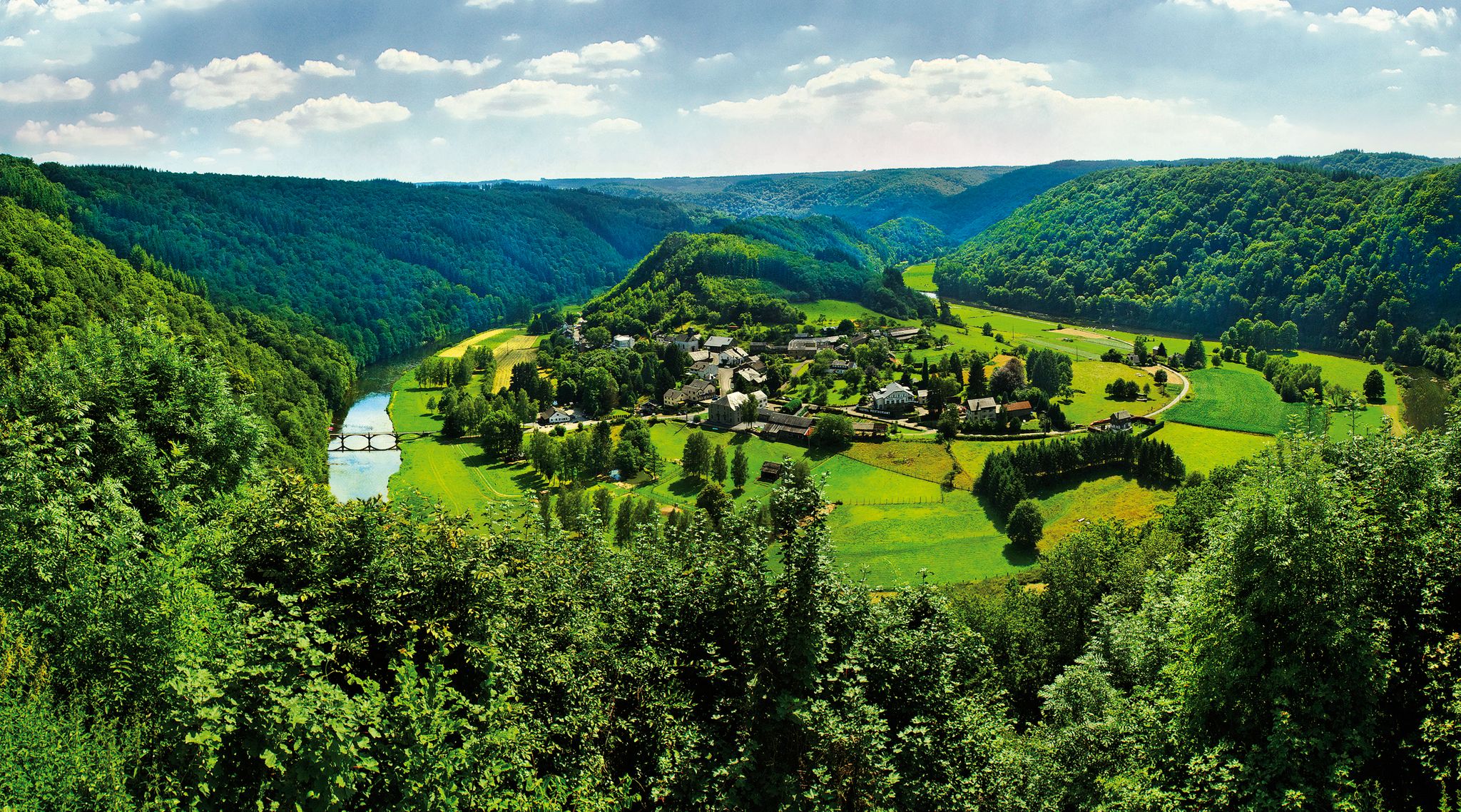
エタール周辺の交通量の少ないグラベルバイクトレイルは、広大な森林地帯、数多くの水路、変化に富んだ地形を特徴とする多様な景観を横断します。この地域には起伏のある丘陵地帯と深い谷があり、さまざまなスキルレベルのサイクリストに魅力的な体験を提供します。エタールは、鬱蒼とした森で知られる広大なアルデンヌ地方に位置し、セモワ川などの主要な川も含まれています。これらの要素の組み合わせにより、顕著な標高変化と自然の景観を持つルートネットワークが提供されます。
エタール周辺の交通量の少ない最高のグラベルバイクトレイル
- 最も人気のある交通量の少ないグラベルバイクトレイルは、森や川沿いを走り、所要時間2時間21分、距離41.6km(25.9マイル)の、中程度の難易度のラ・リュル・リバーサイド – フラタン発ラ・トラペリー・ループです。
- 地元のグラベルバイカーに人気のもう一つのトレイルは、鬱蒼とした森を抜ける大幅な標高差がある、難易度が高い35.8マイル(57.6km)のムーラン・ダンリエ – モルタンサール発フォレスト・パス・ループです。
- 地元のグラベルバイカーに愛されているのは、歴史的な地域や森林地帯を通り抜け、所要時間約4時間15分で走破できる、43.5マイル(70.0km)の旧ブゼノール駅 – フラタン発シャレー・ド・ラ・ルージュ・オー・ループです。
- エタール周辺のグラベルバイキングは、緑豊かな森、数多くの水路、変化に富んだ地形が特徴で、中程度から難易度の高いさまざまなレベルのオプションを提供しています。
- エタールのルートは、40件以上のレビューから平均4.6つ星の評価を得ており、komootコミュニティから高く評価されています。700人以上のグラベルバイカーがkomootを利用して、エタールの多様な地形を探索しています。
最終更新日: 9月 20, 2026
4.3
(6)
45
ライダー
45.6km
02:41
350m
350m
中程度のグラベルライド. ある程度のフィットネスレベルが必要です。 全般的に舗装された状態です。あらゆるスキルレベルに適しています。
5.0
(1)
17
ライダー
70.1km
04:15
560m
560m
難しいグラベルライド. 標準以上のフィットネスレベルが必要です。 全般的に舗装された状態です。あらゆるスキルレベルに適しています。

23
ライダー
101km
06:17
940m
940m
難しいグラベルライド. 標準以上のフィットネスレベルが必要です。 全般的に舗装された状態です。あらゆるスキルレベルに適しています。
5.0
(1)
11
ライダー
49.6km
03:51
690m
690m
難しいグラベルライド. 標準以上のフィットネスレベルが必要です。 全般的に舗装された状態です。あらゆるスキルレベルに適しています。
8
ライダー
29.4km
01:52
200m
200m
難しいグラベルライド. ある程度のフィットネスレベルが必要です。 ツアーの一部で自転車を押して歩く必要があるかもしれません。
さらに多くのルートや他のユーザーのおすすめ情報を確認できます。
すでにアカウントをお持ちですか?
おすすめのツアーは他のkomootユーザーが実際に経験した何千ものアクティビティに基づいています。
無料アカウントで今日から始めよう
次の冒険が待っています。



コミュニティからのヒント

Magnificent fresco inspired by Jean-Claude Servais
0
0

The Trench of Gates: Gateway to Gaume, Gateway to Legends 1. What is it? Physical Description The Trench of Gates is a deep and spectacular rocky gorge, naturally carved by the Vire River (a tributary of the Semois) into the sandstone plateau of the Gaume forest. Located in the village of Dampicourt (commune of Rouvroy), on the French border, it forms a narrow and winding notch, framed by high sandstone walls and strangely shaped rocks. Its name comes from its topography: the site gives the impression of crossing several successive natural "gates." 2. A Strategic Position: Military History The true fame of the Trench of Gates comes from its historical role as a natural fortress and strategic border post. A Gallic Stronghold? : Its easily defensible configuration suggests that it was used as a refuge since the Gallic era. The Roman Fort: Its strategic role became evident during the Roman era. The Romans established a castellum (a fortified camp) there to control the passage between Belgic Gaul and Imperial Trier, and to protect the nearby Roman road. Remains of these fortifications were still visible several centuries ago. A Millennial Challenge: Due to its position on the border, the site has been contested and fortified throughout history, from the Middle Ages to modern wars. It offered an ideal control point over one of the few passable passages through the region's wooded terrain.
1
0


FYI, the ruins are those of old forges and not those of a castle as mentioned above.
0
0

The Gros Cron is a 20-meter-high rock whose site has been classified due to its geological interest. From the top, the view of the surrounding area is delightful.
0
0

Very pretty lake with a small island in the center; beautiful photos to take :D
0
0

The Cuisine Sauvage chalet in Saint-Léger is a friendly place to spend a Sunday in a unique atmosphere, where the Friends of Rouge Eau team welcomes you! With friends, family, or a loved one, it's the perfect spot for a natural forest meal: Rouge Eau nearby, cold drinks, and shaded tables in the heart of the forest. Enjoy a game of pegs, Mölkky or pétanque, or even walk on stilts. The chalet is open every Sunday in summer from 2 p.m. to 8 p.m. and can be rented outside of certain dates. All you need to bring are sausages, bread, and a market garden salad!
3
0
In Gaume, the term "crons" (or "cranières") refers to the petrifying limestone springs and the limestone tuff massifs thus formed. The site now appears as a steeply sloping clearing facing south-southeast and traversed by a stream of crystal-clear water. The vegetation and ecological conditions are remarkably diverse: calcareous grasslands, alkaline marshes dominated by Molinia, dry and wet rock slabs, sedge meadows with sedge, buckthorn willow, thermophilic proforest ridges, etc. This environment is a NATURA 2000 priority habitat in the European Union. The wild columbine, with its blue flowers, blooms here in spring. The fauna is also remarkable: the site, for example, is a favorite biotope of a rare dragonfly, the bidentate cordulegastre, whose larvae develop in the thin streams of water. The Haie de Han de Saint-Léger Cron Reserve was created thanks to the Municipality of Saint-Léger making available two plots of land located within its forest property (agreement of November 8, 2004): the eastern cron here and the western cron, some 350 m downstream. The formation of the crons is linked to the precipitation of dissolved limestone in the water from springs gushing upstream at an impermeable marl bank. The springs are an outlet for rainwater, which infiltrates through the sandy limestone layers of Orval and becomes saturated with calcium. In the open air, the dissolved limestone precipitates due to the heating promoted by the topography of the area (a sunny slope) and the growth of mosses. The precipitation eventually produces a rock mass, gradually causing the stream to spread and shift. Areas of so-called active cron (current deposits) and dry, non-irrigated slabs (senile stage of cron) coexist. Calcareous tuff, also called travertine, is a hard and light rock that has had various uses in the past as a construction material (road conduits, door frames, etc.) but also as a steelmaking flux (limestone) during the forging era.
2
0
よくある質問
エタール周辺には、交通量のないグラベルバイクコースはいくつありますか?
エタールには、交通量のないグラベルバイクコースが26コースあり、充実しています。これらは中級から上級レベルまであり、車両の干渉なしに地域の自然の美しさを探求したい様々なスキルレベルの方々に選択肢を提供します。
エタールでの交通量のないグラベルコースでは、どのような景観が期待できますか?
エタール周辺の交通量のないグラベルコースは、主に鬱蒼とした森を通り抜けます。特にベルギーで最も森林が多い地域として知られるアルデンヌ地方がそうです。また、セモワーズ川が刻んだような絵のように美しい川の谷、なだらかな丘、そしてガウム地方特有の「マルデル」や「クロン」を含む様々な水路や湿地帯も目にすることができます。
エタールには初心者向けの、簡単で交通量のないグラベルコースはありますか?
多くのコースが中級から上級レベルですが、エタール周辺には少なくとも2つの簡単な交通量のないグラベルコースがあります。これらは通常、獲得標高が少なく、路面が滑らかなため、初心者の方や、景色の良い田園地帯をよりリラックスして走りたい方に最適です。
グラベルコース沿いにある注目すべき自然の魅力や景観ポイントはありますか?
多くのコースで素晴らしい自然の景色が楽しめます。美しいラ・ルル川沿いを走ったり、ラ・ファブリック池のような多くの池があるエリアを探検したり、神秘的な妖精の洞窟を発見したりすることができます。この地域の鬱蒼とした森や川の谷も、数え切れないほどの景観ポイントを提供しています。
エタールで、挑戦的な交通量のないグラベルコースはありますか?
はい、エタールは挑戦を求める経験豊富なグラベルバイカーにとって素晴らしい目的地です。交通量のない難易度の高いコースが12コースあり、しばしばかなりの獲得標高と長い距離を特徴としています。例えば、モルタンサールからのムーラン・ダンリエ – フォレスト・パス・ループは、700メートル以上の登坂を伴う57km以上をカバーしています。
グラベルコースの近くに、歴史的な場所やランドマークはありますか?
もちろんです。この地域は歴史が豊かです。現代美術のインスタレーションが展示されているモンタバン古代鉄工所跡のような場所を訪れたり、保護されているメリエ鉄工所を見学したりできます。ポン・ドワイヤ橋の鉄工所も、ハベイ湖沿いの道 – ポン・ドワイヤ橋の鉄工所ループのようなコースにしばしば組み込まれる、もう一つの注目すべき史跡です。
エタール周辺の交通量のないグラベルコースは、家族連れに適していますか?
多くのコースが中級から上級レベルですが、簡単なコースの存在は、一部の区間や短いループが家族連れに適している可能性を示唆しています。家族での外出を計画する際は、全員が楽しめるように、難易度評価が低く、獲得標高が少ないコースを探すことをお勧めします。
エタールでグラベルバイクに乗るのに最適な時期はいつですか?
エタールの多様な景観は、複数の季節でグラベルバイクを楽しむのに適しています。春と秋は快適な気温と鮮やかな景色を提供し、秋には広大な森で美しい紅葉が見られます。夏も人気がありますが、一部のコースは日差しにさらされる可能性があります。冬のライディングも可能ですが、特に手入れの行き届いた森の小道では、より寒く、潜在的に湿った条件に備える必要があります。
エタールでは、円形の交通量のないグラベルコースはありますか?
はい、エタール周辺のグラベルコースの多くはループ状に設計されており、同じ地点からスタートして同じ地点に戻ることができるため、同じ道を戻る必要がありません。これは、変化に富んだ地形を探索するのに理想的で、連続的で没入感のある体験を保証します。例としては、フラタンからのラ・ルル川沿い – ラ・トラペリエ・ループがあります。
他のグラベルバイカーは、エタールでのグラベルバイク体験のどのような点を最も楽しんでいますか?
komootコミュニティはエタールでのグラベルバイク体験を高く評価しており、平均スコアは4.57つ星です。レビューでは、この地域の広大な静かで交通量のない森の小道のネットワーク、多様で絵のように美しい景観、そして自然の美しさと歴史的建造物の融合がしばしば称賛されています。一部のコースの挑戦的な地形も、経験豊富なライダーにとってハイライトとなっています。
エタールでのグラベルコースにアクセスするために、公共交通機関は利用できますか?
エタールは様々な駐車オプションがあり、車でのアクセスに適していますが、特定のトレイルヘッドへの公共交通機関の接続は限られている可能性があります。最寄りの公共交通機関の停留所から短いライドやウォーキングが必要になる出発点もあるため、近くの町へのバスや電車の時刻表を確認し、ルートを計画することをお勧めします。
エタルでのの人気観光スポット

komootモバイルアプリでインスピレーションを得よう


