ルート

プランナー

機能

アップデート

App

ログインまたはサインアップ

アプリを入手

ログインまたはサインアップ

ルート
Places to see
Natural Monuments
イタリア
カラブリア

メリトディポルトサルボ

メリトディポルトサルボの天然記念物・トップ7


メリトディポルトサルボが誇る美しい風景を見てみたいなら、メリトディポルトサルボの素晴らしい天然記念物・トップ7
に行ってみましょう。あなたにぴったりの場所が見つかるよう、素晴らしい天然記念物を探索するために必要なすべての情報を集めました。次のアウトドアの冒険に出かける計画の参考にしましょう。

最終更新日: 7月 12, 2026

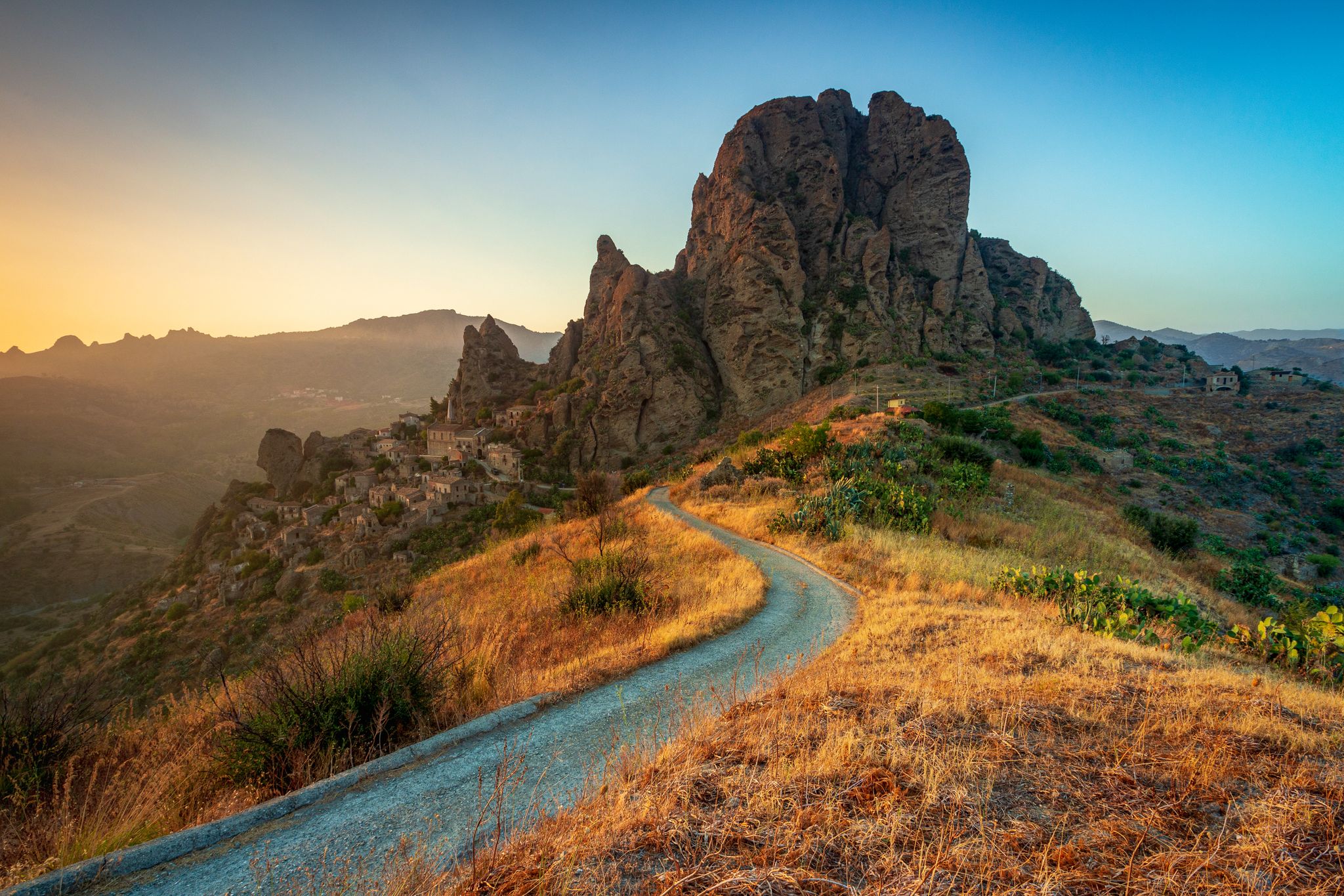
モンテ・カルヴァリオのペンテダッティロ村

ハイライト • 集落

The writer Edward Lear already wrote that Pentidattilo is "so magical that it makes up for any effort endured to reach it". This village was abandoned until recently, today it is still a very suggestive place full of legends.

翻訳者 Google •

役立つ情報

によるものです

ここでのハイキングを見る

スマートフォンに送信

保存

モンテ・カルヴァリオ

ハイライト • 自然記念物

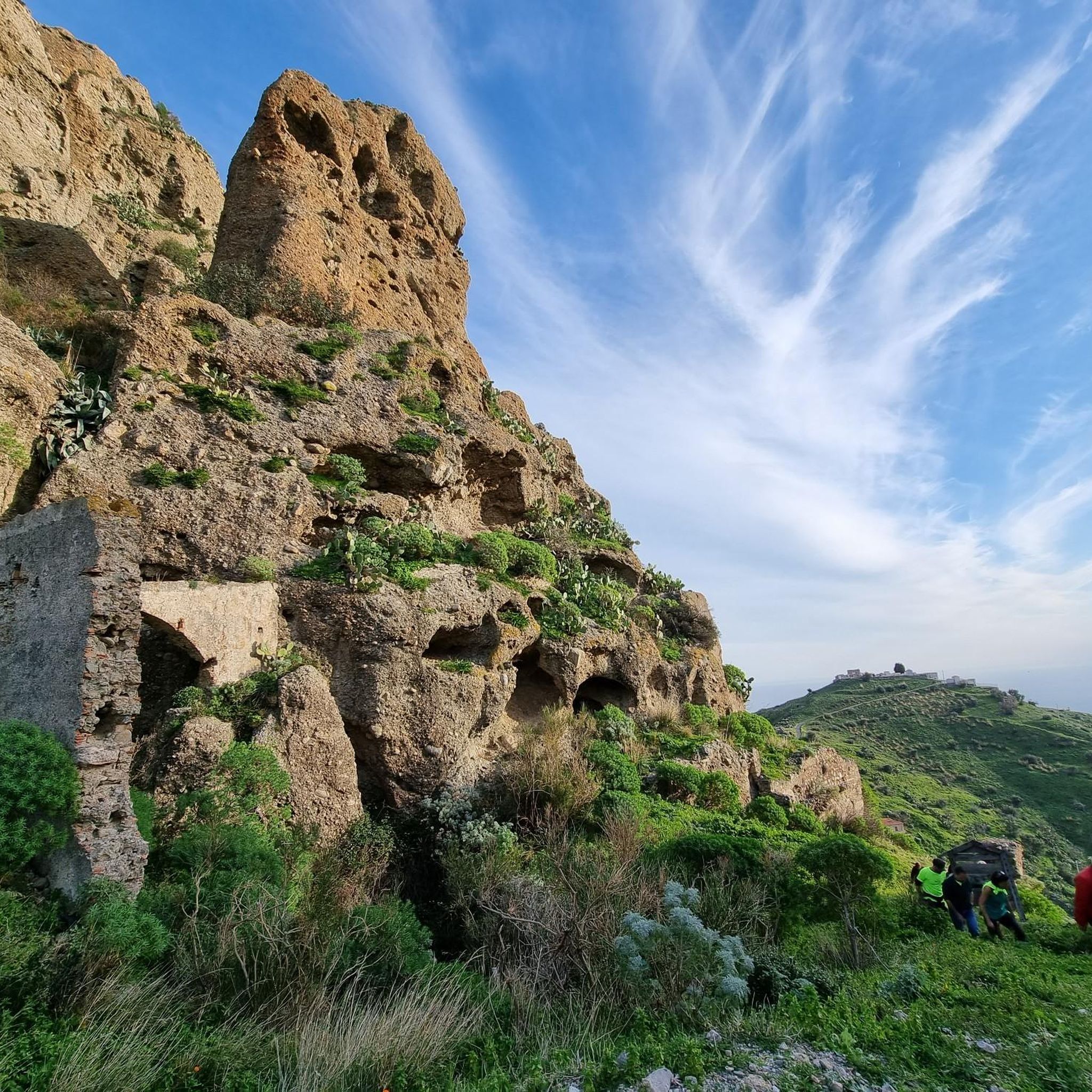
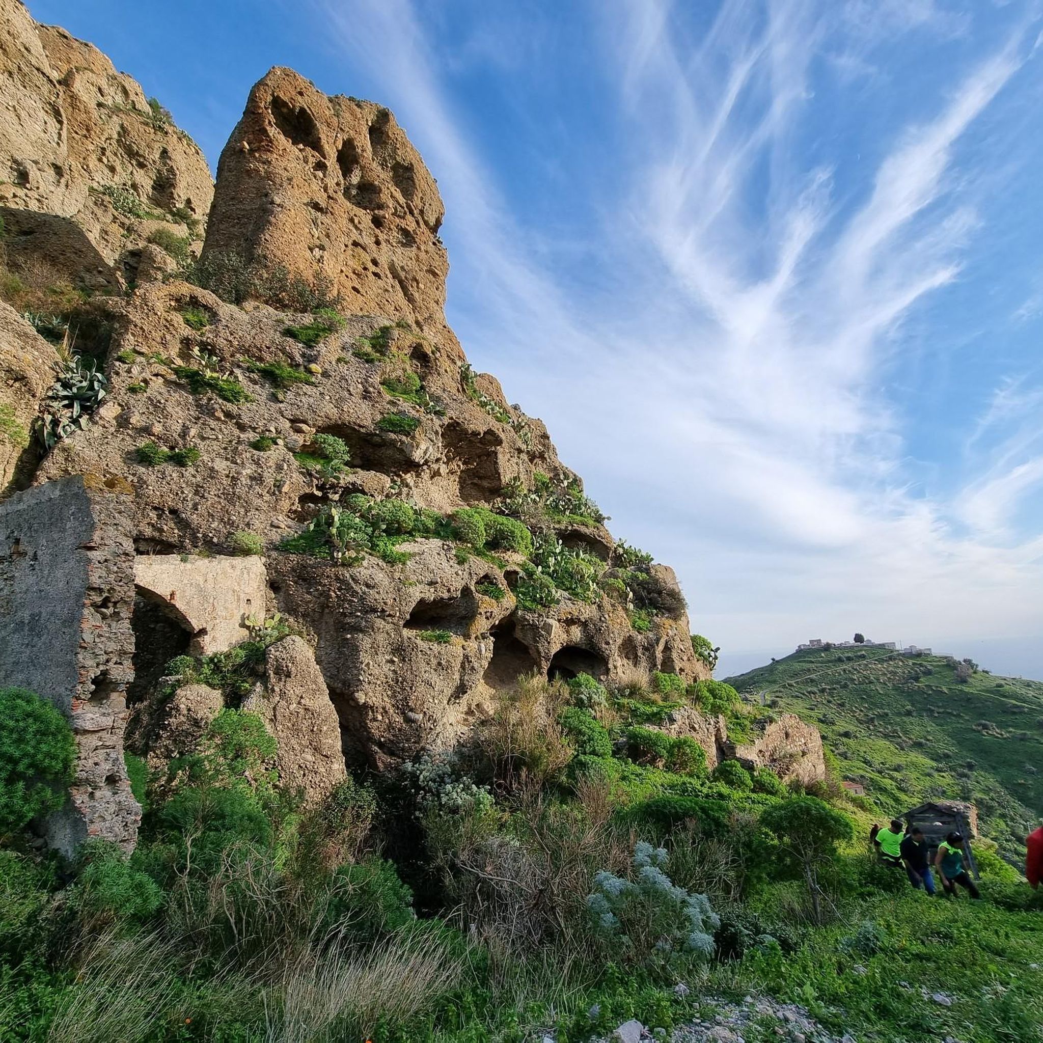
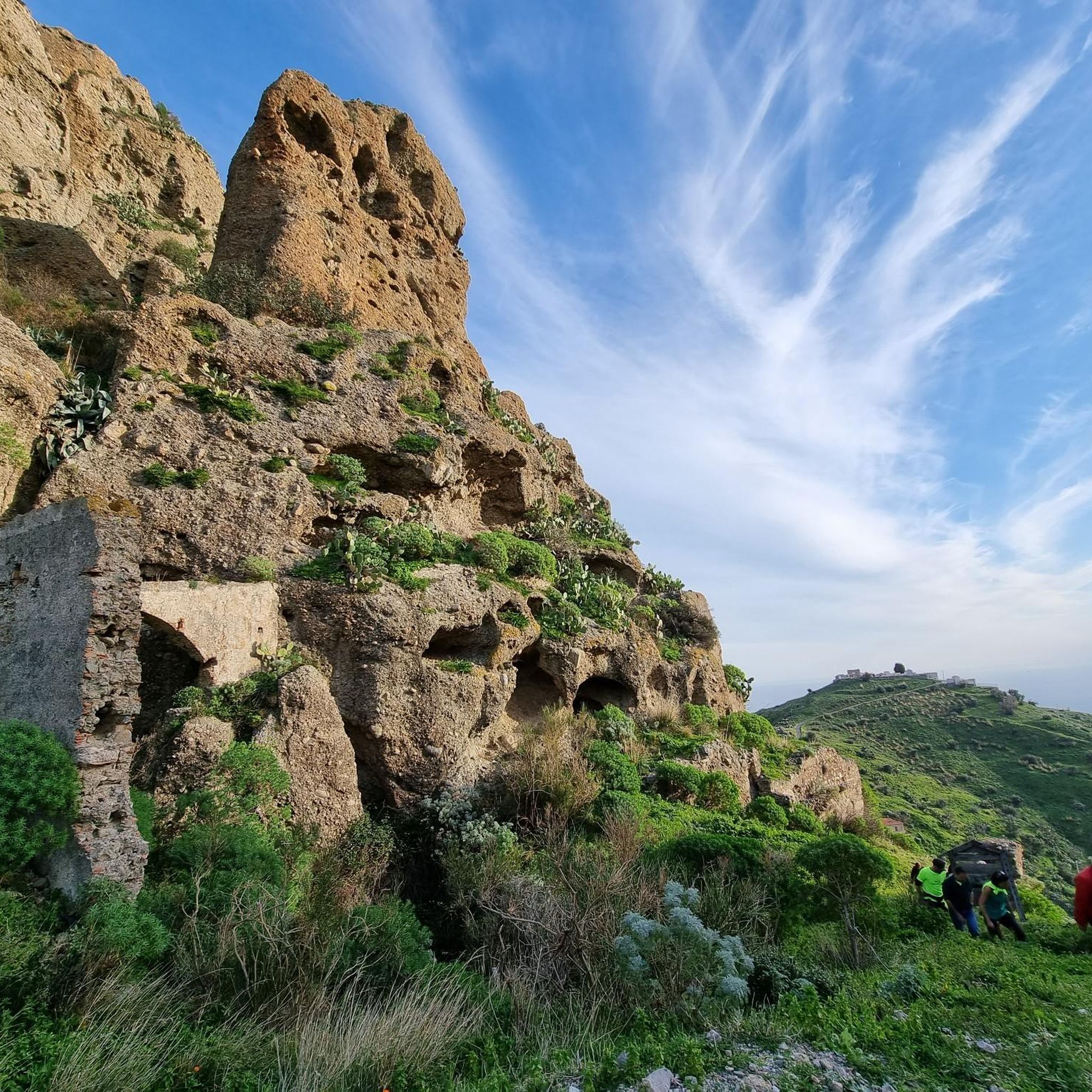
Located 250 meters above sea level, Mount Calvario rises above the village of Pentedattilo which takes its name from its shape, namely the five fingers of a gigantic hand.

翻訳者 Google •

役立つ情報

によるものです

保存

今すぐサインアップして、こんな場所を発見しよう

最高のシングルトラック、ピーク、その他のエキサイティングなアウトドアスポットのおすすめを受け取ろう。

無料新規登録

ペンテダッティロ村

ハイライト • 集落

Situated at 250 metres above sea level, Pentidattilo stands perched on the cliff of Monte Calvario, with a characteristic shape that resembles that of a cyclopean hand with five fingers, …

翻訳者 Google •

役立つ情報

によるものです

保存

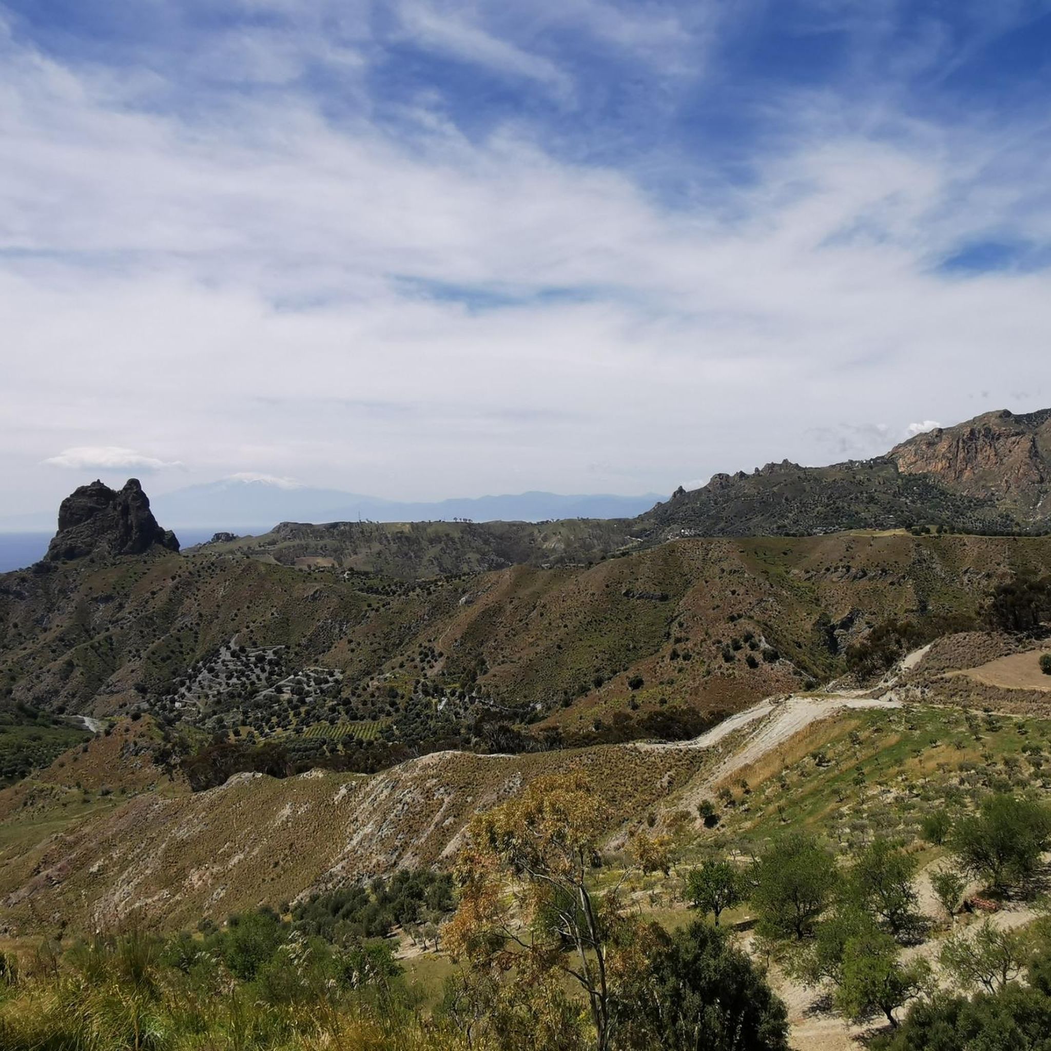
From Amendolea you can admire the spectacular panorama of the fiumara and the mountains that surround the town. In the distance you can also see the Tyrrhenian Sea.

翻訳者 Google •

役立つ情報

によるものです

保存

The Amendolea river originates in the Aspromonte park at 1,720 meters above sea level, begins its course between cliffs and gorges and creates wonderful waterfalls. The name seems to derive …

翻訳者 Google •

役立つ情報

によるものです

保存

無料でサインアップして、さらに多くの自然記念物を発見しましょう メリトディポルトサルボでの。

無料新規登録

すでにアカウントをお持ちですか?

無料アカウントで今日から始めよう

次の冒険が待っています。
ログインまたは登録

メリトディポルトサルボ周辺で人気

エドワード・リアのカラブリアを通る旅路を追跡する – Sentiero dell'Inglese

メリトディポルトサルボでのハイキング

メリトディポルトサルボのロードバイクルート

メリトディポルトサルボでのサイクリング

メリトディポルトサルボのMTBトレイル

メリトディポルトサルボでのの他の冒険

エドワード・リアのカラブリアを通る旅路を追跡する – Sentiero dell'Inglese

ハイキングのコレクション によって

ellierob

コミュニティからのヒント

Cristoforo Scordo
6月 4, 2025, View of Amendolea and the Aspromonte Mountains

Suitable equipment is needed: boots, poles and accessories, but the important thing is to have an adequate supply of water because there are no fountains along the route.

Google翻訳による翻訳

1

0

Interesting rock that makes up Monte Calvario.

Google翻訳による翻訳

2

0

Situated at 250 metres above sea level, Pentidattilo stands perched on the cliff of Monte Calvario, with a characteristic shape that resembles that of a cyclopean hand with five fingers, and from which the name of the village derives in Greek πέντα-δάκτυλος (transliterated pènta-dàktylos), meaning "five fingers". The ancient village, which stood at 320 metres above sea level, was definitively abandoned in 1971, after having been declared uninhabitable three years earlier: the population, in fact, had migrated slightly towards the valley, forming a new small centre from which the old ghost town could be admired. Only recently have some artisans restarted some shops, to which a small restaurant has even been added. The village has undergone some redevelopment works, such as the restoration of some buildings, in addition to the resurfacing of the main street. Every summer Pentidattilo is a stop of the travelling festival Paleariza, an event of Greek culture on the international scene. Between August and September it also hosts the Pentedattilo Film Festival, an international short film festival. Source Wikipedia

Google翻訳による翻訳

0

0

Franz
4月 1, 2024, Monte Calvario

Beautiful almost abandoned ancient village, it is part of the English route

Google翻訳による翻訳

1

0

From Amendolea you can admire the spectacular panorama of the fiumara and the mountains that surround the town. In the distance you can also see the Tyrrhenian Sea.

Google翻訳による翻訳

5

0

The Amendolea river originates in the Aspromonte park at 1,720 meters above sea level, begins its course between cliffs and gorges and creates wonderful waterfalls. The name seems to derive from the presence of almond trees along its course. After about 39 kilometers it flows into the Ionian Sea at Condofuri Marina.

Google翻訳による翻訳

6

0

ellierob
1月 13, 2024, Monte Calvario

Located 250 meters above sea level, Mount Calvario rises above the village of Pentedattilo which takes its name from its shape, namely the five fingers of a gigantic hand.

Google翻訳による翻訳

4

0

A village with an ancient history, apparently abandoned, in reality small solid artisan businesses live inside the village, which alone are worth a visit to the place. I recommend the circumnavigation of Monte Calvario, which makes the visit to the village more complete. The stretch of single track trail on the NW side is beautiful

Google翻訳による翻訳

2

0

メリトディポルトサルボでのの人気ルート

メリトディポルトサルボでのハイキング

メリトディポルトサルボでのの人気観光スポット

Places to see

Store rating

komootモバイルアプリでインスピレーションを得よう

無料のkomootアカウントがあれば、無限のアウトドアコースを簡単に見つけてカスタマイズし、ナビで案内できます。

または

今すぐkomootに参加しよう

Store rating

さらに探索

これらのガイドで、最高の洞窟を探す範囲を広げましょうメリトディポルトサルボでの:

Parco nazionaledell 'アスプロモンテオッピド・マメルティーナコゾレートシラーデリアヌオーヴァログーディレッジョディカラブリアシノポリサンテウフェーミアダスプロモンテStiloアフリカサンルーカサモサンロベルトシードPlatìバガラーディサンロレンツォロッカフォルテデルグレコヴァラポーディオサンタクリスティーナダスプロモンテビヴォンジカルデートチミナアスプロモンテのサントステファノカレーリカウローニアパッツァーノコンドフーリモローキオサンピエトロディカリダアルドーレボバカーノロジェラーチェチッタノーヴァアントニミーナマンモラサンタガータデルビアンコベネスタレサンジョルジョモルゲトグロッテリーアサンティラーリオデッロイオニオアニャーナ・カラブラガラトロマートンモンテベッロ・イオニコサンジョヴァンニディゲレスロクリプラカニカサンプロコーピオメリクッカポルティリオーラボヴァリーノモッタサンジョバンニシデルノバニャーラ・カラブラジョイオーザ・イオニカボヴァマリーナラガナーディロッチェッラ・イオニカPalizziタウリアノーヴァチンクエフロンディカランナカジニャーナサンタレッシオ・イン・アスプロモンテセミナーラテッラノーヴァサッポミヌリオカラッファデルビアンコ

近くのアドベンチャーガイド

モンテベッロ・イオニコでやるべきこと

background

新しいピークを征服する準備をしよう

無料でサインアップ

探検する
ルートルートプランナー機能ハイキングMTBトレイルロードバイクルートバイクパッキングサイトマップ
アプリをダウンロード
SNSでフォローする

© komoot GmbH

プライバシーポリシー