シギロの峠・トップ4
Les cols de montagne près de Sigillo sont situés dans les Apennins Ombrie-Marches, une région caractérisée par son terrain montagneux et ses caractéristiques naturelles. La région offre un accès au Monte Cucco, une montagne proéminente connue pour son parc protégé et ses vastes possibilités de randonnée. Sigillo sert de point de départ pour explorer divers cols de montagne qui relient différentes villes et régions. Le paysage comprend à la fois des pentes douces et des ascensions difficiles, répondant à diverses…
最終更新日: 9月 18, 2026
マドンナ・デッラ・チーマ峠
ハイライト • 山道
翻訳者 Google •
役立つ情報 は

スケッジャ峠
ハイライト • 山道
翻訳者 Google •
役立つ情報 は

今すぐサインアップして、こんな場所を発見しよう
最高のシングルトラック、ピーク、その他のエキサイティングなアウトドアスポットのおすすめを受け取ろう。
ヴァリコ・ディ・フォッサート
ハイライト • 山道
翻訳者 Google •
役立つ情報 は
ヴァリコ・デッラ・ペッツァ
ハイライト • 山道
翻訳者 Google •
役立つ情報 は
無料アカウントで今日から始めよう
次の冒険が待っています。

コミュニティからのヒント

Scheggia is a border town, and has always been, since the times of the Ancient Romans. Its charm lies in the testimonies of that era that can still be visited: the Abbey of Santa Maria di Sitria and the Hermitage of San Girolamo. Nearby is also the suggestive Scheggia pass: an Apennine passage located at 632 meters above sea level.
1
0

Pass at more than a thousand meters on a dirt road just below Monte Aguzzo. From here you can climb to the top at 1110 meters and enjoy a beautiful view of the surrounding landscape.
0
0
The Fossato pass is an Apennine pass at 738 m that connects Umbria with the Marches, between Fossato di Vico and Fabriano. It's an ancient and scenic road, the asphalt is a little worn and there are stretches of cobblestone on the hairpin bends.
4
0
The Madonna della Cima pass is located at 780 meters above sea level and connects Gubbio with the plain of Scheggia and Sigillo. Both sides have gentle slopes, the road is wide and has a well-maintained surface.
2
0

Located at 780 meters above sea level, the Valico di Madonna della Cima connects Gubbio with the plain of Scheggia and Sigillo. Both sides have gentle slopes, the road is wide and has a well-maintained surface. These features make this stretch very popular even among motorcyclists: it is good to pay attention especially on weekends. Shortly after having crossed the hill towards Gubbio, a branch off from the main road allows you to reach the Basilica of Sant'Ubaldo with its beautiful view of Gubbio.
1
0

First (or last) town in Umbria along the old Via Flaminia, excellent for supplies before heading back down to Rome
0
0
よくある質問
シジッロ近郊で、ドライブやサイクリングに最適な景色の良い山道はありますか?
標高780メートルのマドンナ・デッラ・チーマ峠は、緩やかな坂道と広くて整備された道路が特徴で、グッビオとシェッジャおよびシジッロの平野の間を景色の良いドライブやサイクリングするのに理想的です。快適なコンディションから、特にバイク愛好家に人気があります。
シジッロ周辺に歴史的に重要な山道はありますか?
はい、標高632メートルのシェッジャ峠は、古代ローマ時代にまで遡る豊かな歴史を持つ国境の町シェッジャの近くにあります。近くにはサンタ・マリア・ディ・シトリア修道院やサン・ジローラモ隠者の庵などの史跡を探索できます。
パノラマビューを楽しめる山道はどれですか?
息をのむような景色を楽しむなら、ヴァリコ・デッラ・ペッツァを検討してみてください。この峠は、モンテ・アグッツォのすぐ下にある未舗装路で、標高は1000メートルを超えます。ここから標高1110メートルの山頂まで登ると、周囲の景色の美しいパノラマビューが楽しめます。さらに、シジッロからモンテ・クッコへの登り道も壮大な眺めを提供します。
フォッサート峠の地形はどのようなものですか?
アペニン山脈にある標高738メートルのフォッサート峠は、ウンブリア州とマルケ州を結んでいます。古く風光明媚な道として知られていますが、アスファルトが少し摩耗している場合があり、ヘアピンカーブでは石畳の区間に遭遇するかもしれません。
シジッロ近郊の山道を含む、挑戦的なサイクリングルートはありますか?
もちろんです。シジッロからモンテ・クッコへの登りは、全長約9.4km、標高差714メートル、平均勾配7.6%の厳しいクライムです。さらに多くのサイクリングオプションについては、「シジッロ周辺のサイクリング」ガイドをご覧ください。このガイドには、「モンテ・クッコからの眺め – フォッサート峠ループ」のようなルートも含まれています。
これらの峠の近く、特にモンテクッコ周辺ではどのようなアウトドアアクティビティが楽しめますか?
シッリッロからアクセス可能なモンテクッコ地域は、アウトドア愛好家の中心地です。挑戦的なサイクリングのほか、保護されているモンテクッコ公園内の数多くのトレイルでのハイキングにも最適です。この地域は洞窟でも有名で、ハンググライダーやパラグライダーの人気のスポットでもあり、アドベンチャースポーツ愛好家にユニークな体験を提供します。ハイキングルートは、シッリッロ周辺のランニングトレイルガイドで見つけることができます。
グラベルサイクリングに適した未舗装路の峠はありますか?
はい、ヴァリコ・デッラ・ペッツァは未舗装路にあり、グラベルサイクリングに適しています。モンテ・アグッツォのすぐ下に位置し、美しい景色へのアクセスを提供します。さらにグラベルサイクリングの冒険を楽しみたい方は、シッリッロ周辺のグラベルサイクリングガイドをご覧ください。
峠の近くでどのような自然の特徴を探検できますか?
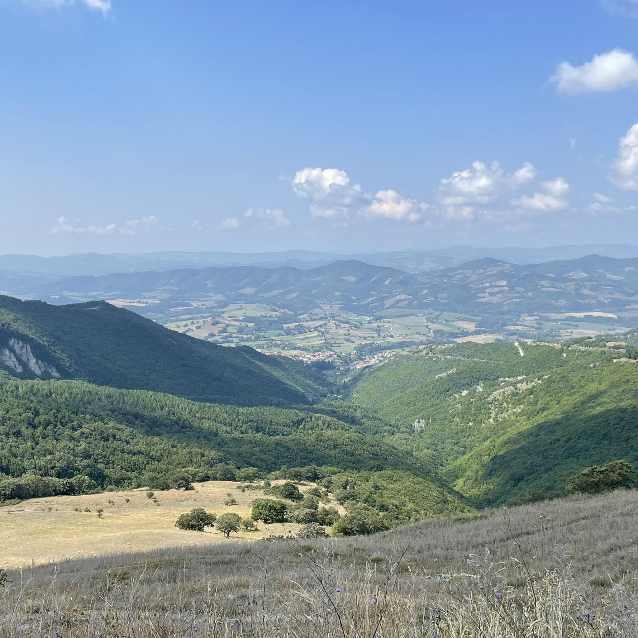
この地域は豊かな自然美に恵まれています。シッリッロ近くの著名な山であるモンテクッコは、広大な洞窟システムと丸みを帯びた尾根で有名な保護地域です。峠自体からは、ウンブリア・マルケ・アペニン山脈の景色を望むことができ、穏やかな斜面からより険しい地形まで、多様な景観が広がっています。
シッリッロ周辺の峠を訪れるのに最適な時期はいつですか?
訪問に最適な時期は、一般的にアクティビティによって異なります。春と秋は、鮮やかな紅葉や咲き誇る野花とともに、サイクリングやハイキングに快適な気温を提供します。モンテクッコのような標高の高い峠では夏も人気がありますが、暑くなることがあります。冬は高地では雪が降ることがあり、装備のある方には、より挑戦的な異なる体験を提供します。
峠からアクセスできる特定の展望スポットはありますか?
メインロードからグッビオ方面へ少し脇道に入ったところにあるマドンナ・デッラ・チーマ峠からは、サン・ウバルド大聖堂へ行くことができ、グッビオの美しい景色を眺めることができます。ヴァリコ・デッラ・ペッツァからモンテ・アグッツォへ登る際も、素晴らしいパノラマビューが楽しめます。
シギロでのの人気観光スポット

komootモバイルアプリでインスピレーションを得よう


さらに探索
これらのガイドでさらに壮大な山道を見てみましょうシギロでの:
