シーフィンの絶景の山頂・トップ4
シーフィン周辺の最高の山頂は、多様な風景と歴史的重要性を提供しています。この地域には、古代の通路墓がある休火山、スライヴ・ガリオンのような著名な山頂があります。訪問者は、挑戦的な登山、史跡、広大なパノラマビューを特徴とする風景を探検できます。この地域は、古代の歴史とつながり、変化に富んだ自然の地形を体験する機会を提供します。
シーフィン周辺の最高の山頂
- 最も人気のある山頂はスライヴ・ガリオン・サミットで、ブリテン諸島で最も高い通路墓(標高573メートル)がある火山です。この休火山からの眺めは、パノラマビューを提供します。
- もう一つの必見スポットはスライヴ・ガリオンのノース・ケアンとカリアグ・ベアラの湖で、南の隣よりもわずかに小さいケアンを持つ山頂です。訪問者は、青銅器時代の古代の石箱と近くの静かなカリアグ・ベアラの湖を見つけることができます。
- 訪問者はクレルモン・カーン・サミットと送信施設も気に入っています。この山頂からは、周囲の風景とアイリッシュ海の見事な眺めを楽しむことができます。この場所は、送信施設と新石器時代の埋葬ケアンで注目に値します。
- シーフィンは、休火山、史跡、挑戦的な登山で知られています。見たり探検したりできる山頂の多様性には、古代の通路墓や重要なケアンを持つ山頂が含まれます。
- シーフィン周辺の山頂は、komootコミュニティによって高く評価されており、訪問者から47件の「いいね」と24枚の写真が共有されています。
最終更新日: 9月 8, 2026
スリーヴ・ガリオン山頂
ハイライト • 火山
翻訳者 Google •
役立つ情報 は

スリーヴ・ガリオン北カーンとキャリア・ベアラの湖
ハイライト • 山頂
翻訳者 Google •
役立つ情報 は
今すぐサインアップして、こんな場所を発見しよう
最高のシングルトラック、ピーク、その他のエキサイティングなアウトドアスポットのおすすめを受け取ろう。
クレルモン・カーン山頂と送信所
ハイライト • 山頂
役立つ情報 は

ブラックマウンテン北側
ハイライト (セグメント) • 登山
This climb is very steep for the first 0.7km and then levels off, with a kick at the end. Ascend to approximately 560m and …
役立つ情報 は

無料アカウントで今日から始めよう
次の冒険が待っています。


コミュニティからのヒント

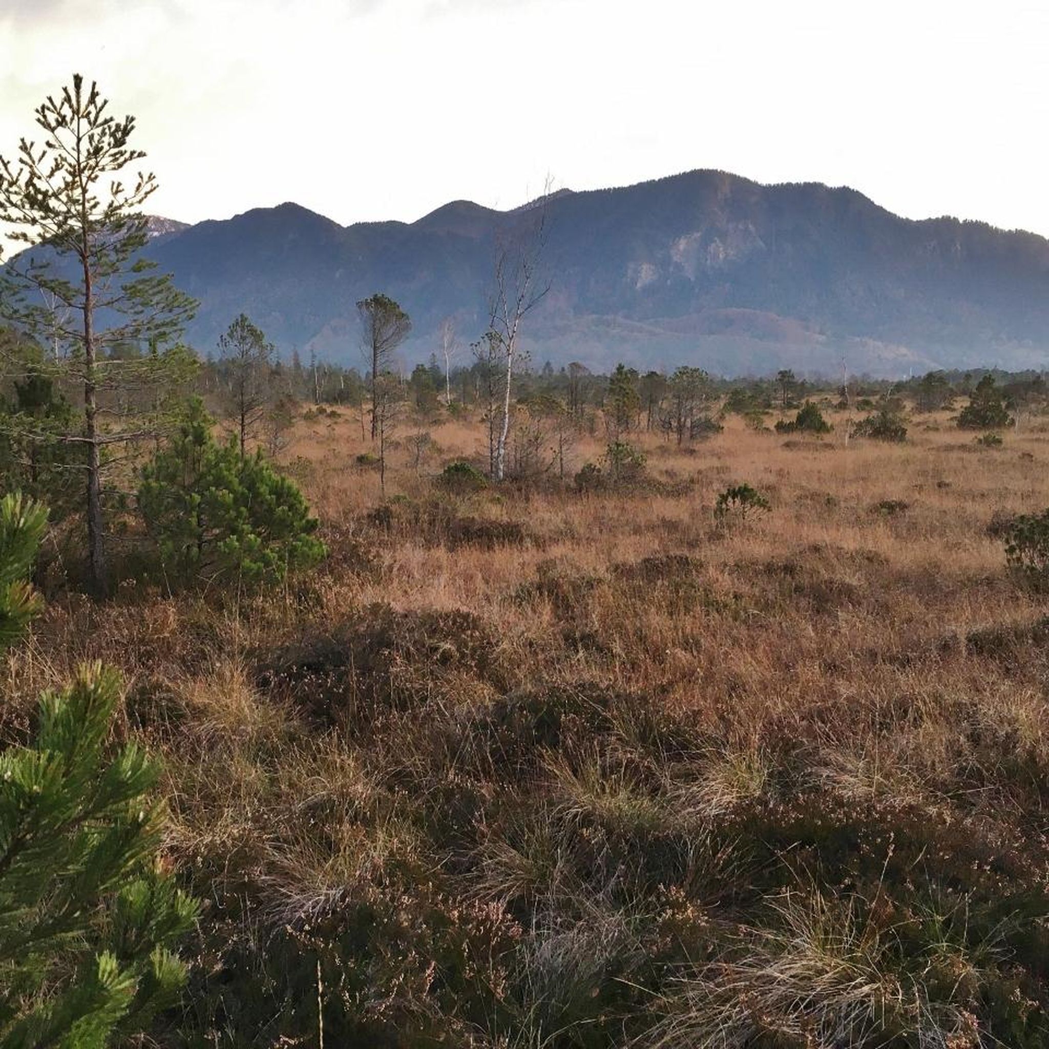
As soon as you cross the gentle ridge of Slieve Gullion, the North Cairn stretches out before you - a slightly smaller hill than its southern neighbour, but no less impressive. The stones that gather here seem like silent sentinels, witnesses of the distant Bronze Age. Two ancient stone boxes were once found here during excavations, which lay hidden in the depths of history. The North Cairn, with its diameter of around 18 metres, invites you to pause for a moment and enjoy the peace. But it is not just the Cairn that is fascinating. Right next to it lies "Calliagh Beara's Lough", a quiet mountain lake that, according to legend, is the home of the witch Beara. On a clear day, the sky is reflected in the calm waters and you can almost feel the ancient magic of this place coming to life. The road here may be rocky, but the landscape rewards with sweeping views and a touch of mysticism that makes Slieve Gullion something special.
1
0


At the highest point of the Black Mountain you are greeted by spectacular views of the surrounding landscape and the Irish Sea.
3
2

At the heart of the Ring of Gullion AONB, you'll find this beautiful mountain, which represents the highest point in the county with an elevation of 573 meters (1,880 ft). Right next to it there is a burial cairn.
1
0
Slieve Gullion, whose name sounds as poetic in English as "Sliabh gCuillinn" in Irish, rises majestically in the "Ó Fiaich Country" in the south of County Armagh in Northern Ireland. At 573 meters high, it not only hides a geological wonder in the form of an extinct volcano, but also the highest Passage Tomb in the British Isles. This passage tomb is particularly mysterious because its entrance is aligned exactly towards the point where the sun sets on the winter solstice. The best place to start your hike is from the Slieve Gullion viewing platform, where there is not only plenty of parking, but also space to stay overnight in a motorhome. From there a clearly marked path, demarcated by a staircase of large rocks, leads to the South Cairn. The transition between the South Cairn and the North Cairn is soft and wet, making the path a true nature experience. However, it should be noted that the descent from the North Cairn back to the viewing platform is rather steep and not always clear. From the summit, hikers are treated to a breathtaking panorama. The view sweeps over the landscape all around and you quickly understand why this area has been classified as an "Area of Outstanding Natural Beauty". The "Slieve Gullion Forest Park" landscape protection area extends over large heath areas on the sunlit mountain slopes. For those who want to experience the full spectrum of this stunning area, there is the 57km long waymarked Ring of Gullion Way. A 13 km long section of this circular hiking trail, the “Slieve Gullion Walk”, leads from the car park at Meigh directly to the summit and back again.
2
0

Wikipedia (Clermont Carn (アイルランド語: Carnán Mhaighréid Náir), 2022-11-03): https://en.m.wikipedia.org/wiki/Clermont_Carn Wikipedia (Clermont Carn 送信所, 2022-11-03): https://en.m.wikipedia.org/wiki/Clermont_Carn_transmission_site Wikipedia (Cooley Mountains, 2022-11-03): https://en.m.wikipedia.org/wiki/Cooley_Mountains MountainViews.ie (Clermont Carn, 2022-11-03): https://mountainviews.ie/summit/434/ - 展望地点 (Carlingford Lough, Dundalk, …) - 送信所 (2RN (RTÉ Networks), Saorview, …) - 新石器時代の埋葬塚
2
2
The climb up the north side of Black Mountain challenges you right from the start - the first half kilometre feels like a wall before it levels out a bit. But don't be fooled, there's a final kick just before the summit that will make your legs feel what they've done. Once at the top, you'll be rewarded with impressive views of the surrounding countryside that will make you feel like you're standing on top of the world. The route itself runs right along the border between Ireland and Northern Ireland, which creates a special atmosphere. Keep warm in changing weather and be prepared for sudden showers - the wind can pick up quickly up here. The descent requires some caution, as some parts are steep and the tarmac isn't always perfect. But that's what makes it so appealing - an adventure worth it and an experience to remember.
1
2

The highest Passage Tomb in the British Isles is located on the summit of Slieve Gullion at 573 meters. The passage grave can be entered through a niche that is oriented towards the point where the sun sets on the winter solstice. The view from the extinct volcano is fantastic all around.
6
0
よくある質問
シーフィン周辺で最も注目すべき山頂は何ですか?
シーフィン周辺の地域には、いくつかの印象的な山頂があります。その中でも、重要な埋葬所を持つ休火山であるスリーヴ・ガリオン・サミット、そしてパノラマビューと歴史的な送信施設で知られるクレルモン・カーン・サミットがあります。もう一つの著名な特徴は、険しい登りと満足のいく眺めを提供するブラック・マウンテン北側です。
これらの山頂で見られる歴史的または考古学的な遺跡は何ですか?
シーフィン周辺の山頂は歴史が豊かです。スリーヴ・ガリオン・サミットには、5,000年前のブリテン諸島で最も高い埋葬所があります。近くにあるスリーヴ・ガリオン北埋葬塚にも青銅器時代の石箱があります。クレルモン・カーン・サミットには、現代の送信施設とともに新石器時代の埋葬塚があります。
シーフィン地域には、経験豊富なトレッカー向けの挑戦的なハイキングはありますか?
はい、挑戦を求める方のために、ブラック・マウンテン北側は非常に急な最初の区間を持つ厳しい登りを提供します。スリーヴ・ガリオン・サミットへの登りも挑戦的と考えられており、特に北埋葬塚からの下りは場所によっては急になることがあります。
シーフィン周辺の山頂からはどのような景色が期待できますか?
シーフィン周辺の山頂からは、壮観なパノラマビューが期待できます。スリーヴ・ガリオン・サミットからは、休火山の全周にわたる素晴らしい眺めが楽しめます。クレルモン・カーン・サミットからは、カーリングフォード湾やダンダークを含む、周囲の景観とアイリッシュ海の広大な眺めが楽しめます。ブラック・マウンテン北側も、田園地帯の印象的な眺めを登頂者に提供します。
山頂の近くにユニークな自然の特徴はありますか?
はい、スリーヴ・ガリオン北埋葬塚の近くには、地元の伝説に彩られた静かな山間の湖、「カリア・ベアの湖」があります。スリーヴ・ガリオン地域全体も、広大なヒースランドを持つ景観保護地域(AONB)の一部です。
これらの山頂の近くでどのようなアウトドアアクティビティができますか?
山頂自体のハイキング以外にも、シーフィン地域では様々なアウトドアアクティビティが楽しめます。「カムロック湖ランニングループ」や「スリーヴ・ガリオン・ランニングループ」を含む、数多くのランニングトレイルを探索できます。サイクリストには、「ニューリー運河ウェイ・ループ」や挑戦的な「リング・オブ・ガリオン・ループ」のようなルートがあります。これらのアクティビティの詳細については、「シーフィン周辺のランニングトレイル」および「シーフィン周辺のサイクリング」ガイドをご覧ください。
これらの山の特定のハイキングコースや散策路はありますか?
スリーヴ・ガリオン(Slieve Gullion)については、マイ(Meigh)近くの駐車場から山頂まで往復する、全長13kmの「スリーヴ・ガリオン・ウォーク」があります。南側のケルンへの登りは、大きな岩の階段でよく整備されています。全長57kmの「リング・オブ・ガリオン・ウェイ」も山を一周しており、より長いハイキングの機会を提供しています。
山のトレイルにアクセスするための駐車場はありますか?
スリーヴ・ガリオン(Slieve Gullion)については、山頂へのハイキングの出発点となるスリーヴ・ガリオン展望台(Slieve Gullion Viewing Platform)に十分な駐車スペースがあります。
これらの山のハイキング中に、天候に関して注意すべきことは何ですか?
ブラック・マウンテン北側(Black Mountain North Side)のような山をハイキングする際は、天候の急変に備えてください。高地では風がすぐに強くなり、突然の雨に見舞われる可能性もあります。常に様々な状況に対応できる適切な装備を携帯することをお勧めします。
シーフィン地域にある主要な山の標高はどのくらいですか?
スリーヴ・ガリオン山頂(Slieve Gullion Summit)は標高573メートルに達します。ブラック・マウンテン北側(Black Mountain North Side)の登りは約560メートルまで上昇します。クレモント・カーン山頂(Clermont Carn Summit)もこの地域における重要な高所です。
シーフィン周辺の山々で、訪問者が最も楽しんでいることは何ですか?
訪問者は特に、山頂からのやりがいのあるパノラマビュー、厳しい登頂後の達成感、そしてスリーヴ・ガリオンの通路式墳墓のような遺跡の豊かな歴史的重要性などを楽しんでいます。自然の美しさと古代の歴史のユニークな融合が、これらの山々を記憶に残る目的地にしています。
シーフィンでのの人気観光スポット

komootモバイルアプリでインスピレーションを得よう


さらに探索
これらのガイドでさらに素晴らしい頂上を見てみましょうシーフィンでの:
