ヴァルダル地方周辺のアトラクション&必見スポット - トップ19
ヴァルダル地方には必見のスポットがたくさんあります。ハイキング愛好家やサイクリング愛好家の方は、ぜひヴァルダル地方を探索してこのエリアにある19
の隠れたスポットを訪れてみてください。このエリアの必見スポットを確認し、次の冒険に出かける計画を立てましょう。
最終更新日: 8月 17, 2026
デミル・カピヤ渓谷 - トンネルの切れ目
ハイライト • 渓谷
役立つ情報 は

川沿いの景色の良い道
ハイライト (セグメント) • サイクリングロード
翻訳者 Google •
役立つ情報 は

今すぐサインアップして、こんな場所を発見しよう
最高のシングルトラック、ピーク、その他のエキサイティングなアウトドアスポットのおすすめを受け取ろう。
無料新規登録
ポポヴァ・クラ ワイナリー
ハイライト • レストラン
The Demir Kapija valley is located in the southeastern part of the Tikveshiya grape growing sub-region, which is part of the Povardarie region.
The oldest archaeological finds that show that the people of this area grew vineyards and made wine date back to the 13th century BC
King Aleksander Karadjordjevic had a kingdom that spanned what is now Macedonia, Serbia, Croatia, Bosnia and Slovenia, including the Adriatic coast and the Panonian Valley. With the location of his vineyard, he had a wide choice. But on the advice of trustworthy advisors, King Aleksander carefully selected and planted his first vines in the Demir Kapija microregion exactly where we have our vineyards today.
When we first got to the place, we knew it was the perfect place for our vineyards and winery. Through our pictures on this website we will try to show you why. However, we invite you to visit us and experience the beauty and splendor of the region. We are sure that you will agree with our decision for the location.
Source: popovakula.com.mk/index.php?option=com_content&view=article&id=60&Itemid=78&lang=en
翻訳者 Google •
役立つ情報 は

Klisura(Клисура)島の展望スポット
ハイライト • 展望台
役立つ情報 は
Pcinjaバレー・ロード 🚵 カトラノヴォからエゼロ・ムラドスト湖まで
ハイライト (セグメント) • トレイル
役立つ情報 は
ロイヤルワイナリー・クイーンマリア
ハイライト • 歴史的な場所
As early as 1927, after being consulted by his royal experts that the land near the legendary "Demir Kapija" gorge in the Balkans is fertile and perfect for growing grapes and wine production, King Aleksandar Karadjordjevic decided to be there to build royal estate. His aim was to create a wine and a place of exceptional quality exclusively for the needs of the royal family. The king named the property after his wife Maria Karadjordjevic.
The royal estate included a hospital, a church, a kindergarten and the famous villa that was built for Queen Maria and was called Villa Maria. Production began in 1928 after Milos Leovac from Belgrade was appointed property manager. Wine of exceptional quality was produced in a cellar with a capacity of 500,000 liters. The wine was fermented in four glass basins designed in Austria and stored in wooden barrels with a capacity of 4,000 to 6,000 liters. The royal family made sure that their property had the perfect foundation on which to realize their ambitions.
Source: website of the winery
翻訳者 Google •
役立つ情報 は

ストビ遺跡
ハイライト • 歴史的な場所
The site is located immediately north of the Macedonian A1 motorway, also known as Autoput Bratstvo i jedinstvo, south of the village of Gradsko. The excavation site and the restored buildings form an open-air museum.
Source: Wikipedia
翻訳者 Google •
役立つ情報 は
静かなヴァルダル渓谷ロード
ハイライト (セグメント) • サイクリングロード
役立つ情報 は
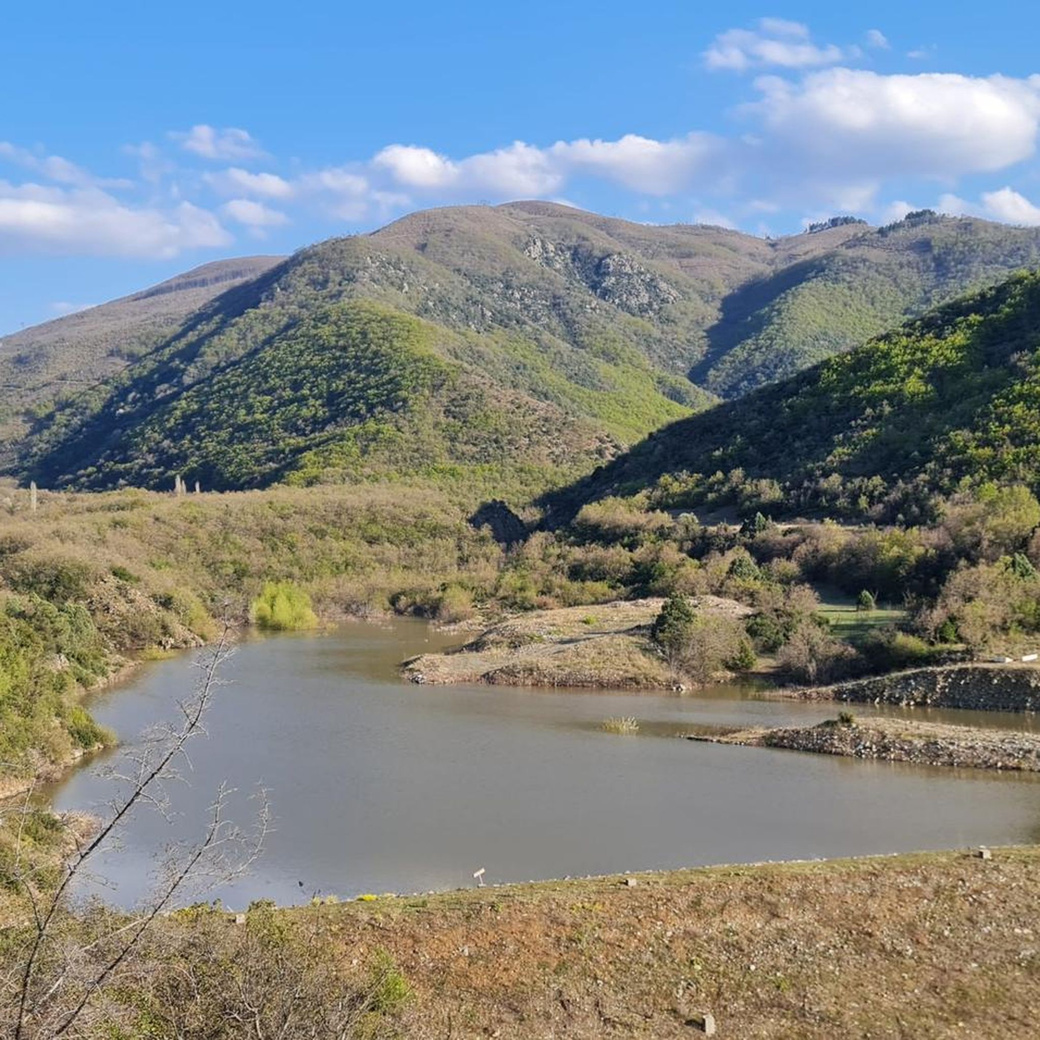
エゼロ・ムラドスト湖ダム 🌊
ハイライト • 湖
役立つ情報 は
ストビ遺跡発掘現場
ハイライト • 歴史的な場所
役立つ情報 は
無料でサインアップして、さらに多くの観光スポットを発見しましょう ヴァルダル地方での。
無料新規登録
すでにアカウントをお持ちですか?
無料アカウントで今日から始めよう
次の冒険が待っています。
ログインまたは登録
ヴァルダル地方周辺で人気
コミュニティからのヒント

The Vardar River here splits in two channels, creating a scenic River island. The lonely train station on the opposite side is Klisura (Macedonian: Клисура), the oldest village in Demir Kapija Municipality. It was along the Vardar River but moved into the mountains to be away from the main road in the mid 19th century. Many current Demir Kapija residents came to develop the town and municipality during socialism, one of Tito's plans for the modernization and industrialization of his Yugoslavia. Klisura was at its highest population of over 600 residents just after World War I. A large church and monastery were built there before then. Today, the village is nearly abandoned, but it has a unique tradition around Easter. Former inhabitants return to the village on Good Friday for a village reunion. On May 23, many people come to celebrate the patron Saint Nicholas. https://en.wikipedia.org/wiki/Klisura,_North_MacedoniaSeveral residents still herd goats, sheep, and other livestock.
1
0
Well paved and now quiet thanks to the parallel highway, the old Vardar River Road is a great scenic section of the EuroVelo 11 through the Vardar River Valley
3
0
Стоби, Stobi, was an ancient town of Paeonia, later conquered by Macedon, and finally turned into the capital of the Roman province of Macedonia Salutaris. It is located near Gradsko, North Macedonia, on the main road that leads from the Danube to the Aegean Sea and is considered by many to be the most famous archaeological site in North Macedonia. Stobi was built where the Erigon (Crna River) joins the Axios (Vardar), making it strategically important as a center for both trade and warfare. For updated hours and fees check http://www.stobi.mk
1
0

Quite a bit of traffic, with trucks driving past but at quite a high speed. The landscape is beautiful. The asphalt is good for the most part. We recommend driving this route.
0
0

Beautiful, but partly very bad road! Still good to drive for the most part. It's worth it :)
0
0

Popova Kula winery and vineyards are located on the southern slopes of Grand Hill (Veliko Brdo) west of the beautiful town of Demir Kapija and close to the E-75 motorway. The Demir Kapija valley is located in the southeastern part of the Tikveshiya grape growing sub-region, which is part of the Povardarie region. The oldest archaeological finds that show that the people of this area grew vineyards and made wine date back to the 13th century BC King Aleksander Karadjordjevic had a kingdom that spanned what is now Macedonia, Serbia, Croatia, Bosnia and Slovenia, including the Adriatic coast and the Panonian Valley. With the location of his vineyard, he had a wide choice. But on the advice of trustworthy advisors, King Aleksander carefully selected and planted his first vines in the Demir Kapija microregion exactly where we have our vineyards today. When we first got to the place, we knew it was the perfect place for our vineyards and winery. Through our pictures on this website we will try to show you why. However, we invite you to visit us and experience the beauty and splendor of the region. We are sure that you will agree with our decision for the location. Source: http://www.popovakula.com.mk/index.php?option=com_content&view=article&id=60&Itemid=78&lang=en
3
0
Stobi was the capital of the ancient Paionien landscape, was later conquered by the Macedonians and came together with Macedonia in the 2nd century BC. Under the rule of the Romans. Stobi was at the mouth of the Erigon River in the Vardar on the main road that connected the middle Danube with the Aegean coast. The ruins of Stobi are the most significant ancient remains on the territory of the Republic of Macedonia today. The site is located immediately north of the Macedonian A1 motorway, also known as Autoput Bratstvo i jedinstvo, south of the village of Gradsko. The excavation site and the restored buildings form an open-air museum. Source: Wikipedia
5
0

It starts with a king ... As early as 1927, after being consulted by his royal experts that the land near the legendary "Demir Kapija" gorge in the Balkans is fertile and perfect for growing grapes and wine production, King Aleksandar Karadjordjevic decided to be there to build royal estate. His aim was to create a wine and a place of exceptional quality exclusively for the needs of the royal family. The king named the property after his wife Maria Karadjordjevic. The royal estate included a hospital, a church, a kindergarten and the famous villa that was built for Queen Maria and was called Villa Maria. Production began in 1928 after Milos Leovac from Belgrade was appointed property manager. Wine of exceptional quality was produced in a cellar with a capacity of 500,000 liters. The wine was fermented in four glass basins designed in Austria and stored in wooden barrels with a capacity of 4,000 to 6,000 liters. The royal family made sure that their property had the perfect foundation on which to realize their ambitions. Source: website of the winery
5
0
ヴァルダル地方でのの人気ルート

komootモバイルアプリでインスピレーションを得よう


