ルート

プランナー

機能

アップデート

App

ログインまたはサインアップ

アプリを入手

ログインまたはサインアップ

ルート
ロードバイクルート
イギリス
北アイルランド
Newry And Mourne

スリーヴガリオン

スリーヴガリオンのおすすめライド

4.1

(23)

1,395

ライダー

24

ライド

スリーヴガリオン周辺でのロードバイクライドをお考えですか?komootはスリーヴガリオン周辺のあらゆるロードバイクライドを評価し、人気ルートを厳選しました。スリーヴガリオン周辺の各ロードバイクルートの詳細をご覧になり、自分に合ったルートを見つけてください。

最終更新日: 7月 2, 2026

3.5

(2)

35

ライダー

#1.

Jonesboroughから出発する ランパーズ・バー – ベースキャンプコーヒー ループコース

28.2km

01:11

160m

160m

初級者向けロードバイクライド. あらゆるフィットネスレベルに適しています。 全般的に舗装状態が良好で走行しやすい道です。

デバイスでナビ

スマートフォンに送信

保存

初級

中程度のロードライド. ある程度のフィットネスレベルが必要です。 全般的に舗装状態が良好で走行しやすい道です。

中程度
guide_signup
私たちがkomootモバイルアプリで道を示します
無料の komoot アカウントがあれば、無限のアウトドアコースを簡単に見つけてカスタマイズし、ナビで案内できます。

無料新規登録

中程度のロードライド. ある程度のフィットネスレベルが必要です。 全般的に舗装状態が良好で走行しやすい道です。

中程度

中程度のロードライド. ある程度のフィットネスレベルが必要です。 全般的に舗装状態が良好で走行しやすい道です。

中程度

中程度のロードライド. ある程度のフィットネスレベルが必要です。 ツアーの一部に、未舗装のため走行が難しい箇所があるかもしれません。

中程度
無料新規登録すると、スリーヴガリオンでのでのライドをさらに20件ご覧いただけます。

さらに多くのルートや他のユーザーのおすすめ情報を確認できます。

無料新規登録

すでにアカウントをお持ちですか?

おすすめのツアーは他のkomootユーザーが実際に経験した何千ものアクティビティに基づいています。

無料アカウントで今日から始めよう

次の冒険が待っています。
ログインまたは登録

スリーヴガリオン周辺で人気

スリーヴガリオンでのハイキング

スリーヴガリオンのランニングコース

スリーヴガリオンでのサイクリング

スリーヴガリオンのMTBトレイル

コミュニティからのヒント

Willem VS
6月 5, 2026, Cathedral of Saint Patrick and Saint Colman

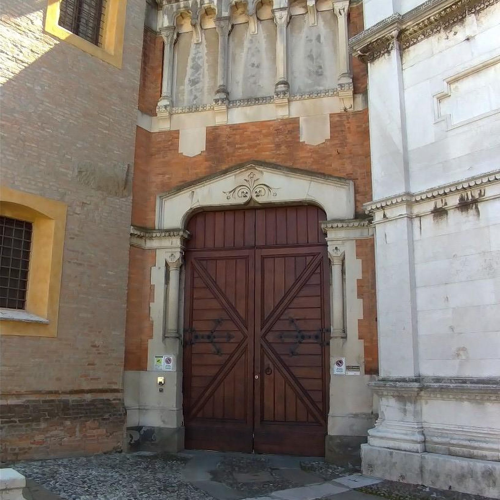
聖パトリック大聖堂と聖コルマン大聖堂は、ニューリーの建築上の傑作であり、アイルランドで最も印象的なネオゴシック建築の一つです。建設は1825年に始まり、1829年の完成時には、カトリック解放令(Catholic Emancipation)の後、アイルランドで最初に開かれたカトリック大聖堂として歴史に名を刻みました。近くのモーヌ山脈(Mourne Mountains)産の地元産花崗岩で造られたこの建物は、堅牢でありながらエレガントな力強さを放っています。この大聖堂は、その素晴らしい内装で世界的に有名です。壁と天井は、20世紀初頭にイタリアの熟練した職人たちによって手作業で取り付けられた色鮮やかなモザイクで覆われています。サイクリストにとって、ここはルート沿いの視覚的なハイライトであるだけでなく、静寂な安らぎの場所でもあります。精巧なステンドグラスの窓と記念碑的な塔は、この街で最も写真に撮られる場所の一つであり、ニューリー運河の遊歩道(Newry Canal Towpath)沿いのツアーの価値ある終着点(または出発点)となっています。

Google翻訳による翻訳

6

0

Scotty C
3月 12, 2026, Lumpers Bar

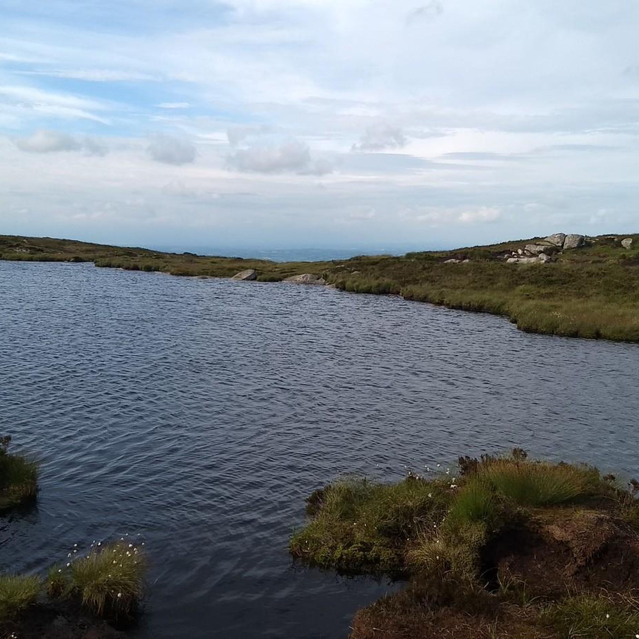
The highest bar in County Louth along the Táin Way. A traditional Irish pub that offers a cozy interior with a warming fire and excellent food. A favourite amongst locals and hikers!

0

0

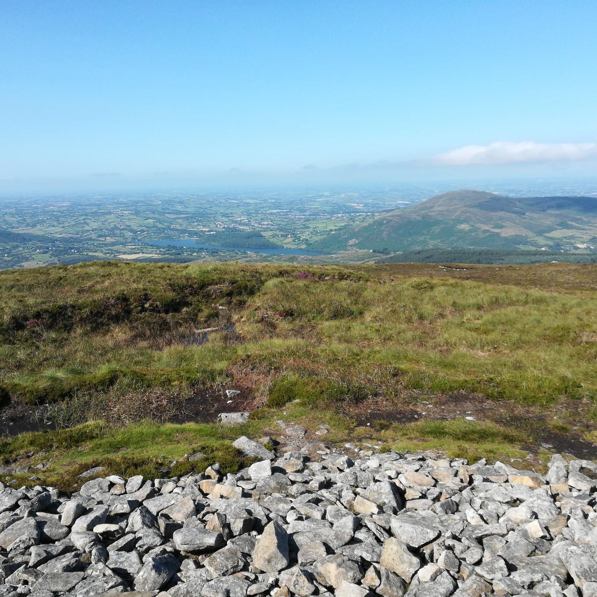
Táin Wayは、カーリングフォードで始まりカーリングフォードで終わる、全長40キロメートル(25マイル)の円形のハイキングコースです。 古代アイルランドの叙事詩「Táin Bó Cúailnge」にちなんで名付けられたこのルートは、クーリー半島を蛇行し、海岸の景色、森の小道、山のトレイルが混在しています。通常2日間かけて踏破され、総上昇量は約1,025メートルで、黒い背景に黄色い矢印で表示されています。 道中、ハイカーは青銅器時代の石塚のような史跡に出会い、カーリングフォード・ラフとモーヌ山のパノラマビューを楽しむことができます。オミースとレイヴンズデールには代替の登山口があり、さまざまな出発点に対応できます。 農耕地の区間では犬の立ち入りは許可されていませんのでご注意ください。

Google翻訳による翻訳

1

0

gravel paths and a tarmac road up the middle, also has public toilets

0

0

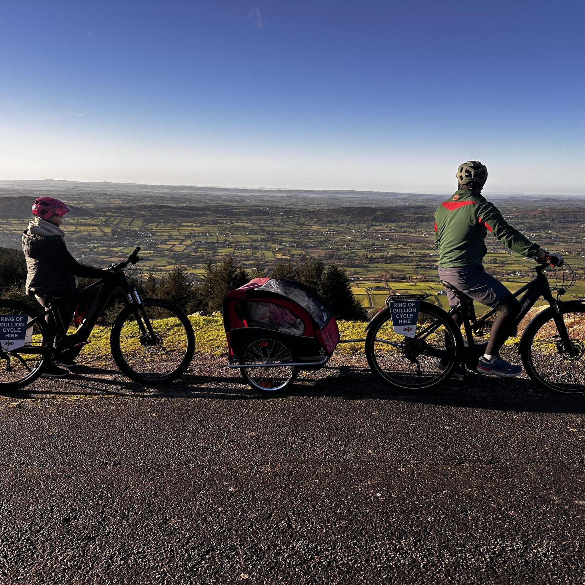
The setting is done with great attention to detail, and it almost feels like a quick picnic in the mountains when you sit down at the rustic tables and look into the distance. The patterned cups and saucers give the place a cozy touch and make the whole thing that little bit more special. The view of the surrounding hills and the relaxed atmosphere invite you to take a short break - perfect for resting your legs and just taking a breather. The coffee house is not only friendly to cyclists, but even offers bike rental for the Ring of Gullion. Handy if you need an extra boost for the next stage! The surroundings are green and spacious, a nice mix of Irish idyll and relaxed hospitality. The owners seem to take the attention to detail seriously, which is reflected in the little things like the decorative elements and the cozy atmosphere.

Google翻訳による翻訳

1

0

A quick stop at the coffee and snack hut next to Lumper's Bar is just the thing to recharge your batteries after a challenging stage. The small hut offers everything a cyclist's heart desires: fresh coffee, sweet waffles and hearty snacks that give you the energy you need for the next stretch. With the smell of freshly brewed coffee in the air and the cozy atmosphere, it's easy to take a quick breather and rest your legs here. The location right on the road makes it an ideal stopover, even if the traffic can be a bit noisy at times. But hey, who cares about small things with such beautiful surroundings and typical Irish hospitality? The colorful bench and the small decorations give the place a special charm that invites you to linger - even if it's just for a moment.

Google翻訳による翻訳

0

2

The Craigmore Viaduct is an impressive structure, with its 18 arches spanning the Camlough River Valley, dominating the landscape of south Armagh. As I cycled along the gently curving roads, the viaduct suddenly appeared on the horizon - a massive but elegant sight. The tall stone arches seem to effortlessly support the train traffic that runs between Dublin and Belfast. I stopped for a moment to take a closer look at the structure. It is fascinating to know that this structure has been standing here since 1852, designed by Irish engineer John Benjamin Macneill. The highest arch rises 126 feet, and standing under it you can really appreciate the scale and importance of this structure to the region. The surroundings are just perfect for putting your bike down and taking some time to look at the view. Perhaps a small lookout point with information about the history of the viaduct would be a nice addition, but even without it it is a worthwhile stop along the way. We continue, but the image of the arches remains in our minds.

Google翻訳による翻訳

2

0

The old walls of the two joined churches stand still and weathered amidst tall trees - you can almost feel the history in the air here. It is amazing that the roots of this place go back to the 6th century, when Saint Moninna founded a nunnery here. Today, the ruins from the 11th and 15th centuries still stand, and although much has fallen into disrepair, the remains give a sense of calm and past. A special detail is the large stone slab that is believed to be the tomb of Saint Moninna. It is a little hidden, but if you look for it, you will definitely find it. The old cemetery setting with the Celtic crosses and weathered gravestones adds to the mood. For me, it was a pleasant break from the ride. Here you can sit back for a few minutes, park your bikes and just soak up the atmosphere. It is one of those places that does not scream loudly for attention, but tells its stories in silence

Google翻訳による翻訳

2

0

スリーヴガリオンでのの人気ルート

スリーヴガリオンでのハイキング

スリーヴガリオンでのの人気観光スポット

Places to see

Store rating

komootモバイルアプリでインスピレーションを得よう

無料のkomootアカウントがあれば、無限のアウトドアコースを簡単に見つけてカスタマイズし、ナビで案内できます。

または

今すぐkomootに参加しよう

Store rating

さらに探索

他の地域の最高のロードサイクリングルートを見てみましょう。

Ellisholdingクロンラムクログホグ新しい町クログホグシーフィンBallinlissCarrivemacloneAltnaveighターモアバリンレアカーナカリーLisdrumliskaBallymacdermotバリーナクレイグバリンレアシンドルマレーンLisdrumgullionカーニーハフドラムカシェロンSaval BegカーナガットドルマレーンドルマレーンLisdrumliskaMullartownMoneydorraghもっと上LisserboyクランキーノックナナニーバリーブロードラモンドノックダフレッシュキルレアデリークロウドラムバナガーBallyloughリサモンバリーデスランドタリーウィニーDuburrenアマケインCarrickbrackanCorcreeghyメイタウンエシュワリーRathcarbryリサディアンクロガレヴァンCloghanramerクロギニークロリーゴラグスターガンTamnaghbaneクロスCarnmeenキルモナハンDuvernaghキーディベグCarrickcloghanバリーナラックコリンシゴグラスドラモンドドラムハーリフカーンベインリスナリーデリーモアタリーハピーMaghernahelyラットCarrivekeenyEnaghケガルデリーウィリガンドラミリーリサロウCarrickcroppanマラグラスセルセバスクヒルマニーモアクロンティゴラグリーブコルガリードラマンティンAughnacavenFoughill EtraLisdrumgullionLoughorneキャリックルーバディールルガナーレドラムミラーリスダフバラガネリーデリーベグダモリーデリーボアイキリーンファゾムロワーバリーヴァリードナガガイアグナモイラAghayallogeファゾムアッパーバレンCarrickmacstayClonallan GlebeバリーホーランドアッパーメイキャリックブロードLurgancantyドロモア狭い水LevallyreaghBallyagholyクロンタフリースタムナハリーキャロッグバラガナリーアッパーグリーナンモイガノンノックバラグラスドラムマンアッパームラタウンアッパーエデナッパFoughill OtraファゾムロワーBallinturLisnacree UppoerティーブクロムCarrickastickanグレンローアンアガダボイルEdentrumlyアナロンウッドバリンカリーバリーエドモンドリンゴリッシュモーンマウンテンズウエストメイヨーCorcreaghanルーガンリーLurganconaryモーンマウンテンズイーストLisnagreeRingmackilroyイーデンモアアウグナゴンバリーラッセルアガビリーバリーマコナギーグラスドラムマンRing Of Gullion AonbミルタウンCarrickcrossanBallymadeerfyギネウェイズAghyoghillLisnacreeTamnyveaghMaghereaghバリンランリートリムアッパーキーディモアモーンマウンテンズミドルバラードLatbirgetコモンズアナグベインリングクラレKillybodaghキャリックブラックSkegatillidaバリーネダンバリーエドモンドアッパーバリーネダンアッパーバリンランアッパーBallincurryアッパーキローウェン山脈キルフィーガンアッパーポイントパークロスターバー山脈バリンランロストレバーの森CullentraghクランフィールドベナロワードラムマンレーンベナアッパーバリーゴーワングランジシェンシャンローロングフィールドグリーンキャッスルBallinturデザートKilfeaghanグレンローアンアッパーギネウェイズアッパーベナードラムリーアッパーロスターバー新しい町バリーホーランドロワークリーブクロベインシープタウンドラムクロウクロレアデリーレッカーキャリブカブラアナクログムリンドラムセスクバリンテンプルBallindoaltyアッパーロスターバーアッパーバヴァンクロギニードラミンティーモヤドアッパーバリーローガンオーグリムモヤードドラムクロマガリーMagheramurphyBallymageoghアチカルダンナマンバリーマガートタリーフレームキルキールオーナフーリーリートリムオーナルーピー

近くのアドベンチャーガイド

Ring Of Gullion Aonbでやるべきこと

background

新しいピークを征服する準備をしよう

無料でサインアップ

探検する
ルートルートプランナー機能ハイキングMTBトレイルロードバイクルートバイクパッキングサイトマップ
アプリをダウンロード
SNSでフォローする

© komoot GmbH

プライバシーポリシー