Οι καλύτερες ποδηλατικές διαδρομές Brantingham
4,5
(150)
1.469
Ποδηλάτες
140
Ποδηλασίες
Ψάχνετε τις καλύτερες ποδηλατικές διαδρομές Brantingham; Σε αυτή τη σελίδα σας φέρνουμε τις καλύτερες βόλτες με ποδήλατο Brantingham ώστε να ξεκινήσετε αμέσως. Το μόνο που χρειάζεται είναι να διαλέξετε τη διαδρομή σας!
Τελευταία ενημέρωση: 1 Σεπτεμβρίου 2026
4,8
(4)
27
Ποδηλάτες
63,7km
03:49
100m
100m
Μέτρια ποδηλασία. Απαιτείται καλή φυσική κατάσταση. Κυρίως ασφαλτοστρωμένες επιφάνειες. Κατάλληλο για όλα τα επίπεδα δεξιοτήτων.
4,0
(2)
43
Ποδηλάτες
67,7km
03:53
90m
90m
Μέτρια ποδηλασία. Απαιτείται καλή φυσική κατάσταση. Κυρίως ασφαλτοστρωμένες επιφάνειες. Κατάλληλο για όλα τα επίπεδα δεξιοτήτων.

Εγγραφή δωρεάν
4,9
(7)
33
Ποδηλάτες
21,8km
01:14
70m
70m
Εύκολη ποδηλασία. Κατάλληλο για όλα τα επίπεδα φυσικής κατάστασης. Κυρίως ασφαλτοστρωμένες επιφάνειες. Κατάλληλο για όλα τα επίπεδα δεξιοτήτων.
23
Ποδηλάτες
50,2km
03:06
350m
350m
Μέτρια ποδηλασία. Απαιτείται καλή φυσική κατάσταση. Κυρίως ασφαλτοστρωμένες επιφάνειες. Κατάλληλο για όλα τα επίπεδα δεξιοτήτων.
18
Ποδηλάτες
37,1km
02:15
70m
70m
Μέτρια ποδηλασία. Απαιτείται καλή φυσική κατάσταση. Κυρίως ασφαλτοστρωμένες επιφάνειες. Κατάλληλο για όλα τα επίπεδα δεξιοτήτων.
Πάρε πρόσβαση σε περισσότερες διαδρομές και προτάσεις από άλλους εξερευνητές.
Εγγραφή δωρεάν
Έχεις ήδη λογαριασμό;
Οι προτάσεις διαδρομών μας βασίζονται σε χιλιάδες πεζοπορίες, ποδηλασίες και τρεξίματα που ολοκληρώθηκαν από άλλους χρήστες στο komoot.
Ξεκίνα σήμερα με έναν δωρεάν λογαριασμό
Η επόμενη περιπέτειά σου σε περιμένει.
Σύνδεση ή εγγραφή
Συμβουλές από την κοινότητα

Really picturesque village, grab a coffee at South Cave serviced
0
0

Faxfleet is a little village sited on fenland where the rivers Ouse and Trent meet to form the Humber. From the path on the bank, there are sweeping views to the Wolds, and across to RSPB Blacktoft Sands nature reserve, Alkborough Flats and the largest sand bank in the Humber, Whitton Sands.
2
0
The Market Weighton Navigation starts at Weighton Lock on the Humber Estuary and did run to Canal Head, a couple of miles short of Market Weighton. Today, the Canal is only navigable at best as far as Sod House Lock, 6 miles upstream.
2
0
Built in 1825 by James Pigott Pritchett and Charles Watson for the Saltmarshe family, eponymous owners of the neighbouring village from 1313- 1974. https://en.wikipedia.org/wiki/Saltmarshe_Hall
2
0
This is a woodland and wetland reserve with 600m of mainly grass footpaths which create a circular route and can be very muddy during winter. There are lots of tree roots and uneven surfaces across the reserve. Footpaths tend to be narrow. There is one gate onto the reserve at the footpath entrance which is closed from April to July to protect breeding birds.
2
0

Archetypal English village with its large village green surrounded by pretty stone houses and two pubs. The open beck runs in front of the houses in Eastgate, each with their own private bridge. The banks of the stream are planted with flowers. A large flat circular stone on the green known as the whipping stone is probably the base of the old market cross but rumour has it that a man was whipped to death here in 1624. https://www.newbaldparishcouncil.gov.uk/about-newbald/
1
0
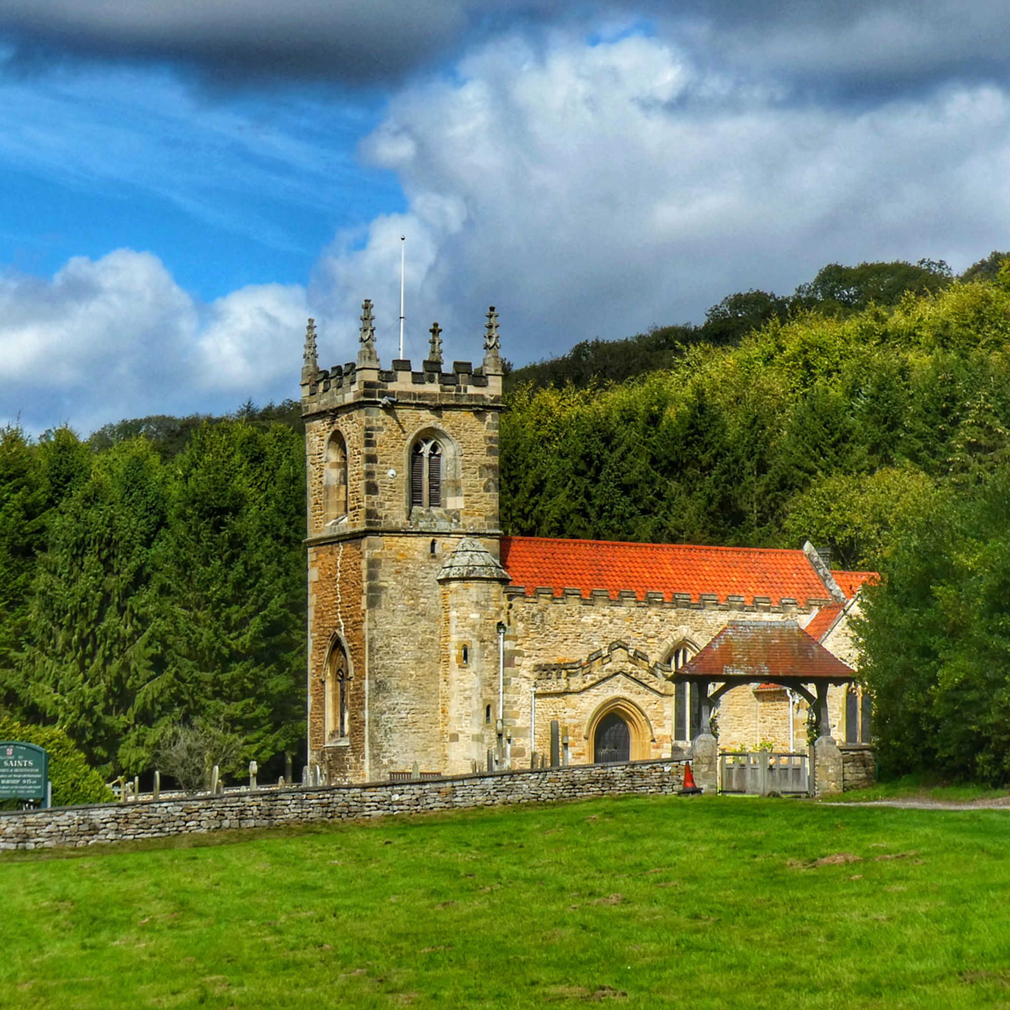
All Saints’ Church is 12th Century in origin and was restored by the Victorians in the late 19th Century. It is situated almost at the foot of Brantingham Dale in an open aspect. It is without doubt one of the most picturesque churches in the East Riding of Yorkshire. A fairly detailed history of the church compiled in 1965 and updated in 2014 is available as a pdf at https://d3hgrlq6yacptf.cloudfront.net/5f115a55324ea/content/pages/documents/1573224210.pdf
1
0
Οι πιο δημοφιλείς διαδρομές Brantingham
Τα πιο δημοφιλή αξιοθέατα Brantingham

Εμπνεύσου με την εφαρμογή komoot για κινητά


Ανακάλυψε περισσότερα
Περιηγήσου τα καλύτερα Διαδρομές ποδηλασίας σε άλλες περιοχές.
